|
Shivpuri District
Shivpuri District () is a Districts of Madhya Pradesh, district of Madhya Pradesh States and territories of India, state of India. The town of Shivpuri is the district headquarters. National Highway 3 (India), National Highway 3 (NH-3) runs through the district. History Most of present-day Shivpuri District formed Narwar District of the erstwhile princely state of Gwalior, with Shivpuri as administrative headquarters of the district. After India's independence in 1947, the princely states acceded to the Government of India, and Shivpuri District acquired its present boundaries with the addition of the small princely state of Khaniadhana in the southeast of the district, portions of Datia state in the northeast, and most of Pauri estate in the northwest. Shivpuri District became part of the new state of Madhya Bharat, which was merged into Madhya Pradesh in 1956. Geography The district is bounded on the south by Ashoknagar district, Ashoknagar and Guna district, Guna districts, on t ... [...More Info...] [...Related Items...] OR: [Wikipedia] [Google] [Baidu] |
List Of Districts Of Madhya Pradesh
The Indian state of Madhya Pradesh came into existence on 1 November 1956. Madhya Pradesh has various geographic regions which have no official administrative governmental status; some correspond to historic countries, states or provinces. Currently, the number of districts in the state is 55. and Of these Mauganj, Pandhurna & Maihar are newly created districts. 2 districts, Chachaura and Nagda are also proposed which was approved by state cabinet on 18th March 2020. These 55 districts are grouped into 10 administrative divisions. Districts are subdivided into tehsils, of which there are 428 in Madhya Pradesh. List of districts There are 55 districts in Madhya Pradesh, categorized into ten divisions. Proposed districts A bill giving in-principle approval to the creation of three districts was passed on 18 March 2020. The following districts would be created: * Chachaura district (Guna) * Nagda district (Ujjain) * Maihar district (satna) Announced by state government ... [...More Info...] [...Related Items...] OR: [Wikipedia] [Google] [Baidu] |
Khaniadhana
Khaniyadhana is a tehsil and a Nagar Palika in Shivpuri district in the Indian state of Madhya Pradesh. It is known for its eight Jain temples. History Before Indian independence in 1947, Khaniyadhana was the capital of a judev maharaj kalkhsingh of the same name - Khaniyadhana State. He also had a small brother named diwan mardan singh judev. In present time the family of maharaj khalk singh judev lives in khaniyadhana fort. And his small brother diwan mardan singh judev's family lives in haweli khaniyadhana known as nand bhavan khaniyadhana Dhapora Garhi This place on Dhapora Garhi is considered to be the stronghold of Lodhi Rajput (landlord) ruler Raja Shrilal Lodhi Rajput, Shri Lal Lodhi Rajput's son Shri Badri Prasad Lodhi is considered to be the stronghold, now daughter-in-law Anil-Abhilasha Lodhi, son of Badri Prasad Lodhi, is the District Panchayat Sadas. Ward Number-19. Prasad ji's younger brother Prabendra Lodhi Rajput is illuminating the name of his fathe ... [...More Info...] [...Related Items...] OR: [Wikipedia] [Google] [Baidu] |
Malwa Plateau
Malwa () is a historical region of west-central India occupying a plateau of volcanic origin. Geologically, the Malwa Plateau generally refers to the volcanic upland north of the Vindhya Range. Politically and administratively, it is also synonymous with the former state of Madhya Bharat which was later merged with Madhya Pradesh. At present the historical Malwa region includes districts of western Madhya Pradesh and parts of south-eastern Rajasthan. Sometimes the definition of Malwa is extended to include the Nimar region south of the Vindhyas. The Malwa region had been a separate political unit from the time of the ancient Malava Kingdom. It has been ruled by several kingdoms and dynasties, including the Avanti Kingdom, The Mauryans, the Malavas, the Guptas, the Paramaras, The Rajputs, the Delhi Sultanate, the Malwa sultans, the Mughals and the Marathas. Malwa continued to be an administrative division until 1947, when the Malwa Agency of British India was merged into ... [...More Info...] [...Related Items...] OR: [Wikipedia] [Google] [Baidu] |
Rajasthan
Rajasthan (; Literal translation, lit. 'Land of Kings') is a States and union territories of India, state in northwestern India. It covers or 10.4 per cent of India's total geographical area. It is the List of states and union territories of India by area, largest Indian state by area and the List of states and union territories of India by population, seventh largest by population. It is on India's northwestern side, where it comprises most of the wide and inhospitable Thar Desert (also known as the Great Indian Desert) and shares a border with the Pakistani provinces of Punjab, Pakistan, Punjab to the northwest and Sindh to the west, along the Sutlej-Indus River valley. It is bordered by five other Indian states: Punjab, India, Punjab to the north; Haryana and Uttar Pradesh to the northeast; Madhya Pradesh to the southeast; and Gujarat to the southwest. Its geographical location is 23°3' to 30°12' North latitude and 69°30' to 78°17' East longitude, with the Tropic of Can ... [...More Info...] [...Related Items...] OR: [Wikipedia] [Google] [Baidu] |
Kota District
Kota District is a district of the state of Rajasthan in western India. The city of Kota is the administrative headquarters of the district. During the period around 12th century AD, Rao Deva, a Hada Chieftain conquered the territory and founded Bundi and Hadoti. In the early 17th century AD, during the reign of the Mughal Emperor Jahangir, the ruler of Bundi, Rao Ratan Singh, gave the smaller principality of Kota to his son, Madho Singh. Since then Kota became a hallmark of the Rajput gallantry and culture. The district is bounded on the north by Bundi District, on the east by Baran District, on the south by Jhalawar District, and on the west by Chittorgarh District and Mandsaur District. It is now the hub of educational institutions and is home to Asia's biggest manufacturer of fertilizer. Further, Kota is surrounded by four power stations within its 50 km radius. First is Rajasthan atomic power plant which is an atomic power plant and is very near to Kota at ... [...More Info...] [...Related Items...] OR: [Wikipedia] [Google] [Baidu] |
Uttar Pradesh
Uttar Pradesh ( ; UP) is a States and union territories of India, state in North India, northern India. With over 241 million inhabitants, it is the List of states and union territories of India by population, most populated state in India as well as the List of first-level administrative divisions by population, most populous country subdivision in the world – more populous than List of countries and dependencies by population, all but four other countries outside of India (China, United States, Indonesia, and Pakistan) – and accounting for 16.5 percent of the population of India or around 3 percent of the total world population. The state is bordered by Rajasthan to the west, Haryana, Himachal Pradesh and Delhi to the northwest, Uttarakhand and Nepal to the north, Bihar to the east, Madhya Pradesh, Chhattisgarh and Jharkhand to the south. It is the List of states of India by area, fourth-largest Indian state by area covering , accounting for 7.3 percent of the total ... [...More Info...] [...Related Items...] OR: [Wikipedia] [Google] [Baidu] |
Gwalior District
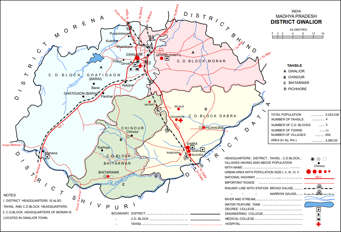
Gwalior district () is one of the 52 districts of Madhya Pradesh state in central India. The historic city of Gwalior is its administrative headquarters. Other cities and towns in this district are Antari, Bhitarwar, Bilaua, Dabra, Morar Cantonment, Pichhore, and Tekanpur. The district is at the centre of the Gird region. The district has an area of 4,560 km2, and a population 2,032,036 (2011 census), a 25% increase from the 2001 census. Kaushlendra Vikram Singh has been the district collector since March 2020. Geography Located in a transitional zone between the Malwa plateau and the Gangetic plain in Upper (Northern) Madhya Pradesh, Gwalior district consists of several distinct geographical areas. North and east of Gwalior city there is a broad alluvial plain, mostly flat and covered in dumat, parua, and kabar soils. The central part of the district, around Gwalior, is somewhat hilly, with sandstone outcrops that have often served as a source for building mater ... [...More Info...] [...Related Items...] OR: [Wikipedia] [Google] [Baidu] |
Guna District
Guna District () is one of the 52 districts of Madhya Pradesh in central India. Its administrative headquarters is Guna. The district has a population of 1,241,519 (2011 census). It has an area of 6390 km², and is bounded on the northeast by Shivpuri District, on the east by Ashoknagar District, on the southeast by Vidisha District, on the southwest by Rajgarh District, on the west and northwest by Jhalawar and Baran districts of Rajasthan state. The Sindh River flows northward along the eastern edge of the district, forming part of the boundary with Ashoknagar District, and the Parvati River flows northwestward through the southern portion of the district, forming part of the boundary with Baran District before flowing into Rajasthan. On 15 August 2003 Guna District was split in two, with the eastern portion becoming Ashoknagar District. Guna was part of the ancient Avanti Kingdom founded by Chand Pradyota Mahesena. Later Shishusangh added the kingdom of Avant, ... [...More Info...] [...Related Items...] OR: [Wikipedia] [Google] [Baidu] |
Ashoknagar District
Ashoknagar District () is a district of Madhya Pradesh state in central India. The city of Ashoknagar is the administrative headquarters of the district. Ashoknagar district was formed in 2003. Geography The district has an area of 4673.94 km2. It is bounded on the east by the Betwa River, which separates it from Lalitpur District of Uttar Pradesh and Sagar District of Madhya Pradesh. Vidisha District lies to the south. The Sindh River forms the western border of the district, which separates it from Guna District. Shivpuri District lies to the north. The district has a population of 688,920 (2001 census). It is divided into eight tehsils: Ashoknagar, Chanderi, Isagarh, Mungaoli, Shadora, Naisarai, Piprai and Bahadurpur. The district was created on August 15, 2003, when it was split from Guna District. Ashoknagar also has a great historical importance. It is a part of ancient Ahirwada region, where Yaduvanshi ahirs used to rule. The details of the Block wise popu ... [...More Info...] [...Related Items...] OR: [Wikipedia] [Google] [Baidu] |


