|
Santa Clara County Parks And Recreation Department
Santa Clara County Parks and Recreation Department, sometimes referred to as Santa Clara County Parks Department or Santa Clara County Parks, is a government department in Santa Clara County, California. The department manages 28 parks with a total area over . History Santa Clara County's first parkland was purchased in on January 24, 1924 from Joseph M. Mac Donough and Bessie P. MacDonough, a parcel near Cupertino which eventually became Stevens Creek County Park. Mount Madonna park was acquired in 1927. The Parks and Recreation Department was founded in 1956. A major expansion with numerous additional parks became possible in the 1970s with the availability of state funds and voter-approved tax setasides. A Master Plan was adopted in 1972 which called for major regional parks throughout the area as well as recreational corridors along creeks. In 1995 the county adopted a Master Plan for trails emphasizing connections between park trails and trails of other agencies. A separate a ... [...More Info...] [...Related Items...] OR: [Wikipedia] [Google] [Baidu] |
San Jose, California
San Jose, officially the City of San José ( ; ), is a cultural, commercial, and political center within Silicon Valley and the San Francisco Bay Area. With a city population of 997,368 and a metropolitan area population of 1.95 million, it is the most populous city in both the Bay Area and Northern California and the List of United States cities by population, 12th-most populous in the United States. Located in the center of the Santa Clara Valley on the southern shore of San Francisco Bay, San Jose covers an area of and is the county seat, seat of Santa Clara County, California, Santa Clara County. Before the Spanish colonization of the Americas, arrival of the Spanish, the area around San Jose was long inhabited by the Tamyen people, Tamien nation of the Ohlone people San Jose was founded on November 29, 1777, as the ''Pueblo de San José de Our Lady of Guadalupe, Guadalupe'', the first city founded in the Californias. It became a part of Mexico in 1821 after the Mexican Wa ... [...More Info...] [...Related Items...] OR: [Wikipedia] [Google] [Baidu] |
Hellyer County Park
Hellyer County Park is one of 28 Santa Clara County Parks. The park is located just off of Highway 101 in San Jose, California, United States. The park is home to Hellyer Park Velodrome and Cottonwood Lake. Other recreational opportunities at the park include picnicking, hiking, fishing, biking, and a playground. Coyote Creek Parkway is a multi-use trail that is paved for south to Anderson Lake County Park. Coyote Creek Parkway is a jurisdiction of the Santa Clara County Parks. Coyote Creek Trail The Coyote Creek Trail is a pedestrian and cycling trail along Coyote Creek in San Jose, California, which continues into Coyote Valley and northern Morgan Hill. The Coyote Creek Trail was designated part of the National Recreation Trail sy ... continues to the north along Coyote Creek under the jurisdiction of San Jose city parks. References Parks in San Jose, California Regional parks in California {{SanJoseCA-stub ... [...More Info...] [...Related Items...] OR: [Wikipedia] [Google] [Baidu] |
Uvas Canyon County Park
Uvas Canyon County Park is a natural park located in upper Uvas Canyon on the eastern side of the Santa Cruz Mountains, west of Morgan Hill, California. The park has several small waterfalls, some of which flow perennially, that feed into tributaries Confluence, confluent with Uvas Creek. The park is part of the Santa Clara County Parks System, and facilitates picnics, hiking and overnight camping. It is one of the few parks in the area that allows dogs in the campgrounds. Access to Uvas Canyon County Park is via Croy Road, a two-lane paved secondary road off Uvas Road with no outlet that narrows to a single lane within the small private community of Sveadal, California, Sveadal, just before the park entrance. The park is located at 8515 Croy Rd, Morgan Hill. Uvas Canyon has 7.2 miles of hiking trails that includes a 1 mile Waterfall Loop. There are picnic areas and campsites as well. At one time Uvas Canyon was the tribal territory of the Mutsun Ohlone Indians. Uva is the S ... [...More Info...] [...Related Items...] OR: [Wikipedia] [Google] [Baidu] |
Upper Stevens Creek County Park , a video game by Marvelous
{{Disambiguation ...
Upper may refer to: * Shoe upper or ''vamp'', the part of a shoe on the top of the foot * Stimulant, drugs which induce temporary improvements in either mental or physical function or both * ''Upper'', the original film title for the 2013 found footage film ''The Upper Footage'' * Dmitri Upper (born 1978), Kazakhstani ice hockey player See also * Uppers (video game) is a Japanese video game developer and publisher, and anime producer. The company was founded in 1997 but formed in its current state in October 2011 by the merger of the original Marvelous Entertainment with AQ Interactive, and Liveware. Hi ... [...More Info...] [...Related Items...] OR: [Wikipedia] [Google] [Baidu] |
Sunnyvale Baylands
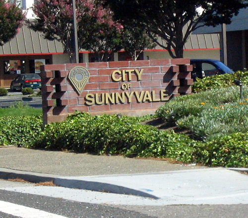
Sunnyvale () is a city located in the Santa Clara Valley in northwestern Santa Clara County, California, United States. Sunnyvale lies along the historic El Camino Real and Highway 101 and is bordered by portions of San Jose to the north, Moffett Federal Airfield and NASA Ames Research Center to the northwest, Mountain View to the northwest, Los Altos to the southwest, Cupertino to the south, and Santa Clara to the east. Sunnyvale's population was 155,805 at the 2020 census, making it the second most populous city in the county (after San Jose) and the seventh most populous city in the San Francisco Bay Area. As one of the major cities that make up California's high-tech area known as Silicon Valley, Sunnyvale is the birthplace of the video game industry, former location of Atari headquarters. Many technology companies are headquartered in Sunnyvale and many more operate there, including several aerospace/defense companies. Sunnyvale was also the home to Onizuka Air ... [...More Info...] [...Related Items...] OR: [Wikipedia] [Google] [Baidu] |
Stevens Creek County Park
Stevens Creek Reservoir is an artificial lake located in the foothills of the Santa Cruz Mountains near Cupertino, California. A county park surrounds the reservoir and provides limited fishing ("catch and release"), picnicking, hiking, and horseback riding activities. Although swimming is not allowed, non-power boating (such as by kayak) is allowed for certain parts of the year. No powered boats or jet skis are allowed. All vessels must be inspected for invasive Quagga mussels prior to launch. The California Office of Environmental Health Hazard Assessment has issued a safe eating advisory for any fish caught in Stevens Creek Reservoir due to elevated levels of mercury. History The reservoir was formed by the Stevens Creek Dam, built in across Stevens Creek. It is one of the smaller reservoirs owned by the Santa Clara Valley Water District. Originally named Arroyo de San José Cupertino, Stevens Creek flows into the reservoir and out of the dam to San Francisco Bay. Steve ... [...More Info...] [...Related Items...] OR: [Wikipedia] [Google] [Baidu] |
Santa Teresa County Park
Santa Teresa County Park is an park in the Santa Teresa neighborhood of San Jose, California, located within the Santa Teresa Hills Park description It is operated by the Santa Clara County Parks and Recreation Department. Most of the park consists of non-native grassland and mixed oak woodland. Native wildflowers displays are common in late winter and early spring in the serpentine soil Serpentine soil is an uncommon soil type produced by weathered ultramafic rock such as peridotite and its metamorphic derivatives such as serpentinite. More precisely, serpentine soil contains minerals of the serpentine subgroup, especially an ... in the northwest and southern sections of the park. Elevations range from 64 m (210 ft) in the northeast section to 352 m (1155 ft) at Coyote Peak in the eastern section. The park offers over 17 miles of unpaved trails for equestrian, hiking and bicycle use. Some of the trails are steep around Coyote Peak. Picnicking by ... [...More Info...] [...Related Items...] OR: [Wikipedia] [Google] [Baidu] |
Sanborn County Park
Sanborn County Park is a 3,453 acre (13.97 km2) county park situated in the Santa Cruz Mountains, managed by the Santa Clara County Parks and Recreation Department. The deeply forested park features over 15 miles of trails, second-growth redwoods, and creeks that flow year-round. It offers hiking, RV camping, walk-in campsites, and picnicking/BBQ sites. In the summer months, Sanborn County Park hosts the only outdoor Shakespearean company in Silicon Valley. The park is located four miles west of the town of Saratoga and straddles the steep slopes of the Santa Cruz Mountains from Sanborn Road all the way up to Skyline Boulevard. Adjacent properties include the Walden West Environmental Education Center, Castle Rock State Park, the Los Altos Rod and Gun Club Range and the Santa Clara County Peace Officers Association gun range. Practical information The park is open year-round, although there is no entry after sunset. Sanborn County Park is located on Sanborn Road. From ... [...More Info...] [...Related Items...] OR: [Wikipedia] [Google] [Baidu] |
Rancho San Antonio County Park
Rancho San Antonio County Park and Rancho San Antonio Open Space Preserve are a conjoined public recreational area in the Santa Cruz Mountains, in the northwest quadrant of Santa Clara County, California, Santa Clara County, California. The County Park is bordered by Los Altos with some parts of the eastern part of the County Park in western Cupertino. The Open Space Preserve is on the west side of the County Park, also bordered by Los Altos Hills, Monte Bello Open Space Preserve, and the Permanente Quarry. The Midpeninsula Regional Open Space District manages both the 3988 acre Open Space Preserve and the 289 acre County Park. This article covers both Rancho San Antonio County Park and Rancho San Antonio Open Space Preserve. History The Ohlone people, Ohlone Indians lived in the area for over 3,000 years prior to the arrival of the Spanish. A large village, known as Partacsi, was located in the general area. In March 1776, Juan Bautista de Anza led the first overland expeditio ... [...More Info...] [...Related Items...] OR: [Wikipedia] [Google] [Baidu] |
Penitencia Creek
Upper Penitencia Creek is actually one of two creeks by the name Penitencia Creek in the northeastern Santa Clara Valley of Santa Clara County, California. They are both tributaries of Coyote Creek. The upper creek was diverted southwestward, connecting it directly to Coyote Creek ca. 1850 by a farmer to irrigate his fields, permanently splitting Upper Penitencia Creek from Lower Penitencia Creek. Upper Penitencia Creek drains the western slopes of Mount Hamilton of the Diablo Range, and passes through Alum Rock Park, before ending at its confluence with Coyote Creek at Berryessa Road. In December 2018, the San Francisco Estuary Institute published a report commissioned by the Santa Clara Valley Water District to establish a vision for Upper Penitencia Creek's lower four miles focusing on ways "to expand flow conveyance and flood water storage from the Coyote Creek confluence upstream to the Dorel Drive bridge in a manner that works with the existing landscape features and s ... [...More Info...] [...Related Items...] OR: [Wikipedia] [Google] [Baidu] |
Motorcycle County Park
A motorcycle (motorbike, bike; uni (if one-wheeled); trike (if three-wheeled); quad (if four-wheeled)) is a lightweight private 1-to-2 passenger personal motor vehicle steered by a handlebar from a saddle-style seat. Motorcycle designs vary greatly to suit a range of different purposes: long-distance travel, commuting, cruising, sport (including racing), and off-road riding. Motorcycling is riding a motorcycle and being involved in other related social activities such as joining a motorcycle club and attending motorcycle rallies. The 1885 Daimler Reitwagen made by Gottlieb Daimler and Wilhelm Maybach in Germany was the first internal combustion, petroleum-fueled motorcycle. In 1894, Hildebrand & Wolfmüller became the first series production motorcycle. Globally, motorcycles are comparable numerically to cars as a method of transport: in 2021, approximately 58.6 million new motorcycles were sold around the world, while 66.7 million cars were sold over the same period. In ... [...More Info...] [...Related Items...] OR: [Wikipedia] [Google] [Baidu] |
Martial Cottle Park
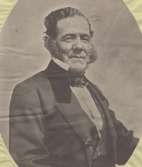
Martial Cottle Park is a park developed as a collaboration between the California Department of Parks and Recreation and Santa Clara County Parks. The park is located on 287.54 acres (116.36 hectares) of land in the city of San Jose, California, U.S. History Martial Cottle Park is a 287.54 acre property located in a residential and commercial neighborhood of South San Jose South San Jose is the southern :Neighborhoods in San Jose, California, region of San Jose, California, San Jose, California. The name "South Side" refers to an area bounded roughly by Hillsdale Avenue and Capitol Expressway to the North, Camden ..., bounded by Branham Lane, Snell Avenue and Chynoweth Avenue. An agricultural farm through four generations, the Martial Cottle Park property is now jointly owned by the California Department of Parks and Recreation and County of Santa Clara Parks and Recreation Department. References External linksCounty of Santa Clara information page {{Coord, 37.2627 ... [...More Info...] [...Related Items...] OR: [Wikipedia] [Google] [Baidu] |

