|
Sankuru River
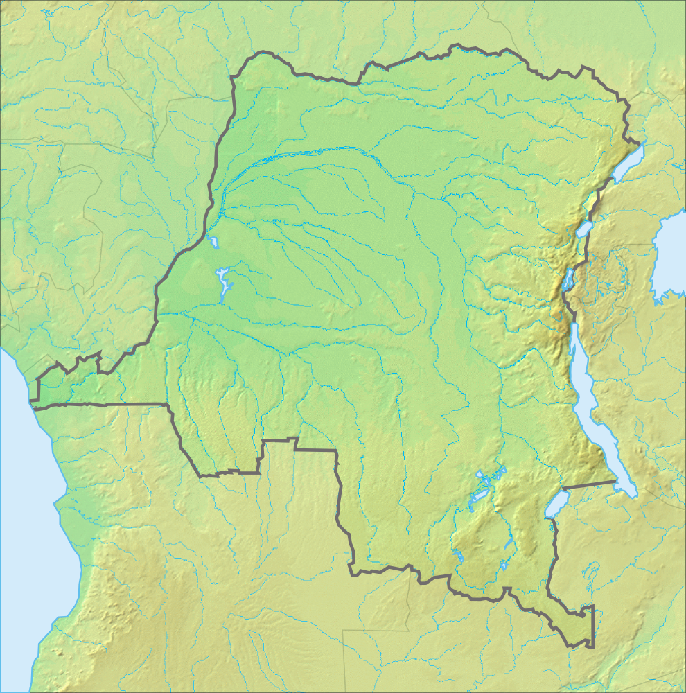
The Sankuru River () is a major river in the Democratic Republic of the Congo. Its approximate length of 1,200 km"Sankuru River" in '' The New Encyclopædia Britannica''. Chicago: Encyclopædia Britannica Inc., 15th edn., 1992, Vol. 10, p. 278. makes it the longest tributary of the Kasai River. Above the confluence with its tributary Mbuji-Mayi it is also known as Lubilash or Lubilanji. It flows northwards and then westwards crossing through a few towns, most notably Lusambo Lusambo () is the capital Cities of the Democratic Republic of the Congo, city of Sankuru province, Democratic Republic of the Congo. The town lies north of the confluence of the Sankuru River and the Lubi River. Lusambo is served by Lusambo Airp .... Then it enters the Kasai River near Bena-Bendi, at . References Rivers of the Democratic Republic of the Congo Kasai River {{DRCongo-river-stub ... [...More Info...] [...Related Items...] OR: [Wikipedia] [Google] [Baidu] |
Sankuru River Entering Kasai River NASA
Sankuru is one of the 21 provinces of the Democratic Republic of the Congo created in the 2015 repartitioning. Sankuru, Kasaï-Oriental, and Lomami provinces are the result of the dismemberment of the former Kasaï-Oriental province. Sankuru was formed from the Sankuru District whose town of Lusambo was elevated to capital city of the new province. The 2020 population was estimated to be 2,593,400. Administration The capital of the province is Lusambo. While Sankuru's territories are governed by Territorial Administrators and his Deputy, including various Counselors, cities in Sankuru are governed by Mayors. Townships or collectivities have always Mayors with Council and villages are mainly governed by traditional Kingdoms according to succession legacy. Administered from 1966 to 2009 as the District of Sankuru, the province is now divided into 6 territories: * Katako Kombe – with the town of Katako-Kombe and the City of Lumumbaville * Kole – with the town of Kole * L ... [...More Info...] [...Related Items...] OR: [Wikipedia] [Google] [Baidu] |
Democratic Republic Of The Congo
The Democratic Republic of the Congo (DRC), also known as the DR Congo, Congo-Kinshasa, or simply the Congo (the last ambiguously also referring to the neighbouring Republic of the Congo), is a country in Central Africa. By land area, it is the List of African countries by area, second-largest country in Africa and the List of countries and dependencies by area, 11th-largest in the world. With a population of around 112 million, the DR Congo is the most populous nominally List of countries and territories where French is an official language, Francophone country in the world. Belgian French, French is the official and most widely spoken language, though there are Languages of the Democratic Republic of the Congo, over 200 indigenous languages. The national capital and largest city is Kinshasa, which is also the economic center. The country is bordered by the Republic of the Congo, the Cabinda Province, Cabinda exclave of Angola, and the South Atlantic Ocean to the west; the Cen ... [...More Info...] [...Related Items...] OR: [Wikipedia] [Google] [Baidu] |
Encyclopædia Britannica
The is a general knowledge, general-knowledge English-language encyclopaedia. It has been published by Encyclopædia Britannica, Inc. since 1768, although the company has changed ownership seven times. The 2010 version of the 15th edition, which spans 32 volumes and 32,640 pages, was the last printed edition. Since 2016, it has been published exclusively as an online encyclopedia, online encyclopaedia. Printed for 244 years, the ''Britannica'' was the longest-running in-print encyclopaedia in the English language. It was first published between 1768 and 1771 in Edinburgh, Scotland, in three volumes. The encyclopaedia grew in size; the second edition was 10 volumes, and by its fourth edition (1801–1810), it had expanded to 20 volumes. Its rising stature as a scholarly work helped recruit eminent contributors, and the 9th (1875–1889) and Encyclopædia Britannica Eleventh Edition, 11th editions (1911) are landmark encyclopaedias for scholarship and literary ... [...More Info...] [...Related Items...] OR: [Wikipedia] [Google] [Baidu] |
Encyclopædia Britannica Inc
An encyclopedia is a reference work or compendium providing summaries of knowledge, either general or special, in a particular field or discipline. Encyclopedias are divided into articles or entries that are arranged alphabetically by article name or by thematic categories, or else are hyperlinked and searchable. Encyclopedia entries are longer and more detailed than those in most dictionaries. Generally speaking, encyclopedia articles focus on ''factual information'' concerning the subject named in the article's title; this is unlike dictionary entries, which focus on linguistic information about words, such as their etymology, meaning, pronunciation, use, and grammatical forms.Béjoint, Henri (2000)''Modern Lexicography'', pp. 30–31. Oxford University Press. Encyclopedias have existed for around 2,000 years and have evolved considerably during that time as regards language (written in a major international or a vernacular language), size (few or many volumes), intent ( ... [...More Info...] [...Related Items...] OR: [Wikipedia] [Google] [Baidu] |
Kasai River
The Kasai River (, ; called Cassai in Angola) is a left bank tributary of the Congo River, located in Central Africa. The river begins in central Angola and flows to the east until it reaches the border between Angola and the Democratic Republic of the Congo, where it turns north and serves as the border until it flows into the DRC. From Ilebo, between the confluences with Lulua river and Sankuru river, the Kasai river turns to a westerly direction. The lower stretch of the river, from the confluence with Fimi river until it joins the Congo at Kwamouth northeast of Kinshasa, is also known as the Kwa(h) River. The Kasai basin consists mainly of equatorial rainforest areas, which provide an agricultural land in a region noted for its infertile, sandy soil. It is a tributary of Congo river and diamonds are found in it. Around 60% of diamonds in Belgium go from Kasai river for cutting and shaping. Exploration Henry Morton Stanley reached the confluence on 9 March 1877, calli ... [...More Info...] [...Related Items...] OR: [Wikipedia] [Google] [Baidu] |
Mbuji-Mayi River
The Mbuji-Mayi River, also spelt ''Bushmaie'', ''Bushimaie'', ''Bushimay'' or ''Mbushimaie'', () is a river in the Democratic Republic of the Congo, a major tributary of the Sankuru River. It flows northwards from the Kapanga Territory in the province of Lualaba to the province of Kasaï-Oriental, where it is the namesake of the city of Mbuji-Mayi. From the 17th to 19th centuries, the river formed one of the borders of the Kingdom of Lunda The Lunda Empire or Kingdom of Lunda was a confederation of states in what is now the Democratic Republic of Congo, north-eastern Angola, and north-western Zambia. Its central state was in Katanga Province, Katanga. Origin Initially, the core of .... References Rivers of the Democratic Republic of the Congo {{DRCongo-river-stub ... [...More Info...] [...Related Items...] OR: [Wikipedia] [Google] [Baidu] |
Lusambo
Lusambo () is the capital Cities of the Democratic Republic of the Congo, city of Sankuru province, Democratic Republic of the Congo. The town lies north of the confluence of the Sankuru River and the Lubi River. Lusambo is served by Lusambo Airport. In 1890 Lusambo was chosen by Paul Le Marinel as the main Belgian base in the Kasai region to defend against the Arab or Swahili traders in slaves and ivory who came from the east. The station would soon become one of the most important military posts of the Congo Free State with a permanent staff of seventeen whites, six hundred native soldiers and four artillery pieces. In 1999 the new Laurent-Désiré Kabila, Kabila government and its ally, the Zimbabwean government of Robert Mugabe, claimed that U.S. mercenaries were helping Ugandan and Rwandan-backed rebel forces who had surrounded 700 Zimbabwean troops near Lusambo during the Second Congo War. References Sankuru River 1890 establishments in the Congo Free State Popul ... [...More Info...] [...Related Items...] OR: [Wikipedia] [Google] [Baidu] |
Sankuru River
The Sankuru River () is a major river in the Democratic Republic of the Congo. Its approximate length of 1,200 km"Sankuru River" in '' The New Encyclopædia Britannica''. Chicago: Encyclopædia Britannica Inc., 15th edn., 1992, Vol. 10, p. 278. makes it the longest tributary of the Kasai River. Above the confluence with its tributary Mbuji-Mayi it is also known as Lubilash or Lubilanji. It flows northwards and then westwards crossing through a few towns, most notably Lusambo Lusambo () is the capital Cities of the Democratic Republic of the Congo, city of Sankuru province, Democratic Republic of the Congo. The town lies north of the confluence of the Sankuru River and the Lubi River. Lusambo is served by Lusambo Airp .... Then it enters the Kasai River near Bena-Bendi, at . References Rivers of the Democratic Republic of the Congo Kasai River {{DRCongo-river-stub ... [...More Info...] [...Related Items...] OR: [Wikipedia] [Google] [Baidu] |
Rivers Of The Democratic Republic Of The Congo
Geographic regions Several major geographic regions may be defined in terms of terrain and patterns of natural vegetation, namely the central Congo Basin, the uplands north and south of the basin, and the eastern highlands. The country's core region is the central Congo Basin. Having an average elevation of about , it measures roughly , constituting about a third of the DRC's territory. Much of the forest within the basin is swamp, and still more of it consists of a mixture of marshes and firm land. North and south of the basin lie higher plains and, occasionally, hills covered with varying mixtures of savanna grasses and woodlands. The southern uplands region, like the basin, constitutes about a third of the DRC's territory. The area slopes from south to north, starting at about near the Angolan border and falling to about near the basin. Vegetation cover in the southern uplands territory is more varied than that of the northern uplands. In some areas, woodland is dom ... [...More Info...] [...Related Items...] OR: [Wikipedia] [Google] [Baidu] |


