|
Sbs Transit
SBS Transit Ltd (abbreviation: SBS or SBST) is a multi-modal public transport operator in Singapore operating bus and rail services. With a majority of its shares owned by Singaporean multinational transport conglomerate ComfortDelGro Corporation at 75%, it was formerly known as Singapore Bus Services before rebranding to SBS Transit on 1 November 2001. It is the largest public bus operator in Singapore, as well as one of the two major operators of Singapore's rail services along with SMRT Corporation. It has a fleet of 3,656 buses and operates 261 routes, as of 2015. History Singapore Bus Services (19732001) Singapore Bus Services Limited was established on 1 July 1973 when the regional bus companies Amalgamated Bus Company, Associated Bus Services and United Bus Company (which were in turn results of amalgamations of privately run Chinese bus companies of the 1960s in 1971) agreed to merge their operations with each taking shareholdings of 53%, 19% and 28% respectively in th ... [...More Info...] [...Related Items...] OR: [Wikipedia] [Google] [Baidu] |
Public Company
A public company is a company whose ownership is organized via shares of share capital, stock which are intended to be freely traded on a stock exchange or in over-the-counter (finance), over-the-counter markets. A public (publicly traded) company can be listed on a stock exchange (listing (finance), listed company), which facilitates the trade of shares, or not (unlisted public company). In some jurisdictions, public companies over a certain size must be listed on an exchange. In most cases, public companies are ''private'' enterprises in the ''private'' sector, and "public" emphasizes their reporting and trading on the public markets. Public companies are formed within the legal systems of particular states and so have associations and formal designations, which are distinct and separate in the polity in which they reside. In the United States, for example, a public company is usually a type of corporation, though a corporation need not be a public company. In the United Kin ... [...More Info...] [...Related Items...] OR: [Wikipedia] [Google] [Baidu] |
Punggol LRT Line
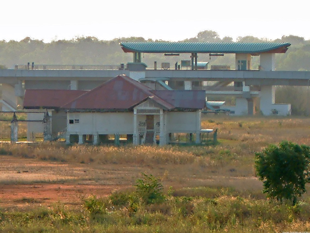
The Punggol LRT line (PGLRT) is a elevated automated guideway transit line in Punggol, Singapore. The Driverless train, driverless system consists of 15 stations on two loops, with Punggol MRT/LRT station, Punggol station serving as the interchange for both loops and linking the line to the North East MRT line. It is the third Light Rail Transit (Singapore), Light Rail Transit (LRT) line in Singapore and the second LRT line to be operated by SBS Transit. The PGLRT was conceived as part of the Punggol 21 development plan. Construction of the LRT line began in June 2000 and was completed in June 2004, and the Land Transport Authority transferred operations to SBS Transit in December that year. The East Loop began operations on 29 January 2005, with Oasis and Damai only opening in 2007 and 2011 respectively. The West Loop commenced operations on 29 June 2014, with Teck Lee LRT station, Teck Lee station being the last to open on 15 August 2024. The line utilises the Kyosan Auto ... [...More Info...] [...Related Items...] OR: [Wikipedia] [Google] [Baidu] |
Punggol
Punggol ( or ) is a Planning Areas of Singapore, planning area and New towns of Singapore, new town situated on the Tanjong Punggol peninsula in the North-East Region, Singapore, North-East Region of Singapore. The town directly borders Sengkang to the south and shares riverine boundaries with the planning area of Seletar, as well as Yishun to the west and Pasir Ris to the east. Bounding the town to the north and north-east is the Straits of Johor, with Coney Island, Punggol, Coney Island included as a part of the Punggol planning area. Under the Pungool 21 initiative, plans to turn the area into a new residential town were announced in 1996 and development of the town started in 1998. Due to the Asian financial crisis in 1997 and the financial troubles within the construction industry in 2003, the plan did not fully materialise. In 2007, a new initiative, the Punggol 21-plus plan, was introduced to redevelop the area into a waterfront town. Punggol is divided into 11 district ... [...More Info...] [...Related Items...] OR: [Wikipedia] [Google] [Baidu] |
Yishun
Yishun ( ), formerly known as Nee Soon, is a New towns of Singapore, residential town located in the northeastern corner of the North Region, Singapore, North Region of Singapore, bordering Simpang and Sembawang to the north, Mandai to the west, the Central Catchment Nature Reserve, Central Water Catchment to its southwest, Ang Mo Kio to its south, as well as Seletar and Sengkang to its east and southeast respectively. Etymology The name Yishun () is the Mandarin Chinese equivalent of "Nee Soon", the given name of Lim Nee Soon (Chinese language, Chinese: ), a prominent industrialist who made his fortune from the rubber and pineapple plantations he had in the area. Yishun planning area is divided into nine sub-zones namely Khatib, Lower Seletar, Nee Soon, North Land, Springleaf, Yishun Central, Yishun East, Yishun South and Yishun West. Springleaf and Nee Soon subzones are private housing estates in Yishun. Sub planning areas *Khatib, Singapore, Khatib *Lower Seletar *North ... [...More Info...] [...Related Items...] OR: [Wikipedia] [Google] [Baidu] |
Sembawang
Sembawang ( ) is a Planning Areas of Singapore, planning area and New towns of Singapore, residential town located in the North Region, Singapore, North Region of Singapore. Sembawang planning area is bordered by Simpang to the east, Mandai to the south, Yishun to the southeast, Woodlands, Singapore, Woodlands to the west and the Straits of Johor to the north. Despite the relatively large development in the Sembawang New Town, the area remains largely suburban, with military, industrial and recreational facilities at its periphery. It hosted a major Singapore Naval Base, naval base and port facilities since the early 20th century, and continues to handle regular shipping traffic today along its wharves. Sembawang has nine subzones, these are Admiralty, Singapore, Admiralty, Sembawang Central, Sembawang East, Sembawang North, Sembawang Springs, Sembawang Straits, Senoko North, Senoko South and the Wharves. Etymology The earliest reference to Sembawang is found in Jackson Plan, ... [...More Info...] [...Related Items...] OR: [Wikipedia] [Google] [Baidu] |
Woodlands, Singapore
Woodlands is a Planning Areas of Singapore, planning area and New towns of Singapore, residential town located in the North Region, Singapore, North Region of Singapore. As of 2019, the town has a population of 254,733. Located approximately north of the Central Area, Singapore, central business district (CBD), it is the densest planning area and the Regional centre (Singapore), regional centre for the northern parts of the country. The Woodlands planning area borders Sembawang to the east, Mandai to the south and Sungei Kadut to the west. It has nine subzones; Greenwood Park, Midview, North Coast, Senoko West, Woodgrove, Woodlands East, Woodlands Regional Centre, Woodlands South and Woodlands West. Woodlands New Town is situated within the Woodlands planning area, which was developed during the 1980s as part of Singapore's plan to decentralise the city centre and create self-contained residential areas throughout the country. Woodlands also serves as one of the two inter ... [...More Info...] [...Related Items...] OR: [Wikipedia] [Google] [Baidu] |
Bukit Panjang
Bukit Panjang ( ) is a Planning Areas of Singapore, planning area and New towns of Singapore, residential town located in the West Region, Singapore, West Region of Singapore. A portion of this town is situated on a low-lying elongated hill. The planning area is bounded by Bukit Batok to the west, Choa Chu Kang to the northwest, Sungei Kadut to the north, the Central Catchment Nature Reserve, Central Water Catchment to the east, and Bukit Timah to the south. Bukit Panjang New Town is located at the northern portion of the planning area. Bukit Panjang has an average elevation of 36m/118 ft. The town is categorised into seven subzones, namely Jelebu, Bangkit, Fajar, Saujana, Senja, Dairy Farm, and Nature Reserve. Etymology Bukit Panjang means "long hill" in Malay language, Malay. It gets its name from the low hills which end south to Bukit Timah. The roads in the town are named after the old 1960s kampung tracks (Lorong Petir, Lorong Pending, Jalan Fajar, Jalan Senja) which ... [...More Info...] [...Related Items...] OR: [Wikipedia] [Google] [Baidu] |
Choa Chu Kang
Choa Chu Kang (), alternatively spelled Chua Chu Kang and often abbreviated as CCK, is a planning area and residential town located at the northwestern point of the West Region of Singapore. The town shares borders with Sungei Kadut to the north, Tengah to the southwest, Bukit Batok to the southeast, Bukit Panjang to the east and the Western Water Catchment to the west. Choa Chu Kang New Town is separated into two portions by the Kranji Expressway. Originally a kampung, the area has been rapidly developed under the ambition of the Housing and Development Board, to transform it into a modern township. The town comprises six subzones, five of which are the most densely populated: Choa Chu Kang Central, Choa Chu Kang North, Yew Tee, Teck Whye, and Keat Hong. Etymology Choa Chu Kang's name is derived from its historical core at the former site of Chua Chu Kang Village located near the junction of Choa Chu Kang Road and Jalan Sungei Poyan, currently occupied by the grou ... [...More Info...] [...Related Items...] OR: [Wikipedia] [Google] [Baidu] |
Bukit Batok
Bukit Batok ( ), often abbreviated as Bt Batok, is a planning area and matured residential town located along the eastern boundary of the West Region of Singapore. Bukit Batok statistically ranks in as the 25th largest, the 10th most populous and the 9th most densely populated planning area in Singapore. It is bordered by six other planning areas - Choa Chu Kang to the north, northeast and northwest, Bukit Panjang to the northeast and east, Clementi to the south, Bukit Timah to the southeast, Jurong East to the southwest and Tengah to the west. Bukit Batok largely sits on Gombak norite, a geological formation that is found in high concentrations within the planning area itself, as well as in the western parts of neighbouring Cashew. It was this presence of the igneous rock that made Bukit Batok a pivotal location for the quarrying industry in Singapore around the turn of the mid-20th century. Etymology Many differing accounts describe the origin of the name Bukit Bat ... [...More Info...] [...Related Items...] OR: [Wikipedia] [Google] [Baidu] |
Tengah
''Tengah'' is an Indonesian and Malay word meaning "Central". It can be found in topography, e.g. * Jawa Tengah * Kalimantan Tengah * Papua Tengah * Sulawesi Tengah * Tengah Islands or Central Archipelago. * Tengah, Singapore * Tengah Air Base Indonesian words and phrases Malay words and phrases {{vocab-stub ... [...More Info...] [...Related Items...] OR: [Wikipedia] [Google] [Baidu] |
Jurong East
Jurong East is a Planning Areas of Singapore, planning area and New towns of Singapore, residential town situated in the West Region, Singapore, West Region of Singapore. It borders Jurong West and Boon Lay to the west, Clementi, Singapore, Clementi to the east, Tengah, Singapore, Tengah and Bukit Batok to the north and Selat Jurong to the south. First developed in the 1970s, it is located approximately west of the Downtown Core district. Jurong East is the 7th most populated planning area in the West Region. Jurong East, along with the entire Jurong area in general, is envisioned to be the country's second central business district (CBD) as part of the Jurong Lake District project. History The development of Jurong started in the 1970s when estates such as Boon Lay, Taman Jurong, Bukit Batok, Bukit Gombak, Hong Kah, Teban Gardens and Yuhua, Singapore, Yuhua were built, mostly due to the resettlement of Hong Kah (present-day Tengah) and surrounding villages. Yuhua, Singapore ... [...More Info...] [...Related Items...] OR: [Wikipedia] [Google] [Baidu] |
Jurong West
Jurong West is a Planning Areas of Singapore, planning area and New towns of Singapore, residential town located in the West Region, Singapore, West Region of Singapore. Jurong West shares Wiktionary:boundary, boundaries with Tengah, Singapore, Tengah in the north, Jurong East in the east, Boon Lay Planning Area, Boon Lay and Pioneer, Singapore, Pioneer in the south, and Western Water Catchment in the west. Originally a forest, forested area, Jurong West is undergoing rapid development under the ambition of the Housing and Development Board (HDB) to transform it into a fully mature housing estate. History Jurong West originated from the area once called Peng Kang, named after the Gambier (extract), gambier plantations along Sungei Jurong. By the mid-20th century, the area was home to several brickworks, palm oil plantations and Plant nursery, nurseries. At that time, the only public housing estates in Jurong West were Boon Lay and Taman Jurong. Jurong West was largely left alon ... [...More Info...] [...Related Items...] OR: [Wikipedia] [Google] [Baidu] |


