|
Røyken Municipality
Røyken is a district and village (''bygd'') and a former municipality in Buskerud in Viken County, Norway. In 2020 Røyken was merged with the municipalities of Hurum and Asker to form the new Asker Municipality (informally called "Greater Asker") located in the newly formed Viken county. The administrative centre of the municipality is the village of Midtbygda. The parish of ''Røken'' was established as a municipality on 1 January 1838 (see formannskapsdistrikt). Oslo ATCC, the Area Control Center for the controlled airspace above Østlandet is located here. General information Name The municipality (originally the parish) is named after the old ''Røyken'' farm ( Norse ''Raukvin''), since the first church was built there. The first element is ''raukr'' which means "pile, stack; mountain" and the last element is ''vin'' which means "meadow" or "pasture". Coat-of-arms The coat-of-arms is from modern times. They were granted on 15 December 1967. The figure shows a yellow ... [...More Info...] [...Related Items...] OR: [Wikipedia] [Google] [Baidu] |
Buskerud
Buskerud () is a Counties of Norway, county and a current electoral district in Norway, bordering Akershus, Oslo, Innlandet, Vestland, Telemark and Vestfold. The region extends from the Oslofjord and Drammensfjorden in the southeast to Hardangervidda mountain range in the northwest. The county administration was in modern times located in Drammen. Buskerud was merged with Akershus and Østfold into the newly created Viken (county), Viken County on 1 January 2020. On 23 February 2022, the Viken County Council voted in a 49 against 38 decision to submit an application to the Norwegian government for a county demerger. Due to this, Buskerud (except the area forming the defunct municipalities of Røyken and Hurum) was re-established in 2024. Etymology The county was named after the old manor Buskerud Manor, Buskerud () (Biskopsrøysa) located on the west side of the Drammenselva, Drammen River in Åmot, Buskerud, Åmot, Modum municipality. The first element is the genitive case of ', ... [...More Info...] [...Related Items...] OR: [Wikipedia] [Google] [Baidu] |
Mountain
A mountain is an elevated portion of the Earth's crust, generally with steep sides that show significant exposed bedrock. Although definitions vary, a mountain may differ from a plateau in having a limited summit area, and is usually higher than a hill, typically rising at least above the surrounding land. A few mountains are inselberg, isolated summits, but most occur in mountain ranges. mountain formation, Mountains are formed through tectonic plate, tectonic forces, erosion, or volcanism, which act on time scales of up to tens of millions of years. Once mountain building ceases, mountains are slowly leveled through the action of weathering, through Slump (geology), slumping and other forms of mass wasting, as well as through erosion by rivers and glaciers. High elevations on mountains produce Alpine climate, colder climates than at sea level at similar latitude. These colder climates strongly affect the Montane ecosystems, ecosystems of mountains: different elevations hav ... [...More Info...] [...Related Items...] OR: [Wikipedia] [Google] [Baidu] |
Spikkestad
Spikkestad is a village in the municipality of Asker (municipality), Asker, in the province of Akershus, Norway. Its current population (2022) is between 4000 and 5000. Spikkestad is located in the northern part of the peninsula of Hurumlandet, closer to the Drammensfjord than the Oslo Fjord. Spikkestad Station, Spikkestad railway station was opened in 1885 to link Asker to Drammen. The village was named after the farm "Spikkestad", as the station was built on its lands. In the early 1970s, the Lieråsen tunnel was built 3 km to the North-West of the village, which made the trip between Oslo and Drammen much shorter. The segment of the train track between Spikkestad and Drammen was closed after the tunnel opened. Spikkestad thus became the terminus of Spikkestadbanen. However, there are still trains running between Asker and Spikkestad, every half-hour. Spikkestad is also well connected by road. The Norwegian National Road 23 (now European route E134, European highway E134) runs ... [...More Info...] [...Related Items...] OR: [Wikipedia] [Google] [Baidu] |
Slemmestad
Slemmestad is a village in Røyken in Asker (municipality), Asker municipality in Akershus, Norway. Slemmestad is located on the west bank of the Oslofjord, west of Oslo. History Historically Slemmestad was located on the old highway running between Oslo and Drammen. Until the establishment of cement factory in 1892, this was a pure farming village. The largest farms were the Lillelien, together with ''øvre'' and ''nedre Slemmestad''. Slemmestad was built around the ''Aktieselskabet Christiania Portland Cementfabrik'' cement plant. Geography Slemmestad forms part of the Oslo Geological Region (''Oslofeltet''). This is an ancient, sunken part of the crust reaching in the south at sea level and extending north to Brumunddal in the Ringsaker municipality of Hedmark County. By subsidence, the Oslo field had preserved a comprehensive sequence of shale, limestone, siltstone and sandstone of the Cambrian period. Slemmestad Cement Museum Slemmestad Cement Museum (''Slemmestad ... [...More Info...] [...Related Items...] OR: [Wikipedia] [Google] [Baidu] |
Oslofjord Tunnel
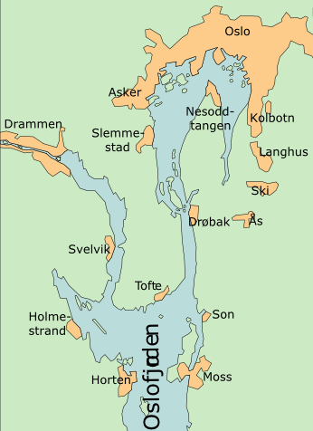
The Oslofjord Tunnel () is a subsea road tunnel which traverses the Oslofjord, connecting Hurum and Frogn in Norway. Carrying three lanes, the long tunnel reaches a depth of below mean sea level. The tunnel has a maximum gradient of seven percent. It acts as a link connecting eastern and western Akershus, Akershus county, supplementing the Moss–Horten Ferry which runs further south. The tunnel is since 2018 a part of European route E134, until 2018 it was part of Norwegian National Road 23, National Road 23. The crossing was originally served by the Drøbak–Storsand Ferry, which commenced in 1939. Plans for a fixed link were launched in 1963, originally based on two bridges which would connect to Håøya, Akershus, Håøya. Plans resurfaced in the early 1980s with the advent of subsea tunneling technology and the Oslo Airport location controversy, which proposed airports in Hurum, Ås, Akershus, Ås and Hobøl. Even though Oslo Airport, Gardermoen, Gardermoen was ultimate ... [...More Info...] [...Related Items...] OR: [Wikipedia] [Google] [Baidu] |
Drammensfjord
Drammensfjord () is a fjord in along the border of Akershus and Buskerud counties in Norway that connects to Ytre Oslofjord on the west side. It stretches about to the north and northeast. The Drammenselva river discharges into the head of the fjord. The fjord shares its name with the city of Drammen, which is located at the head of the fjord. Drammen Municipality is located on its west and north sides. The land on the east side of the fjord is called ''Hurumhalvøya'' or the Hurum peninsula and this is located in Asker Municipality. The peninsula lies between the Drammensfjord and the Oslofjord. The fjord narrows to a strait at Svelvik on the west side and Verket in Asker on the east side. The strait is crossed by an automobile ferry. This narrowing, some broad and deep, combined with the large freshwater inflow from the river Drammenselva (one of Norway's largest rivers) and from the river Lierelva, results in the water north of the strait being brackish. On the surfac ... [...More Info...] [...Related Items...] OR: [Wikipedia] [Google] [Baidu] |
Oslofjord
The Oslofjord (, ; ) is an inlet in southeastern Norway. The fjord begins at the small village of Bonn in Frogn, Frogn Municipality and stretching northwards to the city of Oslo, and then curving to the east and then south again. It then flows south to an imaginary line running between the Torbjørnskjær Lighthouse and Færder Lighthouse where it becomes part of the Skagerrak strait. The Skagerrak connects the North Sea and the Kattegat sea area, which leads to the Baltic Sea. The Oslofjord is not a fjord in the geological sense, but in the Norwegian language, the term can refer to a wide range of waterways including inlets such as this one. The bay is divided into the inner () and Ytre Oslofjord, outer () Oslofjord, separated by the long by wide Drøbak Sound. The innermost part is known as Bunnefjorden. Fjord From 1624 until 1925 the name of the fjord was (or ), since Christiania was the name of the capital during this period (the ''Ch'' was changed to a ''K'' in 1877) ... [...More Info...] [...Related Items...] OR: [Wikipedia] [Google] [Baidu] |
Lier, Norway
Lier is a Municipalities of Norway, municipality in Buskerud Counties of Norway, county, Norway. The administrative centre of the municipality is the village of Lierbyen. The municipality of Lier was established on 1 January 1838 (see formannskapsdistrikt). The area Åssiden was transferred from Lier to the neighboring municipality of Drammen on 1 July 1951. Norway's longest indoor shopping center, Liertoppen, is located in Lierskogen. The newspaper ''Lierposten'' is published in Lier. General information Name The Old Norse form of the name was ''Líðir''. The name is the plural form of ''líð'' which means "hillside". Coat of arms The coat of arms and was designed by Hallvard Trætteberg and granted on 14 August 1970. The arms show five silver-colored apple blossoms on a red background. The area is well known for the production of various types of fruit, berries, vegetables, and flowers, so this was chosen as a symbol of the area's lush scenery and agriculture. Geograph ... [...More Info...] [...Related Items...] OR: [Wikipedia] [Google] [Baidu] |
Heraldry
Heraldry is a discipline relating to the design, display and study of armorial bearings (known as armory), as well as related disciplines, such as vexillology, together with the study of ceremony, Imperial, royal and noble ranks, rank and genealogy, pedigree. Armory, the best-known branch of heraldry, concerns the design and transmission of the Achievement (heraldry), heraldic achievement. The achievement, or armorial bearings usually includes a coat of arms on a escutcheon (heraldry), shield, helmet (heraldry), helmet and Crest (heraldry), crest, together with any accompanying devices, such as supporters, Heraldic badge, badges, Heraldic flag, heraldic banners and mottoes. Although the use of various devices to signify individuals and groups goes back to Ancient history, antiquity, both the form and use of such devices varied widely, as the concept of regular, hereditary designs, constituting the distinguishing feature of heraldry, did not develop until the High Middle Ages. It i ... [...More Info...] [...Related Items...] OR: [Wikipedia] [Google] [Baidu] |
Smoke
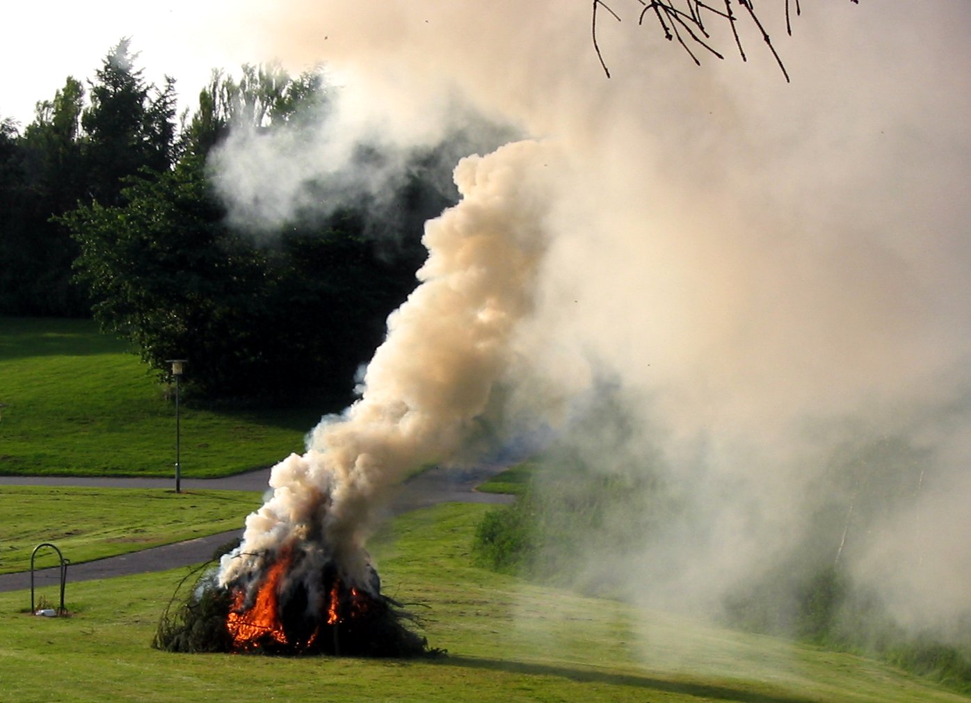
Smoke is an aerosol (a suspension of airborne particulates and gases) emitted when a material undergoes combustion or pyrolysis, together with the quantity of air that is entrained or otherwise mixed into the mass. It is commonly an unwanted by-product of fires (including stoves, candles, internal combustion engines, oil lamps, and fireplaces), but may also be used for pest control ( fumigation), communication ( smoke signals), defensive and offensive capabilities in the military ( smoke screen), cooking, or smoking (tobacco, cannabis, etc.). It is used in rituals where incense, sage, or resin is burned to produce a smell for spiritual or magical purposes. It can also be a flavoring agent and preservative. Smoke inhalation is the primary cause of death in victims of indoor fires. The smoke kills by a combination of thermal damage, poisoning and pulmonary irritation caused by carbon monoxide, hydrogen cyanide and other combustion products. Smoke is an aerosol (or mi ... [...More Info...] [...Related Items...] OR: [Wikipedia] [Google] [Baidu] |
Canting Arms
Canting arms are heraldry, heraldic bearings that represent the bearer's name (or, less often, some attribute or function) in a visual pun or rebus. The expression derives from the latin ''cantare'' (to sing). French heralds used the term (), as they would sound out the name of the armiger. Many armorial allusions require research for elucidation because of changes in language and dialect that have occurred over the past millennium. Canting arms – some in the form of rebuses – are quite common in German civic heraldry. They have also been increasingly used in the 20th century among the British royal family. When the visual representation is expressed through a rebus, this is sometimes called a ''rebus coat of arms''. An in-joke among the Society for Creative Anachronism heralds is the pun, "Heralds don't pun; they cant." Examples of canting arms Personal coats of arms A famous example of canting arms are those of Queen Elizabeth The Queen Mother's paternal family, th ... [...More Info...] [...Related Items...] OR: [Wikipedia] [Google] [Baidu] |
Fire
Fire is the rapid oxidation of a fuel in the exothermic chemical process of combustion, releasing heat, light, and various reaction Product (chemistry), products. Flames, the most visible portion of the fire, are produced in the combustion reaction when the fuel reaches its ignition point temperature. Flames from hydrocarbon fuels consist primarily of carbon dioxide, water vapor, oxygen, and nitrogen. If hot enough, the gases may become ionized to produce Plasma (physics), plasma. The color and Intensity (heat transfer), intensity of the flame depend on the type of fuel and composition of the surrounding gases. Fire, in its most common form, has the potential to result in conflagration, which can lead to permanent physical damage. It directly impacts land-based ecological systems worldwide. The positive effects of fire include stimulating plant growth and maintaining ecological balance. Its negative effects include hazards to life and property, atmospheric pollution, and water ... [...More Info...] [...Related Items...] OR: [Wikipedia] [Google] [Baidu] |


