|
River Lena
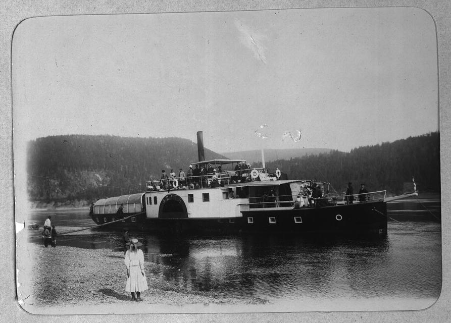
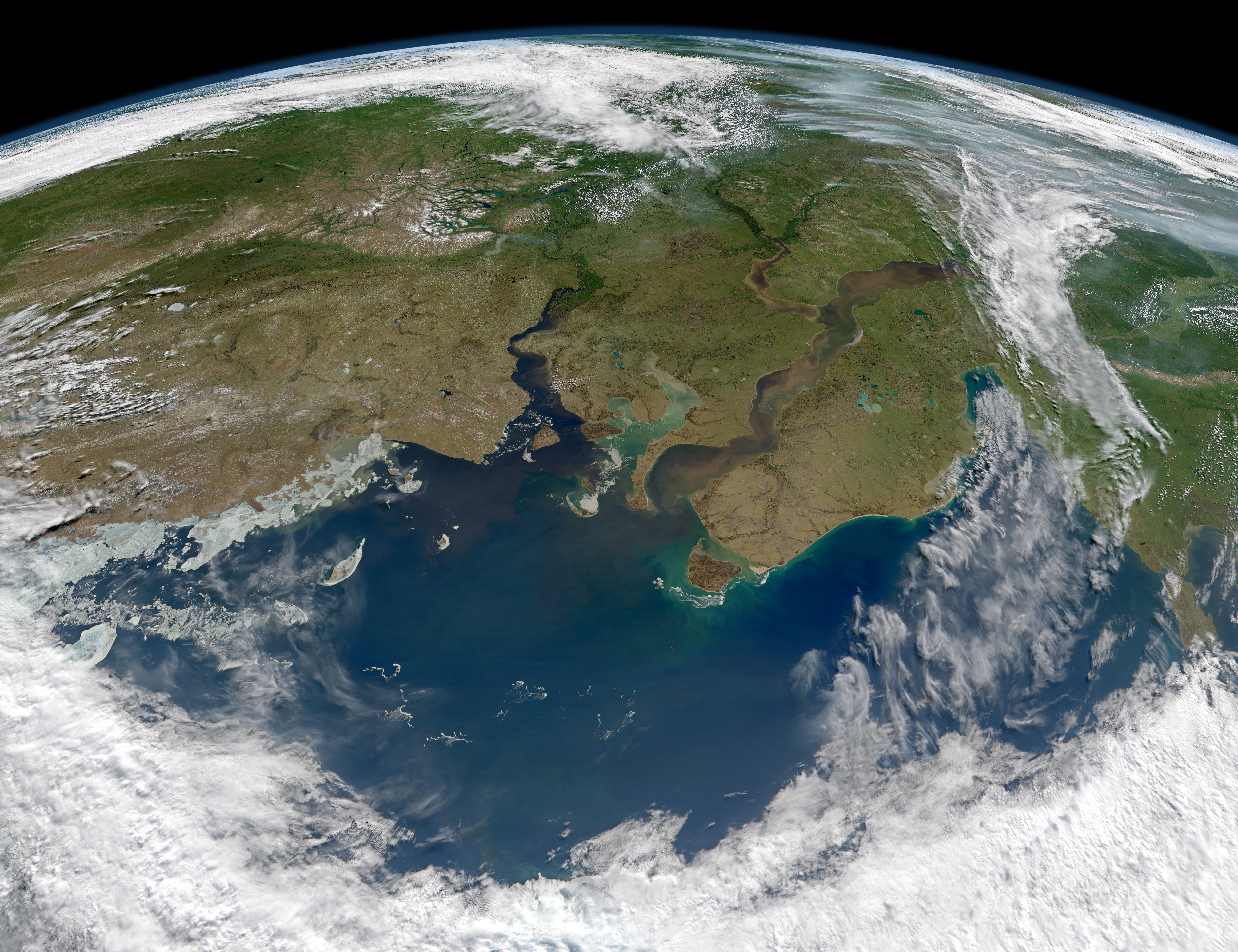
The Lena is a river in the Russian Far East and is the easternmost river of the three great rivers of Siberia which flow into the Arctic Ocean, the others being Ob and Yenisey. The Lena River is long and has a capacious drainage basin of ; thus the Lena is the eleventh-longest river in the world and the longest river entirely within Russia. Geographically, permafrost underlies all the Lena River's catchment and it is continuous in over 75 percent of the basin. Course The Lena originates at of elevation in the Baikal Mountains, west of Lake Baikal, south of the Central Siberian Plateau. The Lena flows north-east and traverses the Lena-Angara Plateau, then is joined by three tributary rivers: (i) the Kirenga, (ii) the Vitim, and (iii) the Olyokma. From Yakutsk, the Lena River enters the Central Yakutian Lowland and flows north until joined by the eastern tributary, the Aldan River, and the western tributary, the Vilyuy River. Afterwards, the Lena bends westwards and nort ... [...More Info...] [...Related Items...] OR: [Wikipedia] [Google] [Baidu] |
Lena Pillars
The Lena Pillars (; , ''Ölüöne Turūk Khayalara'') are a natural rock formation along the banks of the Lena River in far eastern Siberia. The pillars are high, and were formed in some of the Cambrian period sea-basins. The highest density of pillars is reached between the villages of Petrovskoye and Tit-Ary. The Lena Pillars Nature Park was inscribed on the World Heritage List in 2012. The site lies around (less than a day's boat ride) from the city of Yakutsk, the capital of the autonomous Sakha Republic. Tourism One may plan a river cruise by contacting a travel service in the city of Yakutsk. Those interested in limnology or ecotourism, and others who visit Lake Baikal, can coordinate a river sojourn with the aid of a guide from the Lake Baikal region; however, consider that Yakutsk, the world's coldest city and where the river cruises originate, is approximately northeast of Lake Baikal. Few modern amenities exist in this part of Russia, unless one travels by cruise ... [...More Info...] [...Related Items...] OR: [Wikipedia] [Google] [Baidu] |
Aldan (river)
The Aldan ( Sakha and ) is the second-longest right tributary of the Lena in the Sakha Republic in eastern Siberia Siberia ( ; , ) is an extensive geographical region comprising all of North Asia, from the Ural Mountains in the west to the Pacific Ocean in the east. It has formed a part of the sovereign territory of Russia and its predecessor states ....Алдан (река в Якут. АССР) Great Soviet Encyclopedia The river is long, of which around is navigable. It has a drainage basin of . The river was part of the Siberian River Routes, River Route to Okhotsk. In 1639 Ivan Moskvitin ascended the rivers Aldan and Maya (Aldan), Maya and crossed to the Ulya River, Ulya to reach the Sea of Okhotsk. Its Drainage basin, basin is known for gold and for Cambrian fossils. |
Lena-Angara Plateau
The Lena-Angara Plateau (), is a plateau in Siberia. Administratively it is in the Irkutsk Oblast, Russian Federation. The plateau is named after the Lena and Angara rivers, of which it forms the watershed. Rivers on the plateau flow mostly in a south–north direction.Google Earth The plateau has rich mining areas where iron and copper ores are extracted, as well as rock-salt, talc and mica. The Lena-Angara Plateau is mostly sparsely populated. The biggest settlements are Ust-Kut, Kirensk, Zheleznogorsk-Ilimsky, as well as the villages of Zhigalovo and Kachug. The Bratsk Reservoir is located in the plateau area. Geography The Lena-Angara Plateau rises in the middle part of Irkutsk Oblast, between the Angara River to the west and the Kirenga River, a tributary of the Lena, to the east. To the northwest it is bound by the Angara Range, to the south by the Angara valley, to the southeast by the Primorsky Range, and to the east by the Baikal Range, beyond which lies ... [...More Info...] [...Related Items...] OR: [Wikipedia] [Google] [Baidu] |
Central Siberian Plateau
The Central Siberian Plateau (; ) is a vast mountainous area in Siberia, one of the Great Russian Regions. Geography The plateau occupies a great part of central Siberia between the Yenisei and Lena rivers. It is located in the Siberian Platform and extends over an area of , between the Yenisei in the west and the Central Yakutian Lowland in the east. To the south it is bound by the Altai Mountains, Salair Ridge, Kuznetsk Alatau, the Eastern and Western Sayan Mountains and other mountains of Tuva, as well as the North Baikal Highlands and Baikal Mountains. To the north of the plateau lie the North Siberian Lowland and to the east the plateau gives way to the Central Yakutian Lowland and the Lena Plateau.Среднесибирское плоскогорье (Central Siberian ... [...More Info...] [...Related Items...] OR: [Wikipedia] [Google] [Baidu] |
Lake Baikal
Lake Baikal is a rift lake and the deepest lake in the world. It is situated in southern Siberia, Russia between the Federal subjects of Russia, federal subjects of Irkutsk Oblast, Irkutsk Oblasts of Russia, Oblast to the northwest and the Republic of Buryatia to the southeast. At —slightly larger than Belgium—Lake Baikal is the world's List of lakes by area, seventh-largest lake by surface area, as well as the second largest lake in Eurasia after the Caspian Sea. However, because it is also the List of lakes by depth, deepest lake, with a maximum depth of , Lake Baikal is the world's List of lakes by volume, largest freshwater lake by volume, containing of water or 22–23% of the world's fresh surface water, more than all of the North American Great Lakes combined. It is also the world's ancient lake, oldest lake at 25–30 million years, and among the clearest. It is estimated that the lake contains around 19% of the unfrozen fresh water on the planet. Lake Baikal ... [...More Info...] [...Related Items...] OR: [Wikipedia] [Google] [Baidu] |
Catchment
A drainage basin is an area of land in which all flowing surface water converges to a single point, such as a river mouth, or flows into another body of water, such as a lake or ocean. A basin is separated from adjacent basins by a perimeter, the drainage divide, made up of a succession of elevated features, such as ridges and hills. A basin may consist of smaller basins that merge at river confluences, forming a hierarchical pattern. Other terms for a drainage basin are catchment area, catchment basin, drainage area, river basin, water basin, and impluvium. In North America, they are commonly called a watershed, though in other English-speaking places, " watershed" is used only in its original sense, that of the drainage divide line. A drainage basin's boundaries are determined by watershed delineation, a common task in environmental engineering and science. In a closed drainage basin, or endorheic basin, rather than flowing to the ocean, water converges toward the interior ... [...More Info...] [...Related Items...] OR: [Wikipedia] [Google] [Baidu] |
Permafrost
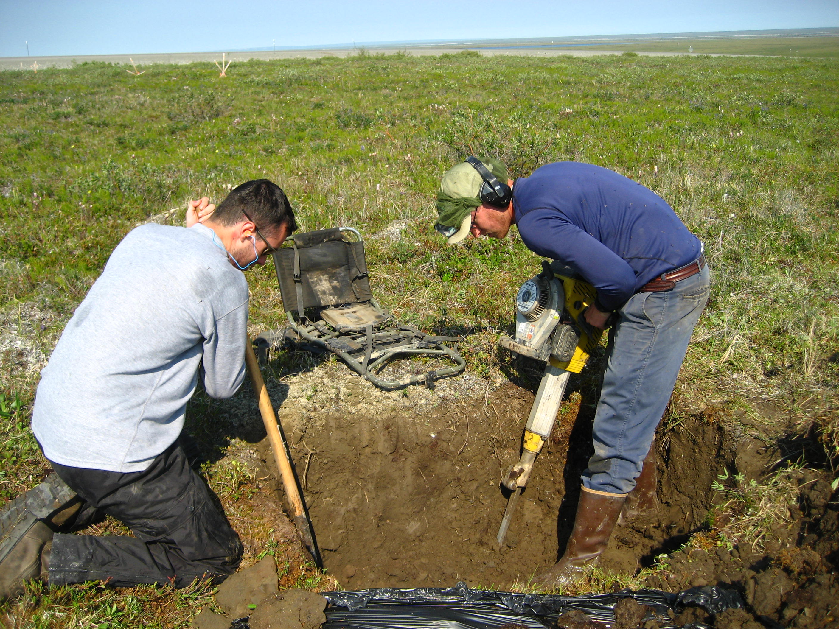
Permafrost () is soil or underwater sediment which continuously remains below for two years or more; the oldest permafrost has been continuously frozen for around 700,000 years. Whilst the shallowest permafrost has a vertical extent of below a meter (3 ft), the deepest is greater than . Similarly, the area of individual permafrost zones may be limited to narrow mountain summits or extend across vast Arctic regions. The ground beneath glaciers and ice sheets is not usually defined as permafrost, so on land, permafrost is generally located beneath a so-called active layer of soil which freezes and thaws depending on the season. Around 15% of the Northern Hemisphere or 11% of the global surface is underlain by permafrost, covering a total area of around . This includes large areas of Alaska, Canada, Greenland, and Siberia. It is also located in high mountain regions, with the Tibetan Plateau being a prominent example. Only a minority of permafrost exists in the Southern Hemi ... [...More Info...] [...Related Items...] OR: [Wikipedia] [Google] [Baidu] |
List Of Rivers By Length
This is a list of the longest rivers on Earth. It includes river systems over in length. Definition of length There are many factors, such as the identification of the source, the identification or the definition of the mouth, and the scale of measurement of the river length between source and mouth, that determine the precise meaning of "river length". As a result, the length measurements of many rivers are only approximations (see also coastline paradox). In particular, there seems to exist disagreement as to whether the Nile or the Amazon River, Amazon is the world's longest river. The Nile has traditionally been considered longer, but in 2007 and 2008 some scientists claimed that the Amazon is longerAmazon Longer Than Nile River, Scientists Say [...More Info...] [...Related Items...] OR: [Wikipedia] [Google] [Baidu] |
Drainage Basin
A drainage basin is an area of land in which all flowing surface water converges to a single point, such as a river mouth, or flows into another body of water, such as a lake or ocean. A basin is separated from adjacent basins by a perimeter, the drainage divide, made up of a succession of elevated features, such as ridges and hills. A basin may consist of smaller basins that merge at river confluences, forming a hierarchical pattern. Other terms for a drainage basin are catchment area, catchment basin, drainage area, river basin, water basin, and impluvium. In North America, they are commonly called a watershed, though in other English-speaking places, " watershed" is used only in its original sense, that of the drainage divide line. A drainage basin's boundaries are determined by watershed delineation, a common task in environmental engineering and science. In a closed drainage basin, or endorheic basin, rather than flowing to the ocean, water converges toward the ... [...More Info...] [...Related Items...] OR: [Wikipedia] [Google] [Baidu] |
Yenisey
The Yenisey or Yenisei ( ; , ) is the list of rivers by length, fifth-longest river system in the world, and the largest to drain into the Arctic Ocean. Rising in Mungaragiyn-gol in Mongolia, it follows a northerly course through Lake Baikal and the Krasnoyarsk Dam before draining into the Yenisey Gulf in the Kara Sea. The Yenisey divides the Western Siberian Plain in the west from the Central Siberian Plateau to the east; it drains a large part of central Siberia. Its delta is formed between the Gyda Peninsula and the Taymyr Peninsula. It is the central one of three large Siberian rivers that flow into the Arctic Ocean (the other two being the Ob (river), Ob and the Lena River, Lena). The maximum depth of the Yenisey is and the average depth is . Geography The Yenisey proper, from the confluence of its source rivers the Great Yenisey and Little Yenisey at Kyzyl to its mouth in the Kara Sea, is long. From the source of its tributary the Selenga, it is long. [...More Info...] [...Related Items...] OR: [Wikipedia] [Google] [Baidu] |
Ob (river)
The Ob (; ) is a major river in Russia. It is in western Siberia, and with its tributary the Irtysh forms the world's seventh-longest river system, at . The Ob forms at the confluence of the Biya and Katun which have their origins in the Altai Mountains. It is the westernmost of the three great Siberian rivers that flow into the Arctic Ocean (the other two being the Yenisei and the Lena). Its flow is north-westward, then northward. The main city on its banks is Novosibirsk, the largest city in Siberia, and the third-largest city in Russia. It is where the Trans-Siberian Railway crosses the river. The Gulf of Ob is the world's longest estuary. Names The internationally known name of the river is based on the Russian name ''Обь'' (''Obʹ'', ). Possibly from Proto-Indo-Iranian '' *Hā́p-'', "river, water" (compare Vedic Sanskrit ''áp-'', Persian ''āb'', Tajik ''ob'', and Pashto ''obə'', "water"). Katz (1990) proposes Komi ''ob'' 'river' as the immediate source o ... [...More Info...] [...Related Items...] OR: [Wikipedia] [Google] [Baidu] |
Arctic Ocean
The Arctic Ocean is the smallest and shallowest of the world's five oceanic divisions. It spans an area of approximately and is the coldest of the world's oceans. The International Hydrographic Organization (IHO) recognizes it as an ocean, although some oceanographers call it the Arctic Mediterranean Sea. It has also been described as an estuary of the Atlantic Ocean. It is also seen as the northernmost part of the all-encompassing world ocean. The Arctic Ocean includes the North Pole region in the middle of the Northern Hemisphere and extends south to about 60°N. The Arctic Ocean is surrounded by Eurasia and North America, and the borders follow topographic features: the Bering Strait on the Pacific side and the Greenland Scotland Ridge on the Atlantic side. It is mostly covered by sea ice throughout the year and almost completely in winter. The Arctic Ocean's surface temperature and salinity vary seasonally as the ice cover melts and freezes; its salinity is the ... [...More Info...] [...Related Items...] OR: [Wikipedia] [Google] [Baidu] |


