|
Richard Sopris
Richard Sopris (1813 – 1893) was an American politician who served as the mayor of Denver, Colorado from 1878 to 1881. Prior to that, he was a prospector, Captain in the 1st Regiment of Colorado Volunteers, and a representative for what is now Colorado in the Kansas Territorial legislature. Early and personal life Richard Sopris was born on June 26, 1813 or July 26, 1813 in Bucks County, Pennsylvania. He was married near Philadelphia to Elizabeth Allen of Trenton, New Jersey on June 3, 1836, and they moved to Indiana that year. They had eight children by 1860, and a total of ten children. His daughter, Indiana Sopris opened a school in May 1860. She was the first white woman to teach school in the city and she is credited as the first woman teacher in Colorado. Career He began working as a house carpenter. Sopris was also a canal builder and steamboat captain. In 1858, he traveled by stage to Omaha, Nebraska and then traveled across the plains in a one-horse wagon with Geor ... [...More Info...] [...Related Items...] OR: [Wikipedia] [Google] [Baidu] |
Bucks County, Pennsylvania
Bucks County is a county in the Commonwealth of Pennsylvania. As of the 2020 census, the population was 646,538, making it the fourth-most populous county in Pennsylvania. Its county seat is Doylestown. The county is named after the English county of Buckinghamshire. Bucks County is part of the northern boundary of the Philadelphia–Camden– Wilmington, PA– NJ– DE– MD Metropolitan Statistical Area, more commonly known as the Delaware Valley. It is located immediately northeast of Philadelphia and forms part of the southern tip of the eastern state border with New Jersey. History Founding Bucks County is one of the three original counties created by colonial proprietor William Penn in 1682. Penn named the county after Buckinghamshire, the county in which he lived in England. He built a country estate, Pennsbury Manor, in Falls Township, Bucks County. Some places in Bucks County were named after locations in Buckinghamshire, including Buckingham and Buckingha ... [...More Info...] [...Related Items...] OR: [Wikipedia] [Google] [Baidu] |
Central City/Black Hawk Historic District
The Central City/Black Hawk Historic District (formerly just the Central City Historic District) is a National Historic Landmark District that encompasses the developed areas of Central City and Black Hawk, Colorado. They are adjacent former gold mining camps in the Front Range of the Rocky Mountains in Gilpin County, Colorado, United States. For a time, the area was known as the ''Richest Square Mile on Earth'', and was the largest urban area of the in the 1870s. The district was designated a |
1813 Births
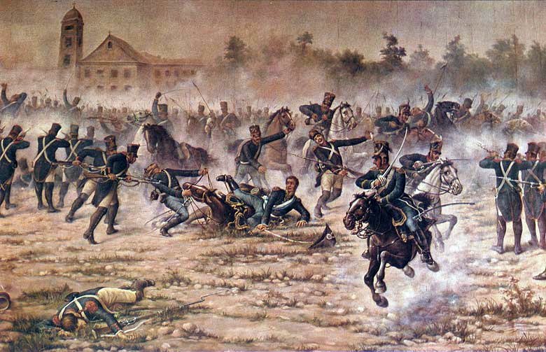
Events January–March * January 18–January 23 – War of 1812: The Battle of Frenchtown is fought in modern-day Monroe, Michigan between the United States and a British and Native American alliance. * January 24 – The Philharmonic Society (later the Royal Philharmonic Society) is founded in London. * January 28 – Jane Austen's ''Pride and Prejudice'' is published anonymously in London. * January 31 – The Assembly of the Year XIII is inaugurated in Buenos Aires. * February – War of 1812 in North America: General William Henry Harrison sends out an expedition to burn the British vessels at Fort Malden by going across Lake Erie via the Bass Islands in sleighs, but the ice is not hard enough, and the expedition returns. * February 3 – Argentine War of Independence: José de San Martín and his Regiment of Mounted Grenadiers gain a largely symbolic victory against a Spanish royalist army in the Battle of San Lorenzo. * Febru ... [...More Info...] [...Related Items...] OR: [Wikipedia] [Google] [Baidu] |
Mayors Of Denver
In many countries, a mayor is the highest-ranking official in a municipal government such as that of a city or a town. Worldwide, there is a wide variance in local laws and customs regarding the powers and responsibilities of a mayor as well as the means by which a mayor is elected or otherwise mandated. Depending on the system chosen, a mayor may be the chief executive officer of the municipal government, may simply chair a multi-member governing body with little or no independent power, or may play a solely ceremonial role. A mayor's duties and responsibilities may be to appoint and oversee municipal managers and employees, provide basic governmental services to constituents, and execute the laws and ordinances passed by a municipal governing body (or mandated by a state, territorial or national governing body). Options for selection of a mayor include direct election by the public, or selection by an elected governing council or board. The term ''mayor'' shares a linguistic o ... [...More Info...] [...Related Items...] OR: [Wikipedia] [Google] [Baidu] |
Mount Sopris
Mount Sopris is a twin-summit mountain in the northwestern Elk Mountains range of the Rocky Mountains of North America. The prominent mountain is located in the Maroon Bells-Snowmass Wilderness of White River National Forest, north by northeast ( bearing 30°) of the community of Redstone in Pitkin County, Colorado, United States. Mountain Mount Sopris is located in western Pitkin County, south of Carbondale and southwest of the confluence of the Crystal and Roaring Fork rivers. Mount Sopris is notable for having two summits, East Sopris and West Sopris, that are one-half mile (0.8 km) apart and have the same elevation of .The peaks are connected by a saddle at elevation of about 12,660 feet, giving them a relative prominence of just around 300 feet. Hence by the usual 300 foot prominence rule for Colorado summits, the two summits are on the borderline of being considered separate peaks. It is named for Richard Sopris, a former mayor of Denver and part of the first ... [...More Info...] [...Related Items...] OR: [Wikipedia] [Google] [Baidu] |
Riverside Cemetery (Denver, Colorado)
Riverside Cemetery, established in 1876, is Denver, Colorado's oldest operating cemetery. More than 67,000 people are buried there, including 1,000 veterans. Location and operation Riverside Cemetery occupies a site between Brighton Boulevard and the east bank of the South Platte River, approximately 4 miles down stream from downtown Denver, Colorado. The majority of Riverside Cemetery lies within Adams County, Colorado, however the rest of the cemetery, the cemetery's original entrance and administration building, are within the City and County of Denver. Riverside Cemetery originally was the property of the Riverside Cemetery Association from its founding in 1876 until 1900 when the association's assets were transferred to the Fairmount Cemetery Association (presently known as Fairmount Cemetery Company). In late 2000, Fairmount Cemetery Company along with members of the community founded the Fairmount Heritage Foundation to be an educational resource for the community and ... [...More Info...] [...Related Items...] OR: [Wikipedia] [Google] [Baidu] |
Confederate States Army
The Confederate States Army, also called the Confederate Army or the Southern Army, was the military land force of the Confederate States of America (commonly referred to as the Confederacy) during the American Civil War (1861–1865), fighting against the United States forces to win the independence of the Southern states and uphold Slavery in the United States, the institution of slavery. On February 28, 1861, the Provisional Confederate Congress established a provisional volunteer army and gave control over military operations and authority for mustering state forces and volunteers to the newly chosen Confederate president, Jefferson Davis. Davis was a graduate of the United States Military Academy, U.S. Military Academy, and colonel of a volunteer regiment during the Mexican–American War. He had also been a United States senator from Mississippi and United States Secretary of War, U.S. Secretary of War under President Franklin Pierce. On March 1, 1861, on behalf of the Conf ... [...More Info...] [...Related Items...] OR: [Wikipedia] [Google] [Baidu] |
Glorieta Pass
Glorieta Pass (elevation 7500 ft.) is a mountain pass in the Sangre de Cristo Mountains of northern New Mexico. The pass is at a strategic location near at the southern end of the Sangre de Cristos in east central Santa Fe County southeast of the city of Santa Fe. Historically, the pass provided the most direct route through the mountains between the upper valley of the Pecos River to the east and the upper valley of the Rio Grande to the west. In the 19th century, it furnished the route of the westernmost leg of the Santa Fe Trail between Santa Fe and the High Plains. The Battle of Glorieta Pass, the decisive battle of the New Mexico Campaign of the American Civil War, was fought near the pass in March 1862. The victory by the Union Army (primarily in the form of the Colorado Militia) prevented the breakout of the Confederate Army forces onto the High Plains on the east side of Sangre de Cristo Mountains, halting the intended Confederate advance northward along t ... [...More Info...] [...Related Items...] OR: [Wikipedia] [Google] [Baidu] |
Atchison, Kansas
Atchison is a city and county seat of Atchison County, Kansas, United States, along the Missouri River. As of the 2020 census, the population of the city was 10,885. The city is named in honor of US Senator David Rice Atchison from Missouri and was the original eastern terminus of the Atchison, Topeka and Santa Fe Railway. Atchison is also the home of Benedictine College. History Founding Atchison was founded in 1854 and named in honor of Missouri senator David Rice Atchison, who, when Kansas was opened for settlement, interested some of his friends in the scheme of forming a city in the new territory. Senator Atchison was interested in ensuring that the population of the new Kansas Territory would be majority pro-slavery, as he had been a prominent promoter of both slavery and the idea of popular sovereignty over the issue in the new lands. However, not everyone agreed upon the location he had selected, and on July 20, 1854, Dr. John H. Stringfellow, Ira Norris, Leoni ... [...More Info...] [...Related Items...] OR: [Wikipedia] [Google] [Baidu] |
Michigan City, Indiana
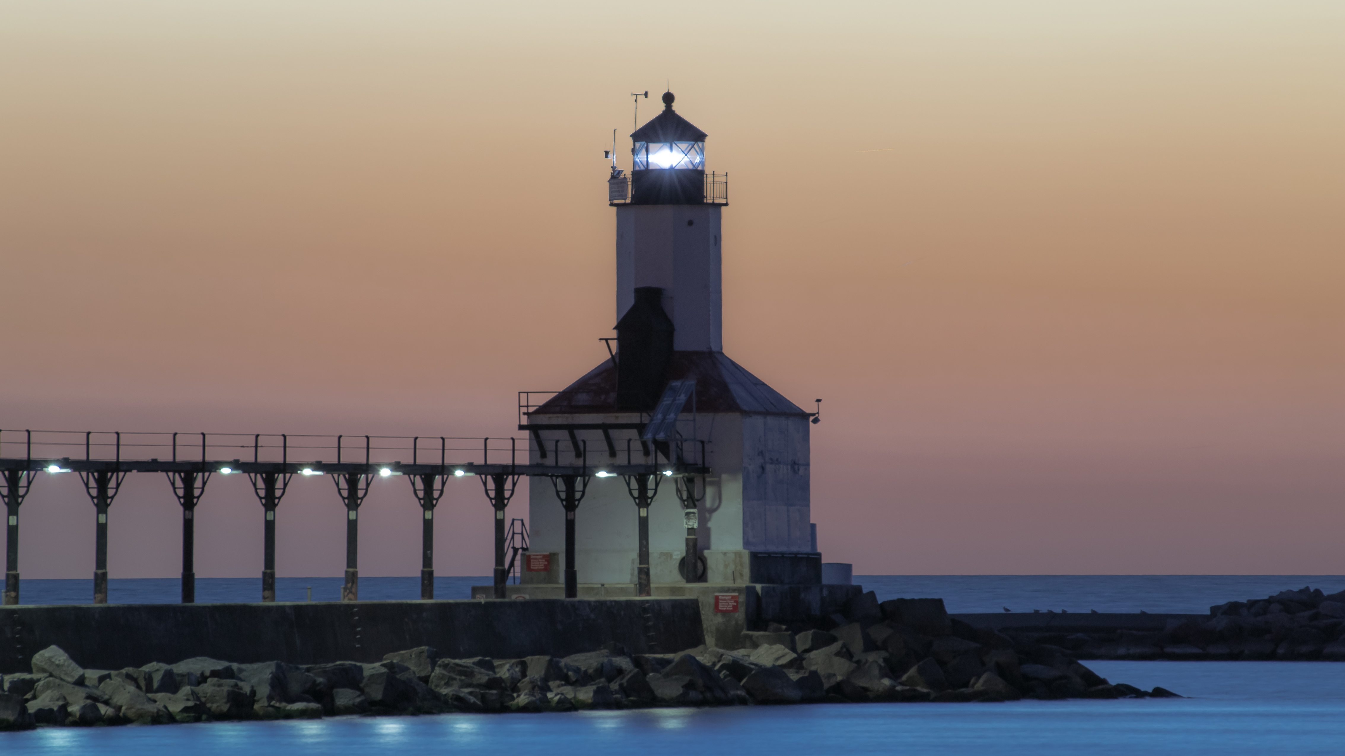
Michigan City is a city in LaPorte County, Indiana, United States. It is one of the two principal cities of the Michigan City- La Porte, Indiana Metropolitan statistical area, which is included in the Chicago-Naperville-Michigan City Combined statistical area. In the region known to locals as Michiana, the city is about east of Chicago and west of South Bend. It had a population of 31,479 at the 2010 census. Michigan City is noted for both its proximity to Indiana Dunes National Park and for bordering Lake Michigan. It receives a fair amount of tourism during the summer, especially by residents of Chicago and nearby cities in Northern Indiana. The lighthouse is a notable symbol of the city and is incorporated in the heading of its sole newspaper, ''The News Dispatch'', and its official seal. History Michigan City's origins date to 1830, when the land for the city was first purchased by Isaac C. Elston, a real estate speculator who had made his fortune in Crawfordsville, In ... [...More Info...] [...Related Items...] OR: [Wikipedia] [Google] [Baidu] |
Central City, Colorado
The historic City of Central, commonly known as Central City, is a home rule municipality located in Gilpin and Clear Creek counties, Colorado, United States. Central City is the county seat and the most populous municipality of Gilpin County. The city population was 779, all in Gilpin County, at the 2020 United States Census. The city is a historic mining settlement founded in 1859 during the Pike's Peak Gold Rush and came to be known as the "Richest Square Mile on Earth". Central City and the adjacent city of Black Hawk form the federally designated Central City/Black Hawk Historic District. The city is now a part of the Denver-Aurora-Lakewood, CO Metropolitan Statistical Area and the Front Range Urban Corridor. History On May 6, 1859, during the Pike's Peak Gold Rush, John H. Gregory found a gold-bearing vein (the Gregory Lode) in Gregory Gulch between Black Hawk and Central City. Within two months many other veins were discovered, including the Bates, Gunnell, Kan ... [...More Info...] [...Related Items...] OR: [Wikipedia] [Google] [Baidu] |
Auraria, Colorado
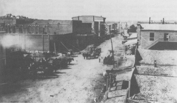
Auraria was a small mining settlement in the Kansas Territory in the United States. Today it survives in its original location as a neighborhood of Denver, Colorado, south of the confluence of Cherry Creek and the South Platte River. Geography Auraria is located in central Denver. It is just west of downtown Denver and is shaped roughly like a triangle. It borders Colfax Avenue on the south, Cherry Creek to the northeast, and South Platte River to the northwest. History On October 3, 1858, a group of Georgia prospectors led by Green Russell establish the townsite of Auraria south of Cherry Creek near the Cherry Creek Diggings, over a month before a group of Kansas Territory speculators led by William Larimer established the rival Denver City on the other side of Cherry Creek. Henry Allen, a surveyor, laid the town platte and was Auraria town company's first president. The town was named for the gold mining settlement of Auraria, Georgia. On October 29, Cha ... [...More Info...] [...Related Items...] OR: [Wikipedia] [Google] [Baidu] |


.png)