|
Regions Of Singapore
The regions of Singapore are urban planning subdivisions demarcated by the Urban Redevelopment Authority of Singapore to aid in its planning efforts. Over time, other governmental organisations have also adopted the five regions in their administrative work, as for example the Department of Statistics in the census of 2000. The regions are further subdivided into 55 planning areas, which include two water-catchment areas. The largest region in terms of area is the West Region with , while the Central Region is the most populous with an estimated population of 922,980 inhabitants in the area in 2019. Singapore is governed as a unitary state without provinces or states. While used by some governmental organizations, these regions are not administrative subdivisions in a conventional sense. For administrative purposes, Singapore is divided into five districts and further divided into divisions governed by councils and headed by mayors. These subdivisions are incompatible with th ... [...More Info...] [...Related Items...] OR: [Wikipedia] [Google] [Baidu] |
Unitary State
A unitary state is a (Sovereign state, sovereign) State (polity), state governed as a single entity in which the central government is the supreme authority. The central government may create or abolish administrative divisions (sub-national or sub-state units). Such units exercise only the powers that the central government chooses to delegate. Although Power (social and political), political power may be delegated through devolution to regional or local governments by statute, the central government may alter the statute, to override the decisions of Devolution, devolved governments or expand their powers. The modern unitary state concept originated in France; in the aftermath of the Hundred Years' War, national feelings that emerged from the war unified France. The war accelerated the process of transforming France from a feudal monarchy to a unitary state. The French people, French then later spread unitary states by conquests, throughout Europe during and after the Napoleoni ... [...More Info...] [...Related Items...] OR: [Wikipedia] [Google] [Baidu] |
Changi
Changi ( ) is a planning area located in the geographical region of Tanah Merah in the East Region of Singapore. Sharing borders with Pasir Ris and Tampines to the west, Changi Bay to the southeast, the South China Sea to the east and the Serangoon Harbour to the north. It is further divided into the subzones Changi Airport, Changi Point and Changi West. Changi, excluding the two water catchments and islands of Singapore, is the largest planning area by land size. Today, Changi is an aviation hub. It is the location of both the Changi Airport and Changi Air Base. Also located within Changi is Singapore's largest prison, Changi Prison. It was used as a Japanese prisoner-of-war camp during the occupation of Singapore in World War II. The prison is Singapore's oldest operating internment facility. Etymology The early Malay place name of Changi was Tanjong Rusa (English: Deer cape), as written in the 1604 Godinho de Eredia map of Singapore. The name Changi was kn ... [...More Info...] [...Related Items...] OR: [Wikipedia] [Google] [Baidu] |
Tampines
Tampines ( or ) is the Regional centre (Singapore), regional centre of the East Region, Singapore, East Region of Singapore. With a population of 284,560 living across its five subzones as of 2024, it is the most populous Planning Areas of Singapore, planning area in Singapore. It is home to approximately 5% of Singapore's population. Tampines is bordered to the west by Bedok and Paya Lebar, to the north by Pasir Ris, to the east by Changi, and to the south by the Singapore Strait, Straits of Singapore. Situated in the historical region of Tanah Merah, Singapore, Tanah Merah, its present-day terrain is particularly flat due to the large-scale sand quarrying in the 1960s. Tampines is composed of five subzones — Tampines North, Tampines East, Tampines West, Simei and Xilin. These subzones were created in the early 1990s predominantly for urban planning purposes and have no relation to the three Constituencies of Singapore, political constituencies in Tampines. Four of its subzo ... [...More Info...] [...Related Items...] OR: [Wikipedia] [Google] [Baidu] |
Bukit Merah
Bukit Merah, also known as Redhill, is a Planning Areas of Singapore, planning area and New towns of Singapore, new town situated in the southernmost part of the Central Region, Singapore, Central Region of Singapore. The planning area borders Tanglin to the north, Queenstown, Singapore, Queenstown to the west and the Downtown Core, Outram, Singapore, Outram and Singapore River planning areas of the Central Area, Singapore, Central Area to the east. It also shares a maritime boundary with the Southern Islands planning area to the south. Bukit Merah is linked to Sentosa Island via Sentosa Gateway, Sentosa Broadwalk, Sentosa Express and the Singapore Cable Car, Cable Car. Bukit Merah planning area also includes two offshore islands which are linked to the mainland by road, namely Pulau Brani and Keppel Island, Singapore, Keppel Island. It is the most populated planning area in the Central Region, and the 12th most populated planning area in the country overall, being home to more t ... [...More Info...] [...Related Items...] OR: [Wikipedia] [Google] [Baidu] |
Queenstown, Singapore
Queenstown is a Planning Areas of Singapore, planning area and New towns of Singapore, satellite residential town situated on the south-westernmost fringe of the Central Region, Singapore, Central Region of Singapore. It borders Bukit Timah to the north, Tanglin to the northeast, Bukit Merah to the east and southeast, as well as Clementi, Singapore, Clementi to the northwest and west. Its southern and southwesternmost limits are bounded by the Pandan Strait. Developed by the Singapore Improvement Trust in the 1950s and subsequently by the Housing and Development Board in the 1960s, Queenstown was the first satellite town to be built in the country. Most apartments within the township consists of simple one, two, or three-room flats, typically in low-rise, walk-up blocks. Major development work was carried out during the first Five-Year Building Programme between 1960 and 1965. A total of 19,372 dwelling units were constructed between 1952 and 1968. The headquarters of Grab (com ... [...More Info...] [...Related Items...] OR: [Wikipedia] [Google] [Baidu] |
Punggol Digital District
This article shows the notable future developments in Singapore. Most of them are currently under construction with most to be completed within the next five years. Commercial 8 Shenton Way (Redevelopment of AXA Tower) Announced by the Urban Redevelopment Authority on 5 August 2022, the upcoming mixed-use development to replace the existing AXA Tower in Tanjong Pagar has been granted a maximum approved height of 305 metres. Surpassing the 284 metres-tall Guoco Tower, the 63-storey skyscraper is set to be Singapore's tallest building when completed in 2028. The development will comprise commercial spaces, offices, a hotel, and residential units with sky terraces. CanningHill Piers and CanningHill Square (Redevelopment of Liang Court) A new mixed-use, integrated development named CanningHill Piers will be built on the current Liang Court complex with a 696-unit condominium spread across two residential towers, a 2-storey retail mall named CanningHill Square, a 460- to 475- ... [...More Info...] [...Related Items...] OR: [Wikipedia] [Google] [Baidu] |
Punggol
Punggol ( or ) is a Planning Areas of Singapore, planning area and New towns of Singapore, new town situated on the Tanjong Punggol peninsula in the North-East Region, Singapore, North-East Region of Singapore. The town directly borders Sengkang to the south and shares riverine boundaries with the planning area of Seletar, as well as Yishun to the west and Pasir Ris to the east. Bounding the town to the north and north-east is the Straits of Johor, with Coney Island, Punggol, Coney Island included as a part of the Punggol planning area. Under the Pungool 21 initiative, plans to turn the area into a new residential town were announced in 1996 and development of the town started in 1998. Due to the Asian financial crisis in 1997 and the financial troubles within the construction industry in 2003, the plan did not fully materialise. In 2007, a new initiative, the Punggol 21-plus plan, was introduced to redevelop the area into a waterfront town. Punggol is divided into 11 district ... [...More Info...] [...Related Items...] OR: [Wikipedia] [Google] [Baidu] |
East Region, Singapore
The East Region (, zh, 東區, ) of Singapore is one of the five regions in the city-state. The region is the 2nd most densely populated among the five, and has the smallest land area. Bedok is the region's most populous town and Tampines is the regional centre of the area. Comprising 11,000 hectares, it includes six planning areas and is also home to Singapore's Changi Airport and Paya Lebar Air Base. The region also houses the Changi Naval Base and Changi Prison, which was first constructed in 1936 by the British and is Singapore's oldest internment facility. Geography With a total land area of , the region is situated on the eastern corner of Singapore Island, bordering the North-East Region to the north-west, Central Region to the south-west and shares riverine borders with the North-Eastern Islands to the north. Government The East Region is governed locally by two different Community Development Councils, namely the North East CDC and the South East CDC, both ... [...More Info...] [...Related Items...] OR: [Wikipedia] [Google] [Baidu] |
Mass Rapid Transit (Singapore)
The Mass Rapid Transit system, locally known by the Acronym, initialism MRT, is a rapid transit system in Singapore and the island country's principal mode of Rail transport in Singapore, railway transportation. After two decades of planning the system commenced operations in November 1987 with an initial stretch consisting of five stations. The network has since grown to span the length and breadth of the country's Singapore Island, main island – with the exception of the Central Catchment Nature Reserve, forested core and the rural Lim Chu Kang, northwestern region – in accordance with Singapore's aim of developing a comprehensive rail network as the backbone of the country's Transport in Singapore, public transportation system,Singapore's heavy rail network is composed of three distinct systems. Two of the three are rapid transit networks, chiefly a) the MRT system, which falls entirely within the city-state and forms the core of the network, and b) the two-station cross- ... [...More Info...] [...Related Items...] OR: [Wikipedia] [Google] [Baidu] |
Central Area, Singapore
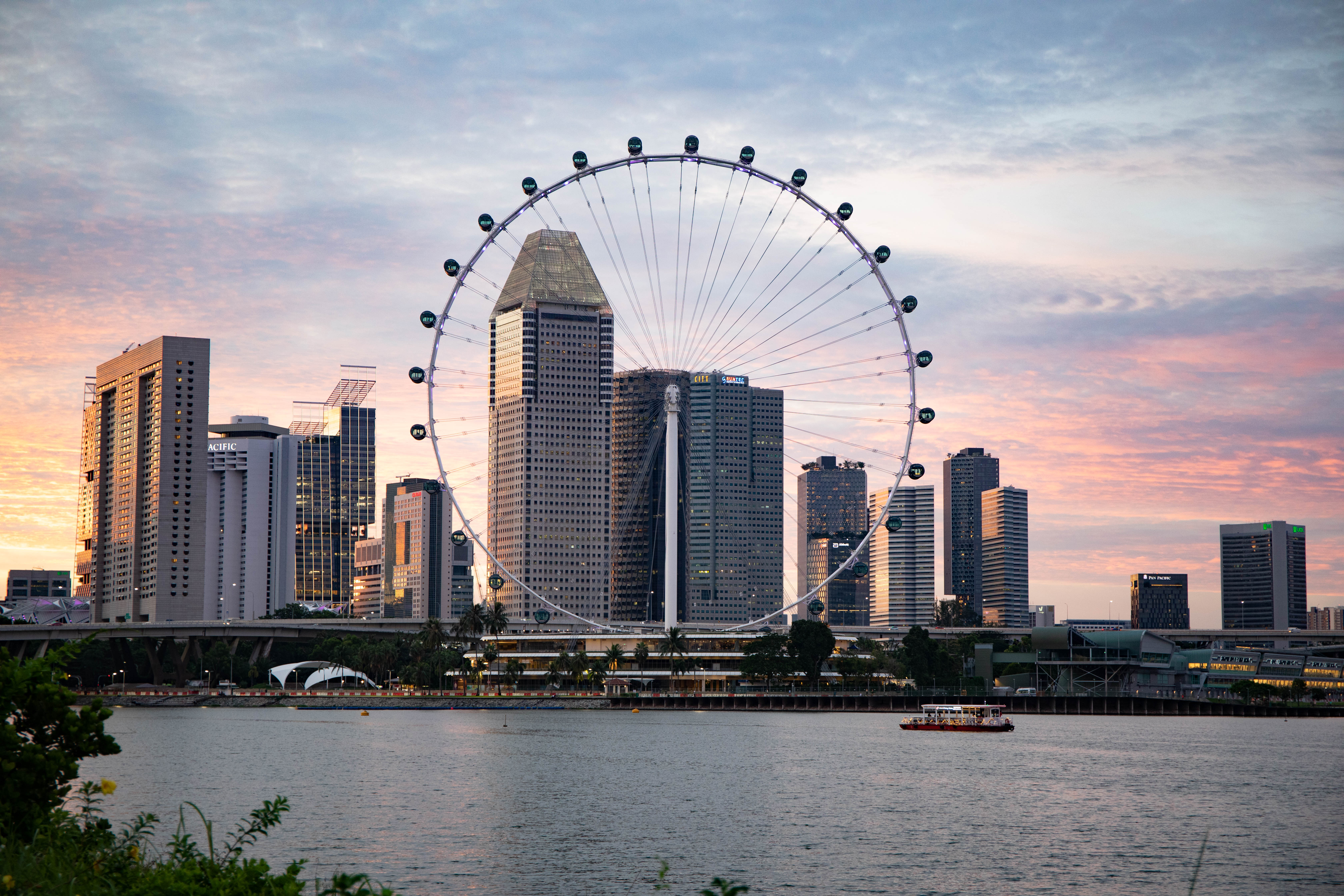
The Central Area, also called the City Area, and informally The City, is the main commercial and financial city centre of Singapore. Located in the south-eastern part of the Central Region, the Central Area consists of eleven constituent planning areas: the Downtown Core, Marina East, Marina South, the Museum Planning Area, Newton, Orchard, Outram, River Valley, Rochor, the Singapore River and Straits View, as defined by the Urban Redevelopment Authority. The term Central Business District (CBD) has also been used to describe most of the Central Area as well, although its boundaries lie within the Downtown Core. Singapore's modern history began in this area, when British colonial official Stamford Raffles and representatives of the British East India Company landed along the banks of the Singapore River in 1819 to set up a free port of trade between Europe and Asia. As the old harbour grew along the mouth of the river bank, the historical city naturally expanded aro ... [...More Info...] [...Related Items...] OR: [Wikipedia] [Google] [Baidu] |
Downtown Core
The Downtown Core is the historical and downtown centre of the city-state of Singapore and the main commercial area in Singapore excluding reclaimed lands with two integrated resorts such as the Marina Bay Sands, one of the most expensive buildings in the world, with a luxurious standalone casino at Bayfront Avenue. There are many skyscrapers in Raffles Place, Tanjong Pagar and Marina Bay CBD with a height limit of 280m. It is one of the eleven planning areas located within the most urbanised Central Area, forming the latter's dense urban core. It is bounded by Rochor to the north, Kallang to the northeast, Marina East and Marina South to the east, Straits View to the southeast, Bukit Merah to the south, as well as Outram, Museum and Singapore River to the west. As the financial Heart of Singapore, the Downtown Core houses the headquarters and offices of numerous corporations, as well as the Singapore Exchange. The area is also home to many governmental institutions, nota ... [...More Info...] [...Related Items...] OR: [Wikipedia] [Google] [Baidu] |


