|
Rarhi, Bihar
Rarhi is a village in Jale Block, Darbhanga District, Bihar, India. It is located near the northern border of the country, about 27 kilometres northwest of the district capital Darbhanga, and 5 kilometres south of the block capital Jale, Bihar. In the year 2011, it has a population of 36,569. Geography Rarhi is located to the north of Bagmati River The Bagmati River flows through the Kathmandu valley of Nepal, separating the cities of Kathmandu and Patan, before flowing through Madesh Province of southern Nepal and joining the Kamla River in the Indian state of Bihar. It is considered .... The Jale-Atarwel Path passes through the west of the village. Its total area is 2861 hectares. Demographics According to the 2011 Census of India, there are 7,500 households within Rarhi. Among the 36,569 inhabitants, 18,868 are male and 17,701 are female. The total literacy rate is 42.45%, with 9,284 of the male population and 6,238 of the female population being literate. Its ce ... [...More Info...] [...Related Items...] OR: [Wikipedia] [Google] [Baidu] |
List Of Sovereign States
The following is a list providing an overview of sovereign states around the world with information on their status and recognition of their sovereignty. The 205 listed states can be divided into three categories based on membership within the United Nations System: 193 member states of the United Nations, UN member states, two United Nations General Assembly observers#Current non-member observers, UN General Assembly non-member observer states, and ten other states. The ''sovereignty dispute'' column indicates states having undisputed sovereignty (188 states, of which there are 187 UN member states and one UN General Assembly non-member observer state), states having disputed sovereignty (15 states, of which there are six UN member states, one UN General Assembly non-member observer state, and eight de facto states), and states having a political status of the Cook Islands and Niue, special political status (two states, both in associated state, free association with New ... [...More Info...] [...Related Items...] OR: [Wikipedia] [Google] [Baidu] |
Indian Standard Time
Indian Standard Time (IST), sometimes also called India Standard Time, is the time zone observed throughout the Republic of India, with a time offset of UTC+05:30. India does not observe daylight saving time or other seasonal adjustments. In military and aviation time, IST is designated E* ("Echo-Star"). It is indicated as ''Asia/Kolkata'' in the IANA time zone database. History The Indian Standard Time was adopted on 1 January 1906 during the British era with the phasing out of its precursor Madras Time (Railway Time), and after Independence in 1947, the Union government established IST as the official time for the whole country, although Kolkata and Mumbai retained their own local time (known as Calcutta Time and Bombay Time) until 1948 and 1955, respectively. The Central observatory was moved from Chennai to a location at Shankargarh Fort in Allahabad district, so that it would be as close to UTC+05:30 as possible. Daylight Saving Time (DST) was used brief ... [...More Info...] [...Related Items...] OR: [Wikipedia] [Google] [Baidu] |
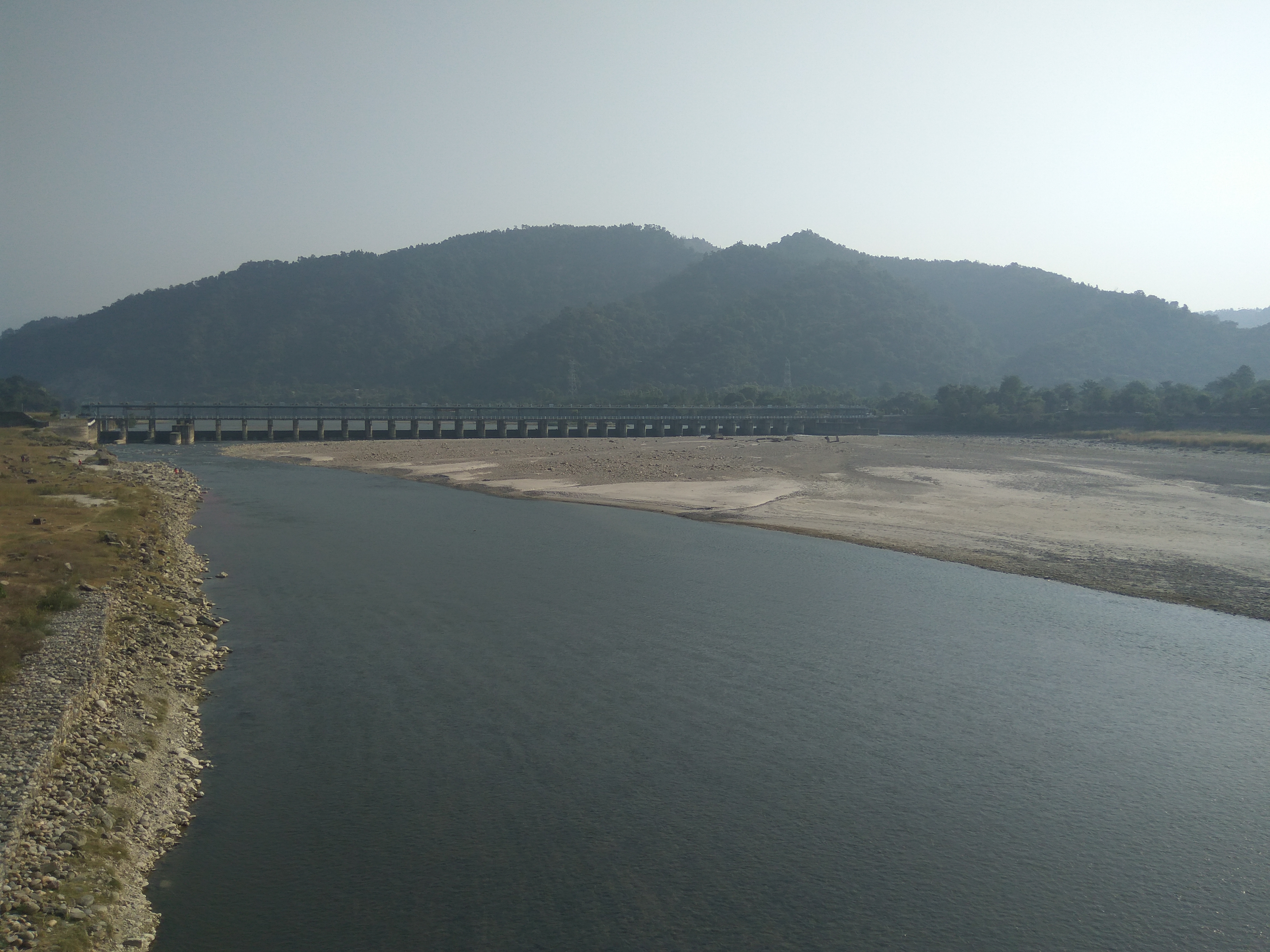
Bagmati River
The Bagmati River flows through the Kathmandu valley of Nepal, separating the cities of Kathmandu and Patan, before flowing through Madesh Province of southern Nepal and joining the Kamla River in the Indian state of Bihar. It is considered holy by both Hindus and Buddhists. A number of Hindu temples are located on its banks. The importance of the Bagmati also lies in the fact that Hindus are cremated on the banks of this holy river, and Kirants are buried in the hills by its side. According to the Nepalese Hindu tradition, the dead body must be dipped three times into the Bagmati before cremation, so that the reincarnation cycle may be ended. The chief mourner (usually the first son) who lights the funeral pyre must take a holy river-water bath immediately after cremation. Many relatives who join the funeral procession also take a bath in the river or sprinkle holy water on their bodies at the end of the cremation. It is believed that the Bagmati River purifies people spir ... [...More Info...] [...Related Items...] OR: [Wikipedia] [Google] [Baidu] |
Jale, Bihar
Jale, or Jalley, is a town and the administrative center of Jale Block, Darbhanga District, Bihar, India. It is located to the north of Bagmati River, about 32 kilometres northwest of the district capital Darbhanga. The town was named after Jaleshwari sthan which is a pilgrimage site in rural area of Darbhanga. In the year 2011, it has a total population of 37,256. Geography Jale is situated at the northwestern corner of Darbhanga District. It borders the village of Khesar to the north, the village of Pakkhauli to the east, the village of Latraha to the south, and the village of Dinanathpur to the west. The National Highway 527C passes through the town. Its average elevation is 53 metres above the sea level. Climate Jale has a Humid Subtropical Climate. It gets the most amount of precipitation in July, with 447 mm of average rainfall; and the least amount of precipitation in November, with 5 mm of average rainfall. Demographics As of the 2001 India census A census (f ... [...More Info...] [...Related Items...] OR: [Wikipedia] [Google] [Baidu] |
Darbhanga
Darbhanga is the fifth largest city and municipal corporation in the state of Bihar in India, and is considered an important city in North Bihar. It serves as the headquarters of the Darbhanga district and the Darbhanga division. Darbhanga is also referred to as the ''gateway to Bengal'', because it is held that the name Darbhanga has been derived from ''Dwār Banga'' or ''Dari – Banga'', meaning the 'door of Bengal'. Darbhanga was the seat of the erstwhile Khandwala zamidaar dynasty under the Mughals and British India. It is considered an important medical centre of North Bihar as it is the location of the Darbhanga Medical College and Hospital, and the second AIIMS of Bihar i.e AIIMS Darbhanga is to be constructed here. Similarly by the end of year 2029, it is expected that the city will be equipped with modern infrastructure of metro railway services called as Darbhanga Metro having 18.8 kilometres long metro line with 18 metro stations on it. Darbhanga is one of ... [...More Info...] [...Related Items...] OR: [Wikipedia] [Google] [Baidu] |
India
India, officially the Republic of India, is a country in South Asia. It is the List of countries and dependencies by area, seventh-largest country by area; the List of countries by population (United Nations), most populous country since 2023; and, since its independence in 1947, the world's most populous democracy. Bounded by the Indian Ocean on the south, the Arabian Sea on the southwest, and the Bay of Bengal on the southeast, it shares land borders with Pakistan to the west; China, Nepal, and Bhutan to the north; and Bangladesh and Myanmar to the east. In the Indian Ocean, India is near Sri Lanka and the Maldives; its Andaman and Nicobar Islands share a maritime border with Thailand, Myanmar, and Indonesia. Modern humans arrived on the Indian subcontinent from Africa no later than 55,000 years ago., "Y-Chromosome and Mt-DNA data support the colonization of South Asia by modern humans originating in Africa. ... Coalescence dates for most non-European populations averag ... [...More Info...] [...Related Items...] OR: [Wikipedia] [Google] [Baidu] |
Telephone Numbers In India
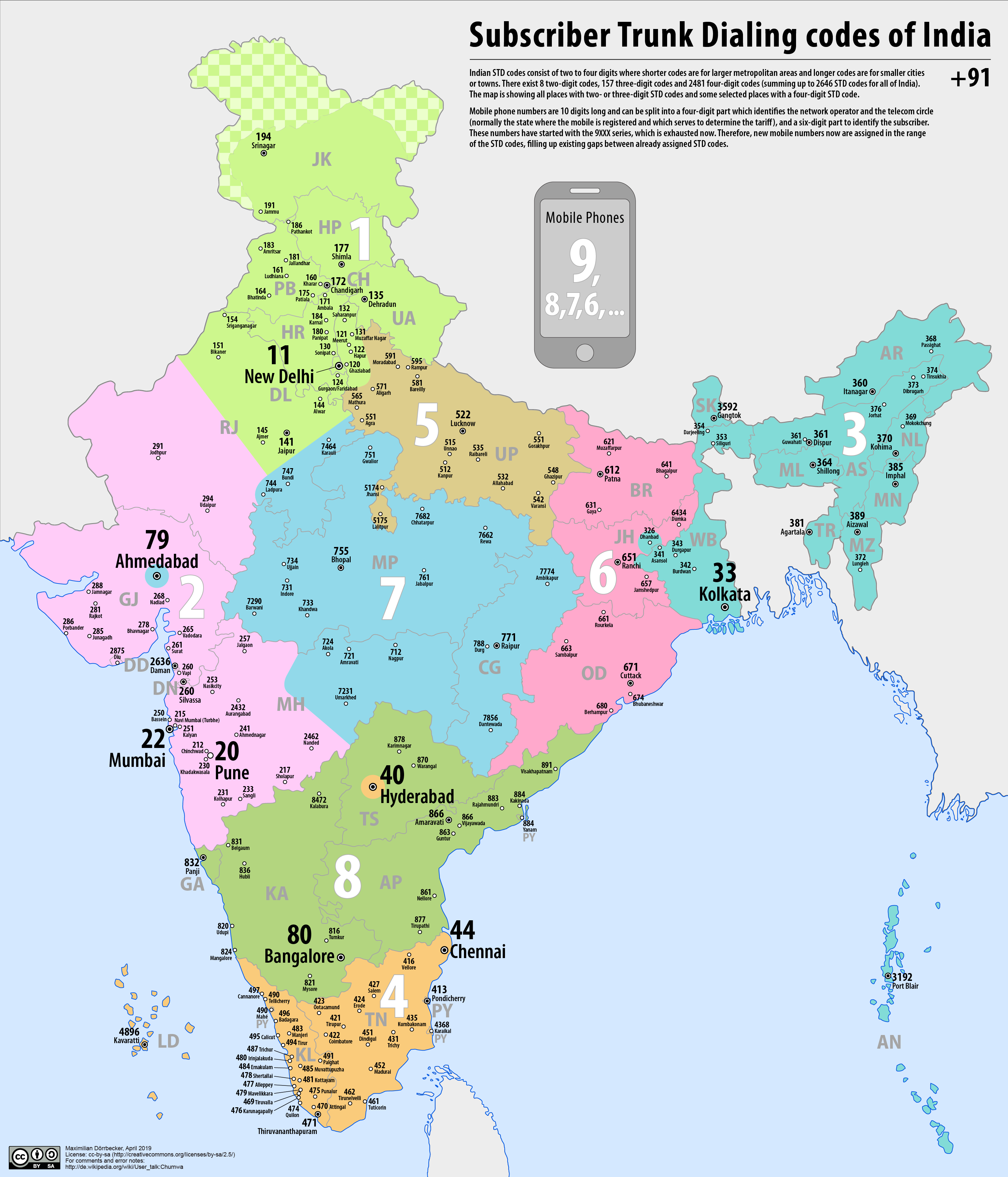
Telephone numbers in India are administered under the ''National Numbering Plan of 2003'' by the Department of Telecommunications of the Government of India. The numbering plan was last updated in 2015. The country code "91" was assigned to India by the International Telecommunication Union in the 1960s. Fixed-line (landline) numbers Subscriber trunk dialling (STD) codes are assigned to each city, town and village. These codes can be between 2 and 8 digits long, with the largest metropolitan areas and cities having the shortest (two-digit) codes: *11 - New Delhi, Delhi *22 - Mumbai, Maharashtra *33 - Kolkata, West Bengal *44 - Chennai, Tamil Nadu *20 - Pune, Maharashtra *40 - Hyderabad, Telangana *79 - Ahmedabad, Gujarat *80 - Bengaluru, Karnataka Second-tier cities and metropolitan areas, as well as large or particularly significant towns have three-digit area codes: *120 - Ghaziabad, Uttar Pradesh, Ghaziabad and Noida, Uttar Pradesh *124 - Gurugram, Haryana *129 - Farida ... [...More Info...] [...Related Items...] OR: [Wikipedia] [Google] [Baidu] |
Postal Index Number
A Postal Index Number (PIN; sometimes redundantly a PIN code) refers to a six-digit code in the Indian postal code system used by India Post. On 15 August 2022, the PIN system celebrated its 50th anniversary. History The PIN system was introduced on 15 August 1972 by Shriram Bhikaji Velankar, an additional secretary in the Government of India, Government of India's Ministry of Communications (India), Ministry of Communications. The system was introduced to simplify the manual sorting and delivery of mail by eliminating confusion over incorrect addresses, similar place names, and different languages used by the public. PIN structure The first digit of a PIN indicates the zone, the second indicates the sub-zone, and the third, combined with the first two, indicates the sorting district within that zone. The final three digits are assigned to individual post offices within the sorting district. Postal zones There are nine postal zones in India, including eight regional zon ... [...More Info...] [...Related Items...] OR: [Wikipedia] [Google] [Baidu] |
Maithili Language
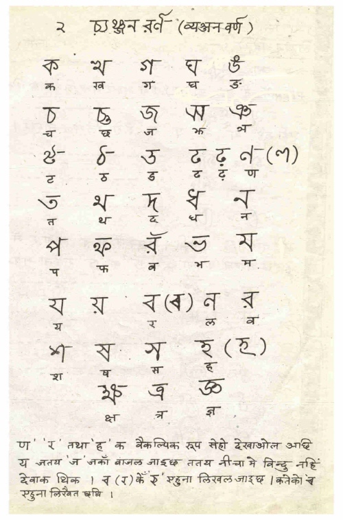
Maithili ( , ) is an Indo-Aryan language spoken in parts of India and Nepal. It is native to the Mithila region, which encompasses parts of the eastern Indian states of Bihar and Jharkhand as well as Nepal's Koshi Province, Koshi and Madhesh Provinces. It is one of the 22 scheduled languages of India. It is the second most commonly spoken native languages of Nepal, Nepalese language constitutionally registered as one of the fourteen provincial official languages of Nepal. It is spoken by 21.7 million people. Of those, 3.2 million are Nepalis, Nepalese speakers. The language is predominantly written in Devanagari, but the historical Tirhuta script, Tirhuta and Kaithi scripts retained some use until today. Official status In 2003, Maithili was included in the 8th Schedule, Eighth Schedule of the Indian Constitution as a recognised language of India, Indian language, which allows it to be used in education, government, and other official contexts in India. The Maithili language i ... [...More Info...] [...Related Items...] OR: [Wikipedia] [Google] [Baidu] |
States And Territories Of India
India is a federalism, federal union comprising 28 federated state, states and 8 union territory, union territories, for a total of 36 subnational entities. The states and union territories are further subdivided into 800 List of districts in India, districts and smaller administrative divisions of India, administrative divisions by the respective subnational government. The states of India are self-governing administrative divisions, each having a State governments of India, state government. The governing powers of the states are shared between the state government and the Government of India, union government. On the other hand, the union territories are directly governed by the union government. History 1876–1919 The British Raj was a very complex political entity consisting of various imperial divisions and states and territories of varying autonomy. At the time of its establishment in 1876, it was made up of 584 princely state, constituent states and the prov ... [...More Info...] [...Related Items...] OR: [Wikipedia] [Google] [Baidu] |
Hindi
Modern Standard Hindi (, ), commonly referred to as Hindi, is the Standard language, standardised variety of the Hindustani language written in the Devanagari script. It is an official language of India, official language of the Government of India, alongside English language, English, and is the ''lingua franca'' of North India. Hindi is considered a Sanskritisation (linguistics), Sanskritised Register (sociolinguistics), register of Hindustani. Hindustani itself developed from Old Hindi and was spoken in Delhi and neighbouring areas. It incorporated a significant number of Persian language, Persian loanwords. Hindi is an Languages with official status in India, official language in twelve states (Bihar, Gujarat , Mizoram , Maharashtra ,Chhattisgarh, Haryana, Himachal Pradesh, Jharkhand, Madhya Pradesh, Rajasthan, Uttar Pradesh, Uttarakhand), and six Union territory, union territories (Andaman and Nicobar Islands, Delhi, Chandigarh, Dadra and Nagar Haveli and Daman and Di ... [...More Info...] [...Related Items...] OR: [Wikipedia] [Google] [Baidu] |
Sarpanch
A sarpanch, gram pradhan, mukhiya, or president is a decision-maker, elected by the village-level constitutional body of local self-government called the gram sabha (village government) in India. The sarpanch, together with other elected panchayat members (referred to as ''ward panch'' or ''ward member''), constitute gram panchayats and zilla panchayat The Zila Panchayat or District Development Council or Zilla Parishad or District Panchayat or is the third tier of the Panchayati Raj system and functions at the district levels in all states. A Zila Parishad is an elected body representing the ...s. The sarpanch is the focal point of contact between government officers and the village community and retains power for five years. The term used to refer to the sarpanch can vary across different states of India. There are many commonly used terms for sarpanch in various states: ''panchayat president'', ''gram pramukh, gram pradhan, gram adhyaksha, gaon panchayat president, gram p ... [...More Info...] [...Related Items...] OR: [Wikipedia] [Google] [Baidu] |


