|
R336 Road (Ireland)
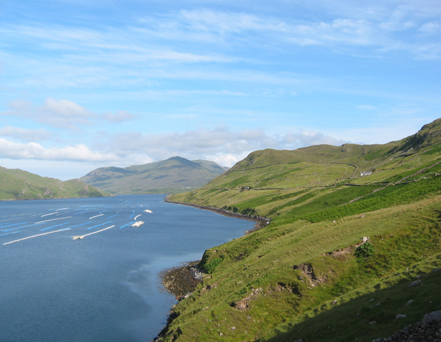
__NOTOC__ The R336 road is a regional road in County Galway in Ireland which connects the N59 road at Leenaun beside Killary Harbour – via Inverin – to the N6 and N83 in Galway, to the southeastmap. ''Irish Statute Book'' (irishstatutebook.ie), 2012-02-28. On leaving the fjord in Killary Harbour at Leenaun, the road travels south between the Maumturk and mountain ranges in Joyce Country and passes through the Irish speaking |
Spiddal
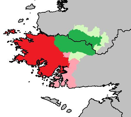
Spiddal, also known as Spiddle (Irish language, Irish and official name: , , meaning 'the hospital'), is a village on the shore of Galway Bay in County Galway, Ireland. It is west of Galway city, on the R336 road (Ireland), R336 road. It is on the eastern side of the county's Gaeltacht (Irish-speaking area) and of the Connemara region. According to the 2022 census of Ireland, 2022 census, approximately 75% of the population are Irish-speaking and, of these, approximately 40% speak Irish on a daily basis outside the education system. It is a centre for tourism with a beach, harbour, and shore fishing. The village is part of the Civil parishes in Ireland, civil parish of Moycullen (civil parish), Moycullen. Name The name of the village in Irish language, Irish, , derives from the word , which in turn derived from the Insular French, or Anglo-Norman language , Anglo-Normand, word . The name originates from a mediaeval leper hospital situated in (West Spiddal). A number of ot ... [...More Info...] [...Related Items...] OR: [Wikipedia] [Google] [Baidu] |
Salthill
Salthill () is a Coast, seaside area to the southwest of Galway city centre in the west of Ireland. The area is home to a number of tourist amenities and there is a 2 km long promenade, locally known as "the Prom", which overlooks Galway Bay. History The village of Salthill, which was known as "Salt Hill" until 1819, was originally a separate and "outlying village" of Galway city. Salthill's promenade opened in 1856. 19th century tourism Salthill became a bathing resort in the 19th century, capitalising on the rising popularity of seaside bathing amongst both pleasure seekers and believers in the medicinal properties of mineral waters. Doctor Robert Rogers Gray opened his artificial medicinal baths in 1831 on the site that today consists of the reclaimed land of Claude Toft Park. These baths remained Salthill's primary bathing attraction until a fire burned down the complex in 1870. The influx of tourism, brought to Salthill through the baths, created corresponding de ... [...More Info...] [...Related Items...] OR: [Wikipedia] [Google] [Baidu] |
Gaeltacht
A ( , , ) is a district of Ireland, either individually or collectively, where the Irish government recognises that the Irish language is the predominant vernacular, or language of the home. The districts were first officially recognised during the 1920s in the early years of the Irish Free State, following the Gaelic revival, as part of a government policy aimed at restoring the Irish language. The is threatened by serious language decline. Research published in 2015 showed that Irish is spoken on a daily basis by two-thirds or more of the population in only 21 of the 155 electoral divisions in the . Daily language use by two-thirds or more of the population is regarded by some academics as a tipping point for language survival.RTÉ News Report of Friday 29 May 2015 History In 1926, the official was designated as a result of the report of the first Gaeltacht Commission ''Coimisiún na Gaeltachta''. The exact boundaries were not defined. At the time, an area was clas ... [...More Info...] [...Related Items...] OR: [Wikipedia] [Google] [Baidu] |
Irish Language
Irish (Standard Irish: ), also known as Irish Gaelic or simply Gaelic ( ), is a Celtic language of the Indo-European language family. It is a member of the Goidelic languages of the Insular Celtic sub branch of the family and is indigenous language, indigenous to the island of Ireland. It was the majority of the population's first language until the 19th century, when English (language), English gradually became dominant, particularly in the last decades of the century, in what is sometimes characterised as a result of linguistic imperialism. Today, Irish is still commonly spoken as a first language in Ireland's Gaeltacht regions, in which 2% of Ireland's population lived in 2022. The total number of people (aged 3 and over) in Ireland who declared they could speak Irish in April 2022 was 1,873,997, representing 40% of respondents, but of these, 472,887 said they never spoke it and a further 551,993 said they only spoke it within the education system. Linguistic analyses o ... [...More Info...] [...Related Items...] OR: [Wikipedia] [Google] [Baidu] |
Joyce Country
Joyce Country () is a cultural region in counties Galway and Mayo in Ireland. It is sometimes called Partry, after the former tribal territory of the '' Partraige'', which it largely matches. Part of it falls within the Connacht Gaeltacht. Joyce Country lies on the shores of Lough Mask and Lough Corrib, and includes the Partry Mountains. It is a rural area that includes small settlements such as Clonbur, Cong, Cornamona and Toormakeady. It borders Connemara, to its south and west. Joyce family One of the first of the family ("Seoige" in Gaelic) recorded in Connacht was Thomas Joy, who established a minor Hiberno-Norman lordship in northern Iar Connacht. His territory was the barony of Ross, contiguous to Killery Bay and extending from Cong river to the river. The Joyce family became completely Gaelicised, ruled over their followers like the Chiefs of an Irish clan, and assimilated into the local Gaelic culture. Statistics See also County Galway * Galway City Gaelta ... [...More Info...] [...Related Items...] OR: [Wikipedia] [Google] [Baidu] |
Partry Mountains
The Partry Mountains () is a mountain range in western Connacht, Ireland. It is in an area known as Joyce Country, Partry, on the borders of County Mayo and County Galway. The mountains stand between Lough Mask (to the northeast), Lough Corrib (southeast), the Maam Valley (southwest) and the River Erriff (northwest). At the heart of the range is Lough Nafooey. The highest peak in the Partry Mountains is Maumtrasna, which rises to . Other mountains in the range include Devilsmother, Knocklaur, and Bunnacunneen. References Listing at mountainviews.ie Mountains and hills of County Mayo {{Mayo-geo-stub ... [...More Info...] [...Related Items...] OR: [Wikipedia] [Google] [Baidu] |
Maumturks
The Maumturks or Maamturks (; mountains of the boar's pass) is a mountain range in Connemara, County Galway, in the west of Ireland. It is a long, broadly-straight range, consisting of weathered quartzite peaks in its central section. The Maumturks lie east of the Twelve Bens, on the other side of Lough Inagh and the Inagh Valley (a Western Way route). Hill walking The walk of the full range (from Maam Cross to Leenaun), is considered one of the "great classic ridge-walks of Ireland", and since 1975, the University of Galway Mountaineering Club, has run the annual "Maamturks Challenge", a walk covering the entire 25–kilometre range in a single day. Near the centre of the range in a deep valley is , a site of pilgrimage dedicated to Saint Patrick. List of peaks The table below lists some of the highest major mountain peaks of the Maumturk Mountains. (‡) The anglicised version is rarely used or marked on any maps; a more common anglicised name is the incorrect name of " ... [...More Info...] [...Related Items...] OR: [Wikipedia] [Google] [Baidu] |
Galway
Galway ( ; , ) is a City status in Ireland, city in (and the county town of) County Galway. It lies on the River Corrib between Lough Corrib and Galway Bay. It is the most populous settlement in the province of Connacht, the List of settlements on the island of Ireland by population, fifth most populous city on the island of Ireland and the List of urban areas in the Republic of Ireland, fourth most populous in the Republic of Ireland, with a population at the 2022 census of Ireland, 2022 census of 85,910. Located near an earlier settlement, Galway grew around a fortification built by the List of kings of Connacht, King of Connacht in 1124. A municipal charter in 1484 allowed citizens of the by then walled city to form a Galway City Council, council and mayoralty. Controlled largely by a group of merchant families, the Tribes of Galway, the city grew into a trading port. Following a period of decline, as of the 21st century, Galway is a tourist destination known for festivals ... [...More Info...] [...Related Items...] OR: [Wikipedia] [Google] [Baidu] |
Killary Harbour
Killary Harbour or Killary Fjord () is a fjord or fjard on the west coast of Ireland, in northern Connemara. To its north is County Mayo and the mountains of Mweelrea and Ben Gorm; to its south is County Galway and the Maumturk Mountains. Structure The flooded valley is long, and in the centre over deep; the sea level is higher outside its mouth, as is normal for a fjord.Collins Press, Cork, Ireland - Ireland's Coastline: Exploring its Nature and Heritage - Nairn, Richard, 2007: "the long, narrow fjord of Killary Harbour, which forms the boundary between the counties of Mayo and Galway. ... only a few hundred metres wide. A glacier must have scoured the bottom as it moved towards the sea, taking large volumes of rock and gravel with it. Just outside the entrance, the depth reduces dramatically and there are a number of rocky islands giving a profile that is typical of the fjords of Scandinavia." For nearly half its length, it runs south east from the Atlantic, and then it c ... [...More Info...] [...Related Items...] OR: [Wikipedia] [Google] [Baidu] |
Republic Of Ireland
Ireland ( ), also known as the Republic of Ireland (), is a country in Northwestern Europe, north-western Europe consisting of 26 of the 32 Counties of Ireland, counties of the island of Ireland, with a population of about 5.4 million. Its capital city, capital and largest city is Dublin, on the eastern side of the island, with a population of over 1.5 million. The sovereign state shares its only land border with Northern Ireland, which is Countries of the United Kingdom, part of the United Kingdom. It is otherwise surrounded by the Atlantic Ocean, with the Celtic Sea to the south, St George's Channel to the south-east and the Irish Sea to the east. It is a Unitary state, unitary, parliamentary republic. The legislature, the , consists of a lower house, ; an upper house, ; and an elected President of Ireland, president () who serves as the largely ceremonial head of state, but with some important powers and duties. The head of government is the (prime minister, ), ... [...More Info...] [...Related Items...] OR: [Wikipedia] [Google] [Baidu] |
Regional Road (Ireland)
A regional road () in the Republic of Ireland is a class of road not forming a major route (such as a national primary road or national secondary road), but nevertheless forming a link in the Roads in Ireland, national route network. There are over 11,600 kilometres (7,200 miles) of regional roads. Regional roads are numbered with three-digit route numbers, prefixed by "R" (e.g. R105 road (Ireland), R105). The equivalent road category in Northern Ireland are Roads in Northern Ireland#"B" roads, B roads. History Until 1977, classified roads in the Republic of Ireland were designated with one of two prefixes: Trunk roads in Ireland, "T" for trunk roads and "L" for link roads. The ''Local Government (Roads and Motorways) Act, 1974'' authorised the designation of roads as national roads: in 1977, twenty-five national primary roads (N1-N25) and thirty-three national secondary roads (N51-N83) were initially designated under the ''Local Government (Roads and Motorways) Act, 1974 (Declar ... [...More Info...] [...Related Items...] OR: [Wikipedia] [Google] [Baidu] |


