|
Pre-Columbian Engineering In The Americas
Engineering in the Americas before the arrival of Christopher Columbus was advanced in agriculture, hydrology, irrigation systems, transportation, mechanical engineering, civil engineering and astronomy. In addition Native Americans made extensive use of fire to change the landscape and to create open areas for farming and hunting. Examples of pre-Columbian engineering from different indigenous civilizations can be found across North and South America. North America *Pueblo Structures *Hohokam Canals *Chaco Canyon *Tenochitlan Flood Gates *Teotihuacan *Serpent Mound *Cahokia Mounds South America *Inca road system * Nazca Lines *Machu Picchu * Sacsayhuaman * Chavin/Inca canals *Tiwanaku *Chan Chan * AndenZenu canals and drains See also *Inca Empire * Incan agriculture * Kuelap *Paracas culture *Nazca culture *Caral The Sacred City of Caral-Supe, or simply Caral, is an archaeological site in Peru where the remains of the main city of the Caral civilization are fou ... [...More Info...] [...Related Items...] OR: [Wikipedia] [Google] [Baidu] |
Pre-Columbian Era
In the history of the Americas, the pre-Columbian era, also known as the pre-contact era, or as the pre-Cabraline era specifically in Brazil, spans from the initial peopling of the Americas in the Upper Paleolithic to the onset of European colonization of the Americas, European colonization, which began with Christopher Columbus's voyage in 1492. This era encompasses the history of Indigenous peoples of the Americas, Indigenous cultures prior to significant European influence, which in some cases did not occur until decades or even centuries after Columbus's arrival. During the pre-Columbian era, many civilizations developed permanent settlements, cities, agricultural practices, civic and monumental architecture, major Earthworks (archaeology), earthworks, and Complex society, complex societal hierarchies. Some of these civilizations had declined by the time of the establishment of the first permanent European colonies, around the late 16th to early 17th centuries, and are know ... [...More Info...] [...Related Items...] OR: [Wikipedia] [Google] [Baidu] |
Serpent Mound
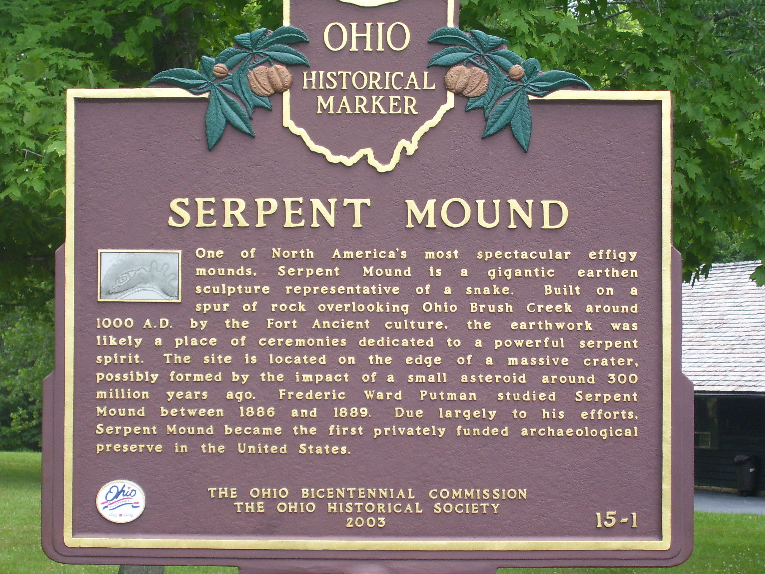
The Great Serpent Mound is a 1,348-feet-long (411 m), three-feet-high prehistoric effigy mound located in Peebles, Ohio, Peebles, Ohio. It was built on what is known as the Serpent Mound crater plateau, running along the Ohio Brush Creek in Adams County, Ohio. The mound is the largest serpent effigy known in the world. The first published surveys of the mound were by E. G. Squier, Ephraim G. Squier and Edwin Hamilton Davis, featured in their historic volume, ''Ancient Monuments of the Mississippi Valley'' (1848), that was commissioned by the Smithsonian Institution. The United States Department of Interior designated the mound as a National Historic Landmark in 1966. The mound is maintained through the Ohio History Connection, a nonprofit organization dedicated to preserving historical sites throughout Ohio. Description Effigy mounds have been constructed independently by several cultures. The significance of Serpent Mound is based on its size and historical relevance. M ... [...More Info...] [...Related Items...] OR: [Wikipedia] [Google] [Baidu] |
Paracas Culture
The Paracas culture was an Andean society existing between approximately 800 BCE and 100 BCE, with an extensive knowledge of irrigation and water management and that made significant contributions in the textile arts. It was located in what today is the Ica Region of Peru. Most information about the lives of the Paracas people comes from excavations at the large seaside Paracas site on the Paracas Peninsula, first formally investigated in the 1920s by Peruvian archaeologist Julio Tello. The ''Paracas Cavernas'' are shaft tombs set into the top of Cerro Colorado, each containing multiple burials. There is evidence that over the centuries when the culture thrived, these tombs were reused. In some cases, the heads of the deceased were taken out, apparently for rituals, and later reburied. The associated ceramics include incised polychrome, "negative" resist decoration, and other wares of the Paracas tradition. The associated textiles include many complex weave structures, as w ... [...More Info...] [...Related Items...] OR: [Wikipedia] [Google] [Baidu] |
Incan Agriculture
The Inca Empire, officially known as the Realm of the Four Parts (, ), was the largest empire in pre-Columbian America. The administrative, political, and military center of the empire was in the city of Cusco. The Inca civilisation rose from the Peruvian highlands sometime in the early 13th century. The Portuguese explorer Aleixo Garcia was the first European to reach the Inca Empire in 1524. Later, in 1532, the Spanish began the conquest of the Inca Empire, and by 1572 the last Inca state was fully conquered. From 1438 to 1533, the Incas incorporated a large portion of western South America, centered on the Andean Mountains, using conquest and peaceful assimilation, among other methods. At its largest, the empire joined modern-day Peru with what are now western Ecuador, western and south-central Bolivia, northwest Argentina, the southwesternmost tip of Colombia and a large portion of modern-day Chile, forming a state comparable to the historical empires of Eurasia. Its of ... [...More Info...] [...Related Items...] OR: [Wikipedia] [Google] [Baidu] |
Chan Chan
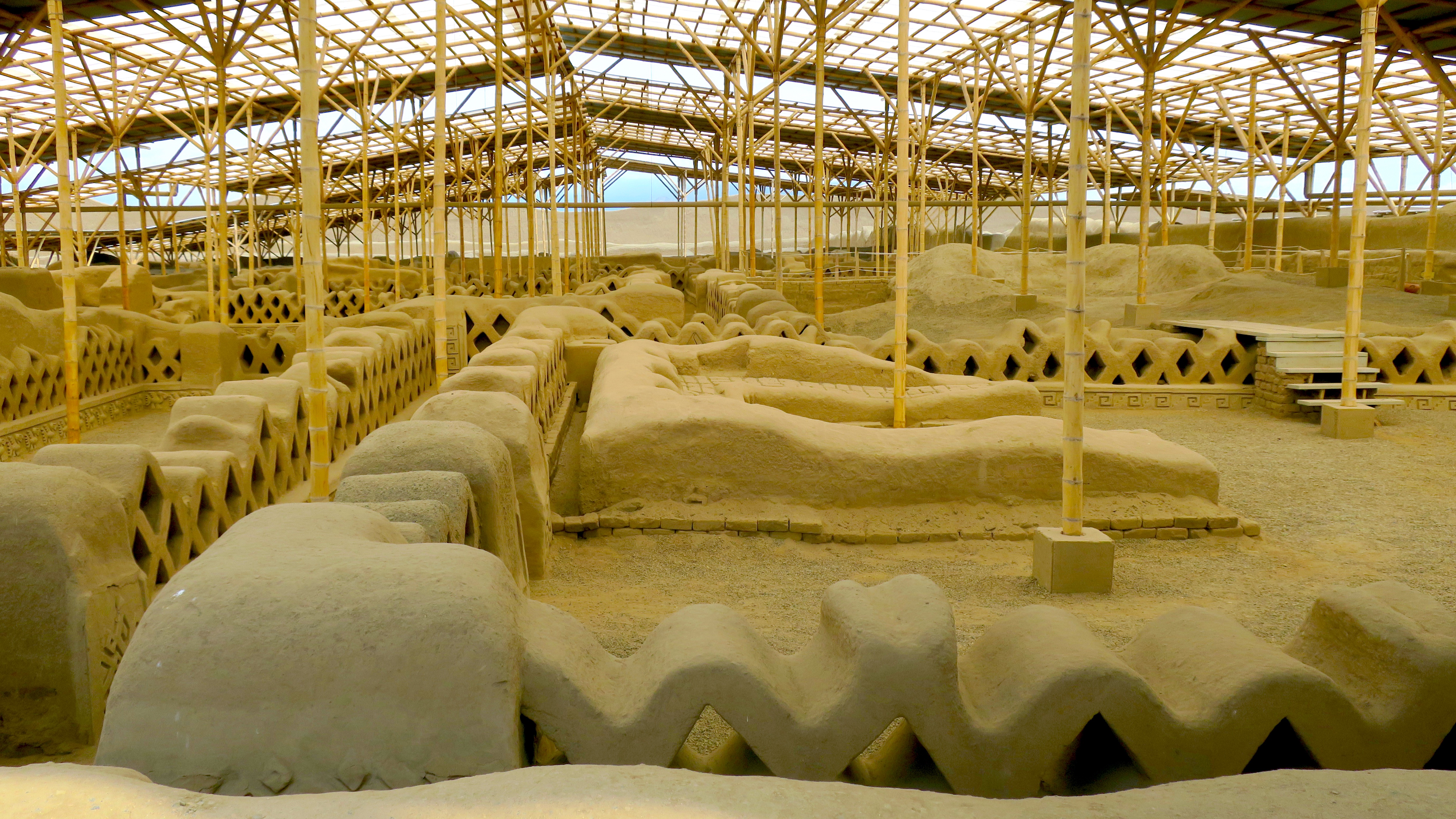
Chan Chan (), sometimes itself called Chimor, was the capital city of the Chimor kingdom. It was the largest city of the pre-Columbian era in South America. It is now an archeological site in the department of La Libertad west of Trujillo, Peru. Chan Chan is located in the mouth of the Moche Valley and was the capital of the historical empire of the Chimor from 900 to 1470, when they were defeated and incorporated into the Inca Empire. Chimor, a conquest state, developed from the Chimú culture which established itself along the Peruvian coast around 900 CE. Chan Chan is in a particularly arid section of the coastal desert of northern Peru. Due to the lack of rain in this area, the major source of nonsalted water for Chan Chan is in the form of rivers carrying surface runoff from the Andes. This runoff allows for control of land and water through irrigation systems. The city of Chan Chan spanned and had a dense urban center of which contained extravagant ''ciudade ... [...More Info...] [...Related Items...] OR: [Wikipedia] [Google] [Baidu] |
Tiwanaku
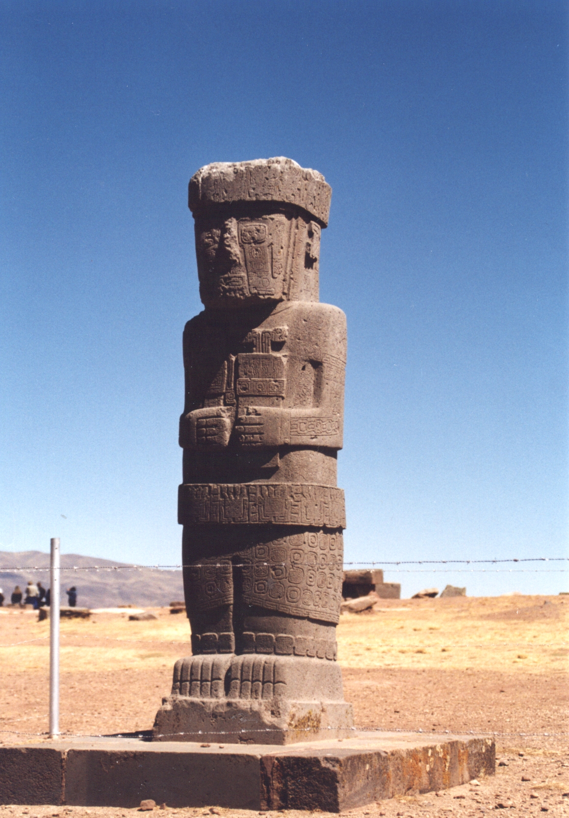
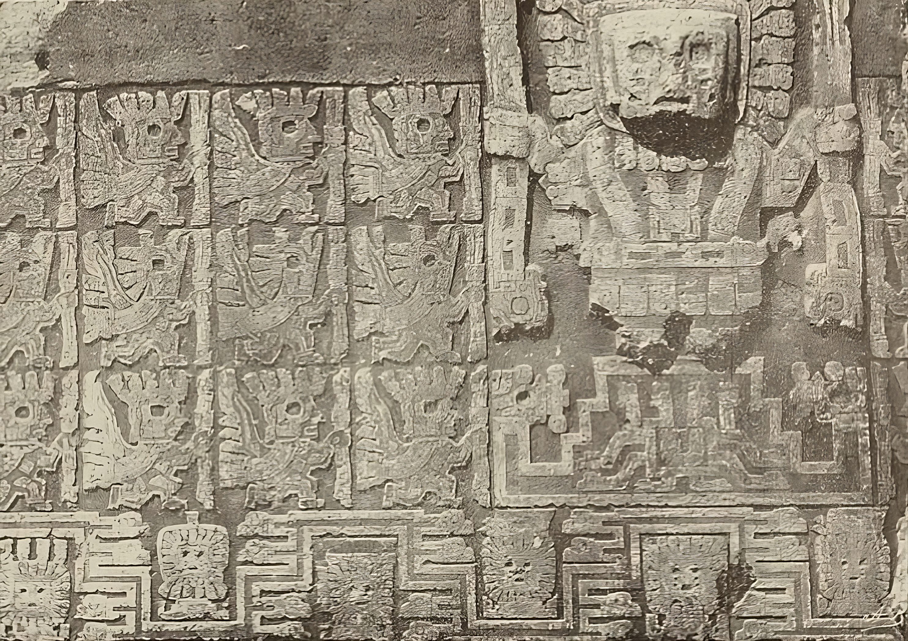
Tiwanaku ( or ) is a Pre-Columbian archaeological site in western Bolivia, near Lake Titicaca, about 70 kilometers from La Paz, and it is one of the largest sites in South America. Surface remains currently cover around 4 square kilometers and include decorated ceramics, monumental structures, and megalithic blocks. It has been conservatively estimated that the site was inhabited by 10,000 to 20,000 people in AD 800. The site was first recorded in written history in 1549 by Spanish conquistador Pedro Cieza de León while searching for the southern Inca capital of Qullasuyu. Jesuit chronicler of Peru Bernabé Cobo reported that Tiwanaku's name once was ''taypiqala'', which is Aymara meaning "stone in the center", alluding to the belief that it lay at the center of the world. The name by which Tiwanaku was known to its inhabitants may have been lost as they had no written language. Heggarty and Beresford-Jones suggest that the Puquina language is most likely to have been the ... [...More Info...] [...Related Items...] OR: [Wikipedia] [Google] [Baidu] |
Chavín Culture
The Chavín culture was a Pre-Columbian era, pre-Columbian civilization, developed in the northern Andean highlands of Peru around 900 BCE, ending around 250 BCE. It extended its influence to other civilizations along the Peruvian coast.Burger, Richard L. 2008 "Chavin de Huantar and its Sphere of Influence", In ''Handbook of South American Archeology'', edited by H. Silverman and W. Isbell. New York: Springer, pp. 681–706Burger, Richard L., and Nikolaas J. Van Der Merwe (1990). "Maize and the Origin of Highland Chavín Civilization: An Isotopic Perspective", ''American Anthropologist'' 92(1):85–95. The Chavín people (whose name for themselves is unknown) were located in the Mosna Valley where the Huari District, Mosna and Huachecsa river, Huachecsa rivers merge. This area is above sea level and encompasses the ''Quechua (geography), quechua'', ''suni (geography), suni'', and ''puna grassland, puna'' life zones.Burger (1992), ''Chavin and the Origins of Andean Civilization'' ... [...More Info...] [...Related Items...] OR: [Wikipedia] [Google] [Baidu] |
Machu Picchu
Machu Picchu is a 15th-century Inca citadel located in the Eastern Cordillera of southern Peru on a mountain ridge at . Often referred to as the "Lost City of the Incas", it is the most familiar icon of the Inca Empire. It is located in the Machupicchu District within the Urubamba Province above the Sacred Valley, which is northwest of the city of Cusco. The Urubamba River flows past it, cutting through the Cordillera and creating a canyon with a subtropical mountain climate. The Inca civilization had no written language and following the first encounter by the Spanish soldier Baltasar Ocampo, no Europeans are recorded to have visited the site from the late 16th century until the 19th century. As far as historical knowledge extends, there are no existing written records detailing the site during its period of active use. The leading theory is that Machu Picchu was a private city for Incan royalty. The names of the buildings, their supposed uses, and their inhabitants, ... [...More Info...] [...Related Items...] OR: [Wikipedia] [Google] [Baidu] |


