|
Portumna
Portumna (- meaning 'the landing place of the oak') is a market town in the south-east of County Galway, Ireland, on the border with and linked by a Portumna bridge, bridge to County Tipperary. The town is located to the west of the point where the River Shannon enters Lough Derg (Shannon), Lough Derg. This historic crossing point over the River Shannon between counties Tipperary and Galway has a long history of bridges and ferry crossings. On the south-western edge of the town lie Portumna Castle and Portumna forest park. History Portumna Bridge Portumna is served with a five-span road bridge over the Shannon. This was designed by C. E. Stanier of London, and completed in 1911, with a central section resting on Hayes's Island which divides the river into two channels. The steel structure of the main bridge and pivoting swing bridge over the navigation channel are of technical and engineering interest, and it is the largest early-twentieth-century swing bridge in Europe. The o ... [...More Info...] [...Related Items...] OR: [Wikipedia] [Google] [Baidu] |
Portumna Castle
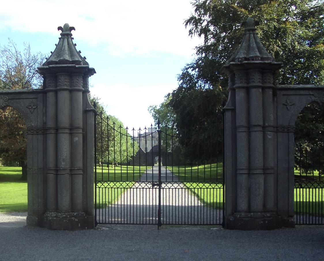
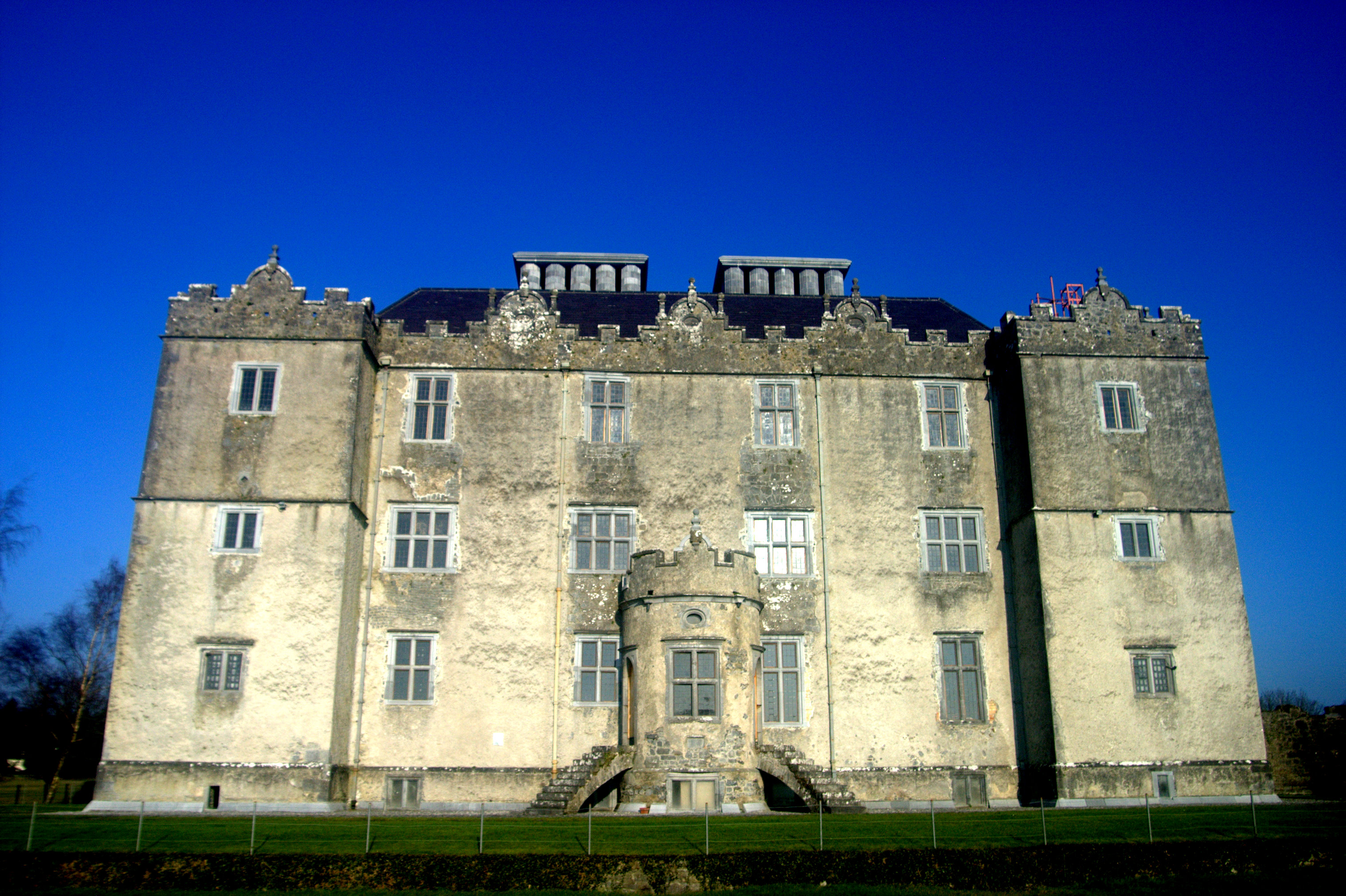
Portumna Castle is a semi-fortified house in Portumna, County Galway, Ireland which was built in the early 17th century by Richard Burke, 4th Earl of Clanricarde. Location Portumna Castle is located close to the shore of Lough Derg near where the River Shannon enters the lake. Portumna Abbey is to the east. History When it was built, Portumna Castle was without equal in Ireland at the time in style, grandeur and distinction, outshining castles at Rathfarnham, Kanturk, Carrickfergus, Charlemont and Burncourt. Its builder was Richard Burke, 4th Earl of Clanricarde, Lord President of Connaught, of the de Burgo family of Norman descent. The castle was built around 1610 to 1617 at a cost of £10,000. The Earl also built a mansion, Somerhill House, Royal Tunbridge Wells in Kent. Portumna castle was built in the Renaissance style already prevalent in Italy and France for over a century, but not commonly found in Ireland or England at that time. The Renaissance features of th ... [...More Info...] [...Related Items...] OR: [Wikipedia] [Google] [Baidu] |
Portumna Bridge
Portumna bridge lies east of the town of Portumna, in County Galway, Ireland. It is a five-span road bridge, which carries the N65 across the River Shannon to Lehinch in County Tipperary. The present bridge was designed by C. E. Stanier of London, and completed in 1911, with a central section resting on Hayes's Island which divides the river into two channels. The structure of the main bridge, consisting of steel girders supported by concrete filled cast iron cylinders, and the pivoting swing bridge over the navigation channel, are of technical and engineering interest. The house on Hayes Island, accessed from the bridge, was the bridge operator's house and pre-dates the present bridge. The opening section was replaced in October 2008. Navigation Situated about 1 mile to the north of where the River Shannon enters Lough Derg, Portumna Bridge must be opened to allow craft with more than 4 ft of air draft to pass by. The bridge is opened only at fixed times. There are quay ... [...More Info...] [...Related Items...] OR: [Wikipedia] [Google] [Baidu] |
Lough Derg (Shannon)
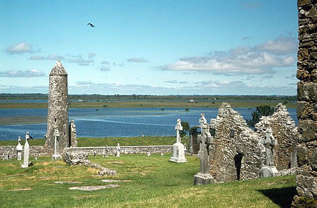
Lough Derg, historically Lough Dergart (), is a freshwater lake in the Shannon River Basin, Ireland. It is the third-biggest on the island of Ireland (after Lough Neagh and Lough Corrib) and the second largest lake in the Republic of Ireland. It is a long, narrow lake, with shores in counties Clare (south-west), Galway (north-west), and Tipperary (to the east). It is the southernmost of three large lakes on the River Shannon; the others being Lough Ree and Lough Allen. Towns and villages on Lough Derg include Portumna, Killaloe & Ballina, Dromineer, Terryglass, Mountshannon and Garrykennedy. The lake's name evolved from the Irish ''Loch Deirgdheirc''. This was one of the names of The Dagda, the father of gods and men in Irish mythology, and literally means "red eye". Lough Derg has many islands including Inis Cealtra or Holy Island. Geography At its deepest, the lake is deep and covers an area of . Close downstream from where Lough Derg empties into the Shanno ... [...More Info...] [...Related Items...] OR: [Wikipedia] [Google] [Baidu] |
Richard Burke, 4th Earl Of Clanricarde
Richard Burke (or de Burgh), 4th Earl of Clanricarde Privy Counsellor, PC (Ire) ( ; 1572 – 12 November 1635), styled Lord Dunkellin ( ) until 1601, was an Irish nobleman and politician. He was the son of Ulick Burke, 3rd Earl of Clanricarde. Knighted in 1602 for his exploits as leader of the English cavalry during the Siege of Kinsale, Battle of Kinsale, he would later serve as Lord President of Connaught from 1604 to 1616, Governor of Galway from 1616, and as a member of the Privy Council of Ireland (1625). Having established himself as the largest and most influential landowner in Connacht, his later life was characterized by animosity between him and an increasingly hostile and acquisitive Dublin government. Birth and origins Richard was born in 1572, the second but eldest surviving son of Ulick Burke, 3rd Earl of Clanricarde, Ulick Burke and his wife Honora Burke. His father was the 3rd Earl of Clanricarde. His father's family was Normans in Irel ... [...More Info...] [...Related Items...] OR: [Wikipedia] [Google] [Baidu] |
County Galway
County Galway ( ; ) is a Counties of Ireland, county in Republic of Ireland, Ireland. It is in the Northern and Western Region, taking up the south of the Provinces of Ireland, province of Connacht. The county population was 276,451 at the 2022 census. There are several Gaeltacht, Irish-speaking areas in the west of the county. The traditional county includes the city of Galway, but the city and county are separate local government areas, administered by the Local government in the Republic of Ireland, local authorities of Galway City Council in the urban area and Galway County Council in the rest of the county. History The first inhabitants in the Galway area arrived around the 5th millennium BC. Shell middens indicate the existence of people as early as 5000 BC. The county originally comprised several kingdoms and territories which predate the formation of the county. These kingdoms included , , , , and . County Galway became an official entity around 1569 AD. The region ... [...More Info...] [...Related Items...] OR: [Wikipedia] [Google] [Baidu] |
Earl Of Clanricarde
Earl of Clanricarde ( ; ) is a title that has been created twice in the Peerage of Ireland, first in 1543 and again in 1800. The former creation became extinct in 1916 while the 1800 creation is extant and held by the Marquess of Sligo since 1916. Clanricarde (or Lord of Clanricarde) was a Gaelic title meaning ''"(head of) Richard's family"'' (also known as Mac William Uachtar/Upper Mac William) and this family were descended from Richard Mór de Burgh, 1st Lord of Connacht (d.1243), son of William de Burgh (d.1205/6), founder of the House of Burke, de Burgh/Burke family in Ireland. In 1543, Ulick na gCeann Burke, 1st Earl of Clanricarde, Ulick na gCeann Burke, 12th Clanricarde, was created Baron of Dunkellin ( ) and Earl of Clanricarde in the Peerage of Ireland. His great-grandson, the Richard Burke, 4th Earl of Clanricarde, fourth Earl, was created Baron of Somerhill and Viscount Tunbridge in the Peerage of England in 1624, Baron of Imanney and Viscount Galway in the Peerage ... [...More Info...] [...Related Items...] OR: [Wikipedia] [Google] [Baidu] |
Swing Bridge
A swing bridge (or swing span bridge) is a movable bridge that can be rotated horizontally around a vertical axis. It has as its primary structural support a vertical locating pin and support ring, usually at or near to its center of gravity, about which the swing span (turning span) can then pivot horizontally as shown in the animated illustration to the right. In its closed position, a swing bridge carrying a road or railway over a river or canal, for example, allows traffic to cross. When a water vessel needs to pass the bridge, road traffic is stopped (usually by traffic signals and barriers), and then motors rotate the bridge horizontally about its pivot point. The typical swing bridge will rotate approximately 90 degrees, or one-quarter turn; however, a bridge which intersects the navigation channel at an oblique angle may be built to rotate only 45 degrees, or one-eighth turn, in order to clear the channel. Small swing bridges as found over narrow canals may be pivo ... [...More Info...] [...Related Items...] OR: [Wikipedia] [Google] [Baidu] |
Ballinasloe
Ballinasloe ( ; ) is a town in the easternmost part of County Galway, Ireland. Located at an ancient crossing point on the River Suck, evidence of ancient settlement in the area includes a number of Bronze Age sites. Built around a 12th-century castle, which defended the Ford (crossing), fording point, the modern town of Ballinasloe was "founded" in the early 13th century. As of the 2022 census of Ireland, 2022 census, it was one of the largest towns in County Galway, with a population of 6,597 people. History The town developed as a crossing point on the River Suck, a tributary of the River Shannon, Shannon. The Irish placename – meaning the 'mouth of the ford of the crowds' – reflects this purpose. The patron saint of Ballinasloe is Grellan, Saint Grellan, who tradition believes built the first church in the area. A local housing estate, a GAA club, the branch of Conradh na Gaeilge, and formerly a school are named after him. While there is evidence of more ancient settl ... [...More Info...] [...Related Items...] OR: [Wikipedia] [Google] [Baidu] |
River Shannon
The River Shannon ( or archaic ') is the major river on the island of Ireland, and at in length, is the longest river in the British Isles. It drains the Shannon River Basin, which has an area of , – approximately one fifth of the area of Ireland. Known as an important waterway since antiquity, the Shannon first appeared in maps by the Graeco-Egyptian geographer Ptolemy ( 100 – 170 AD). The river flows generally southwards from the Shannon Pot in County Cavan before turning west and emptying into the Atlantic Ocean through the long Shannon Estuary. Limerick city stands at the point where the river water meets the sea water of the estuary. The Shannon is tidal east of Limerick as far as the base of the Ardnacrusha dam. The Shannon divides the west of Ireland (principally the province of Connacht) from the east and south (Leinster and most of Munster; County Clare, being west of the Shannon but part of the province of Munster, is the major exception.) The river rep ... [...More Info...] [...Related Items...] OR: [Wikipedia] [Google] [Baidu] |
Fortified House
A fortified house or fortified mansion is a type of building which developed in Europe during the Middle Ages, generally with significant fortifications added. During the earlier Roman Empire, Roman period it was common for wealthy landowners to construct unfortified villa, villas on their lands. After the fall of Rome, increased social instability and military conflict necessitated more austere, defensible types of structures. United States In the United States, historically a fortified house was often called a Fortification, fort or Station (frontier defensive structure), station depending on the region. This was a building built for defense against primarily Indigenous peoples of the Americas, Indian attacks in frontier areas. While some fortified houses were sometimes used by militias, state and federal military units, their primary purpose was for private or civilian defense. Sometimes a stockade would surround the building(s). Examples of historic private or civilian f ... [...More Info...] [...Related Items...] OR: [Wikipedia] [Google] [Baidu] |


