|
Piperi Clan
Piperi ( cyrl, Пипери) is a historical tribe (''pleme'') of Albanian origin and a region in northeastern Montenegro. Piperi is located between the Morača and Zeta rivers up to the northern suburbs of the Montenegrin capital Podgorica. Origins Originally an Albanian tribe (), the Piperi underwent a process of gradual cultural integration into the neighbouring Slavic population. A Franciscan report of the 17th century illustrates the final stages of their acculturation. Its author writes that the Bratonožići, Piperi, Bjelopavlići and Kuči:"'' nulla di meno essegno quasi tutti del rito serviano, e di lingua Illrica ponno piu presto dirsi Schiavoni, ch' Albanesi ''" (since almost all of them use the Serbian rite and the Illyric (Slavic) language, soon they should be called Slavs, rather than Albanians). Historical research has shown that Piperi is not a tribe (''pleme'') of common patrilineal ancestry. It formed in the period between the mid 15th century and the 16th c ... [...More Info...] [...Related Items...] OR: [Wikipedia] [Google] [Baidu] |
Tribes Of Montenegro
The tribes of Montenegro (Montenegrin language, Montenegrin and sr-Cyrl-Latn, племена Црне Горе, plemena Crne Gore) or Montenegrin tribes (Montenegrin and sr-Cyrl-Latn, црногорска племена, crnogorska plemena, link=no) are historical tribes in the areas of Old Montenegro, Brda (Montenegro), Brda, Old Herzegovina and Montenegrin Littoral, Primorje. Most tribes were formed in the 15th and 16th centuries, during and after the Ottoman Empire, Ottoman conquest of the medieval state of Zeta under the Crnojevići, Zeta, where they replaced former administrative units known as župas. As a result, the tribal territories also became basic geopolitical units of larger divisions of the Ottoman Empire, such as the Vilayet of Montenegro, the eastern parts of the Sanjak of Herzegovina and parts of the Sanjak of Scutari. From the late 14th century to the 18th century, some tribes were also under the rule of Venetian Albania. In the 18th century, many tribes became ... [...More Info...] [...Related Items...] OR: [Wikipedia] [Google] [Baidu] |
Trush, Albania
Trush is a settlement in the former Bërdicë municipality, Shkodër County, northern Albania. At the 2015 local government reform it became part of the municipality Shkodër Shkodër ( , ; sq-definite, Shkodra; historically known as Scodra or Scutari) is the List of cities and towns in Albania, fifth-most-populous city of Albania and the seat of Shkodër County and Shkodër Municipality. Shkodër has been List of o .... References Bërdicë Populated places in Shkodër Villages in Shkodër County {{Shkodër-geo-stub ... [...More Info...] [...Related Items...] OR: [Wikipedia] [Google] [Baidu] |
Mrke
Mrke ( sr-Cyrl, Мрке) is a village in the municipality of Podgorica, Montenegro , image_flag = Flag of Montenegro.svg , image_coat = Coat of arms of Montenegro.svg , coa_size = 80 , national_motto = , national_anthem = () , image_map = Europe-Mont .... Demographics According to the 2011 census, its population was 207. References Populated places in Podgorica Municipality {{Montenegro-geo-stub ... [...More Info...] [...Related Items...] OR: [Wikipedia] [Google] [Baidu] |
Crnci, Podgorica
Crnci (; ) is a village in the municipality of Podgorica, Montenegro , image_flag = Flag of Montenegro.svg , image_coat = Coat of arms of Montenegro.svg , coa_size = 80 , national_motto = , national_anthem = () , image_map = Europe-Mont .... Demographics According to the 2011 census, its population was 182. References Populated places in Podgorica Municipality Albanian communities in Montenegro {{Montenegro-geo-stub ... [...More Info...] [...Related Items...] OR: [Wikipedia] [Google] [Baidu] |
Spahi
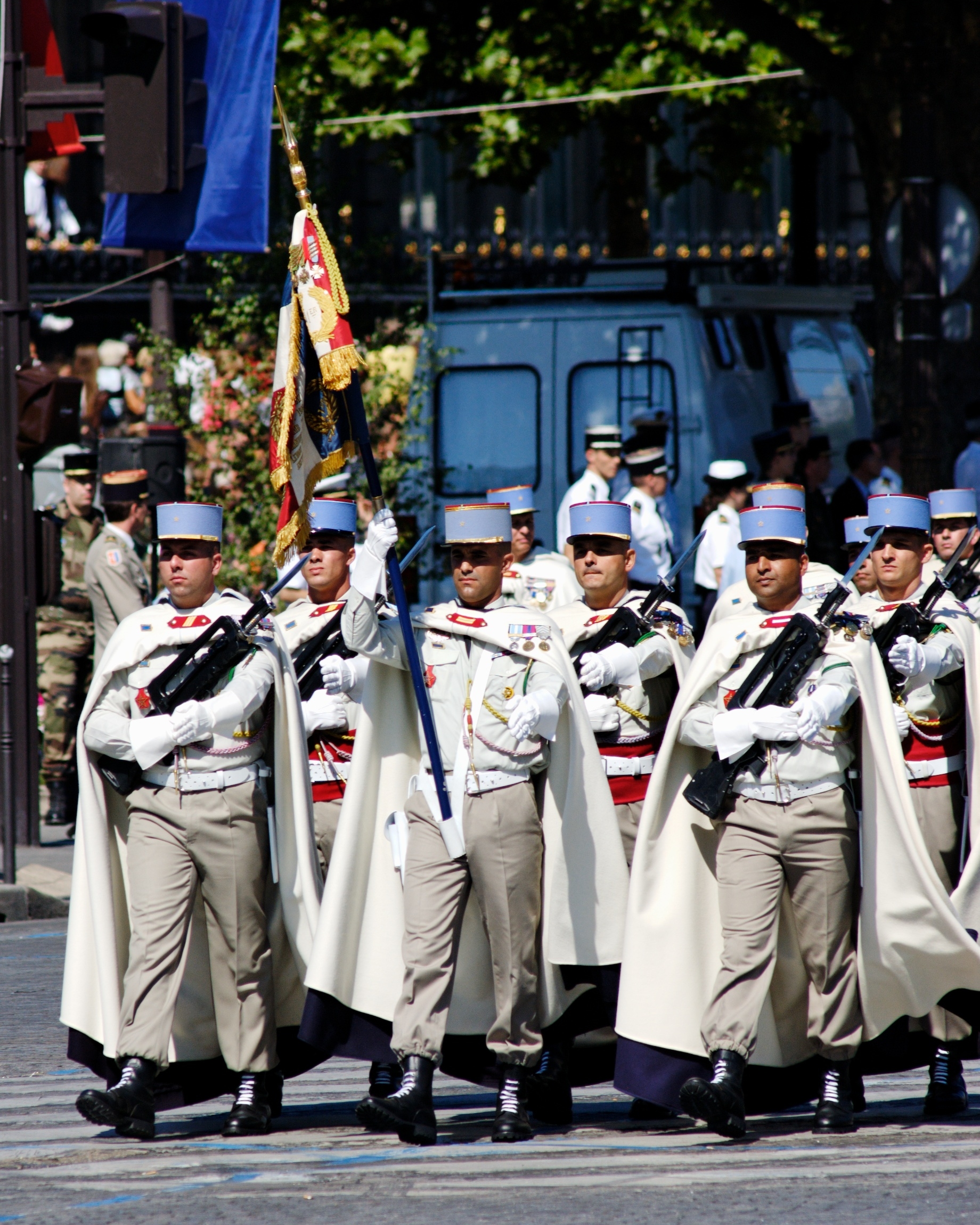
Spahis () were light cavalry, light-cavalry regiments of the French army recruited primarily from the Arab and Berber populations of Algeria, Tunisia and Morocco. The modern French Army retains one regiment of Spahis as an armoured unit, with personnel now recruited in mainland France. Senegal also maintains a mounted unit with spahi origins as a presidential escort: the Red Guard of Senegal, Red Guard. Etymology The name is the French form of the Ottoman Turkish language, Ottoman Turkish word , a word derived from Persian language#New Persian, Persian , "soldier", "horseman", ultimately from Persian meaning "army", "cavalry". Early history Following the French occupation of Algiers in 1830, detachments of locally recruited irregular horsemen were attached to the regiments of light cavalry assigned to North African service. These auxiliaries were designated as ''chasseurs spahis''. Between 1834 and 1836 they were organised into four squadrons of regular spahis. In 1841 ... [...More Info...] [...Related Items...] OR: [Wikipedia] [Google] [Baidu] |
Timar
A timar was a land grant by the sultans of the Ottoman Empire between the fourteenth and sixteenth centuries, with an annual tax revenue of less than 20,000 akçes. The revenues produced from the land acted as compensation for military service. A holder of a timar was known as a timariot. If the revenues produced from the timar were from 20,000 to 100,000 ''akçes'', the land grant was called a '' zeamet'', and if they were above 100,000 ''akçes'', the grant would be called a '' hass''.Hütteroth and Abdulfattah, 1977, p. 99 Timar system In the Ottoman Empire, the timar system was one in which the projected revenue of a conquered territory was distributed in the form of temporary land grants among the Sipahis (cavalrymen) and other members of the military class including Janissaries and other servants of the sultan. These prebends were given as compensation for annual military service, for which they received no pay. In rare circumstances women could become timar holders. Howe ... [...More Info...] [...Related Items...] OR: [Wikipedia] [Google] [Baidu] |
Sanjak Of Scutari
The Sanjak of Scutari or Sanjak of Shkodra (; ; or ''İşkodra Sancağı'') was one of the sanjaks of the Ottoman Empire. It was established after the Ottoman Empire acquired Shkodra after the siege of Shkodra in 1478–9. It was part of the Eyalet of Rumelia until 1867, when it became a part, together with the Sanjak of Skopje, of the newly established Scutari Vilayet. In 1912 and the beginning of 1913 it was occupied by members of the Balkan League during the First Balkan War. In 1914 the territory of Sanjak of Scutari became a part of the Principality of Albania, established on the basis of the peace contract signed during the London Conference in 1913. History Background and formation With short interruptions, the territory of northern Albania, including what would become the Sanjak of Scutari, remained under the rule of the Serbian feudal lords of the state of Duklja and Raška for centuries. After the fall of the Serbian Empire in the mid-14th century, loca ... [...More Info...] [...Related Items...] OR: [Wikipedia] [Google] [Baidu] |
Nahiya
A nāḥiyah ( , plural ''nawāḥī'' ), also nahiyeh, nahiya or nahia, is a regional or local type of administrative division that usually consists of a number of villages or sometimes smaller towns. In Tajikistan, it is a second-level division while in Syria, Iraq, Lebanon, Jordan, Xinjiang, and the former administrative divisions of the Ottoman Empire, Ottoman Empire, where it was also called a ''bucak (administrative unit), bucak'', it is a third-level or lower division. It can constitute a division of a ''qadaa'', ''mintaqah'' or other such district-type division and is sometimes translated as "subdistrict". Ottoman Empire The nahiye () was an administrative territorial entity of the Ottoman Empire, smaller than a . The head was a (governor) who was appointed by the Pasha. The was a subdivision of a Selçuk Akşin Somel. "Kazâ". ''The A to Z of the Ottoman Empire''. Volume 152 of A to Z Guides. Rowman & Littlefield, 2010. p. 151. and corresponded roughly to a city w ... [...More Info...] [...Related Items...] OR: [Wikipedia] [Google] [Baidu] |
Upper Zeta
Upper Zeta ( sr-Cyrl-Latn, Горња Зета, Gornja Zeta, separator=" / ") is a historical region in modern Montenegro, situated roughly between the Morača and Zeta rivers in east-west direction, and between massif of Lovćen and Skadar Lake and Durmitor massif in south-north direction, encompassing the Zeta Plain and plain surrounding modern-day capital of Montenegro, Podgorica. During the Middle Ages, the province of Upper Zeta was part of the Serbian state under the Nemanjić dynasty, existing alongside Lower Zeta. It was then held by the Balšić and Crnojević noble families until the Ottoman conquest (1496). In the early modern period, the term was used for an area in the northern half of the " Old Montenegro" region, though its borders fluctuated. Term Upper and Lower Zeta were mentioned in medieval documents. Lower Zeta included the maritime belt from the Luštica bay and Grbalj to the Bojana river, while Upper Zeta spanned over a branch of the Lovćen ... [...More Info...] [...Related Items...] OR: [Wikipedia] [Google] [Baidu] |
Vranjina
Vranjina () is a settlement, island, and a hill in Lake Skadar, in the new Zeta Municipality of Montenegro. Until 2022, it was part of Podgorica Municipality. Until the first half of the 18th century, Vranjina like other islands of Skadar lake, was one of the hills in the Zeta–Skadar lowlands. Geography Created by a delta of the Morača River, the island is in the northern part of the lake. It has an area of 4.6 km2 and its highest point is at 296 meters, making it the highest island in Montenegro. The island is connected to the mainland by a bridge, towards Podgorica, and a causeway, across the lake towards Bar. History Vranjina Monastery is a well-known feature of the island. According to the legend, the island had different name before the monastery has been built. When Ilarion Šišojević, the first metropolitan bishop of the Zetan Orthodox Metropolitanate, started the construction of the monastery he decided that the island will be named against the first bird he ... [...More Info...] [...Related Items...] OR: [Wikipedia] [Google] [Baidu] |
Zeta Under The Crnojevići
Zeta ( sr-cyrl, Зета) was one of the Serbian medieval polities that existed between 1371 and 1496, whose territory encompassed parts of present-day Montenegro and northern Albania. The Crnojević noble family ruled the Principality of Zeta from 1451 until 1496. Background In 1421, before his death and under the influence of his mother Jelena, Balša III passed the rule of Zeta to Serbian Despot Stefan Lazarević. Despot Stefan fought the Republic of Venice and regained Bar in mid-1423, and in 1424 his nephew Đurađ Branković regained Drivast and Ulcinium (Ulcinj). With the death of Despot Stefan in 1427, his nephew Đurađ inherited the rule of Serbia. History Ascent to power The most important roles in establishing this family's rule in Zeta were played by Stefan I Crnojević (1451–1465) and his son Ivan (1465–1490). Ivan's son Đurađ Crnojević (1490–1496) was the last ruler from this dynasty. Stefan Stefan I Crnojević consolidated his power in Zeta and ru ... [...More Info...] [...Related Items...] OR: [Wikipedia] [Google] [Baidu] |
Lijeva Rijeka
Lijeva Rijeka ( sr-Cyrl, Лијева Ријека) is a settlement in the municipality of Podgorica, Montenegro. It is perhaps best known as the paternal ancestral homeland of Slobodan Milošević. Demographics According to the 2011 census, its population was 36. Notable people * Gavro Vuković, lawyer and Minister of Foreign Affairs of the Principality of Montenegro * Savo Orović, colonel of the Royal Yugoslav Army and colonel general of the Yugoslav People's Army The Yugoslav People's Army (JNA/; Macedonian language, Macedonian, Montenegrin language, Montenegrin and sr-Cyrl-Latn, Југословенска народна армија, Jugoslovenska narodna armija; Croatian language, Croatian and ; , J ... References Populated places in Podgorica Municipality {{Montenegro-geo-stub ... [...More Info...] [...Related Items...] OR: [Wikipedia] [Google] [Baidu] |


