|
National Freeway 5
National freeway 5 is a freeway in Taiwan, which begins in Taipei City at Nangang Junction on National freeway 3 and ends in Su-ao, Yilan on Masai Road. Although it was called the Beiyi Freeway (Chinese abbreviation for Taipei to Yilan) prior to its final completion in June 2006, the official name is the Chiang Wei-shui Memorial Freeway, after the early twentieth century Taiwanese political activist and Yilan native Chiang Wei-shui. Major cities along the route *Taipei City *New Taipei City (although this route passes through the mountainous area) *Yilan City Intersections with other freeways and expressways * National freeway 3 at Nangang JCT. in Taipei City Lanes The lanes in each direction are listed below. *2 lanes: **Nangang Junction – Su-ao Interchange Traffic rules The speed limit in the Hsuehshan Tunnel section is 90 km/h. The separation distance is 50 m. Toll Stations Only a toll station named and located in Toucheng, Yilan County is now active. Other ... [...More Info...] [...Related Items...] OR: [Wikipedia] [Google] [Baidu] |
Freeway
A controlled-access highway is a type of highway that has been designed for high-speed vehicular traffic, with all traffic flow—ingress and egress—regulated. Common English terms are freeway, motorway, and expressway. Other similar terms include ''wikt:throughway, throughway'' or ''thruway'' and ''parkway''. Some of these may be limited-access highways, although this term can also refer to a class of highways with somewhat less isolation from other traffic. In countries following the Vienna Convention on Road Signs and Signals, Vienna convention, the motorway qualification implies that walking and parking are forbidden. A fully controlled-access highway provides an unhindered flow of traffic, with no traffic signals, Intersection (road), intersections or frontage, property access. They are free of any at-grade intersection, at-grade crossings with other roads, railways, or pedestrian paths, which are instead carried by overpasses and underpasses. Entrances and exits to t ... [...More Info...] [...Related Items...] OR: [Wikipedia] [Google] [Baidu] |
Shiding District
Shiding District () is a rural district in southern New Taipei City, Taiwan. History Shiding used to be a thriving town during the Qing Dynasty due to its geographically favorable condition as a resting place on the way to Yilan and its coal mine resources and tea trading. Shiding was a rural township of Taipei County until the upgrade of the county to become the New Taipei municipality on 25 December 2010, Shiding became a district. Geography *Area: 144.35 km2 *Population: 7,251 people (March 2023) Education * Huafan University * New Taipei Municipal ShiDing High School Tourist attractions * Huafan Culture Gallery * Lumantan Forest Bath * Putty Painting House * Shiding Danlan Culture Hall * Shiding East Street * Shiding West Street Transportation The district is accessible by bus from Jingmei Station of Taipei Metro Taipei Metro (also known as Taipei Mass Rapid Transit (MRT) and branded as Metro Taipei) is a rapid transit system operated by the Taipei Rapi ... [...More Info...] [...Related Items...] OR: [Wikipedia] [Google] [Baidu] |
Pinglin IC
Pinglin District (a.k.a. Ping-Lin, ) is a rural district of southeastern New Taipei, Taiwan. It is the third-largest district of New Taipei City and it is located in the mountainous area bordering Yilan County. Overview Pinglin is part of the water district of the greater Taipei area as the Feicui Dam is located in the neighboring Shiding District, so land development is restricted. Pinglin is most known for producing pouchong tea. The Pinglin Tea Museum is the world's largest tea museum. Over 80% of its residents are tea growers or are involved in the tea business. Geography *Area: 170.84 km2 *Population: 6,547 people (February 2023) Tourist attractions * Beishi River Historical Trail * Ping-Lin Tea Museum * Jingualiao River Fish-Watching Trails * Jingualiao Tiema Recreation Park * Jiuchionggen Mountain Trails Transportation Roads * National Highway No. 5, also known as Beiyi or the Chiang Wei-shui Freeway. * Highway No. 9, also known as Beiyi Highway. Bus *Bus 9 ... [...More Info...] [...Related Items...] OR: [Wikipedia] [Google] [Baidu] |
Hualien City
Hualien City (; Wade-Giles: Hua¹-lien² Shih⁴; Hokkien Pe̍h-ōe-jī, POJ: ''Hoa-lian-chhī'' or ''Hoa-liân-chhī'') is a county-administered city and the county seat of Hualien County, Taiwan. It is located on the east coast of Taiwan on the Pacific Ocean, and has a population of 99,458 inhabitants. Name Hualien County annals () record that the city was called "Kilai" () until the early twentieth century. This name refers to the Sakizaya people, Sakiraya Taiwanese aborigines and their settlement. After Taiwan came under Taiwan under Japanese rule, Japanese rule in 1895 its governors sought to change the name because "Kilai" is pronounced the same as the Japanese word for . The name was eventually changed to . After World War II the incoming Kuomintang-led Republic of China (1912–1949), Republic of China retained the Kanji spelling but shortened the name to just , or ''Hualien'' via Chinese romanization. History The Spaniards built mines for gold in Hualien in 1622. Perman ... [...More Info...] [...Related Items...] OR: [Wikipedia] [Google] [Baidu] |
Tunnel
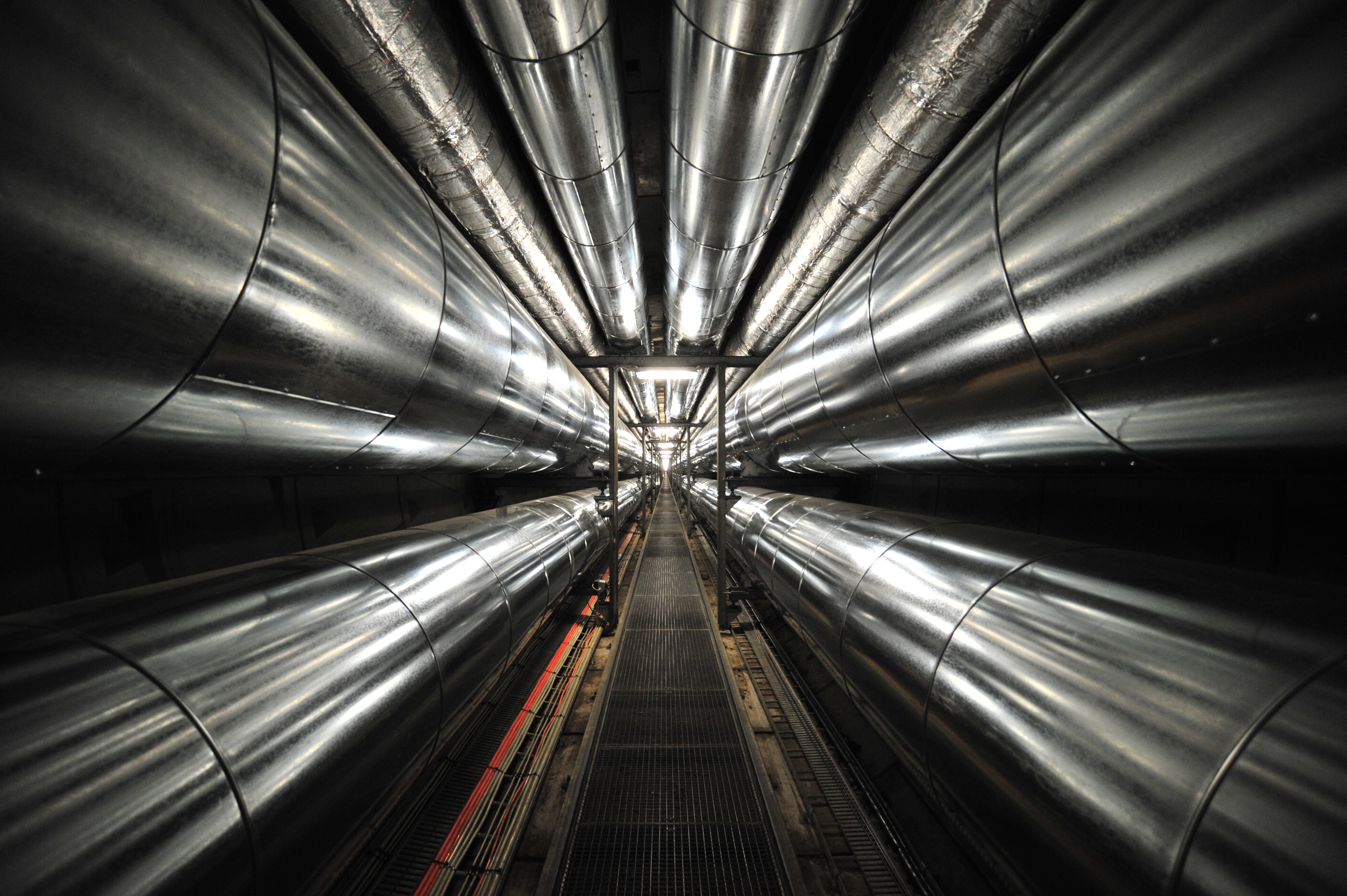
A tunnel is an underground or undersea passageway. It is dug through surrounding soil, earth or rock, or laid under water, and is usually completely enclosed except for the two portals common at each end, though there may be access and ventilation openings at various points along the length. A pipeline differs significantly from a tunnel, though some recent tunnels have used immersed tube construction techniques rather than traditional tunnel boring methods. A tunnel may be for foot or vehicular road traffic, for rail traffic, or for a canal. The central portions of a rapid transit network are usually in the tunnel. Some tunnels are used as sewers or aqueducts to supply water for consumption or for hydroelectric stations. Utility tunnels are used for routing steam, chilled water, electrical power or telecommunication cables, as well as connecting buildings for convenient passage of people and equipment.Salazar, Waneta. ''Tunnels in Civil Engineering''. Delhi, India : Wh ... [...More Info...] [...Related Items...] OR: [Wikipedia] [Google] [Baidu] |
Pinglin, Taipei
Pinglin District (a.k.a. Ping-Lin, ) is a rural district of southeastern New Taipei, Taiwan. It is the third-largest district of New Taipei City and it is located in the mountainous area bordering Yilan County. Overview Pinglin is part of the water district of the greater Taipei area as the Feicui Dam is located in the neighboring Shiding District, so land development is restricted. Pinglin is most known for producing pouchong tea. The Pinglin Tea Museum is the world's largest tea museum. Over 80% of its residents are tea growers or are involved in the tea business. Geography *Area: 170.84 km2 *Population: 6,547 people (February 2023) Tourist attractions * Beishi River Historical Trail * Ping-Lin Tea Museum * Jingualiao River Fish-Watching Trails * Jingualiao Tiema Recreation Park * Jiuchionggen Mountain Trails Transportation Roads * National Highway No. 5, also known as Beiyi or the Chiang Wei-shui Freeway. * Highway No. 9, also known as Beiyi Highway. Bus *Bus 9 ... [...More Info...] [...Related Items...] OR: [Wikipedia] [Google] [Baidu] |
Suao
Suao Township (), postal romanization, alternately romanized as Su-ao or Su'ao, is located in southern Yilan County, Taiwan, Yilan County, Taiwan, is an Township (Taiwan), urban township that is famous for its seafood restaurants and Su'ao Cold Spring, cold springs. It is a terminus of National Highway No. 5 (Taiwan), National Highway No. 5, the Suhua Highway Improvement Project, Suao-Hualien Express Way, and the North-Link Line of the Taiwan Railway Administration. It also has two large harbors: Suao Port, a seaport that also houses a naval base, and Nanfang-ao Port, a major fishing port of Taiwan. History During Taiwan under Japanese rule, Japanese rule, the area was established as , Suō District, Taihoku Prefecture. After World War II, the town was converted to a township under Taipei County. In 1950, the township was put under the newly established Yilan County. Demographics As of September 2023, Suao had 14,533 households and a total population of 37,602, including 18,5 ... [...More Info...] [...Related Items...] OR: [Wikipedia] [Google] [Baidu] |
Dongshan, Yilan
Dongshan Township () is a rural township in the central part of Yilan County, Taiwan. Geography * Area: 79.86 km2 * Population: 53,235 people (September 2023) Administrative divisions Zhenzhu, Bucheng, Sanji, Daxing, Tungcheng, Xianghe, Nanxing, Anping, Dongshan, Taihe, Babao, Wanshan, Zhongshan, Shunan, Yongmei, Wuyuan, Qunying, Qinggou, Lupu, Dean, Guangxing, Guangan, Kelin and Dajin Village. Economy The main industry in Dongshan Township are agriculture and tourism. In agriculture, tea and pomelo are the specialties for this township. While the tourism industry creates more business in leisure, food and beverages and farm tourism. Tourist attractions * Meihua Lake * Shangri-La Leisure Farm Transportation The township is accessible by the Dongshan Station of the Taiwan Railway Administration. Notable natives * Lee Chin-lung, Minister of Council of Agriculture (2002–2006) * Liao Feng-teh, politician * Yu Shyi-kun, Premier of the Republic of China Th ... [...More Info...] [...Related Items...] OR: [Wikipedia] [Google] [Baidu] |
Luodong
Luodong Township (), sometimes spelled Lotung or Lotong, is an Township (Taiwan), urban township in the central part of Yilan County, Taiwan, Yilan County, Taiwan. Luodong is the smallest township in the county by area. Toponym Its name and former name () derive from the Kavalan language, Kavalan word ''lutung (other), rutung'', meaning "monkey", referring to a large population of monkeys there half century ago. History Qing dynasty In 1804, Taiwanese Plains Aborigines, Pingpu tribe chiefs Pan Xian Wen and Maoge from Changhua County, Changhua led a group of people to settle in the Luodong area, where they established Alishih and Ashushih communities and developed agriculture on a large scale. In 1812, Taiwan under Qing rule, Qing dynasty officer Fan Bang Gan was assigned to Luodong. Two years later, Han settlers entered the region to begin clearing and developing the area. The Pingpu tribe and Han settlers fought over land ownership but eventually they ended up workin ... [...More Info...] [...Related Items...] OR: [Wikipedia] [Google] [Baidu] |
Wujie, Yilan
Wujie Township () is a Township (Taiwan), rural township in the eastern part of Yilan County, Taiwan, Yilan County, Taiwan. Geography * Area: 38.87 km2 * Population: 40,984 people (September 2023) Administrative divisions The township comprises 15 villages: Chengxing, Daji, Erjie, Fuxing, Jinzhong, Jixin, Lize, Sanxing, Shangsi, Sijie, Wujie, Xiaowei, Xiehe, Zengan and Zhongxing. Tourist attractions * Chung Hsing Cultural and Creative Park * Dongshan River Water Park * Erjie Rice Barn * :zh:利澤簡永安宮, Lizejian Yong'an Temple * National Center for Traditional Arts Festivals * Yilan International Children's Folklore and Folkgame Festival Transportation The Erjie railway station, Erjie Station and Zhongli railway station (Yilan), Zhongli Station of Taiwan Railways Administration, Taiwan Railways is located in the township. Notable natives * Lin Yi-hsiung, Chairperson of Democratic Progressive Party (1998–2000) External links * {{taiwan-geo-stub Townshi ... [...More Info...] [...Related Items...] OR: [Wikipedia] [Google] [Baidu] |
Zhuangwei, Yilan
Zhuangwei Township or Jhuangwei Township () is a rural township in eastern Yilan County, Taiwan Province, Republic of China, the smallest in the county. Geography * Area: * Population: 24,433 (September 2023) Politics and government Administrative divisions The township comprises 14 villages: * Dafu (), Fuxing/Fusing (), Gonglao (), Gujie (), Guoling (), Guting (), Jixiang/Jisiang (), Meicheng (), Meifu (), Donggang (), Xinnan/Sinnan (), Xinshe/Sinshe (), Yongzhen/Yongjhen () and Zhongxiao/Jhongsiao (). Elections The township participated in the 2018 Taiwanese municipal elections supporting the candidacy of Lin Zi-miao (KMT). Energy The township government is currently constructing an organic refuse resource center to process 200 tons of refuse daily with a planned capacity of 400 kW. Tourist attractions * Wujian Ziyun Temple * Yongzhen Coast Park Transportation The nearest train station to the township is Yilan Station of Taiwan Railways, located in Yilan City. No ... [...More Info...] [...Related Items...] OR: [Wikipedia] [Google] [Baidu] |
Jiaoxi, Yilan
Jiaoxi Township ( zh, c=, hp=jiāo xī xiāng, tp=Jiaosi Siang, w=Chiao1-hsi1 Hsiang1, poj=Ta-khe-hiong, Taⁿ-khe-hiong, Taⁿ-kheⁿ-hiong) or Chiaohsi Township is a rural township in the northern section of Yilan County, Taiwan. Geography * Area: 101.43 km2 * Population: 34,932 people (September 2023) Administrative divisions The township includes eighteen rural villages: *Baiyun (), Yushi (Yushih; ), Deyang (), Dazhong (), Dayi (), Liujie (), Erlong (), Shichao (), Yutian (), Sanmin (), Linmei (), Baie (), Yuguang (), Guangwu (), Wusha (), Longtan (), Paolun () and Erjie Village (). Education * Fo Guang University *Tamkang University Lanyang Campus Tourist attractions Jiaoxi is famous for its hot springs. The industry, as well as associated industries like hospitality, experience noticeable increases in revenue on weekends and holidays during the hot spring season in winter. In March 2012, it was named one of the ''Top 10 Small Tourist Towns'' by the Tour ... [...More Info...] [...Related Items...] OR: [Wikipedia] [Google] [Baidu] |


