|
Merlin's Bridge
Merlin's Bridge ( cy, Bont Myrddin or Pont Fadlen) is a village and a community south of, and contiguous with, Haverfordwest, Pembrokeshire, on the A4076 to Milford Haven. Merlin's Bridge has its own elected community council which meets monthly, and is an electoral ward to Pembrokeshire County Council Pembrokeshire County Council ( cy, Cyngor Sir Penfro) is the governing body for Pembrokeshire, one of the Principal Areas of Wales. Political control The first election to the council was held in 1995, initially operating as a shadow authori ..., electing one county councillor. The community had a population of 2,202 in the 2011 census. The village has a community centre, a post office and a creamery. Worship The English Wesleyan Methodist Chapel, Emmanuel Christian Centre, and St Mark's Chapel, the three places of worship in Merlin's Bridge, are all buildings noted by the Royal Commission on the Ancient and Historical Monuments of Wales (Coflein). Sport The village's ... [...More Info...] [...Related Items...] OR: [Wikipedia] [Google] [Baidu] |
Pembrokeshire
Pembrokeshire ( ; cy, Sir Benfro ) is a county in the south-west of Wales. It is bordered by Carmarthenshire to the east, Ceredigion to the northeast, and the rest by sea. The county is home to Pembrokeshire Coast National Park. The Park occupies more than a third of the area of the county and includes the Preseli Hills in the north as well as the Pembrokeshire Coast Path. Historically, mining and fishing were important activities, while industry nowadays is focused on agriculture (86 per cent of land use), oil and gas, and tourism; Pembrokeshire's beaches have won many awards. The county has a diverse geography with a wide range of geological features, habitats and wildlife. Its prehistory and modern history have been extensively studied, from tribal occupation, through Roman times, to Welsh, Irish, Norman, English, Scandinavian and Flemish influences. Pembrokeshire County Council's headquarters are in the county town of Haverfordwest. The council has a majority of Independ ... [...More Info...] [...Related Items...] OR: [Wikipedia] [Google] [Baidu] |
Dyfed
Dyfed () is a preserved county in southwestern Wales. It is a mostly rural area with a coastline on the Irish Sea and the Bristol Channel. Between 1974 and 1996, Dyfed was also the name of the area's county council and the name remains in use for certain ceremonial and other purposes. History Dyfed is a preserved county of Wales. It was originally created as an administrative county council on 1 April 1974 under the terms of the Local Government Act 1972, and covered approximately the same geographic extent as the ancient Principality of Deheubarth, although excluding the Gower Peninsula and the area west of the River Tawe. The choice of the name ''Dyfed'' was based on the historic name given to the region once settled by the Irish Déisi and today known as Pembrokeshire. The historic Dyfed never included Ceredigion and only briefly included Carmarthenshire. Modern Dyfed was formed from the administrative counties which corresponded to the ancient counties of Cardiganshire ... [...More Info...] [...Related Items...] OR: [Wikipedia] [Google] [Baidu] |
Preseli Pembrokeshire (UK Parliament Constituency)
Preseli Pembrokeshire ( cy, Preseli Sir Benfro) is a seat and constituency of the House of Commons of the Parliament of the United Kingdom. The Preseli Pembrokeshire Senedd constituency was created with the same boundaries in 1999. Its MP, who has held the seat since 2005, is the Conservative Stephen Crabb, who was Secretary of State for Work and Pensions (Work and Pensions Secretary) from March to July 2016. The seat was held by Labour's candidate from its creation in 1997 until 2005. The Labour and Conservative parties have won at least 27.7% of the vote apiece since its 1997 creation, with the next-placed parties having reached a maximum of 14.5% of the vote to date in a generally broad field. The seat attracted five candidates in 2010, eight in 2015 (an election in which five of the deposits were refunded and three lost) and seven in 2017. At the 2017 election, Crabb's majority was the 27th closest out of the 650 Commons seats, 0.8% or 314 votes. In 2019, there were ... [...More Info...] [...Related Items...] OR: [Wikipedia] [Google] [Baidu] |
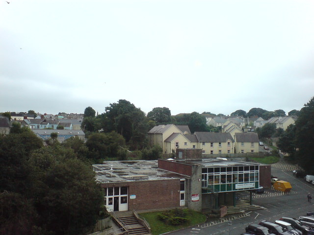
The Old Pembrokeshire College - Geograph
''The'' () is a grammatical article in English, denoting persons or things that are already or about to be mentioned, under discussion, implied or otherwise presumed familiar to listeners, readers, or speakers. It is the definite article in English. ''The'' is the most frequently used word in the English language; studies and analyses of texts have found it to account for seven percent of all printed English-language words. It is derived from gendered articles in Old English which combined in Middle English and now has a single form used with nouns of any gender. The word can be used with both singular and plural nouns, and with a noun that starts with any letter. This is different from many other languages, which have different forms of the definite article for different genders or numbers. Pronunciation In most dialects, "the" is pronounced as (with the voiced dental fricative followed by a schwa) when followed by a consonant sound, and as (homophone of the archaic pron ... [...More Info...] [...Related Items...] OR: [Wikipedia] [Google] [Baidu] |
Community (Wales)
A community ( cy, cymuned) is a division of land in Wales that forms the lowest tier of local government in Wales. Welsh communities are analogous to civil parishes in England. There are 878 communities in Wales. History Until 1974 Wales was divided into civil parishes. These were abolished by section 20 (6) of the Local Government Act 1972, and replaced by communities by section 27 of the same Act. The principal areas of Wales are divided entirely into communities. Unlike in England, where unparished areas exist, no part of Wales is outside a community, even in urban areas. Most, but not all, communities are administered by community councils, which are equivalent to English parish councils in terms of their powers and the way they operate. Welsh community councils may call themselves town councils unilaterally and may have city status granted by the Crown. In Wales, all town councils are community councils. There are now three communities with city status: Bangor, St ... [...More Info...] [...Related Items...] OR: [Wikipedia] [Google] [Baidu] |
Haverfordwest
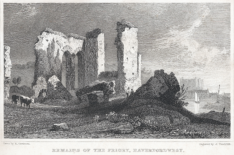
Haverfordwest (, ; cy, Hwlffordd ) is the county town of Pembrokeshire, Wales, and the most populous urban area in Pembrokeshire with a population of 14,596 in 2011. It is also a community, being the second most populous community in the county, with 12,042 people, after Milford Haven. The suburbs include the former parish of Prendergast, Albert Town and the residential and industrial areas of Withybush (housing, retail parks, Withybush General Hospital, hospital, Withybush Airport, airport and showground). Haverfordwest is located in a strategic position, being at the lowest bridging point of the Western Cleddau prior to the opening of the Cleddau Bridge in 1975. Topography Haverfordwest is a market town, the county town of Pembrokeshire and an important road network hub between Milford Haven, Pembroke Dock, Fishguard and St David's as a result of its position at the tidal limit of the River Cleddau, Western Cleddau. The majority of the town, comprising the old parishes of ... [...More Info...] [...Related Items...] OR: [Wikipedia] [Google] [Baidu] |
A4076 Road
The A4076 is a long, primary trunk road in Pembrokeshire, Wales. The A4076 begins at the Salutation Square roundabout junction with the A40 road, A40 by County Hall, Haverfordwest, Pembrokeshire County Hall, then bypasses Haverfordwest to the southeast and continues south to the oil refineries, now converted into petroleum storage and distribution terminals, at Milford Haven. Other main settlements from north to south are: *Merlin's Bridge (junction with A487 road, A487) *Johnston, Pembrokeshire, Johnston (junction with A477 road, A477) *Steynton (junction with A477 again) References External links * {{DEFAULTSORT:4-4076 Roads in Wales Transport in Pembrokeshire Roads in Pembrokeshire ... [...More Info...] [...Related Items...] OR: [Wikipedia] [Google] [Baidu] |
Milford Haven
Milford Haven ( cy, Aberdaugleddau, meaning "mouth of the two Rivers Cleddau") is both a town and a community in Pembrokeshire, Wales. It is situated on the north side of the Milford Haven Waterway, an estuary forming a natural harbour that has been used as a port since the Middle Ages. The town was founded in 1790 by Sir William Hamilton, who designed a grid pattern. It was originally intended to be a whaling centre, though by 1800 it was developing as a Royal Navy dockyard which it remained until the dockyard was transferred to Pembroke in 1814. It then became a commercial dock, with the focus moving in the 1960s, after the construction of an oil refinery built by Esso, to logistics for fuel oil and liquid gas. By 2010, the town's port had become the fourth largest in the United Kingdom in terms of tonnage, and continues its important role in the United Kingdom's energy sector with several oil refineries and one of the biggest LNG terminals in the world. Milford Haven is t ... [...More Info...] [...Related Items...] OR: [Wikipedia] [Google] [Baidu] |
Community Council
A community council is a public representative body in Great Britain. In England they may be statutory parish councils by another name, under the Local Government and Public Involvement in Health Act 2007, or they may be non-statutory bodies. In Scotland and Wales they are statutory bodies. Scottish community councils were first created under the Local Government (Scotland) Act 1973, many years after Scottish parish councils were abolished by the Local Government (Scotland) Act 1929. Welsh community councils – which may, if they wish, style themselves ''town councils'' – are a direct replacement, under the Local Government Act 1972, for the previously existing parish councils and are identical to English parish councils in terms of their powers and the way in which they operate. England In England, a parish council can call itself a ''community council'', as an 'alternative style' under the Local Government and Public Involvement in Health Act 2007. There are thirt ... [...More Info...] [...Related Items...] OR: [Wikipedia] [Google] [Baidu] |
Electoral Ward
A ward is a local authority area, typically used for electoral purposes. In some countries, wards are usually named after neighbourhoods, thoroughfares, parishes, landmarks, geographical features and in some cases historical figures connected to the area (e.g. William Morris Ward in the London Borough of Waltham Forest, England). It is common in the United States for wards to simply be numbered. Origins The word “ward”, for an electoral subdivision, appears to have originated in the Wards of the City of London, where gatherings for each ward known as “wardmotes” have taken place since the 12th century. The word was much later applied to divisions of other cities and towns in England and Wales and Ireland. In parts of northern England, a ''ward'' was an administrative subdivision of a county, very similar to a hundred in other parts of England. Present day In Australia, Canada, New Zealand, Sri Lanka, South Africa, the United Kingdom, and the United States, w ... [...More Info...] [...Related Items...] OR: [Wikipedia] [Google] [Baidu] |
Pembrokeshire County Council
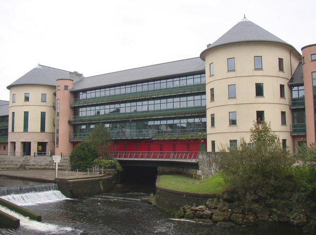
Pembrokeshire County Council ( cy, Cyngor Sir Penfro) is the governing body for Pembrokeshire, one of the Principal Areas of Wales. Political control The first election to the council was held in 1995, initially operating as a shadow authority before coming into its powers on 1 April 1996. Since 1996 the majority of the seats on the council have always been held by independent councillors, with different groupings forming among the independents at different times. Elections normally take place every five years. The last elections were on 5 May 2022. The 2021 elections were postponed to 2022 to avoid a clash with the 2021 Senedd election. Leadership The leaders of the council since 1996 have been: David Simpson was elected as the new council leader on 25 May 2017, after the previous leader Jamie Adams had withdrawn from the contest. The council had previously been controlled by the Independent Plus Political Group (IPPG), of which Adams was a member, but their numbers w ... [...More Info...] [...Related Items...] OR: [Wikipedia] [Google] [Baidu] |


.png)


