|
Maximum-value Composite Procedure
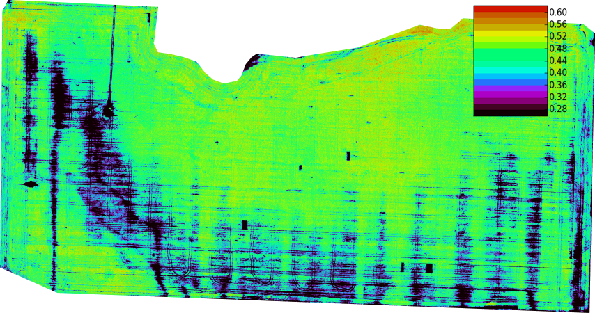
A maximum-value composite procedure (or MVC) is a procedure used in satellite imaging, which is applied to botany, vegetation studies. It requires that a series of multi-temporal geo-referenced satellite data be processed into NDVI images. On a pixel-by-pixel basis, each NDVI value is examined, and only the highest value is retained for each pixel location. After all pixels have been evaluated, the result is known as an MVC image. An alternative method is the maximum value interpolated procedure (MVI), which not only retains the NDVI maximum values within a period, but also retains temporal data. This allows the detection of a representative NDVI value for each time period, using simple linear interpolation. A profile simulation shows that MVI has a significant error reduction compared with the MVC method. References Satellite meteorology Remote sensing {{remote-sensing-stub ... [...More Info...] [...Related Items...] OR: [Wikipedia] [Google] [Baidu] |
Satellite Imaging
Satellite images (also Earth observation imagery, spaceborne photography, or simply satellite photo) are images of Earth collected by imaging satellites operated by governments and businesses around the world. Satellite imaging companies sell images by licensing them to governments and businesses such as Apple Maps and Google Maps. History The first images from space were taken on sub-orbital flights. The US-launched V-2 flight on October 24, 1946, took one image every 1.5 seconds. With an apogee of 65 miles (105 km), these photos were from five times higher than the previous record, the 13.7 miles (22 km) by the Explorer II balloon mission in 1935. The first satellite (orbital) photographs of Earth were made on August 14, 1959, by the U.S. Explorer 6. The first satellite photographs of the Moon might have been made on October 6, 1959, by the Soviet satellite Luna 3, on a mission to photograph the far side of the Moon. The Blue Marble photograph was taken from sp ... [...More Info...] [...Related Items...] OR: [Wikipedia] [Google] [Baidu] |
Botany
Botany, also called plant science, is the branch of natural science and biology studying plants, especially Plant anatomy, their anatomy, Plant taxonomy, taxonomy, and Plant ecology, ecology. A botanist or plant scientist is a scientist who specialises in this field. "Plant" and "botany" may be defined more narrowly to include only land plants and their study, which is also known as phytology. Phytologists or botanists (in the strict sense) study approximately 410,000 species of Embryophyte, land plants, including some 391,000 species of vascular plants (of which approximately 369,000 are flowering plants) and approximately 20,000 bryophytes. Botany originated as history of herbalism#Prehistory, prehistoric herbalism to identify and later cultivate plants that were edible, poisonous, and medicinal, making it one of the first endeavours of human investigation. Medieval physic gardens, often attached to Monastery, monasteries, contained plants possibly having medicinal benefit. ... [...More Info...] [...Related Items...] OR: [Wikipedia] [Google] [Baidu] |
NDVI
The normalized difference vegetation index (NDVI) is a widely-used metric for quantifying the health and density of vegetation using sensor data. It is calculated from spectrometric data at two specific bands: red and near-infrared. The spectrometric data is usually sourced from remote sensors, such as satellites. The metric is popular in industry because of its accuracy. It has a high correlation with the true state of vegetation on the ground. The index is easy to interpret: NDVI will be a value between -1 and 1. An area with nothing growing in it will have an NDVI of zero. NDVI will increase in proportion to vegetation growth. An area with dense, healthy vegetation will have an NDVI of one. NDVI values less than 0 suggest a lack of dry land. An ocean will yield an NDVI of -1 Brief history The exploration of outer space started in earnest with the launch of Sputnik 1 by the Soviet Union on 4 October 1957. This was the first man-made satellite orbiting the Earth. Subseq ... [...More Info...] [...Related Items...] OR: [Wikipedia] [Google] [Baidu] |
Satellite Meteorology
A weather satellite or meteorological satellite is a type of Earth observation satellite that is primarily used to monitor the weather and climate of the Earth. Satellites are mainly of two types: polar orbiting (covering the entire Earth asynchronously) or geostationary (hovering over the same spot on the equator). While primarily used to detect the development and movement of storm systems and other cloud patterns, meteorological satellites can also detect other phenomena such as city lights, fires, effects of pollution, auroras, sand and dust storms, snow cover, ice mapping, boundaries of ocean currents, and energy flows. Other types of environmental information are collected using weather satellites. Weather satellite images helped in monitoring the volcanic ash cloud from Mount St. Helens and activity from other volcanoes such as Mount Etna. Smoke from fires in the western United States such as Colorado and Utah have also been monitored. El Niño and its effects on wea ... [...More Info...] [...Related Items...] OR: [Wikipedia] [Google] [Baidu] |


