|
Mago-Thingbu To Vijaynagar Border Road
Arunachal Frontier Highway, officially notified as the National Highway-913 and also called Bomdila-Vijaynagar Highway, connecting Bomdila in northwest to VijaynagarQ in southeast including 800 km greenfield section and network of new tunnels & bridges, is mostly lntermediate-lane and in some sections 2-lane paved-shoulder under-construction national highway along the India-Tibet border in the Indian state of Arunachal Pradesh. The highway itself will cost and total cost including 6 additional inter-corridors is . In some places, this highway will run as close as 20 km from the LAC. To be constructed by MoRTH in 9 packages, all packages will be approved by the end of FY 2024-25 (March 2025) and construction will be completed in 2 years by 31 March 2027. Of the total route, 800km is greenfield, rest brownfield will be upgraded and tunnels will be built. [...More Info...] [...Related Items...] OR: [Wikipedia] [Google] [Baidu] |
Bomdila
Bomdila is the headquarters of West Kameng district in the state of Arunachal Pradesh in India. Bomdila is one of the 60 constituencies of the state of Arunachal Pradesh. Geography and climate Bomdila is located at . It has an average elevation of 2415 metres (7923 feet). Climate: In Bomdila, the wet season is cool and mostly cloudy and the dry season is cold and clear. Over the course of the year, the temperature typically varies from 31 °F to 66 °F and is rarely below 27 °F or above 70 °F. Demographics India census, Bomdila had a population of 6685. Males constitute 54% of the population and females 46%. Bomdila has an average literacy rate of 69%, higher than the national average of 59.5%; with male literacy of 75% and female literacy of 63%. 13% of the population is under 6 years of age. It is inhabited by the Monpa, Sherdukpen, Miji, Bugun (Khowa) and Aka tribes. Languages According to Census 2011, Bhotia is Spoken by 2,479 peop ... [...More Info...] [...Related Items...] OR: [Wikipedia] [Google] [Baidu] |
Ministry For Development Of North Eastern Region
The Ministry of Development of North Eastern Region is a Government of India ministry, established in September 2001, which functions as the nodal Department of the Central Government to deal with matters related to the socio-economic development of the eight States of Northeast India: Arunachal Pradesh, Assam, Manipur, Meghalaya, Mizoram, Nagaland, Tripura and Sikkim. It acts as a facilitator between the Central Ministries/ Departments and the State Governments of the North Eastern Region in the economic development including removal of infrastructural bottlenecks, provision of basic minimum services, creating an environment for private investment and to remove impediments to lasting peace and security in the North Eastern Region. The current Minister of Development of North Eastern Region is Jyotiraditya Scindia. Functions and responsibilities The Department of Development of North Eastern Region (DoNER) was created in 2001 and was accorded the status of a full-fledged m ... [...More Info...] [...Related Items...] OR: [Wikipedia] [Google] [Baidu] |
Lower Dibang Valley District
The Lower Dibang Valley district ( ) is an administrative district in the state of Arunachal Pradesh in northeastern India,. .It is the tenth least populous district in the country, and the least densely populated district. History In June 1980, the Dibang Valley district was created from part of the Lohit district. On 16 December 2001, the Dibang Valley district was bifurcated into Dibang Valley district and Lower Dibang Valley district. Geography and timeline The headquarters of the district is the town of Roing. Before it was carved out of the district on 16 December 2001, Anini housed the district headquarters. Transport The proposed Arunachal Pradesh Frontier Highway goes along the McMahon Line, and will pass through the Lower Dibang Valley district. An alignment map can be seehereanhere It will intersect with the proposed East-West Industrial Corridor Highway. Divisions There are two Arunachal Pradesh Legislative Assembly constituencies located in this district: ... [...More Info...] [...Related Items...] OR: [Wikipedia] [Google] [Baidu] |
Desali
Desali is a village'' panchayat'' in the Hunli-Desali ''tehsil'' of Lower Dibang Valley district in the north-eastern state of Arunachal Pradesh, India. Location It is located on the proposed Mago-Thingbu to Vijaynagar Arunachal Pradesh Frontier Highway along the McMahon Line.- - - References {{Geographic location , Centre = Arunachal Pradesh , North = {{flagicon, PRC Tibet Autonomous Region, China , Northeast = , East = {{flagicon, Burma Kachin State, Burma , Southeast = {{flagicon, Burma Sagaing Region, Burma , South = Nagaland , Southwest = Assam , West = {{flagicon, Bhutan Eastern Zone Eastern or Easterns may refer to: Transportation Airlines *China Eastern Airlines, a current Chinese airline based in Shanghai * Eastern Air, former name of Zambia Skyways *Eastern Air Lines, a defunct American airline that operated from 192 ..., Bhutan , Northwest = Villages in Lower Dibang Valley district ... [...More Info...] [...Related Items...] OR: [Wikipedia] [Google] [Baidu] |
Dibang Valley District
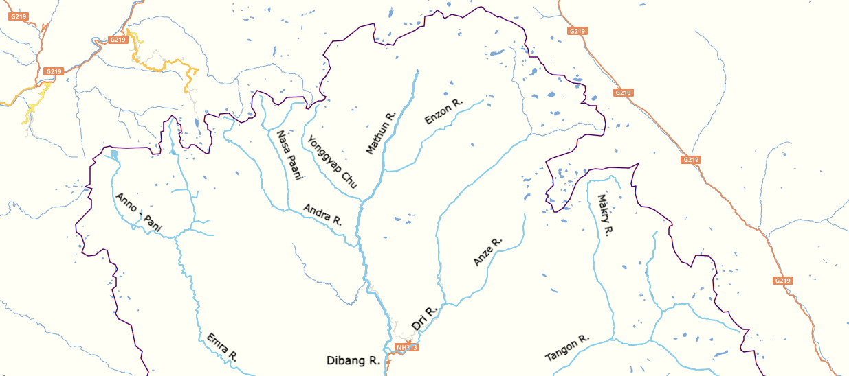
Dibang Valley ( ) is a district of the Indian state of Arunachal Pradesh named after the Dibang River or the Talon as the Mishmis call it. It is the least populated district in India and has an area of . History In June 1980, Dibang Valley district was created out of part of Lohit district. On 16 December 2001, Dibang Valley district was bifurcated into Dibang Valley district and Lower Dibang Valley district. Geography The Dibang River originates in the mountains of Arunachal Pradesh and flows through the length of the valley which is named after it. The Dibang has multiple tributaries and only once it debouches into the plains is it called by its name. Some of the major rivers of Dibang Valley District are: Ahui, Emra, Mathun, Dri, Tangon, Ithun, and Ange. The capital of this district, Anini, is the northernmost district capital in Northeast India. This district contains the northernmost point of Northeast India. Transport The proposed Mago- Thingbu to Vijaynagar A ... [...More Info...] [...Related Items...] OR: [Wikipedia] [Google] [Baidu] |
Upper Siang District
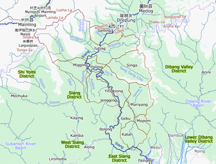
Upper Siang (Pron:/ˈsjæŋ or ˈsɪæŋ/) is an administrative district in the state of Arunachal Pradesh in India. It is the fourth least populous district in the country (out of 640). History The majority of the people are of the Adi tribe while the Memba, Khamba tribe also exists there. Part of the area was controlled by the Tibetan Kingdom of Powo when streams of Tibetan pilgrims searching for one of the 'hidden lands' or beyul () referred to in the prophecies of Guru Rinpoche in the East Himalayas from the mid-seventeenth century came south over the Doshong La pass, to seek the particular location of one of these earthly paradises called Padma bkod (written variously Pema köd, Pemakö and Pemako), literally 'Lotus Array' in the region. The region became administered by British India with the Simla Accord of 1914 and the demarcation of the McMahon Line, though China considers it part of South Tibet. The district was formed in 1999 when it was split from East Siang ... [...More Info...] [...Related Items...] OR: [Wikipedia] [Google] [Baidu] |
West Siang District
West Siang district (Pron:/ˈsjæŋ or ˈsɪæŋ/) is an administrative district in the state of Arunachal Pradesh in India. History In 1989, territory was given from West Siang to the East Siang district. Since 1999, this territory has been in the new Upper Siang district. Archaeological finds from Malinithan in West Siang are on display at the Jawaharlal Nehru Museum, Itanagar. It was once a part of the Chutiya kingdom. West Siang was divided into Upper Siang and Lower Siang. West Siang district was bifurcated on 9 December 2018 when northern areas along China border were made a separate Shi Yomi district. Geography The district headquarters is located at Aalo, Arunachal Pradesh, Aalo. West Siang district occupies an area of , comparatively equivalent to Crete. Transport The proposed Mago-Thingbu to Vijaynagar, Changlang, Vijaynagar Mago-Thingbu to Vijaynagar Border Road, Arunachal Pradesh Frontier Highway along the McMahon Line will intersect with the proposed East-West Ind ... [...More Info...] [...Related Items...] OR: [Wikipedia] [Google] [Baidu] |
Upper Subansiri District
Upper Subansiri (Pron:/su:bənˈsɪɹi/) is an administrative district in the state of Arunachal Pradesh in India. History The district was formed when Subansiri district was bifurcated into Upper and Lower Subansiri districts in 1980. Geography The district headquarter is located at Daporijo. Upper Subansiri district occupies an area of , comparatively equivalent to the United Kingdom's East Falkland island. The important towns are Chetam, Giba, Taksing, Limeking, Nacho, Arunachal Pradesh, Nacho, Siyum, Payeng, Taliha, Gite Ripa, Gussar, Dumporijo, Daporijo, Maro, Arunachal Pradesh, Maro, Baririjo and Puchigeku, each of which is the headquarters of a tehsil, circle. Transport The proposed Mago-Thingbu to Vijaynagar, Changlang, Vijaynagar Mago-Thingbu to Vijaynagar Border Road, Arunachal Pradesh Frontier Highway along the McMahon Line, (will intersect with the proposed East-West Industrial Corridor Highway, Arunachal Pradesh, East-West Industrial Corridor Highway) and will pas ... [...More Info...] [...Related Items...] OR: [Wikipedia] [Google] [Baidu] |
East Kameng District
East Kameng district is one of districts of Arunachal Pradesh state in northeastern, India. It shares an international border with China in the north and district borders with West Kameng district to the west, Pakke-Kessang district to the south, Kurung Kumey district to the east, Papum Pare district to the southeast. Pakke-Kessang district was bifurcated from East Kameng district on 1 December 2018. History The area around the Kameng river has at various times come under the control and influence of the Mon kingdom, Tibet Aka and Nishi chiefs would exert control over the area whenever no major political powers dominated the area. The Kameng Frontier Division was renamed the Kameng District. The Political Officer was also redesignated as the Deputy Commissioner of Kameng. However, for political reasons, the Kameng district was bifurcated between East Kameng and West Kameng on 1 June 1980. Geography Before the bifurcation, East Kameng district occupied an area of , compa ... [...More Info...] [...Related Items...] OR: [Wikipedia] [Google] [Baidu] |
Tawang District
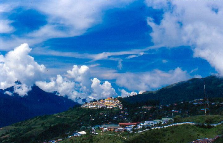
Tawang district (Pron:/tɑ:ˈwæŋ or təˈwæŋ/) is the smallest of the 26 Districts of Arunachal Pradesh, administrative districts of Arunachal Pradesh state in northeastern India. With a population of 49,977, it is the eighth least populous district in the country (out of Districts of India, 707). History Tawang is inhabited by the Monpa people. From 500 BC to 600 AD a kingdom known as Lhomon or Monyul ruled the area. The Monyul kingdom was later absorbed into the control of neighbouring Bhutan and Tibet. Tawang Monastery was founded by the Merak Lama Lodre Gyatso in 1681 in accordance with the wishes of the 5th Dalai Lama, Ngawang Lobsang Gyatso, and has an interesting legend surrounding its name, which means "Chosen by Horse". The sixth Dalai Lama, Tsangyang Gyatso, 6th Dalai Lama, Tsangyang Gyatso, was born in Tawang. Tawang was historically part of Tibet. The Simla Accord (1914), 1914 Simla Accord defined the McMahon Line as the new boundary between British India a ... [...More Info...] [...Related Items...] OR: [Wikipedia] [Google] [Baidu] |
Thingbu
Thingbu is a settlement in Tawang district in the north-eastern state of Arunachal Pradesh, India India, officially the Republic of India, is a country in South Asia. It is the List of countries and dependencies by area, seventh-largest country by area; the List of countries by population (United Nations), most populous country since .... Location It is located on the proposed Mago-Thingbu to Vijaynagar Arunachal Pradesh Frontier Highway along the McMahon Line, alignment map of which can be seehereanhere Demographics Thingbu is a small village occupied by the Monpa tribe & consists of 58 households. Culture Main festivals: Losar, Gandan Ngamchod etc. Religion: Buddhist. Dress: Traditional Shinka, Totung, Tenga-kime, Khichin, etc. ( for women). Khanjar, Chhuba, Totung, etc. (for men) Climate Heavy snowfall occurs during the months of December, January & February. See also * North-East Frontier Agency * List of people from Arunachal Pradesh * Re ... [...More Info...] [...Related Items...] OR: [Wikipedia] [Google] [Baidu] |
Mago, Tawang
Mago is a village Panchayat in Thingbu Tehsil of Tawang district in the north-eastern state of Arunachal Pradesh, India. Situated on the banks of the Goshu Chu, it lies 85 km from Tawang and 59 km from Jang. A well-maintained road connects Jang and Mago. The nearest railway station is in Missamari, and the closest airport is in Guwahati. Demography The inhabitants of Mago belong to the Monpa community, primarily engaged in yak herding. During the summer, these herders move further up into the mountain pastures to graze their yaks. The village is home to over 1,000 yaks. In June and July, the region also sees the growth of caterpillar fungus (Keeda Jadi), which is highly valued in traditional Chinese medicine as an aphrodisiac. Amenities Mago has a hydropower plant and an Airtel mobile tower. The village's main attractions are its two perennial hot water springs. Accommodations include state government guest rooms and home stays. See also * North-East Frontier ... [...More Info...] [...Related Items...] OR: [Wikipedia] [Google] [Baidu] |


