|
Mae Chaem District
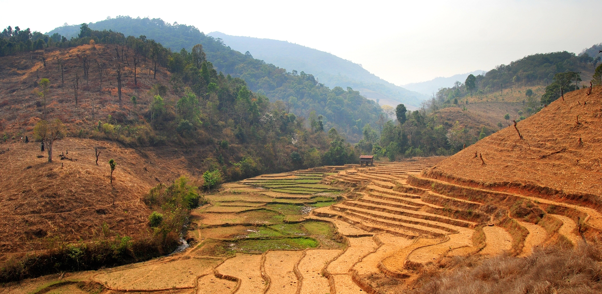
Mae Chaem (, ) is a district (''amphoe'') of Chiang Mai province in northern Thailand. History Mueang Chaem was created in 1908, consisting of the ''tambons'' Mae Thap, Tha Pha, Chang Khoeng, and Mae Suek split off from Chom Thong. In 1917 it was renamed Chang Khoeng, as the district office was in that ''tambon''. In 1938 it was reduced to a minor district (''king amphoe'') and was subordinate to Chom Thong District. In 1939 it was renamed Mae Chaem. In 1956 it was upgraded to a full district. In 2009 the northern part of the district was split off to form the new district, Galyani Vadhana. Geography Neighboring districts are (from the north clockwise) Galyani Vadhana, Samoeng, Mae Wang, Chom Thong and Hot of Chiang Mai Province, and Mae Sariang, Mae La Noi, Khun Yuam, Mueang Mae Hong Son and Pai of Mae Hong Son province. Thailand's highest mountain, high Doi Inthanon, in the Thanon Thong Chai Range, is in Mae Chaem District. Economy The district is a major producer ... [...More Info...] [...Related Items...] OR: [Wikipedia] [Google] [Baidu] |
District
A district is a type of administrative division that in some countries is managed by the local government. Across the world, areas known as "districts" vary greatly in size, spanning regions or county, counties, several municipality, municipalities, subdivisions of municipalities, school district, or political district. Etymology The word "district" in English is a Loanword, loan word from French language, French. It comes from Medieval Latin districtus–"exercising of justice, restraining of offenders". The earliest known English-language usage dates to 1611, in the work of lexicographer Randle Cotgrave. By country or territory Afghanistan In Afghanistan, a district (Persian language, Persian ) is a subdivision of a province. There are almost 400 districts in the country. Australia Electoral districts are used in state elections. Districts were also used in several states as cadastral units for land titles. Some were used as squatting districts. Cadastral divi ... [...More Info...] [...Related Items...] OR: [Wikipedia] [Google] [Baidu] |
Hot District
Hot (, ) is a district (''amphoe'') in the southern part of Chiang Mai province in northern Thailand. Geography Neighboring districts are (from the north clockwise) Mae Chaem, Chom Thong of Chiang Mai Province, Ban Hong, Li of Lamphun province, Doi Tao, Omkoi of Chiang Mai Province, Sop Moei and Mae Sariang of Mae Hong Son province. History In 1905 the district Muet Ka was abolished and split into the district Mueang Hot and the minor district Mueang Hot. In 1917 the district was renamed Hot. Administration The district is divided into six sub-districts (''tambon''), which are further subdivided into 60 villages (''muban''). There are two sub-district municipalities (''thesaban tambon''), Tha Kham and Hang Dong, both covering parts of ''tambon'' Hang Dong. There are a further six tambon administrative organizations (TAO). Tourism Notable tourist sites in Hot include: * Bo Kaeo Pine Tree Garden * Doi Bo Luang Forest * Mae Tho National Park * Op Luang Nati ... [...More Info...] [...Related Items...] OR: [Wikipedia] [Google] [Baidu] |
Ping River
The Ping River (, , ; , ) along with the Nan River, is one of the two main tributaries of the Chao Phraya River. It originates at Doi Thuai in the Daen Lao Range, in Chiang Dao district, Chiang Mai province. After passing Chiang Mai, it flows through the provinces of Lamphun, Tak and Kamphaeng Phet. At the confluence with the Nan at Nakhon Sawan (also named ''Paknam Pho'' in Thai), it forms the Chao Phraya River. History Evidence shows that habitation along the Ping River dates back to 1500 BCE. At that time it controlled trading routes between Yunnan and the Chao Phraya basin. Mengrai, a ruler and conqueror from Xishuangbanna, turned south to create an alternative "silk road" along the Ping River itself and captured Haripunchai in 1281. Following his successful conquest, he created Wiang Kum Kam as his capital before abandoning it following nearly a decade of floods, finally moving kilometres north to establish Chiang Mai as the capital of the Kingdom of Lanna in 1296. ... [...More Info...] [...Related Items...] OR: [Wikipedia] [Google] [Baidu] |
Tonne
The tonne ( or ; symbol: t) is a unit of mass equal to 1,000 kilograms. It is a non-SI unit accepted for use with SI. It is also referred to as a metric ton in the United States to distinguish it from the non-metric units of the short ton ( United States customary units) and the long ton ( British imperial units). It is equivalent to approximately 2,204.6 pounds, 1.102 short tons, and 0.984 long tons. The official SI unit is the megagram (Mg), a less common way to express the same amount. Symbol and abbreviations The BIPM symbol for the tonne is t, adopted at the same time as the unit in 1879.Table 6 . BIPM. Retrieved on 2011-07-10. Its use is also official for the metric ton in the United States, having been adopted by the United States |
Agrochemical
An agrochemical or agrichemical, a contraction of ''agricultural chemical'', is a chemical product used in industrial agriculture. Agrichemical typically refers to biocides (pesticides including insecticides, herbicides, fungicides and nematicides) alongside synthetic fertilizers. It may also include hormones and other chemical growth agents. Though the application of mineral fertilizers and pesticidal chemicals has a long history, the majority of agricultural chemicals were developed from the 19th century, and their use were expanded significantly during the Green Revolution and the late 20th century. Agriculture that uses these chemicals is frequently called conventional agriculture. Agrochemicals are counted among speciality chemicals. Most agrochemicals are products of the petrochemical industry, where chemicals are derivatives of fossil fuels. The production and use of agrochemicals contribute substantially to climate change, both through direct emissions during production, a ... [...More Info...] [...Related Items...] OR: [Wikipedia] [Google] [Baidu] |
Monoculture
In agriculture, monoculture is the practice of growing one crop species in a field at a time. Monocultures increase ease and efficiency in planting, managing, and harvesting crops short-term, often with the help of machinery. However, monocultures are more susceptible to diseases or Pest (organism), pest outbreaks long-term due to localized reductions in biodiversity and nutrient depletion. Crop diversity can be added both in time, as with a crop rotation or sequence, or in space, with a polyculture or intercropping. Monocultures appear in contexts outside of agriculture and food production. Grass lawns are a common form of residential monocultures. Several monocultures, including single-species forest plantations, have become increasingly abundant throughout the tropics following market globalization, impacting local communities. Genetic monocultures refer to crops that have little to no genetic variation. This is achieved using cultivars, made through processes of propagation ... [...More Info...] [...Related Items...] OR: [Wikipedia] [Google] [Baidu] |
Maize
Maize (; ''Zea mays''), also known as corn in North American English, is a tall stout grass that produces cereal grain. It was domesticated by indigenous peoples in southern Mexico about 9,000 years ago from wild teosinte. Native Americans planted it alongside beans and squashes in the Three Sisters polyculture. The leafy stalk of the plant gives rise to male inflorescences or tassels which produce pollen, and female inflorescences called ears. The ears yield grain, known as kernels or seeds. In modern commercial varieties, these are usually yellow or white; other varieties can be of many colors. Maize relies on humans for its propagation. Since the Columbian exchange, it has become a staple food in many parts of the world, with the total production of maize surpassing that of wheat and rice. Much maize is used for animal feed, whether as grain or as the whole plant, which can either be baled or made into the more palatable silage. Sugar-rich varieties called sw ... [...More Info...] [...Related Items...] OR: [Wikipedia] [Google] [Baidu] |
Thanon Thong Chai Range
The Thanon Thong Chai Range (, , formerly Thanon Range; Burmese ''Tanen Taunggyi'') is a mountain range in northern Thailand. Its tallest peak is Doi Inthanon, the highest point in Thailand. Most of the range is in Chiang Mai Province, with parts in Mae Hong Son and Lamphun Provinces. Geologically in the Thanon Thong Chai Range, as in the other southern subranges of the Shan Hills, layers of alluvium are superimposed on hard rock. Precambrian rocks are present in this range, but absent in the ranges further east, such as the Khun Tan Range. Geography The Thanon Thong Chai Range is the southernmost prolongation of the Shan Hills and it consists of two parallel ranges running southwards from the southwestern limits of the Daen Lao Range between rivers Yuam and Ping. The eastern range is also known as Inthanon Range (ทิวเขาอินทนนท์). Often the Dawna Range further west and south is included as the western part of the Thanon Thong Chai Range. Th ... [...More Info...] [...Related Items...] OR: [Wikipedia] [Google] [Baidu] |
Doi Inthanon
Doi Inthanon (, ) is the highest mountain in Thailand. It is in Chom Thong District, Chiang Mai Province. This mountain is an ultra prominent peak, known in the past as Doi Luang Ang Ga (''Grand Mount Ang Ga'') or meaning the 'crow's pond top'. Near the mountain's base was a pond where many crows gathered. The name ''Doi Inthanon'' was given in honour of Inthawichayanon, King of Chiang Mai, who was concerned about the forests in the north and tried to preserve them. After his death, his remains was interred at Doi Luang, which was then renamed in his honour. Today, the summit of Doi Inthanon is a popular tourist destination for both foreign and Thai tourists, with a peak of 12,000 visitors visiting the summit on New Year's Day. In addition to a range of tourist facilities on the summit, there is a weather station operated by the Royal Thai Air Force, with the Thai National Observatory also based there. Geography Doi Inthanon is the highest peak of the Inthanon Range () of the ... [...More Info...] [...Related Items...] OR: [Wikipedia] [Google] [Baidu] |
Mueang Mae Hong Son District
Mueang Mae Hong Son (, ) is the capital district ('' amphoe mueang'') of Mae Hong Son province, northern Thailand. History The Interior Ministry upgraded ''Mueang'' Mae Hong Son to a fourth-class city under Monthon Phayap on 10 May 1910. It then consisted of the four districts, Mueang Mae Hong Son, Mueang Yuam (now Mae Sariang District), Pai, and Khun Yuam. In 1917, the district was renamed from ''Mueang'' to ''Muai To'' (ม่วยต่อ). In 1938 it was renamed Mueang Mae Hong Son. The northeastern part of the district was split off in 1987 and formed the new district Pang Mapha. Geography The Daen Lao Range dominates the landscape of this district. Neighboring districts are (from south clockwise): Khun Yuam of Mae Hong Son Province; Kayah State of Myanmar; Pang Mapha and Pai of Mae Hong Son Province; and Galyani Vadhana and Mae Chaem of Chiang Mai province. The Namtok Mae Surin National Park office is in the district. Administration The district is divided into ... [...More Info...] [...Related Items...] OR: [Wikipedia] [Google] [Baidu] |


