|
List Of Regions Of Hungary
There are seven statistical regions of Hungary created in 1999 by the Law 1999/XCII amending Law 1996/XXI. Regions are groupings of the 19 counties and the capital city. *''Northern Hungary'' includes the counties Borsod-Abaúj-Zemplén, Heves and Nógrád. *''Northern Great Plain'' includes the counties Hajdú-Bihar, Jász-Nagykun-Szolnok, and Szabolcs-Szatmár-Bereg. *''Southern Great Plain'' includes the counties Bács-Kiskun, Békés and Csongrád-Csanád. *''Central Hungary'' includes the county of Pest and the capital Budapest. *''Central Transdanubia'' includes the counties Komárom-Esztergom, Fejér and Veszprém. *''Western Transdanubia'' includes the counties Győr-Moson-Sopron, Vas, Zala. *''Southern Transdanubia'' includes the counties Baranya, Somogy and Tolna. Euroregions Hungary belongs into the following euroregions: * Carpathian Euroregion: Borsod-Abaúj-Zemplén, Szabolcs-Szatmár-Bereg, Hajdú-Bihar, Jász-Nagykun-Szolnok, Heves * West P ... [...More Info...] [...Related Items...] OR: [Wikipedia] [Google] [Baidu] |
Hungary
Hungary ( hu, Magyarország ) is a landlocked country in Central Europe. Spanning of the Carpathian Basin, it is bordered by Slovakia to the north, Ukraine to the northeast, Romania to the east and southeast, Serbia to the south, Croatia and Slovenia to the southwest, and Austria to the west. Hungary has a population of nearly 9 million, mostly ethnic Hungarians and a significant Romani minority. Hungarian, the official language, is the world's most widely spoken Uralic language and among the few non-Indo-European languages widely spoken in Europe. Budapest is the country's capital and largest city; other major urban areas include Debrecen, Szeged, Miskolc, Pécs, and Győr. The territory of present-day Hungary has for centuries been a crossroads for various peoples, including Celts, Romans, Germanic tribes, Huns, West Slavs and the Avars. The foundation of the Hungarian state was established in the late 9th century AD with the conquest of the Carpathian Basin by Hungar ... [...More Info...] [...Related Items...] OR: [Wikipedia] [Google] [Baidu] |
Pécs
Pécs ( , ; hr, Pečuh; german: Fünfkirchen, ; also known by other #Name, alternative names) is List of cities and towns of Hungary#Largest cities in Hungary, the fifth largest city in Hungary, on the slopes of the Mecsek mountains in the country's southwest, close to its border with Croatia. It is the administrative and economic centre of Baranya County, and the seat of the Roman Catholic Diocese of Pécs. A city dating back to ancient times, settled by the Celts and the Romans, it was made an episcopal see in early medieval Hungary. It has University of Pécs, the oldest university in the country, and is one of its major cultural centers. It has a rich cultural heritage from the age of a 150-year Ottoman occupation. It is historically a multi-ethnic city where many cultures have interacted through 2000 years of history. In recent times, it has been recognized for its cultural heritage, including being named as one of the European Capital of Culture cities. Name The earliest ... [...More Info...] [...Related Items...] OR: [Wikipedia] [Google] [Baidu] |
Veszprém County
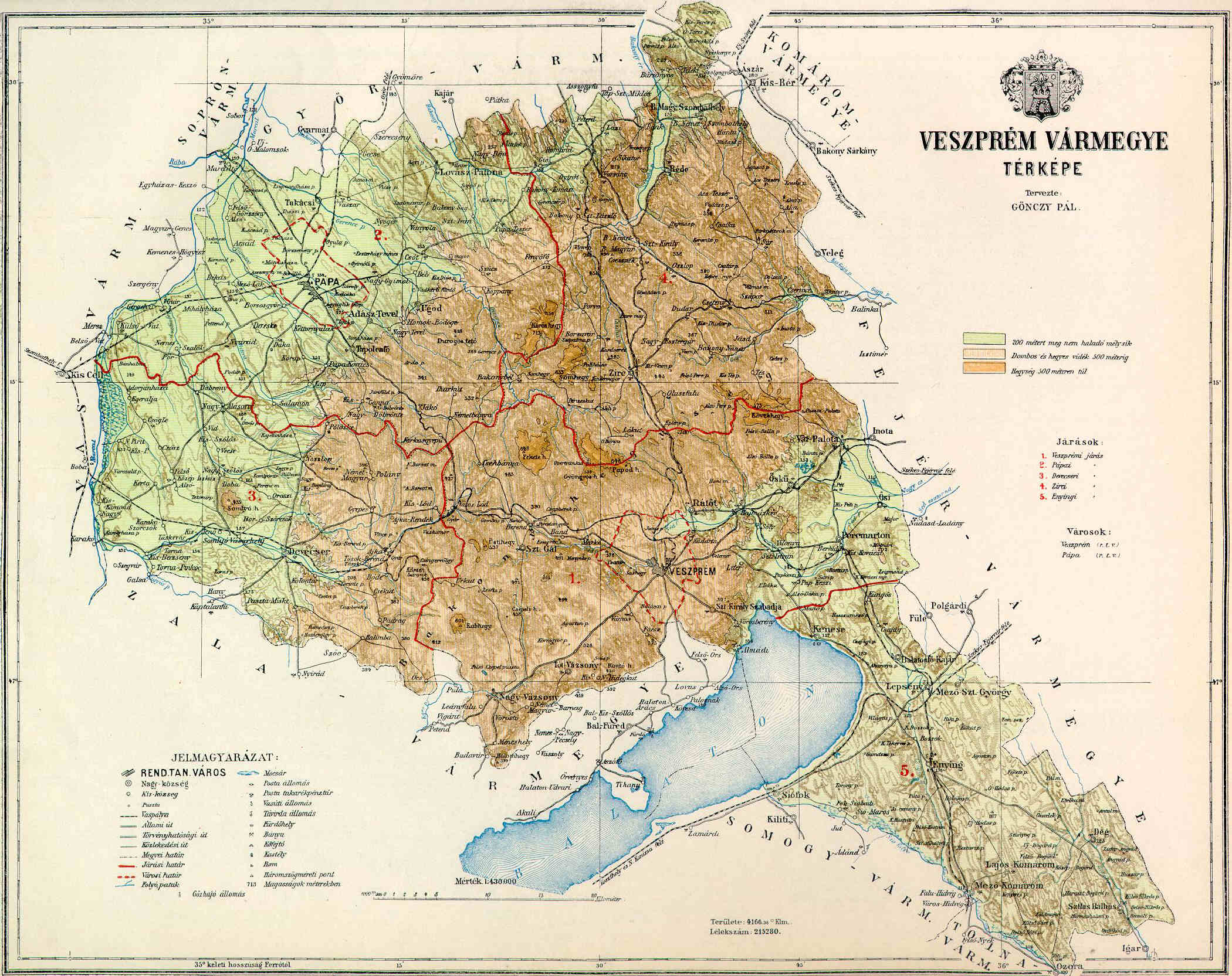
Veszprém ( hu, Veszprém megye, ; german: Komitat Wesprim (Weißbrunn)) is an administrative county (''megye'') in Hungary. Veszprém is also the name of the capital city of Veszprém county. Veszprém county Veszprém county lies in western Hungary. It covers the Bakony hills and the northern shore of Lake Balaton. It shares borders with the Hungarian counties Vas, Győr-Moson-Sopron, Komárom-Esztergom, Fejér, Somogy and Zala. The capital of Veszprém county is Veszprém. The river Marcal runs along part of its western border. Its area is 4613 km². History Demographics In 2015, it had a population of 346,647 and the population density was 77/km². Ethnicity Besides the Hungarian majority, the main minorities are the Germans and Roma. Total population (2011 census): 353,068 Ethnic groups (2011 census): Identified themselves: 315,436 persons: *Hungarians: 299,410 (94.92%) *Germans: 8,473 (2.69%) *Romani: 5,162 (1.64%) *Others and indefinable: 2,391 (0.76% ... [...More Info...] [...Related Items...] OR: [Wikipedia] [Google] [Baidu] |
Fejér County
Fejér ( hu, Fejér megye, ) is an administrative county (comitatus or megye) in Central Hungary. It lies on the west bank of the river Danube and nearly touches the eastern shore of Lake Balaton. It shares borders with the Hungarian counties Veszprém, Komárom-Esztergom, Pest, Bács-Kiskun, Tolna and Somogy. The capital of Fejér county is Székesfehérvár. Geography Geographically, Fejér County is very diverse; its southern part is similar (and adjacent) to the Great Hungarian Plain, and other parts are hilly (Bakony, Vértes, Gerecse mountains). Lake Velence, a popular resort, is also located there. History Early history The area was already inhabited 20,000 years ago. When this part of Hungary formed a Roman province called ''Pannonia'', several settlements stood here: the capital was Gorsium, but there were other significant towns too, where present-day Baracs and Dunaújváros are (the towns were called ''Annamatia'' and ''Intercisa'', respectively). In the earl ... [...More Info...] [...Related Items...] OR: [Wikipedia] [Google] [Baidu] |
Komárom-Esztergom County
Komárom-Esztergom ( hu, Komárom-Esztergom megye, ; german: Komitat Komorn-Gran; sk, Komárňansko-ostrihomská župa) is an administrative Hungarian county in Central Transdanubia Region; its shares its northern border the Danube with Slovakia. It shares borders with the Hungarian counties of , , and and the Slovakian Nitra Region (Nové Zámky District, Komárno District). Its county seat is Tatabánya. History Middle Ages The predecessor of Komárom Esztergom County, Komárom county and Esztergom county were founded by Stephen I of Hungary. Both counties had parts that now belong to Slovakia. Throughout their history the borders of the two counties were frequently modified, and they were merged several times as well. When the castle of Esztergom was captured by the Ottomans in 1543, the leadership of the county fled from there. The castles of Érsekújvár, Komárom, and Tata were the three border castles stopping the Ottoman conquest for long decades. During the O ... [...More Info...] [...Related Items...] OR: [Wikipedia] [Google] [Baidu] |
Csongrád-Csanád County
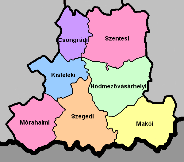
Csongrád-Csanád ( hu, Csongrád-Csanád megye ) is the name of an administrative county (comitatus or ''megye'') in southern Hungary, straddling the river Tisza, on the border with Serbia and Romania. It shares borders with the Hungarian counties Bács-Kiskun County, Jász-Nagykun-Szolnok County and Békés. The administrative centre of Csongrád-Csanád county is Szeged. The county is also part of the Danube–Criș–Mureș–Tisa Euroregion. History On October 3, 2017, the Hungarian Parliament passed a resolution to rename Csongrád County to Csongrád-Csanád County, which took effect on June 4, 2020. The resolution was submitted by János Lázár, then-Minister of the Prime Minister's Office, who called the renaming symbolic as more than a dozen settlements in the area still share Csanád County's identity. Geography This county has a total area of – 4,58% of Hungary. The area of Csongrád-Csanád County is flat. It has a high number of sunshine hours and excellent ... [...More Info...] [...Related Items...] OR: [Wikipedia] [Google] [Baidu] |
Békés County
Békés (, , ro, Județul Bichiș) is an administrative division (county or ''megye'') in south-eastern Hungary, on the border with Romania. It shares borders with the Hungarian counties Csongrád, Jász-Nagykun-Szolnok, and Hajdú-Bihar. The capital of Békés county is Békéscsaba. The county is also part of the Danube-Kris-Mures-Tisa euroregion. Etymology In Slovak, it is known as ''Békešská župa'' and in Romanian as ''Județul Bichiș''. After Hungarians conquered the area, Békés and its surroundings were the property of the '' Csolt'' clan. Békés (the name means "peaceful") was originally the name of the castle which gave its name to the comitatus, and, like many castles, was possibly named after its first steward. Geography This county has a total area of – 6.05% of Hungary. Békés County lies on the Pannonian Plain (Great Plain) and is a flat area with good soil. The average rainfall is 645 mm per year. One-fifth of the natural gas resources of H ... [...More Info...] [...Related Items...] OR: [Wikipedia] [Google] [Baidu] |
Bács-Kiskun County
Bács-Kiskun ( hu, Bács-Kiskun megye, ) is a county (''megye'' in Hungarian) located in southern Hungary. It was created as a result of World War II, merging the prewar Bács-Bodrog and the southern parts of Pest-Pilis-Solt-Kiskun counties. With an area of 8,445 km2, Bács-Kiskun is the largest county in the country. The terrain is mostly flat with slight emergences around Baja. The county seat and largest city of Bács-Kiskun is Kecskemét. The county is also part of the Danube-Kris-Mures-Tisa euroregion. Geography The county is known across Europe for its natural environment. Kiskunság National Park is located in the area. Location Bács-Kiskun borders Baranya, Tolna, and Fejér on the west (across the Danube River); Pest to the north, Jász-Nagykun-Szolnok and Csongrád on the east, across the Tisza River. To the south Bács-Kiskun shares the international border with Serbia. Bács-Kiskun lies on the Great Hungarian Plain. The difference between its highest an ... [...More Info...] [...Related Items...] OR: [Wikipedia] [Google] [Baidu] |
Szabolcs-Szatmár-Bereg County
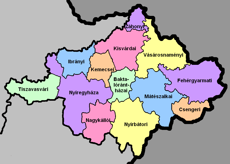
Szabolcs-Szatmár-Bereg ( hu, Szabolcs-Szatmár-Bereg megye, ) is an administrative county (Hungarian: ''megye'') in north-eastern Hungary, bordering Slovakia (Košice Region), Ukraine (Zakarpattia Oblast), and Romania ( Bihor and Satu Mare counties). It shares borders with the Hungarian counties Hajdú-Bihar and Borsod-Abaúj-Zemplén. The capital of Szabolcs-Szatmár-Bereg county is Nyíregyháza. Szabolcs-Szatmár-Bereg County was organised after World War II from the previous counties Szatmár-Ugocsa-Bereg and Szabolcs. Before 1991, it was called Szabolcs-Szatmár County. Geography Szabolcs-Szatmár-Bereg is located in the north-eastern tip of Hungary. It borders Ukraine (Zakarpattia Oblast), Slovakia (Košice Region), and Romania ( Bihor and Satu Mare counties), and has good connections both by road and rail. Within Hungary, the county is bordered by Borsod-Abaúj-Zemplén County and the Tisza River to the north-west and Hajdú-Bihar County to the south-west. The ear ... [...More Info...] [...Related Items...] OR: [Wikipedia] [Google] [Baidu] |
Jász-Nagykun-Szolnok County
Jász-Nagykun-Szolnok ( hu, Jász-Nagykun-Szolnok megye, ) is the name of an administrative county (Comitatus (Kingdom of Hungary), comitatus or ''megye'') in Hungary. It lies in central Hungary and shares borders with the Hungarian counties Pest (county), Pest, Heves (county), Heves, Borsod-Abaúj-Zemplén, Hajdú-Bihar, Békés (county), Békés, Csongrád (county), Csongrád, and Bács-Kiskun. The rivers Tisza and Körös (river), Körös flow through the county. The capital of Jász-Nagykun-Szolnok county is Szolnok. Its area is 5582 km². The county is named after the Jassic people, Ossetians (Jasz) and Cumans (Kun) who settled there, along with Szolnok. The county was part of the Danube–Criș–Mureș–Tisa Euroregion between 1997 and 2004. Geography This county has a total area of – 6,00% of Hungary. Neighbouring counties * Heves County, Heves and Borsod-Abaúj-Zemplén County in the North. * Hajdú-Bihar County, Hajdú-Bihar and Békés County in the East. * C ... [...More Info...] [...Related Items...] OR: [Wikipedia] [Google] [Baidu] |
Hajdú-Bihar County
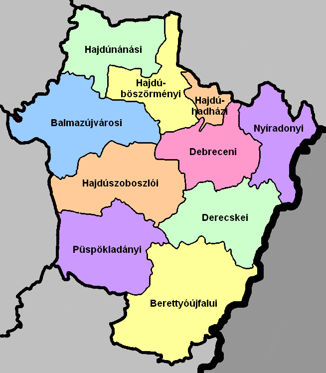
Hajdú-Bihar ( hu, Hajdú-Bihar megye, ) is an administrative county (comitatus or megye) in eastern Hungary, on the border with Romania. It shares borders with the Hungarian counties Szabolcs-Szatmár-Bereg, Borsod-Abaúj-Zemplén, Jász-Nagykun-Szolnok and Békés. The capital of Hajdú-Bihar county is Debrecen. Together with Bihor County in Romania it constitutes the Biharia Euroregion. Geography The area of the county does not form a geographical unit; it shares several features with the neighbouring areas: from northeast the sand hills of the Nyírség spread over the county borders. The western part is the Hortobágy National Park ("Puszta"), a large flat area of the country. The county of Hajdú-Bihar occupies the eastern part of Hungary. Most of its territory is completely flat and is part of the Pannonian Plain region (called the Grand Plain in the country). The highest point hardly rises over 170.5 metres in the north. It seems that the county slopes to the south be ... [...More Info...] [...Related Items...] OR: [Wikipedia] [Google] [Baidu] |


