|
London Ambulance Service
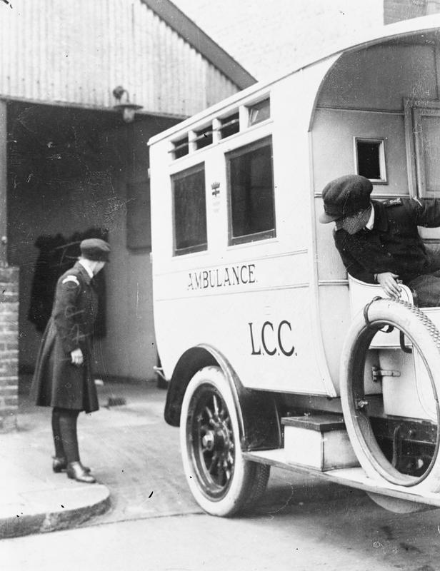
The London Ambulance Service NHS Trust (LAS) is an NHS trust responsible for operating ambulances and answering and responding to urgent and medical emergency, emergency medical situations within the Greater London, London region of England. The service responds to 999 phone calls across the region, and 111 phone calls from certain parts, providing triage and advice to enable an appropriate level of response. It is one of the busiest ambulance services in the world, and the busiest in the United Kingdom, providing care to more than 8.6million people, who live and work in London. The service is currently under the leadership of chief executive Daniel Elkeles and chair Andrew Trotter. The service employs around 5,300 staff. It is one of ten ambulance services trusts in England providing emergency medical services, and is part of the National Health Service, receiving direct government funding for its role. The LAS responded to over 2.1million 999 calls for assistance, and over 1. ... [...More Info...] [...Related Items...] OR: [Wikipedia] [Google] [Baidu] |
Waterloo, London
Waterloo () is a district in Central London, and part of the Waterloo and South Bank (ward), Waterloo and South Bank ward of the London Borough of Lambeth. It is situated east of Charing Cross. The area is part of a List of business improvement districts in London, business improvement district which includes The Cut, London, The Cut and the Old Vic and Young Vic theatres. It includes some sections of the London Borough of Southwark. Marsh The area was marshland towards the northern tip of the ancient parish of Lambeth (parish), Lambeth. It was known as ''Lambeth Marshe'', but was drained in the 18th century and is remembered in the Lower Marsh street name. Notable places Waterloo is connected to the Strand, London, Strand area on the north bank of the River Thames by Waterloo Bridge. The first bridge on the site was opened in 1817 and the current bridge was opened in 1945. The bridge was named to commemorate the Battle of Waterloo in 1815. Waterloo Road, London, Waterloo Roa ... [...More Info...] [...Related Items...] OR: [Wikipedia] [Google] [Baidu] |
Deptford
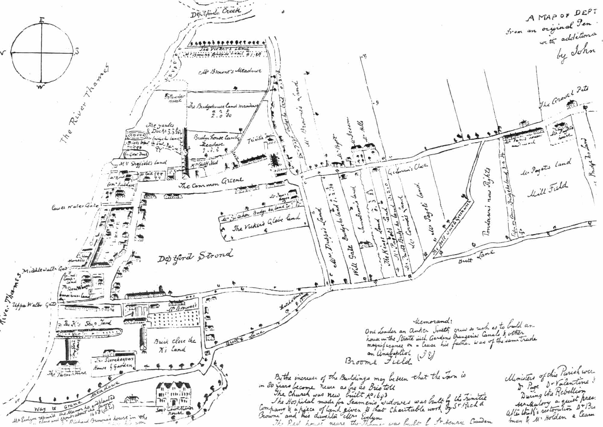
Deptford is an area on the south bank of the River Thames in southeast London, in the Royal Borough of Greenwich and London Borough of Lewisham. It is named after a Ford (crossing), ford of the River Ravensbourne. From the mid 16th century to the late 19th it was home to Deptford Dockyard, the first of the Royal Navy Dockyard, Royal Dockyards. This was a major shipbuilding dock and attracted Peter the Great to come and study shipbuilding. Deptford and the docks are associated with the knighting of Francis Drake, Sir Francis Drake by Elizabeth I, Queen Elizabeth I aboard the ''Golden Hind'', the legend of Walter Raleigh, Sir Walter Raleigh laying down his cape for Elizabeth, James Cook, Captain James Cook's third voyage aboard HMS Resolution (1771), HMS ''Resolution'', and the mysterious apparent murder of Christopher Marlowe in a house along Deptford Strand. Though Deptford began as two small communities, one at the ford, and the other a fishing village on the Thames, Deptfo ... [...More Info...] [...Related Items...] OR: [Wikipedia] [Google] [Baidu] |
Local Government Act 1929
The Local Government Act 1929 ( 19 & 20 Geo. 5. c. 17) was an act of the Parliament of the United Kingdom that made changes to the Poor Law and local government in England and Wales. The act abolished the system of poor law unions in England and Wales and their boards of guardians, transferring their powers to local authorities. It also gave county councils increased powers over highways, and made provisions for the restructuring of urban and rural districts as more efficient local government areas. Poor Law reform Under the act all boards of guardians for poor law unions were abolished, with responsibility for public assistance transferred to public assistance committees of county councils and county boroughs. The local authorities took over infirmaries and fever hospitals, while the workhouses became public assistance institutions. Later legislation was to remove these functions from the control of councils to other public bodies: the National Assistance Board and the ... [...More Info...] [...Related Items...] OR: [Wikipedia] [Google] [Baidu] |
London Fire Brigade
The London Fire Brigade (LFB) is the Fire department, fire and rescue service for London, the capital of the United Kingdom. It was formed by the Metropolitan Fire Brigade Act 1865 (28 & 29 Vict. c. 90), under the leadership of superintendent Eyre Massey Shaw. It has 5,992staff, including 5,096 operational firefighters and officers based at 102 fire stations (plus one river station). The LFB is led by the Commissioner for Fire and Emergency Planning, a position currently held by Andy Roe. The brigade and Commissioner are overseen by the Greater London Authority, which in 2018 took over these responsibilities from the London Fire and Emergency Planning Authority (LFEPA). In the 2015-16 financial year the LFB received 171,488 emergency calls. These consisted of: 20,773 fires, 48,696 false alarms of fire and 30,066 other calls for service. As well as firefighting, the LFB also responds to road traffic collisions, floods, shut-in-elevator, lift releases, and other incidents such a ... [...More Info...] [...Related Items...] OR: [Wikipedia] [Google] [Baidu] |
London County Council
The London County Council (LCC) was the principal local government body for the County of London throughout its existence from 1889 to 1965, and the first London-wide general municipal authority to be directly elected. It covered the area today known as Inner London and was replaced by the Greater London Council. The LCC was the largest, most significant and most ambitious English municipal authority of its day. History By the 19th century, the City of London Corporation covered only a small fraction of the metropolis. From 1855, the Metropolitan Board of Works (MBW) had certain powers across what is now Inner London, but it was appointed rather than elected. Many powers remained in the hands of traditional bodies such as parishes and the counties of Middlesex, Surrey, and Kent. The Local Government Act 1888 created a new County of London, with effect from 1889, and the English County council#England, county councils, of which LCC was one. This followed a succession of scandal ... [...More Info...] [...Related Items...] OR: [Wikipedia] [Google] [Baidu] |
9 Edw
9 (nine) is the natural number following and preceding . Evolution of the Hindu–Arabic digit Circa 300 BC, as part of the Brahmi numerals, various Indians wrote a digit 9 similar in shape to the modern closing question mark without the bottom dot. The Kshatrapa, Andhra and Gupta started curving the bottom vertical line coming up with a -look-alike. How the numbers got to their Gupta form is open to considerable debate. The Nagari continued the bottom stroke to make a circle and enclose the 3-look-alike, in much the same way that the sign @ encircles a lowercase ''a''. As time went on, the enclosing circle became bigger and its line continued beyond the circle downwards, as the 3-look-alike became smaller. Soon, all that was left of the 3-look-alike was a squiggle. The Arabs simply connected that squiggle to the downward stroke at the middle and subsequent European change was purely cosmetic. While the shape of the glyph for the digit 9 has an Ascender (typography), ascender ... [...More Info...] [...Related Items...] OR: [Wikipedia] [Google] [Baidu] |
Tram
A tram (also known as a streetcar or trolley in Canada and the United States) is an urban rail transit in which Rolling stock, vehicles, whether individual railcars or multiple-unit trains, run on tramway tracks on urban public streets; some include segments on segregated Right-of-way (property access), right-of-way. The tramlines or tram networks operated as public transport are called tramways or simply trams/streetcars. Because of their close similarities, trams are commonly included in the wider term ''light rail'', which also includes systems separated from other traffic. Tram vehicles are usually lighter and shorter than Main line (railway), main line and rapid transit trains. Most trams use electrical power, usually fed by a Pantograph (transport), pantograph sliding on an overhead line; older systems may use a trolley pole or a bow collector. In some cases, a contact shoe on a third rail is used. If necessary, they may have dual power systems—electricity in city stre ... [...More Info...] [...Related Items...] OR: [Wikipedia] [Google] [Baidu] |
Gravesend
Gravesend is a town in northwest Kent, England, situated 21 miles (35 km) east-southeast of Charing Cross (central London) on the Bank (geography), south bank of the River Thames, opposite Tilbury in Essex. Located in the diocese of Rochester, it is the administrative centre of the borough of Gravesham. Gravesend marks the eastern limit of the Greater London Built-up Area, as defined by the UK Office for National Statistics. It had a population of 58,102 in 2021. Its geographical situation has given Gravesend strategic importance throughout the maritime history, maritime and History of communication, communications history of South East England. A Thames Gateway commuter town, it retains strong links with the River Thames, not least through the Port of London Authority Pilot Station, and has witnessed rejuvenation since the advent of High Speed 1 rail services via Gravesend railway station. The station was recently refurbished and has a new bridge. Name Recorded as Graves ... [...More Info...] [...Related Items...] OR: [Wikipedia] [Google] [Baidu] |
Joyce Green Hospital
Joyce Green Hospital was a hospital near Dartford, Kent, England. It opened in 1903 as an isolation hospital. In later years it was a training hospital. The hospital was closed in 2000 and the buildings were demolished. The greenspace where the hospital used to stand is known as Joyce Green. Background The hospital was planned in the late 19th century to accommodate sufferers of smallpox, which had reached epidemic levels in London. It replaced three hospital ships based nearby in Long Reach, Gravesend 15 miles downriver from London Bridge on the Thames. The ships, ''Atlas'', ''Endymion'' and the ''Castalia'', were made fast in 1883 at their new custom built moorings, they were in-line, connected by bridges 150 yards from the riverbank. The ships had become unsuitable for their role due to increasing maintenance costs, the risk of collision from passing ships and the increasing demand for beds for smallpox patients. History Designed by the Metropolitan Asylums Board archi ... [...More Info...] [...Related Items...] OR: [Wikipedia] [Google] [Baidu] |
Fulham
Fulham () is an area of the London Borough of Hammersmith and Fulham in West London, England, southwest of Charing Cross. It lies in a loop on the north bank of the River Thames, bordering Hammersmith, Kensington and Chelsea, London, Chelsea, with which it shares the area known as West Brompton. Over the Thames, Fulham faces Wandsworth, Putney, the London Wetland Centre in Barnes, London, Barnes in the London Borough of Richmond upon Thames. First recorded by name in 691, it was an extensive Anglo-Saxon settlement of Britain, Anglo-Saxon estate, the Fulham Palace, Manor of Fulham, and then a parish. Its domain stretched from modern-day Chiswick in the west to Chelsea, London, Chelsea in the southeast; and from Harlesden in the northwest to Kensal Green in the northeast bordered by the littoral of Counter's Creek and the Manor of Kensington. It originally included today's Hammersmith. Between 1900 and 1965, it was demarcated as the Metropolitan Borough of Fulham, before its me ... [...More Info...] [...Related Items...] OR: [Wikipedia] [Google] [Baidu] |
Blackwall, London
Blackwall is an area of Poplar, London, Poplar, in the London Borough of Tower Hamlets, East London. The neighbourhood includes Leamouth and the Coldharbour, Tower Hamlets, Coldharbour conservation area. The area takes its name from a historic stretch of riverside wall built along an outside curve of the River Thames, Thames, to protect the area from flooding. Along with the rest of Poplar, Blackwall has its origin in the Stepney#Manor and Ancient Parish, Manor and Ancient Parish of Stepney. While mostly residential, the Poplar Dock and West India Docks, Blackwall Basin provide moorings for vessels. Setting and administration The area's significance derived from its position on an outside curve of the Thames, where currents slowed down, making it a sheltered spot useful to a range of shipping activities. This sheltered position was enhanced by the presence of the Blackwall Rock reef, though this could also be a danger to shipping. A further advantage of the area was that it lay ... [...More Info...] [...Related Items...] OR: [Wikipedia] [Google] [Baidu] |
Rotherhithe
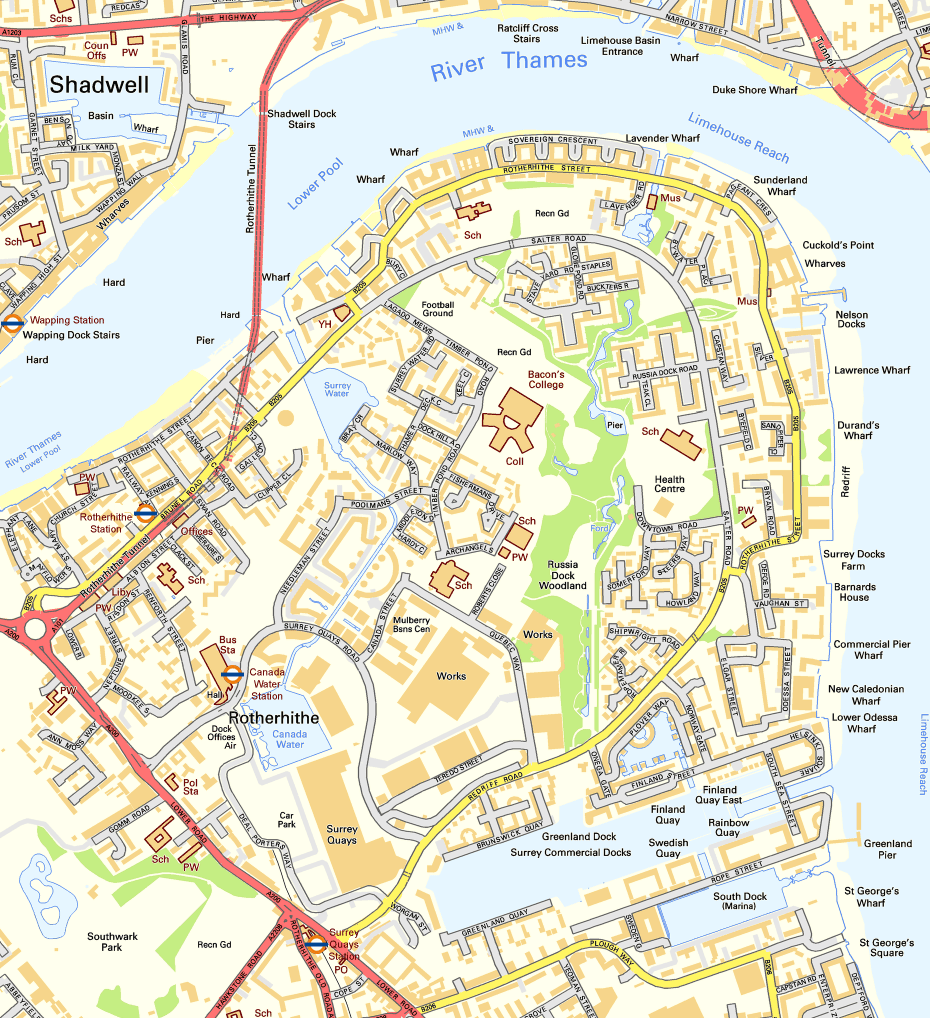
Rotherhithe ( ) is a district of South London, England, and part of the London Borough of Southwark. It is on a peninsula on the south bank of the Thames, facing Wapping, Shadwell and Limehouse on the north bank, with the Isle of Dogs to the east. It borders Bermondsey to the west and Deptford to the south-east. The district is a part of the London Docklands, Docklands area. Rotherhithe has a long history as a port, with Elizabethan era, Elizabethan shipyards and working docks until the 1970s. In the 1980s, the area along the river was redeveloped as housing through a mix of warehouse conversions and new-build developments. The Jubilee line was extended to the area in 1999, giving fast connections to the West End of London, West End and to Canary Wharf; the East London Line, East London London Underground, underground line was converted to part of the London Overground network in 2010, which provides easy access to the City of London. As a result, Rotherhithe is now a gentrifica ... [...More Info...] [...Related Items...] OR: [Wikipedia] [Google] [Baidu] |
