|
Listed Buildings In Azerley
Azerley is a Civil parishes in England, civil parish in the county of North Yorkshire, England. It contains 17 Listed building#England and Wales, listed buildings that are recorded in the National Heritage List for England. All the listed buildings are designated at Grade II, the lowest of the three grades, which is applied to "buildings of national importance and special interest". The parish contains the villages of Azerley, Galphay and Mickley, North Yorkshire, Mickley, and the surrounding countryside. The listed buildings include houses and cottages, farmhouses and farm buildings, a bridge, a watermill, a church and its former vicarage, a former chapel, and a folly and watch tower. __NOTOC__ Buildings References Citations Sources * * * * * * * * * * * * * * * * * * * {{DEFAULTSORT:Asenby Lists of listed buildings in North Yorkshire ... [...More Info...] [...Related Items...] OR: [Wikipedia] [Google] [Baidu] |
Azerley
Azerley is a hamlet and civil parish in the county of North Yorkshire, England. It is about north-west of Ripon. The civil parish includes the larger village of Galphay, and also the village of Mickley, North Yorkshire, Mickley. The population of the parish in the 2001 census was 355, reducing to 340 at the 2011 Census. The civil parish shares a grouped parish council with the civil parish of Winksley. Until 1974 it was part of the West Riding of Yorkshire. From 1974 to 2023 it was part of the Borough of Harrogate, it is now administered by the unitary North Yorkshire Council. Braithwaite Hall, about half a mile north west of Galphay, is a Grade II listed building thought to date from the 16th century. It should not be confused with Braithwaite Hall in Coverdale (dale), Coverdale, a National Trust property. See also *Listed buildings in Azerley References External links * * Villages in North Yorkshire Civil parishes in North Yorkshire {{NorthYorkshire- ... [...More Info...] [...Related Items...] OR: [Wikipedia] [Google] [Baidu] |
Pantile
A pantile is a type of fired roof tile, normally made from clay. It is S-shaped in profile and is single lap, meaning that the end of the tile laps only the course immediately below. Flat tiles normally lap two courses. A pantile-covered roof is considerably lighter than a flat-tiled equivalent and can be laid to a lower pitch. In Britain, pantiles are found in eastern coastal parts of England and Scotland including Norfolk, East Yorkshire, County Durham, Perthshire, Angus, Lothian and Fife, where they were first imported from the Netherlands in the early 17th century. They are rarely used in western England or western Scotland, except in Bristol and the Somerset town of Bridgwater. In paving Roofing pantiles are not to be confused with the paving tiles also named "pantiles." The Pantiles in Royal Tunbridge Wells is named for the paving tiles installed there in 1699 — one-inch-thick square tiles made from heavy weald The Weald () is an area of South East England b ... [...More Info...] [...Related Items...] OR: [Wikipedia] [Google] [Baidu] |
Bollard (traffic)
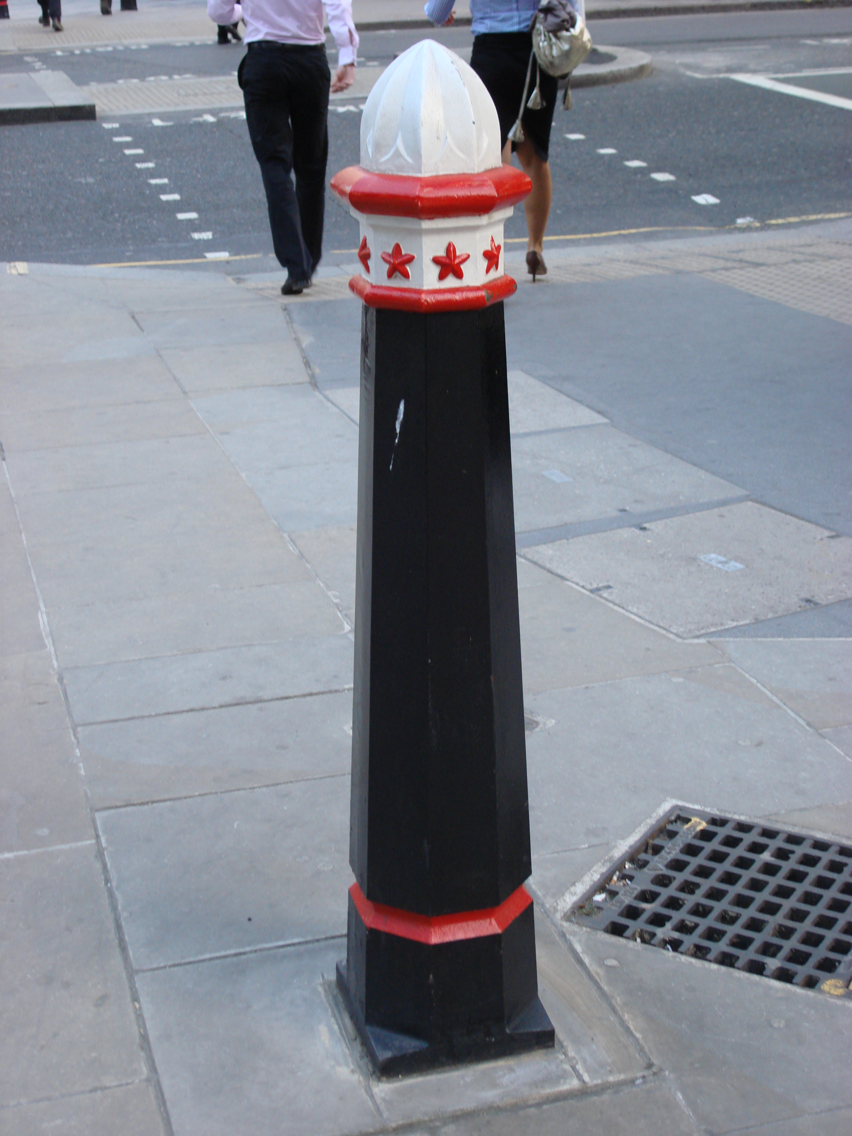
Traffic bollards are short, pillar-like objects used to obstruct roads for traffic control and pedestrian safety. Bollards work by limiting movements and controlling traffic speed by narrowing the available space. Permanent bollards can be used for traffic control or guarding against vehicle-ramming attacks. They may be mounted near enough to each other that they block ordinary cars/trucks, for instance, but spaced widely enough to permit special-purpose vehicles, bicycles, and pedestrians to pass through. Bollards may also be used to enclose car-free zones. Bollards and other street furniture can also be used to control overspill parking onto sidewalks and verges. History Wooden posts were used for basic traffic management from at least the second half of the 17th century. One early well-documented case is that of the "postes and rales in ye King's highway for ye (safety) of all foot passengers" erected in 1671 in the High Street of Old Brentford, Middlesex (part of the A ... [...More Info...] [...Related Items...] OR: [Wikipedia] [Google] [Baidu] |
Pilaster
In architecture, a pilaster is both a load-bearing section of thickened wall or column integrated into a wall, and a purely decorative element in classical architecture which gives the appearance of a supporting column and articulates an extent of wall. As an ornament it consists of a flat surface raised from the main wall surface, usually treated as though it were a column, with a capital at the top, plinth (base) at the bottom, and the various other column elements. In contrast to a Classical pilaster, an engaged column or buttress can support the structure of a wall and roof above. In human anatomy, a pilaster is a ridge that extends vertically across the femur, which is unique to modern humans. Its structural function is unclear. Definition A pilaster is foremost a load-bearing architectural element used widely throughout the world and its history where a structural load is carried by a thickened section of wall or column integrated into a wall. It is also a purel ... [...More Info...] [...Related Items...] OR: [Wikipedia] [Google] [Baidu] |
River Laver
The River Laver is a tributary of the River Skell, itself a tributary of the River Ure in North Yorkshire, England. The name is of Brittonic origin, from ''labaro'', meaning "talkative", i.e. a babbling brook. The Afon Llafar in Wales shares the same name. The Laver is noted as a fly fishing river, especially for brown trout and grayling. Course The river has its origins in a number of small streams which rise on the moors between upper Nidderdale and Kirkby Malzeard. The two largest of these streams, North Gill Beck and South Gill Beck, meet in a narrow wooded valley at Dallowgill to form the River Laver. The river continues to flow through a narrow wooded valley, before broadening at Laverton. The riverbanks again become densely wooded near Winksley, then become more open and shallow as the river approaches Ripon. The river joins the River Skell at the western edge of Ripon Ripon () is a cathedral city and civil parish in North Yorkshire, England. The city ... [...More Info...] [...Related Items...] OR: [Wikipedia] [Google] [Baidu] |
Bridge Near Galphay - Geograph
A bridge is a structure built to span a physical obstacle (such as a body of water, valley, road, or railway) without blocking the path underneath. It is constructed for the purpose of providing passage over the obstacle, which is usually something that is otherwise difficult or impossible to cross. There are many different designs of bridges, each serving a particular purpose and applicable to different situations. Designs of bridges vary depending on factors such as the function of the bridge, the nature of the terrain where the bridge is constructed and anchored, the material used to make it, and the funds available to build it. The earliest bridges were likely made with fallen trees and stepping stones. The Neolithic people built boardwalk bridges across marshland. The Arkadiko Bridge, dating from the 13th century BC, in the Peloponnese is one of the oldest arch bridges in existence and use. Etymology The ''Oxford English Dictionary'' traces the origin of the word ''bridge' ... [...More Info...] [...Related Items...] OR: [Wikipedia] [Google] [Baidu] |


