|
List Of Roads On Lantau Island
This is a list of roads in Lantau Island, Islands District/Tsuen Wan District, Hong Kong. This list only includes vehicular roads, those designed for passage by cars. Trails are included in a separate list at the end. List of major roads on Lantau This includes all major roads on Lantau Island, which connect different regions across Lantau. For intra-regional roads, please see the next section. List of minor roads on Lantau This is a list of minor roads in Lantau, not included within the previous table. It is divided into sections based on their region. Tung Chung North of Tung Chung Hill South of Tung Chung Hill Mui Wo Tai O Discovery Bay Sunny Bay and Disneyland Resort List of trails on Lantau Island See also *List of streets and roads in Hong Kong References {{Reflist Lantau Island Roads Roads A road is a thoroughfare used primarily for movement of traffic. Roads differ from streets, whose primary use is local access. They also differ from stroads ... [...More Info...] [...Related Items...] OR: [Wikipedia] [Google] [Baidu] |
Lantau Island
Lantau Island (also Lantao Island, Lan Tao or Lan Tau) is the largest island in Hong Kong, located west of Hong Kong Island and the Kowloon Peninsula, and is part of the New Territories. Administratively, most of Lantau Island is part of the Islands District of Hong Kong. A small northeastern portion of the island is located in the Tsuen Wan District. Originally an island with fishing villages, it has been developed since the late 20th century with the construction of Tung Chung New Town on its north-western coast and the completion of several major infrastructure projects, including Lantau Link (1997), Hong Kong International Airport (1998), Hong Kong Disneyland (2005), and Ngong Ping 360 (2006). Geography With a land mass of , Lantau is the largest List of islands and peninsulas of Hong Kong, island in Hong Kong, almost twice the size of Hong Kong Island. Lantau Island primarily consists of mountainous terrain. Lantau Peak () is the highest point of the island. It is L ... [...More Info...] [...Related Items...] OR: [Wikipedia] [Google] [Baidu] |
Yat Tung Estate
Yat Tung Estate () is a public housing estate in the western part of Tung Chung, Lantau Island, Hong Kong. It is divided into Yat Tung (I) Estate and Yat Tung (II) Estate, which collectively have a population of 36,913. Yu Tai Court () is a Home Ownership Scheme court in Tung Chung, near Yat Tung Estate and North Lantau Hospital. It has two residential blocks completed in 2020. History Background Yat Tung Estate was built as part of the North Lantau New Town, one of the core projects of the Airport Core Programme. More specifically, Yat Tung Estate was part of the Tung Chung Development Phase II. Originally, Yat Tung Estate was to comprise homes for subsidised sale, but the Hong Kong Government suspended the Home Ownership Scheme (HOS) in 2003 due to a soft property market and pressure from real estate developers. As a result, Yat Tung Estate is entirely public rental housing. Construction Yat Tung Estate was constructed in several phases by several different contractors. T ... [...More Info...] [...Related Items...] OR: [Wikipedia] [Google] [Baidu] |
Ngong Ping
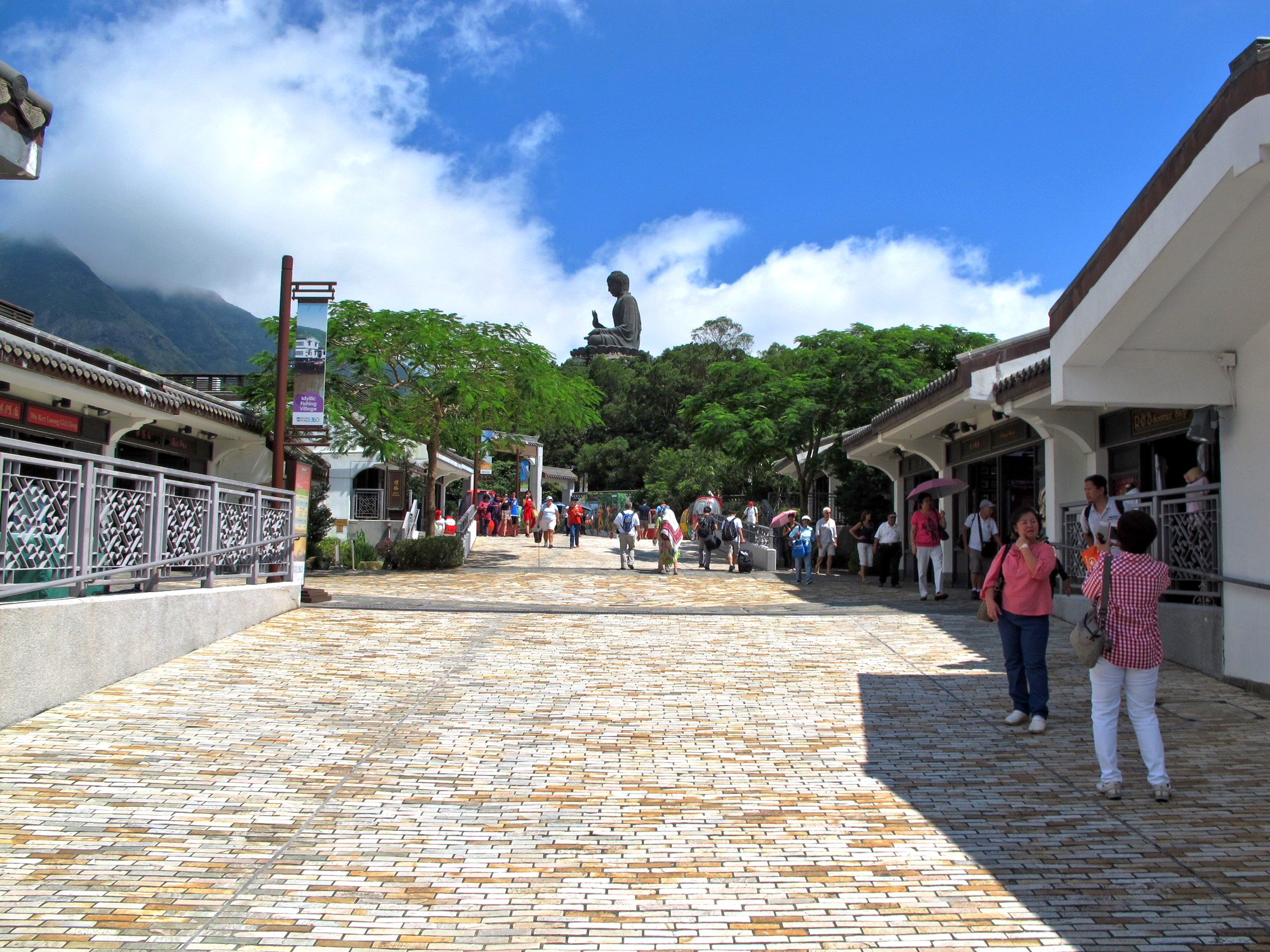
Ngong Ping () is a highland in the western part of Lantau Island, Hong Kong. It hosts Po Lin Monastery and Tian Tan Buddha amidst the hills which is about 34 m tall. There are several hills nearby which are also an attraction to tourists. It is now the terminus of the cable car ride Ngong Ping 360 which travels to Tung Chung. New facilities and tourist attractions have opened including the Ngong Ping Village, Walking with the Buddha, the Monkey's Tale Theatre and Ngong Ping Tea House. A youth hostel is located near the monastery. The second highest peak of Hong Kong, Lantau Peak, is at its southeast. Administration Ngong Ping Wan is a recognized village under the New Territories Small House Policy. Tourism projects In 2002, the Hong Kong government announced that the MTR Corporation (MTRC) had secured the rights to run a cable car which formed part of a HK$750 million tourism project scheduled for completion in August 2005. Under the plan, a theme village would be built at Ngon ... [...More Info...] [...Related Items...] OR: [Wikipedia] [Google] [Baidu] |
Ngong Ping Road , in Hong Kong
{{disambig, geo ...
Ngong may refer to: *Ngong, Cameroon, a town *Ngong, Kenya, a town ** Roman Catholic Diocese of Ngong *Ngong (language), spoken in Cameroon See also *Ngong Hills, in Kenya *Ngong Ping Ngong Ping () is a highland in the western part of Lantau Island, Hong Kong. It hosts Po Lin Monastery and Tian Tan Buddha amidst the hills which is about 34 m tall. There are several hills nearby which are also an attraction to tourists. It is ... [...More Info...] [...Related Items...] OR: [Wikipedia] [Google] [Baidu] |
Kap Shui Mun Bridge
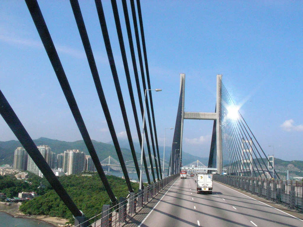
The Kap Shui Mun Bridge (KSMB) in Hong Kong, part of Lantau Link of Route 8, is one of the longest cable-stayed bridges in the world that transports both road and railway traffic, with the upper deck used for motor vehicles and the lower deck for both vehicles and the MTR. It has a main span of and an overall length of . It spans the Kap Shui Mun marine channel between Ma Wan and Lantau islands and has a vertical clearance of above sea level Mean sea level (MSL, often shortened to sea level) is an mean, average surface level of one or more among Earth's coastal Body of water, bodies of water from which heights such as elevation may be measured. The global MSL is a type of vertical .... The bridge was completed in 1997. Structural information The total length of the Kap Shui Mun Bridge includes a approach span on the Lantau side. There is a column in each of the back spans of the cable stayed bridge, making four spans, adding to the main span. This makes th ... [...More Info...] [...Related Items...] OR: [Wikipedia] [Google] [Baidu] |
Ma Wan Viaduct
Ma Wan Viaduct is a viaduct built over Ma Wan, an island in Hong Kong. The viaduct connects the Tsing Ma Bridge and Kap Shui Mun Bridge with an exit to Ma Wan Road, and is part of the Lantau Link (formerly known as the Lantau Fixed Crossing) and Route 8. It was opened on 22 May 1997 and was built to provide access to the Hong Kong International Airport (Chek Lap Kok Airport) as part of the Airport Core Programme. It is long and has six spans (one long span, four long spans, and one long span). It is built using post-tensioned concrete. The Ma Wan Viaduct has the same cross section as the Tsing Ma and Kap Shui Mun Bridges: a dual three-lane carriageway on the upper deck and two tracks of railway and two lanes of roadway in the enclose ... [...More Info...] [...Related Items...] OR: [Wikipedia] [Google] [Baidu] |
Tsing Ma Bridge
Tsing Ma Bridge is a bridge in Hong Kong that connects Tsing Yi and Ma Wan islands. It is the world's 17th-longest span suspension bridge, and was the second longest at the time of its completion. The bridge was named after the two islands it connects, namely Tsing Yi and Ma Wan. It has two decks and carries both road and rail traffic, which also makes it the largest suspension bridge of this type. The bridge has a main span of and a height of . The span is the longest of all bridges in the world carrying rail traffic. The bridge deck carries six lanes of automobile traffic, with three lanes in each direction. The lower level contains two rail tracks and two sheltered carriageways used for maintenance access and traffic lanes when particularly severe typhoons strike Hong Kong and the bridge deck is closed to traffic. History Background The Tsing Ma Bridge is the most prominent element of the Lantau Link, an infrastructure project built to connect Lantau, Hong Kong ... [...More Info...] [...Related Items...] OR: [Wikipedia] [Google] [Baidu] |
Road
A road is a thoroughfare used primarily for movement of traffic. Roads differ from streets, whose primary use is local access. They also differ from stroads, which combine the features of streets and roads. Most modern roads are paved. The words "road" and "street" are commonly considered to be interchangeable, but the distinction is important in urban design. There are many types of roads, including parkways, avenues, controlled-access highways (freeways, motorways, and expressways), tollways, interstates, highways, and local roads. The primary features of roads include lanes, sidewalks (pavement), roadways (carriageways), medians, shoulders, verges, bike paths (cycle paths), and shared-use paths. Definitions Historically, many roads were simply recognizable routes without any formal construction or some maintenance. The Organization for Economic Co-operation and Development (OECD) defines a road as "a line of communication (travelled way) using a stab ... [...More Info...] [...Related Items...] OR: [Wikipedia] [Google] [Baidu] |
Railway
Rail transport (also known as train transport) is a means of transport using wheeled vehicles running in railway track, tracks, which usually consist of two parallel steel railway track, rails. Rail transport is one of the two primary means of land transport, next to road transport. It is used for about 8% of passenger and rail freight transport, freight transport globally, thanks to its Energy efficiency in transport, energy efficiency and potentially high-speed rail, high speed.Rolling stock on rails generally encounters lower friction, frictional resistance than rubber-tyred road vehicles, allowing rail cars to be coupled into longer trains. Power is usually provided by Diesel locomotive, diesel or Electric locomotive, electric locomotives. While railway transport is capital intensity, capital-intensive and less flexible than road transport, it can carry heavy loads of passengers and cargo with greater energy efficiency and safety. Precursors of railways driven by human or an ... [...More Info...] [...Related Items...] OR: [Wikipedia] [Google] [Baidu] |
Hong Kong International Airport
Hong Kong International Airport is an international airport on the island of Chek Lap Kok in western Hong Kong. The airport is also referred to as Chek Lap Kok International Airport or Chek Lap Kok Airport, to distinguish it from its predecessor, the former Kai Tak Airport. Opened in 1998, Hong Kong International Airport is the World's busiest airports by cargo traffic, world's busiest cargo gateway and one of the List of busiest airports by passenger traffic, world's busiest passenger airports. It is also home to one of the world's largest passenger terminal buildings, which was the largest when the airport opened. The airport is operated by Airport Authority Hong Kong, a statutory body of the Hong Kong government established on 1 December 1995. It runs 24 hours a day and is the primary hub for Cathay Pacific, Greater Bay Airlines, Hong Kong Airlines, HK Express, and Air Hong Kong (cargo carrier). The airport is one of the hubs of Oneworld, and also one of the Asia-Pacific ... [...More Info...] [...Related Items...] OR: [Wikipedia] [Google] [Baidu] |
Lantau Link
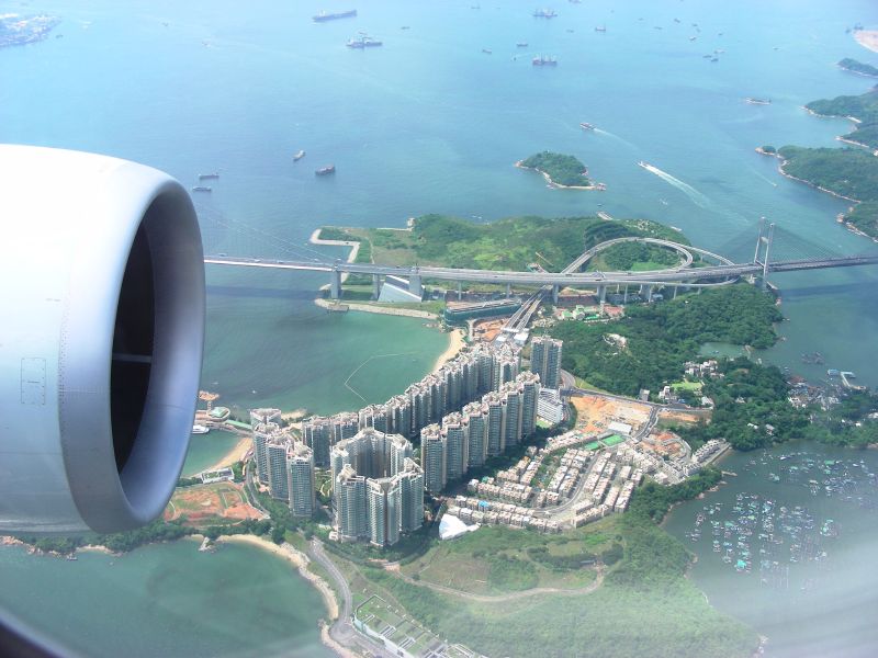
The Lantau Link, formerly known as the Lantau Fixed Crossing, is a roadway in Hong Kong forming part of Route 8 linking Lantau Island to Tsing Yi, from which other roads lead to the urban areas of Kowloon and the rest of the New Territories. It is part of the Airport Core Programme centred on the new Hong Kong International Airport on Lantau. The link was officially opened on 27 April 1997, and it opened to traffic on 22 May the same year. Infrastructure The Lantau Link is long and consists of: * the Tsing Ma Bridge, a suspension bridge linking Tsing Yi to Ma Wan island * the Ma Wan Viaduct, a viaduct crossing Ma Wan * the Kap Shui Mun Bridge, a cable-stayed bridge linking Ma Wan to Lantau Island The link is split into two traffic levels; the upper level is an open, 3-lane divided highway, while the lower level is a double-track railway line used by the MTR Airport Express and Tung Chung line and also contains two single-lane roads for emergency use in both directions. T ... [...More Info...] [...Related Items...] OR: [Wikipedia] [Google] [Baidu] |


