|
List Of National Parks Of Vietnam
The National Parks in Vietnam () are officially recognized by the Government of Vietnam through decrees. Normally, the national parks located in the territory of multiple provinces and cities are managed by the Ministry of Agriculture and Rural Development (Vietnam), Ministry of Agriculture and Rural Development, while the national parks located within the boundary of a province or city are managed by the People's Committee (Vietnam), People's Committee of the province or of the city. The national parks in Vietnam, stretching from the Northern borders to the Southern remote islands, are set up in order to protect the natural ecosystems, flora and fauna, diverse natural landscapes, such as the subtropical rain forests, in Phia Oắc-Phia Đén, the sub-alpine subtropical forests, the evergreen tropical forests to the coastal mangrove forests of Xuân Thủy National Park, Xuân Thủy, Cát Bà National Park, Cát Bà, and Mũi Cà Mau National Park, Mũi Cà Mau, and the melaleuca ... [...More Info...] [...Related Items...] OR: [Wikipedia] [Google] [Baidu] |
Hòa Bình Province
Hòa Bình or Hoà Bình (see tone marks) was a former mountainous province of Vietnam, located in the nation's Northwest region. It borders Phú Thọ province and Sơn La province to the northwest, Hanoi to the northeast, Hà Nam province to the east, Ninh Bình province to the southeast and Thanh Hóa province to the south. The province covers an area of about and as of 2022 it had a population of 875,380 people. In 2020, the GDP per capita of the province was estimated to be $2625 (equivalent to 60.5 million Vietnamese đồng). History Hòa Bình province was created on June 22, 1886, following the decree of Tonkin with the name "Mường Province", splitting Mường majority areas from Hưng Hóa province, Sơn Tây province, Hanoi and Ninh Bình province. Its name derives from the Sino-Vietnamese 和平, meaning "peace." The province was administered from Chợ Bờ (in Đà Bắc District), hence it was also known as "Chợ Bờ Province", until in November ... [...More Info...] [...Related Items...] OR: [Wikipedia] [Google] [Baidu] |
Hoàng Liên National Park
Hoang Lien National Park (, also known as ''Hoàng Liên Sơn, Dãy Hoàng Liên'') is a national park within Hoàng Liên Sơn, Hoang Lien Son Range, in the districts of Sa Pa (town), Sa Pa and Than Uyên District, Than Uyên of Lào Cai Province, and part of Phong Thổ District in Lai Châu Province in Northern Vietnam. Its area is with terrain mostly between 1,000 and 3,000 meters above sea level. The national park was established according to the Decision number 90/2002/QĐ-TTg dated 12 July 2006 by the government of Vietnam. This decision turned the Nature Reserve into a National Park. Hoang Lien National Park is recognized as a part of ASEAN Heritage Parks and a Centre of Plant Diversity in the International Union for Conservation of Nature's (IUCN) Plant Conservation Program. Location Hoang Lien National Park is Vietnam's mountainous Northwest and includes Fansipan, the highest mountain in Vietnam and on the Mainland Southeast Asia, Indochinese Peninsula. The total a ... [...More Info...] [...Related Items...] OR: [Wikipedia] [Google] [Baidu] |
Con Moong Cave
The Con Moong cave (Vietnamese: ''Hang Con Moong'', "beast" cave) is located in the Cúc Phương National Park, just south of Mọ village, in the Thanh Hóa Province, northern Vietnam. The Department of Culture has issued a certificate that declares Con Moong prehistoric site and its surroundings as ''National Relics'' and is managed by the ''Cúc Phương National Park administration'', along with a refuge for rare animals. Among these locations, the archaeological site of Con Moong cave is of central importance for the study of the Mesolithic Hoabinhian culture. In April and May 1976, Vietnamese archaeologists excavated the site. Site description The Con Moong limestone cavity lies about above a valley level on the right bank of the Red River, running along the Da River, about south-west of Hanoi. The cave has two entrances that connect with one another. Excavations were made near the south-western entrance in an area of around and to a depth of . Ten strata, including the ... [...More Info...] [...Related Items...] OR: [Wikipedia] [Google] [Baidu] |
Ba Bể National Park
Ba Bể National Park () is a reserve in Bắc Kạn Province, Northeast region of Vietnam, set up to protect a very murky lake (Ba Bể Lake) along with surrounding limestone and highland nevergreen forests. It is located about 240 kilometers northwest of the capital city Hanoi. Location Ba Bể National Park is located in Bắc Kạn Province, about 240 kilometers north of Hanoi, about 70 km northwest of the provincial capital Bắc Kạn, and about 14 km west of the town of Cho Ra. Ba Bể Lake Ba Bể Lake (, Ba Bể meaning "Three Lakes" in the local Tay language) is the largest natural fresh water lake in Vietnam, stretching about 8 kilometers in the north-south direction. The surface area of the lake fluctuates between 3 and 5 km2 between dry and wet season. Unlike many lakes in Karst limestone areas, Ba Bể Lake never falls dry. Its average depth varies between 17 and 23 meters, the maximum depth is 35 meters. The lake lies about 150 meters abov ... [...More Info...] [...Related Items...] OR: [Wikipedia] [Google] [Baidu] |
Cát Bà Island
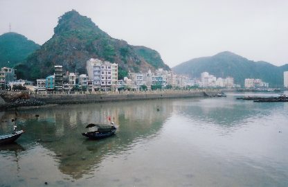
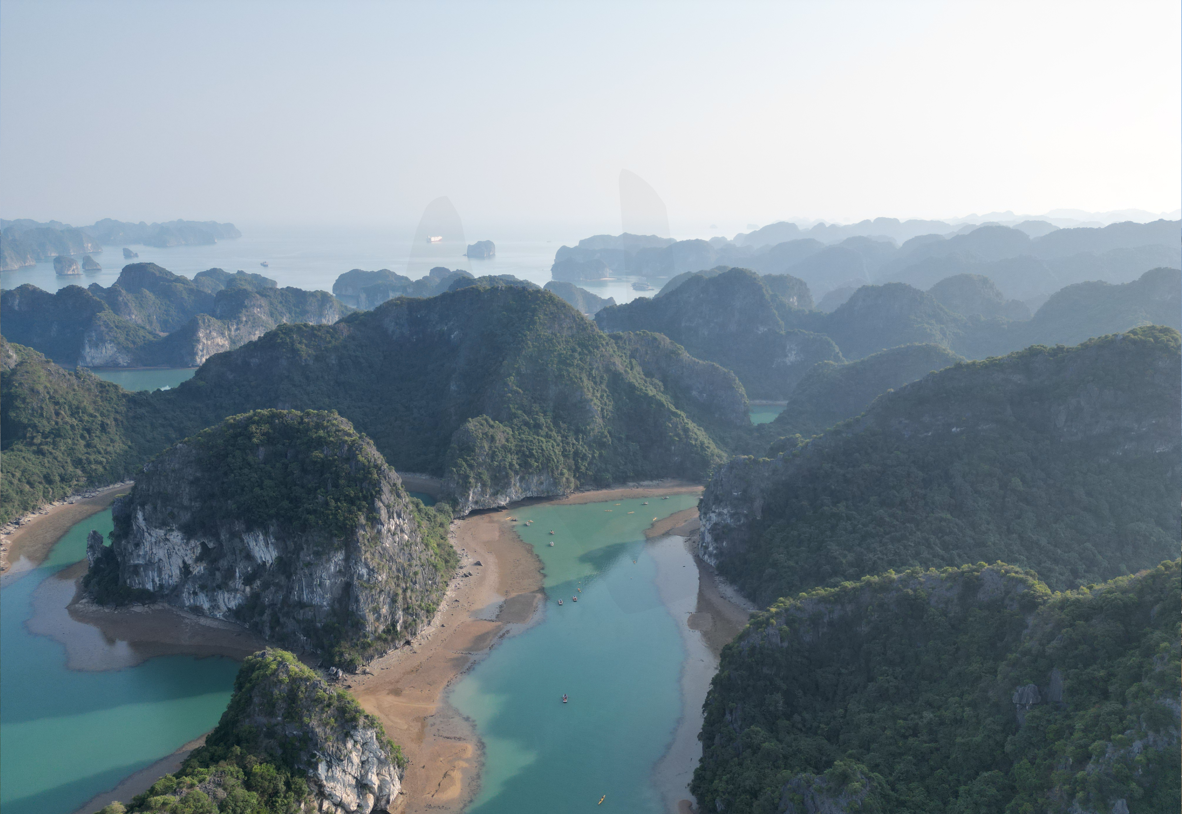
Cát Bà Island is the largest of the 367 islands spanning that comprise the Cat Ba Archipelago, which makes up the southeastern edge of Lan Ha Bay in Northern Vietnam and maintains the dramatic and rugged features of Hạ Long Bay, Ha Long Bay. The archipelago has been a UNESCO Biosphere Reserve since 2004 and a part of Ha Long Bay – Cat Ba Archipelago World Heritage Site since 2023. History Cat Ba (historically called Cac Ba) Island means "Women’s Island" (Cac meaning 'all' and 'Ba' meaning women). Legend has it that many centuries ago, three women of the Tran Dynasty were killed and their bodies floated all the way to Cat Ba Island. Each body washed up on a different beach and all three were found by local fishermen. The residents of Cat Ba built a temple for each woman, and the island soon became known as Cat Ba. Archaeological evidence suggests that people have lived on Cat Ba Island for almost 6,000 years, with the earliest settlements being found on the southeaste ... [...More Info...] [...Related Items...] OR: [Wikipedia] [Google] [Baidu] |
Cát Tiên National Park
Cát Tiên National Park () is a national park located in the south of Vietnam, in the provinces of Đồng Nai province, Đồng Nai, Bình Phước province, Bình Phước and Lâm Đồng province, Lâm Đồng. It is approximately 150 km north of Ho Chi Minh City. It has an area of about 720 km2 and protects one of the largest areas of lowland tropical forests left in Vietnam. Since 2011, Cát Tiên National Park has been a part of Đồng Nai Biosphere Reserve. History The surrounding area was originally occupied by the Ma people – especially in the area that is now Cat Loc (in the 1960s eastern Nam Cat Tien was described as ''inhabité'' ['uninhabited']) – and Stieng people in western Dong Nai Province. After the formation of the park, many of these people were re-settled in Tà Lài, Talai village, to the south-west of Nam Cat Tien. Cát Tiên National Park (CTNP) was protected initially in 1978 as two sectors, Nam Cat Tien and Tay Cat Tien. Another sector, ... [...More Info...] [...Related Items...] OR: [Wikipedia] [Google] [Baidu] |
Hạ Long Bay
Hạ Long Bay or Halong Bay (, ) is a UNESCO World Heritage Site and popular travel destination in Quảng Ninh province, Vietnam. The name Hạ Long means "descending dragon". Administratively, the bay belongs to Hạ Long city, Cẩm Phả city, and is a part of Vân Đồn district. The bay features thousands of limestone karsts and islets in various shapes and sizes. Hạ Long Bay is a center of a larger zone that includes Bai Tu Long Bay to the northeast, and Cát Bà Island to the southwest. These larger zones share a similar geological, geographical, geomorphological, climate, and cultural characters. Hạ Long Bay has an area of around , including 1,969 islets, most of which are limestone. The core of the bay has an area of with a high density of 775 islets.Vịnh Hạ Long. Website c ... [...More Info...] [...Related Items...] OR: [Wikipedia] [Google] [Baidu] |
Bai Tu Long Bay
Bai Tu Long Bay is a bay in Vietnam. It encompasses Bái Tử Long National Park. Bai Tu Long Bay is northeast of Hạ Long Bay. References Bays of Vietnam Geography of Quảng Ninh province Gulf of Tonkin {{Vietnam-stub ... [...More Info...] [...Related Items...] OR: [Wikipedia] [Google] [Baidu] |
World Heritage Site
World Heritage Sites are landmarks and areas with legal protection under an treaty, international treaty administered by UNESCO for having cultural, historical, or scientific significance. The sites are judged to contain "cultural and natural heritage around the world considered to be of outstanding value to humanity". To be selected, a World Heritage Site is nominated by its host country and determined by the UNESCO's World Heritage Committee to be a unique landmark which is geographically and historically identifiable, having a special cultural or physical significance, and to be under a sufficient system of legal protection. World Heritage Sites might be ancient ruins or historical structures, buildings, cities, deserts, forests, islands, lakes, monuments, mountains or wilderness areas, and others. A World Heritage Site may signify a remarkable accomplishment of humankind and serve as evidence of humanity's intellectual history on the planet, or it might be a place of grea ... [...More Info...] [...Related Items...] OR: [Wikipedia] [Google] [Baidu] |
UNESCO
The United Nations Educational, Scientific and Cultural Organization (UNESCO ) is a List of specialized agencies of the United Nations, specialized agency of the United Nations (UN) with the aim of promoting world peace and International security, security through international cooperation in education, arts, sciences and culture. It has 194 Member states of UNESCO, member states and 12 associate members, as well as partners in the Non-governmental organization, non-governmental, Intergovernmental organization, intergovernmental and private sector. Headquartered in Paris, France, UNESCO has 53 regional field offices and 199 National Commissions for UNESCO, national commissions. UNESCO was founded in 1945 as the successor to the League of Nations' International Committee on Intellectual Cooperation.English summary). UNESCO's founding mission, which was shaped by the events of World War II, is to advance peace, sustainable development and human rights by facilitating collaboratio ... [...More Info...] [...Related Items...] OR: [Wikipedia] [Google] [Baidu] |


