|
List Of Highest Railways
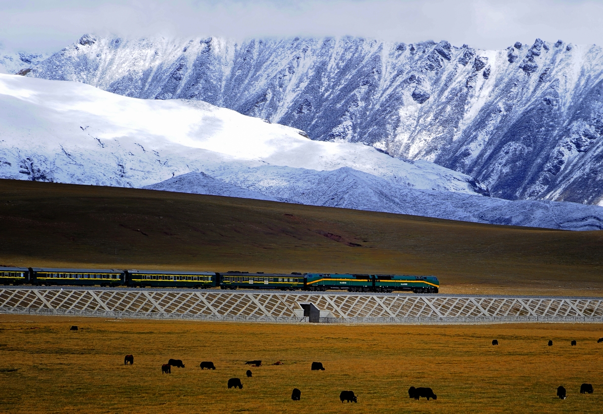
This article lists the highest railways in the world. The table only includes non-cable passenger railways whose culminating point is over 3,000 metres above sea level, regardless of their location, gauge or type. For simplicity, absolute elevation is the only criterion of this list, though two places at exactly the same elevation above sea level can have drastically different topographic or climatic conditions. For example, the permanent snow line is located at sea level near the poles, at 3,000 metres in the Alps and at 6,000 metres in some areas of the Andes and the Himalayas. The tree line also depends on latitude, thus making comparisons between elevations difficult on a world scale. At high altitudes, snow, cold, wind and harsh weather conditions make construction and maintenance an expensive challenge. Before the opening of the Qinghai–Tibet Railway in China, currently the highest in the world, the highest three railways were located in the Andean countries of Peru a ... [...More Info...] [...Related Items...] OR: [Wikipedia] [Google] [Baidu] |
PeruRail
PeruRail is a railway operator providing tourist, freight, and charter services in southern Peru. It was founded in 1999 by two Peruvian entrepreneurs and the British company Sea Containers. The main line between the port of Matarani, Arequipa, Cusco and Puno on Lake Titicaca was formerly known as the Ferrocarril del Sur (Peru Southern Railway), and was for a time owned and operated by the Empresa Nacional de Ferrocarriles del Peru, ENAFER state company. It is the third highest railway in the world after the Qinghai–Tibet Railway to Tibet and the Ferrocarril Central Andino, FCCA line from Lima to Huancayo, and is the longest line in Peru. From Cusco, PeruRail provides passenger services on the Track gauge, gauge Ferrocarril Santa Ana to Aguas Calientes, Peru, Aguas Calientes, delivering tourists for Machu Picchu. It operates in a 50/50 joint venture between Belmond Limited and Peruvian Trains and Railways, owned by two Peruvian entrepreneurs; Lorenzo Sousa Debarbieri is the ... [...More Info...] [...Related Items...] OR: [Wikipedia] [Google] [Baidu] |
Adhesion Railway
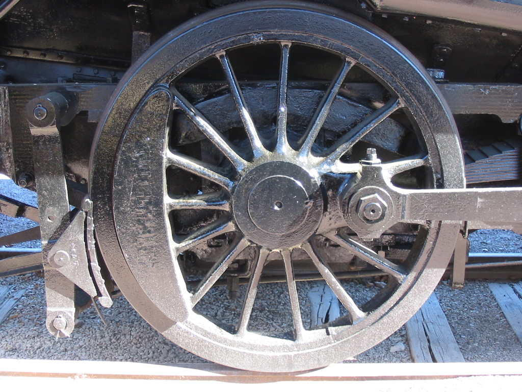
An adhesion railway relies on adhesion traction to move the train, and is the most widespread and common type of railway in the world. Adhesion traction is the friction between the drive wheels and the steel rail. Since the vast majority of railways are adhesion railways, the term ''adhesion railway'' is used only when it is necessary to distinguish adhesion railways from railways moved by other means, such as by a stationary engine pulling on a funicular, cable attached to the cars or by a pinion meshing with a rack railway, rack. The friction between the wheels and rails occurs in the wheel–rail interface or contact patch. The traction force, the braking forces and the centering forces all contribute to stable running. However, running friction increases costs, due to higher fuel consumption and increased maintenance needed to address fatigue (material), fatigue damage and wear on rail heads and on the wheel rims and rail movement from traction and braking forces. Variation ... [...More Info...] [...Related Items...] OR: [Wikipedia] [Google] [Baidu] |
Leadville
Leadville ( ) is a List of municipalities in Colorado#Statutory city, statutory city that is the county seat, the most populous community, and the only List of municipalities in Colorado, incorporated municipality in Lake County, Colorado, Lake County, Colorado, United States. The city population was 2,633 at the 2020 United States census. It is situated at an elevation of . Leadville is the highest United States Cities and Towns above 10,000 feet, incorporated city in the United States and is surrounded by two of the tallest Fourteener, peaks in the state, Mount Elbert and Mount Massive. Leadville is a former silver mining town that lies among the headwaters of the Arkansas River within the Rocky Mountains. The Leadville Historic District, designated a National Historic Landmark in 1961, contains many historic structures and sites of Leadville's mining era. In the late 19th century, Leadville was the second most populous city in Colorado, after Denver. History Settlement T ... [...More Info...] [...Related Items...] OR: [Wikipedia] [Google] [Baidu] |
Leadville, Colorado And Southern Railroad
The Leadville Railroad is a tourist railroad based in Leadville, Colorado Colorado is a U.S. state, state in the Western United States. It is one of the Mountain states, sharing the Four Corners region with Arizona, New Mexico, and Utah. It is also bordered by Wyoming to the north, Nebraska to the northeast, Kansas ..., United States. The Leadville Railroad has operated as a tourist Railroad in Leadville Colorado since 1988. Their season starts on Memorial Day weekend and runs though the 1st of April. References External links * Colorado railroads Lake County, Colorado {{Colorado-transport-stub ... [...More Info...] [...Related Items...] OR: [Wikipedia] [Google] [Baidu] |
Europe
Europe is a continent located entirely in the Northern Hemisphere and mostly in the Eastern Hemisphere. It is bordered by the Arctic Ocean to the north, the Atlantic Ocean to the west, the Mediterranean Sea to the south, and Asia to the east. Europe shares the landmass of Eurasia with Asia, and of Afro-Eurasia with both Africa and Asia. Europe is commonly considered to be Boundaries between the continents#Asia and Europe, separated from Asia by the Drainage divide, watershed of the Ural Mountains, the Ural (river), Ural River, the Caspian Sea, the Greater Caucasus, the Black Sea, and the waterway of the Bosporus, Bosporus Strait. "Europe" (pp. 68–69); "Asia" (pp. 90–91): "A commonly accepted division between Asia and Europe ... is formed by the Ural Mountains, Ural River, Caspian Sea, Caucasus Mountains, and the Black Sea with its outlets, the Bosporus and Dardanelles." Europe covers approx. , or 2% of Earth#Surface, Earth's surface (6.8% of Earth's land area), making it ... [...More Info...] [...Related Items...] OR: [Wikipedia] [Google] [Baidu] |
Jungfraujoch Railway Station
Jungfraujoch is an underground railway station situated near the Jungfraujoch, in the canton of Valais, a few metres from the border with the canton of Bern. At above sea level, it is the terminus of the Jungfrau Railway and the highest railway station in Switzerland and Europe. The Jungfrau Railway runs from Kleine Scheidegg in the Bernese Oberland, through the Jungfrau Tunnel (inside the Eiger and Mönch) and crosses the border between the two cantons shortly before the terminus. The station is located east of the Jungfraujoch, less than 300 metres away, below the Sphinx ridge. The Jungfraujoch itself is a snow saddle constituting the lowest point of the ridge between the Jungfrau and the Mönch. A complex of tunnels connects the railway station to the Top of Europe building, overlooking the Aletsch Glacier on the south side, and an elevator to the summit of the Sphinx, the peak overlooking the saddle from the east. At the Sphinx are enclosed and open viewing platforms, with ... [...More Info...] [...Related Items...] OR: [Wikipedia] [Google] [Baidu] |
Empresa De Ferrocarriles Ecuatorianos
The Ferrocarriles del Ecuador Empresa Pública (Ecuadorian Railways Company) is the national railway of Ecuador. The railway system was devised to connect the Pacific coast with the Andean highlands. After many decades of service the railway was severely damaged by heavy rainfall during the El Niño in 1997 and 1998 and from general neglect as the Pan-American Highway siphoned off passengers.Haines, Gavin,Ecuador's long-neglected railway system chugs back to life; its founder Eloy Alfaro would be proud" ''Cuenca High Life,'' 3 June 2013. Retrieved 8 May 2016. In 2008 the president Rafael Correa named the railroad a "national cultural patrimony" and indicated that it would be restored. The government of Ecuador started to rehabilitate the railway and service was restored between Guayaquil and Quito by 2013. An extensive range of services, primarily for leisure travellers, were operated by Steam locomotive, steam and Diesel locomotive, diesel-electric locomotive hauled trains and by ... [...More Info...] [...Related Items...] OR: [Wikipedia] [Google] [Baidu] |
San Antonio De Los Cobres
San Antonio de los Cobres is a small town of population 5,482 (per the 2001 INDEC census) in northwestern Argentina. It is the capital of the Los Andes Department of the Salta Province. Geography The town is known for its high elevation of approximately above sea level, being one of the highest elevations of any city or town in Argentina. It is located approximately from the city of Salta and from the capital, Buenos Aires. It is part of the Andes desert and described to be an arid region with few trees and scarce drinking water. History San Antonio de los Cobres was established in the early 17th century, specifically in 1641. It was founded as a small settlement to support the mining activities in the region and has since developed into a key town in the high Andes of Argentina. The town's history is closely tied to its mining heritage and the Indigenous cultures of the area. In a 2015 podcast from '' The Naked Scientists'', research has shown that people in the San Antonio ... [...More Info...] [...Related Items...] OR: [Wikipedia] [Google] [Baidu] |
Tren A Las Nubes
The Tren a las Nubes () is a tourist train service in Salta Province, Argentina. The service runs along the eastern part of the Salta–Antofagasta railway Main line (railway), line of the Belgrano Railway (also known as the "C-14" line) that connects the Argentine Northwest with the border in the Andes mountain range, over above mean sea level, the List of highest railways in the world, fifth highest railway in the world. Originally built for economic and social reasons, it is now primarily of interest to tourists as a heritage railway, though cheaper tickets are also available for locals to use the train as transport. Overview The railway line has 29 bridges, 21 tunnels, 13 viaducts, 2 Spiral (railway), spirals and 2 Zig zag (railway), zigzags. Because of the design decision not to use a Rack railway#Rack systems, rack-and-pinion for traction, the route had to be designed to avoid Grade (slope), steep grades. The zigzags allow the train to climb up driving back and forth paral ... [...More Info...] [...Related Items...] OR: [Wikipedia] [Google] [Baidu] |
La Polvorilla
The Tren a las Nubes () is a tourist train service in Salta Province, Argentina. The service runs along the eastern part of the Salta–Antofagasta railway line of the Belgrano Railway (also known as the "C-14" line) that connects the Argentine Northwest with the border in the Andes mountain range, over above mean sea level, the fifth highest railway in the world. Originally built for economic and social reasons, it is now primarily of interest to tourists as a heritage railway, though cheaper tickets are also available for locals to use the train as transport. Overview The railway line has 29 bridges, 21 tunnels, 13 viaducts, 2 spirals and 2 zigzags. Because of the design decision not to use a rack-and-pinion for traction, the route had to be designed to avoid steep grades. The zigzags allow the train to climb up driving back and forth parallel to the slope of the mountain. The train runs four days a week, departing from San Antonio de los Cobres (where passengers arriv ... [...More Info...] [...Related Items...] OR: [Wikipedia] [Google] [Baidu] |


