|
List Of Ecoregions In Cuba
{{Short description, none The following is a list of ecoregions in Cuba as identified by the World Wide Fund for Nature (WWF). Terrestrial ecoregions ''by major habitat type'' Tropical and subtropical moist broadleaf forests * Cuban moist forests Tropical and subtropical dry broadleaf forests * Cuban dry forests Tropical and subtropical coniferous forests * Cuban pine forests Flooded grasslands and savannas * Cuban wetlands Deserts and xeric shrublands * Cuban cactus scrub Mangroves * Greater Antilles mangroves Freshwater ecoregions * Cuba - Cayman Islands Marine ecoregions * Greater Antilles References * Dinerstein, Eric; David Olson; Douglas J. Graham; et al. (1995). ''A Conservation Assessment of the Terrestrial Ecoregions of Latin America and the Caribbean.'' World Bank, Washington DC. * Olson, D., Dinerstein, E., Canevari, P., Davidson, I., Castro, G., Morisset, V., Abell, R., and Toledo, E.; eds. (1998). ''Freshwater Biodiversity of Latin America and the Caribbean: ... [...More Info...] [...Related Items...] OR: [Wikipedia] [Google] [Baidu] |
Cuba
Cuba, officially the Republic of Cuba, is an island country, comprising the island of Cuba (largest island), Isla de la Juventud, and List of islands of Cuba, 4,195 islands, islets and cays surrounding the main island. It is located where the northern Caribbean Sea, Gulf of Mexico, and Atlantic Ocean meet. Cuba is located east of the Yucatán Peninsula (Mexico), south of both Florida and the Bahamas, west of Hispaniola (Haiti/Dominican Republic), and north of Jamaica and the Cayman Islands. Havana is the largest city and capital. Cuba is the List of countries and dependencies by population, third-most populous country in the Caribbean after Haiti and the Dominican Republic, with about 10 million inhabitants. It is the largest country in the Caribbean by area. The territory that is now Cuba was inhabited as early as the 4th millennium BC, with the Guanahatabey and Taino, Taíno peoples inhabiting the area at the time of Spanish colonization of the Americas, Spanish colonization ... [...More Info...] [...Related Items...] OR: [Wikipedia] [Google] [Baidu] |
Deserts And Xeric Shrublands
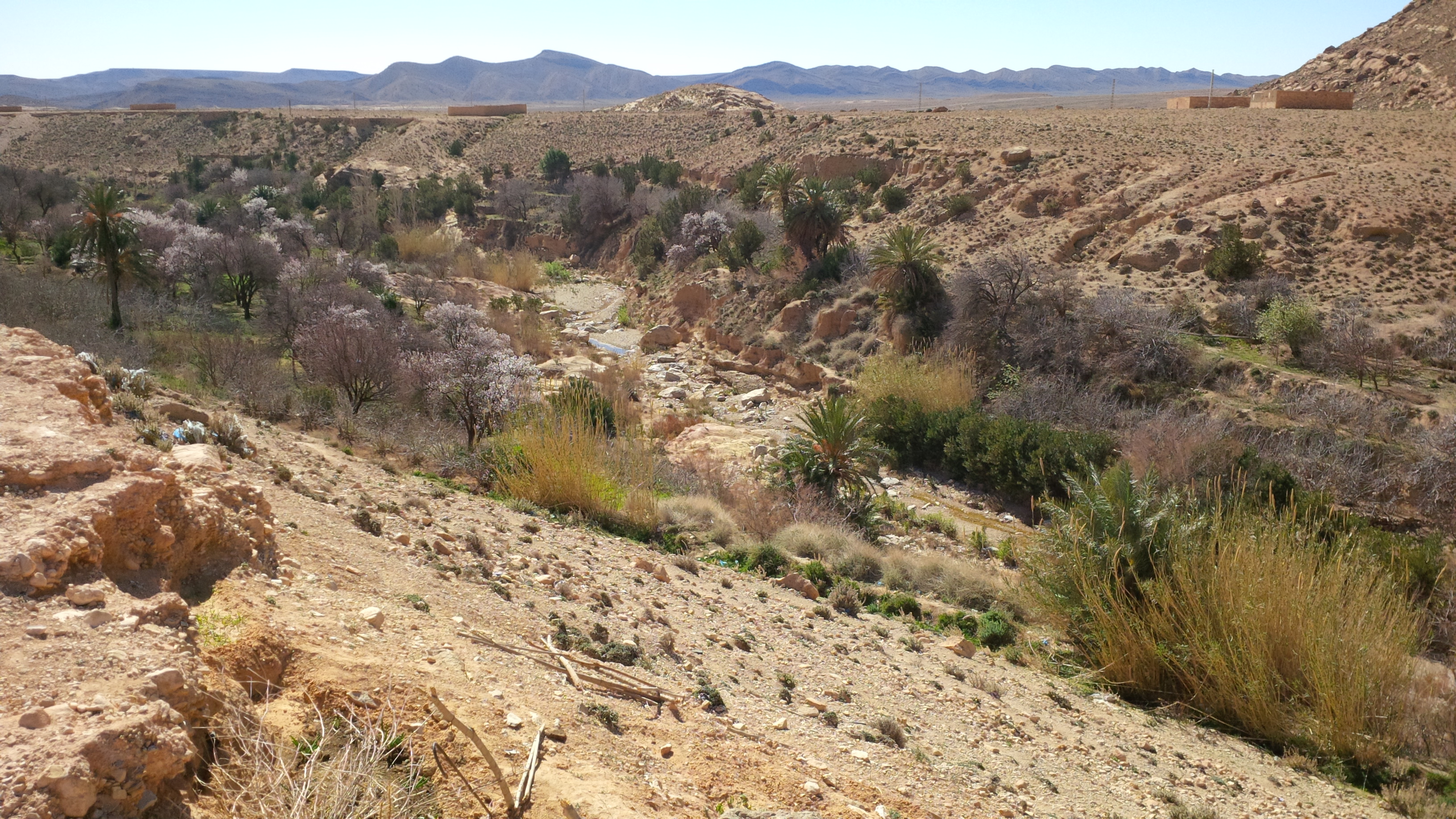
Deserts and xeric shrublands are a biome defined by the World Wide Fund for Nature. Deserts and xeric (Ancient Greek 'dry') shrublands form the largest terrestrial biome, covering 19% of Earth's land surface area. Ecoregions in this habitat type vary greatly in the amount of annual rainfall they receive, usually less than annually except in the margins. Generally evaporation exceeds rainfall in these ecoregions. Temperature variability is also diverse in these lands. Many deserts, such as the Sahara Desert, Sahara, are hot year-round, but others, such as East Asia's Gobi Desert, become quite cold during the winter. Temperature extremes are a characteristic of most deserts. High daytime temperatures give way to cold nights because there is no insulation provided by humidity and cloud cover. The diversity of climatic conditions, though quite harsh, supports a rich array of habitats. Many of these habitats are ephemeral in nature, reflecting the paucity and seasonality of avail ... [...More Info...] [...Related Items...] OR: [Wikipedia] [Google] [Baidu] |
Cuba Geography-related Lists
Cuba, officially the Republic of Cuba, is an island country, comprising the island of Cuba (largest island), Isla de la Juventud, and List of islands of Cuba, 4,195 islands, islets and cays surrounding the main island. It is located where the northern Caribbean Sea, Gulf of Mexico, and Atlantic Ocean meet. Cuba is located east of the Yucatán Peninsula (Mexico), south of both Florida and the Bahamas, west of Hispaniola (Haiti/Dominican Republic), and north of Jamaica and the Cayman Islands. Havana is the largest city and capital. Cuba is the List of countries and dependencies by population, third-most populous country in the Caribbean after Haiti and the Dominican Republic, with about 10 million inhabitants. It is the largest country in the Caribbean by area. The territory that is now Cuba was inhabited as early as the 4th millennium BC, with the Guanahatabey and Taino, Taíno peoples inhabiting the area at the time of Spanish colonization of the Americas, Spanish colonization ... [...More Info...] [...Related Items...] OR: [Wikipedia] [Google] [Baidu] |
Ecoregions Of Cuba
An ecoregion (ecological region) is an ecological and geographic area that exists on multiple different levels, defined by type, quality, and quantity of environmental resources. Ecoregions cover relatively large areas of land or water, and contain characteristic, geographically distinct assemblages of natural communities and species. The biodiversity of flora, fauna and ecosystems that characterise an ecoregion tends to be distinct from that of other ecoregions. In theory, biodiversity or conservation ecoregions are relatively large areas of land or water where the probability of encountering different species and communities at any given point remains relatively constant, within an acceptable range of variation (largely undefined at this point). Ecoregions are also known as "ecozones" ("ecological zones"), although that term may also refer to biogeographic realms. Three caveats are appropriate for all bio-geographic mapping approaches. Firstly, no single bio-geographic framewo ... [...More Info...] [...Related Items...] OR: [Wikipedia] [Google] [Baidu] |
Greater Antilles
The Greater Antilles is a grouping of the larger islands in the Caribbean Sea, including Cuba, Hispaniola, Puerto Rico, and Jamaica, together with Navassa Island and the Cayman Islands. Seven island states share the region of the Greater Antilles, with Haiti and the Dominican Republic sharing the island of Hispaniola. Together with the Lesser Antilles, they make up the Antilles, which along with the Lucayan Archipelago, form the West Indies in the Caribbean region of the Americas. While most of the Greater Antilles consists of independent countries, Puerto Rico and Navassa Island are Territories of the United States, unincorporated territories of the United States, while the Cayman Islands are a British Overseas Territories, British Overseas Territory. The largest island is Cuba, which extends to the western end of the island group. Puerto Rico lies on the eastern end, and the island of Hispaniola, the most populated island, is located in the middle. Jamaica lies to the south of ... [...More Info...] [...Related Items...] OR: [Wikipedia] [Google] [Baidu] |
Cuba - Cayman Islands
Cuba, officially the Republic of Cuba, is an island country, comprising the island of Cuba (largest island), Isla de la Juventud, and 4,195 islands, islets and cays surrounding the main island. It is located where the northern Caribbean Sea, Gulf of Mexico, and Atlantic Ocean meet. Cuba is located east of the Yucatán Peninsula (Mexico), south of both Florida and the Bahamas, west of Hispaniola (Haiti/Dominican Republic), and north of Jamaica and the Cayman Islands. Havana is the largest city and capital. Cuba is the third-most populous country in the Caribbean after Haiti and the Dominican Republic, with about 10 million inhabitants. It is the largest country in the Caribbean by area. The territory that is now Cuba was inhabited as early as the 4th millennium BC, with the Guanahatabey and Taíno peoples inhabiting the area at the time of Spanish colonization in the 15th century. It was then a colony of Spain, through the abolition of slavery in 1886, until the Spanish–Ame ... [...More Info...] [...Related Items...] OR: [Wikipedia] [Google] [Baidu] |
Greater Antilles Mangroves
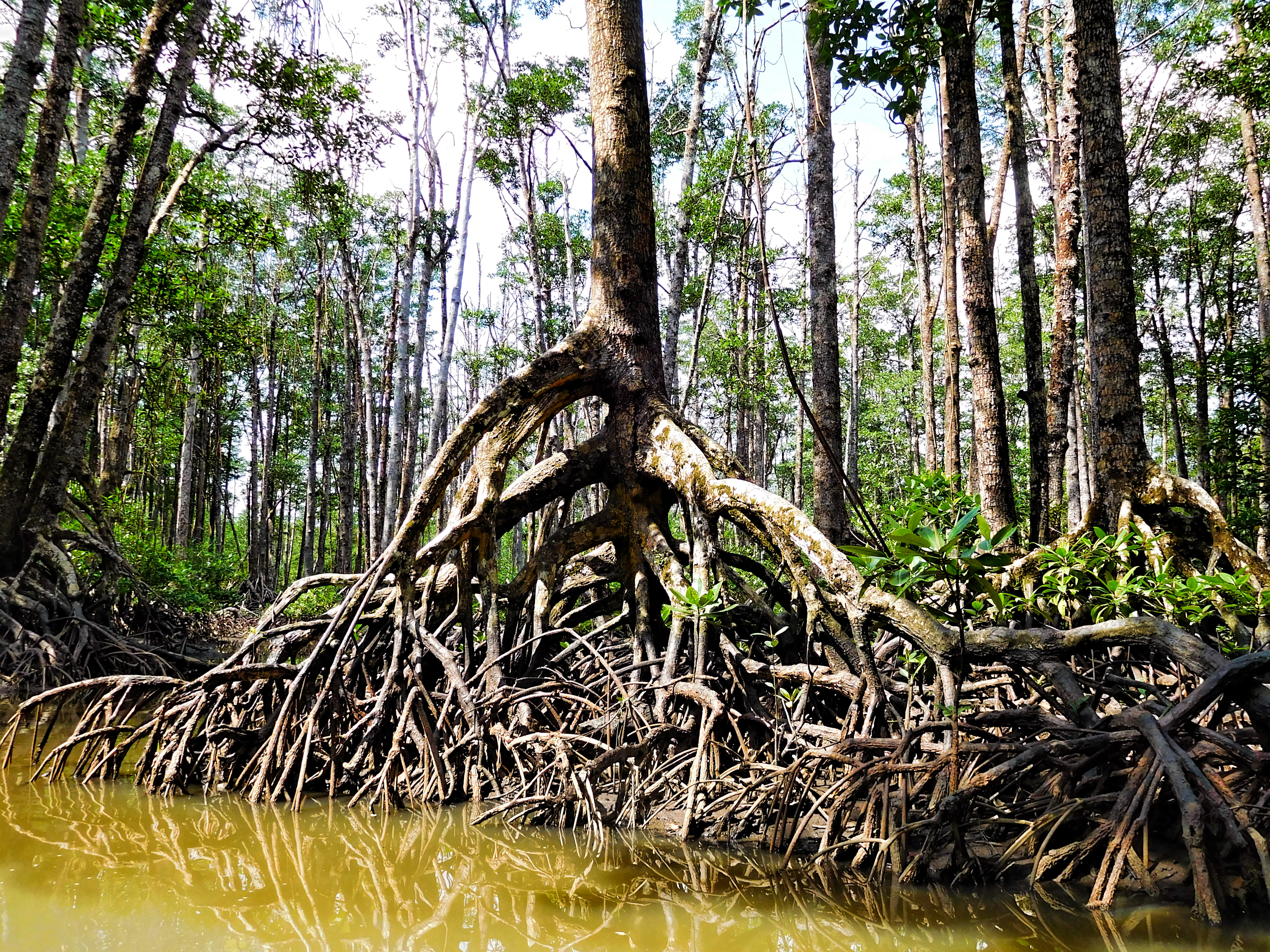
The Greater Antilles mangroves is a mangrove ecoregion that includes the coastal mangrove forests of the Greater Antilles – Cuba, Hispaniola, Jamaica, and Puerto Rico. Geography Mangroves are estimated to cover 5,569 km in Cuba (or 4.8% of the country); 134 km in Haiti; 325 km in the Dominican Republic; and 106 km in Jamaica. Some ecoregion systems include the Greater Antilles mangroves, Bahamian mangroves, and Lesser Antilles mangroves within a single Bahamian-Antillean mangroves ecoregion. Protected areas 30.5% of the ecoregion is in protected areas. These include the Zapata Swamp in Cuba, La Cahouane and Three Bays Protected Area in Haiti, Los Haitises National Park Los Haitises National Park is a national park located on the remote northeast coast of the Dominican Republic that was established in 1976. It consists of a limestone karst plateau with conical hills, sinkholes and caverns, and there is a large a ... in the Dominican Republic, and the Piñones State Fores ... [...More Info...] [...Related Items...] OR: [Wikipedia] [Google] [Baidu] |
Mangroves
A mangrove is a shrub or tree that grows mainly in coastal saline or brackish water. Mangroves grow in an equatorial climate, typically along coastlines and tidal rivers. They have particular adaptations to take in extra oxygen and remove salt, allowing them to tolerate conditions that kill most plants. The term is also used for tropical coastal vegetation consisting of such species. Mangroves are taxonomically diverse due to convergent evolution in several plant families. They occur worldwide in the tropics and subtropics and even some temperate coastal areas, mainly between latitudes 30° N and 30° S, with the greatest mangrove area within 5° of the equator. Mangrove plant families first appeared during the Late Cretaceous to Paleocene epochs and became widely distributed in part due to the movement of tectonic plates. The oldest known fossils of mangrove palm date to 75 million years ago. Mangroves are salt-tolerant ( halophytic) and are adapted to live in har ... [...More Info...] [...Related Items...] OR: [Wikipedia] [Google] [Baidu] |
Cuban Cactus Scrub
The Cuban cactus scrub is a xeric shrubland ecoregion that occupies on the leeward coast of Cuba. Most of it occurs in the southeastern part of the island in the provinces of Guantánamo and Santiago de Cuba. The ecoregion receives less than of rainfall annually. The principal soils are coastal rendzinas that were derived from coralline limestone. Cuban cactus scrub contains four vegetation zones: xerophytic coastal and subcoastal scrubland, coastal thorny semidesert, coastal sclerophyllous scrubland, and rocky coastal scrublands. Xerophytic coastal and subcoastal scrubland Vegetation in the xerophytic coastal and subcoastal scrublands reaches a height of and is dominated by palms and succulents, especially cacti. Common evergreen plants include ('' Bourreria virgata''), ('' Capparis cynophallophora''), ('' Eugenia foetida''), '' Bursera glauca'', '' B. cubana'', '' Croton'' spp., '' Cordia'' spp., '' Calliandra colletioides'', '' Caesalpinia'' spp., ''Acacia ... [...More Info...] [...Related Items...] OR: [Wikipedia] [Google] [Baidu] |
Cuban Wetlands
The Cuban wetlands is a flooded grasslands and savannas ecoregion on the island of Cuba and nearby smaller islands. The ecoregion covers , about 4% of the island's area. Geography The Cuban wetlands are found on lowland floodplains on island's northern and southern (Caribbean) shores. Most are fringed with mangroves nearer to the sea. The largest wetland in Cuba is the Zapata Swamp, located in southern Matanzas Province, and extending west along the Gulf of Batabanó into southern Havana Province. Zapata Swamp has an area of 450 km. It lies between 22º01’ and 22º40’ N latitude and 80º33’ and 82º09’ W longitude in southern Matanzas province. The swamp extends 175 km east and west from Punta Gorda to Jagua, with an average width of 14 to 16 km, reaching a maximum width of 58 km from southern Torriente to Cayo Miguel. Other wetlands along Cuba's southern shore include Pesquero Lake and Alcatraz Grande Lagoon in the western province of Pinar del Río, around the Gulf ... [...More Info...] [...Related Items...] OR: [Wikipedia] [Google] [Baidu] |
World Wide Fund For Nature
The World Wide Fund for Nature (WWF) is a Swiss-based international non-governmental organization founded in 1961 that works in the field of wilderness preservation and the reduction of human impact on the environment. It was formerly named the World Wildlife Fund, which remains its official name in Canada and the United States. WWF is the world's largest conservation organization, with over 5 million supporters worldwide, working in more than 100 countries and supporting around 3,000 conservation and environmental projects. It has invested over $1 billion in more than 12,000 conservation initiatives since 1995. WWF is a foundation with 65% of funding from individuals and bequests, 17% from government sources (such as the World Bank, FCDO, and USAID) and 8% from corporations in 2020. WWF aims to "stop the degradation of the planet's natural environment and to build a future in which humans live in harmony with nature." '' Living Planet Report'' has been published every two ... [...More Info...] [...Related Items...] OR: [Wikipedia] [Google] [Baidu] |
Flooded Grasslands And Savannas
Flooded grasslands and savannas is a terrestrial biome of the World Wide Fund for Nature (WWF) biogeographical system, consisting of large expanses or complexes of flooded grasslands. These areas support numerous plants and animals adapted to the unique hydrologic regimes and soil conditions. Large congregations of migratory and resident waterbirds may be found in these regions. The relative importance of these habitat types for these birds as well as more migratory animals typically varies, as the availability of water and productivity annually and seasonally shifts among complexes of smaller and larger wetlands throughout a region. This habitat type is found in Asia, Africa, North America and South America. Some globally outstanding flooded savannas and grasslands occur in the Everglades, Pantanal, Lake Chad flooded savanna, Zambezian flooded grasslands, and the Sudd. The Everglades, with an area of , are the world's largest rain-fed flooded grassland on a limestone s ... [...More Info...] [...Related Items...] OR: [Wikipedia] [Google] [Baidu] |


