|
List Of Romanian Counties By GDP
This is a list of the 41 Romanian counties, and one city with special status (Bucharest, the national capital) by GDP and GDP per capita. List of counties by GDP Counties by GDP in 2015 according to data by the OECD. Regional Economy > Regional GDP per Capita">Regions and Cities > Regional Statistics > Regional Economy > Regional GDP per Capita OECD.Stats. Accessed on 16 November 2018. List of counties by GDP per capita Counties by GDP per capita in 2015 according to data by the OECD The Organisation for Economic Co-operation and Development (OECD; , OCDE) is an international organization, intergovernmental organization with 38 member countries, founded in 1961 to stimulate economic progress and international trade, wor .... References {{DEFAULTSORT:Romanian counties by GDP Counties by GDP Gross state product GDP Ranked lists of country subdivisions ... [...More Info...] [...Related Items...] OR: [Wikipedia] [Google] [Baidu] |
Romania
Romania is a country located at the crossroads of Central Europe, Central, Eastern Europe, Eastern and Southeast Europe. It borders Ukraine to the north and east, Hungary to the west, Serbia to the southwest, Bulgaria to the south, Moldova to the east, and the Black Sea to the southeast. It has a mainly continental climate, and an area of with a population of 19 million people. Romania is the List of European countries by area, twelfth-largest country in Europe and the List of European Union member states by population, sixth-most populous member state of the European Union. Europe's second-longest river, the Danube, empties into the Danube Delta in the southeast of the country. The Carpathian Mountains cross Romania from the north to the southwest and include Moldoveanu Peak, at an altitude of . Bucharest is the country's Bucharest metropolitan area, largest urban area and Economy of Romania, financial centre. Other major urban centers, urban areas include Cluj-Napoca, Timiș ... [...More Info...] [...Related Items...] OR: [Wikipedia] [Google] [Baidu] |
Mureș County
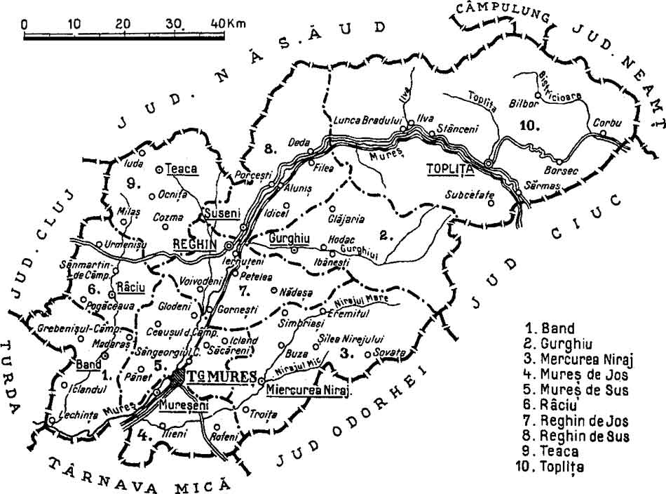
Mureș County (, , ) is a county (''județ'') of Romania, in the Historical regions of Romania, historical region of Transylvania, with the administrative centre in Târgu Mureș. The county was established in 1968, after the administrative reorganization that re-introduced the historical ''județ'' (Counties of Romania, county) system, still used today. This reform eliminated the previous Magyar Autonomous Region, Mureș-Magyar Autonomous Region, which had been created in 1952 within the People's Republic of Romania. Mureș County has a vibrant multicultural fabric that includes Székely Land, Hungarian-speaking Székelys and Transylvanian Saxons, with a rich heritage of Villages with fortified churches in Transylvania, fortified churches and towns. Name In Hungarian language, Hungarian, it is known as ''Maros megye'' (), and in German language, German as ''Kreis Mieresch''. Under Kingdom of Hungary, a county with a similar name (Maros-Torda County, ) was created in 1876. There ... [...More Info...] [...Related Items...] OR: [Wikipedia] [Google] [Baidu] |
Neamț County
Neamț County () is a county ( județ) of Romania, in the historic region of Moldavia, with the county seat at Piatra Neamț. The county takes its name from the Neamț River. Demographics Population In 2011, it had a population of 470,766 and a population density of 80/km2. * Romanians - 98.25% * Lipovans - 0.05% * Hungarians (more specifically Csángós) - 0.04% * Roma - 1.48%, and others Religion Geography Neamț County has an area of . The relief decreases from west to east. In the western part, there are mountains, the Eastern Carpathians, with heights of over and the impressive peak of Ceahlău Massif. Along the Bicaz River lies the canyon of Cheile Bicazului. Construction of the Bicaz Dam in the 1950s on the Bistrița River led to the formation of Lake Bicaz ( Lake Izvorul Muntelui), the largest artificial lake completely in Romania. On the western side, the lowest point, at about , is found along the Siret River's valley. Neighbours *Iași Cou ... [...More Info...] [...Related Items...] OR: [Wikipedia] [Google] [Baidu] |
Vâlcea County
Vâlcea County (also spelt ''Vîlcea''; ) is a county (județ) that lies in south-central Romania. Located in the Historical regions of Romania, historical regions of Oltenia and Muntenia (which are separated by the Olt (river), Olt River), it is also part of the wider Wallachia region. Its capital city is Râmnicu Vâlcea. Demographics In 2011, it had a population of 355,320 and the population density was 61.63/km2. * Romanians - over 98% * Romani people in Romania, Roma, Minorities of Romania, others - 2% Geography This county has a total area of . The North side of the county is occupied by the mountains from the Southern Carpathians group: the Făgăraș Mountains in the east with heights over , and the Lotru Mountains in the west with heights over . They are separated by the Olt (river), Olt River valley — the most accessible passage between Transylvania and Muntenia. Along the Olt River valley there are smaller groups of mountains, the most spectacular being ... [...More Info...] [...Related Items...] OR: [Wikipedia] [Google] [Baidu] |
Buzău County
Buzău County () is a county (județ) of Romania, in the Historical regions of Romania, historical region Muntenia, with the capital city at Buzău. Demographics In 2011, it had a population of 432,054 and the population density was 70.7/km2. * Romanians – 97% * Romani people, Romani – under 3% declared and Minorities of Romania, others Geography This county has a total area of 6,103 km2. In the North Side there are the mountains from the southern end of the Eastern Carpathians group – the Vrancea Mountains and the Buzău Mountains with heights over 1,700 m. The heights decrease in the South and East passing through the subcarpathian hills to the Bărăgan Plain at about 80 m. The main river crossing the county is the Buzău River which collects many small rivers from the mountains and flows to the East into the Siret River. Neighbours * Brăila County to the east. * Prahova County and Brașov County to the west. * Covasna County and Vrancea County to ... [...More Info...] [...Related Items...] OR: [Wikipedia] [Google] [Baidu] |
Hunedoara County
Hunedoara County () is a county (''județ'') of Romania, in Transylvania, with its capital city at Deva, Romania, Deva. The county is part of the Danube–Criș–Mureș–Tisa Euroregion. Name In Hungarian language, Hungarian, it is known as , in German language, German as , and in Slovak language, Slovak as . The county got its name from the city of Hunedoara (), which is the Romanian language, Romanian transliteration of the Hungarian language, Hungarian (, archaic: ), old name of the municipality. That most likely originated from the Hungarian language, Hungarian verb meaning 'to close' or 'to die', but may also come from wear the name of the Huns, who were headquartered near for a time and were the first to establish solid rule over the land since the Dacians. Geography This county has a total area of 7,063 km2. Mainly, the relief is made up of mountains, divided by the Mureș River valley which crosses the county from East to West. To the North side there are the ... [...More Info...] [...Related Items...] OR: [Wikipedia] [Google] [Baidu] |
Gorj County
Gorj County () is a county () of Romania, in Oltenia, with its capital city at Târgu Jiu. ''Gorj'' comes from the Slavic ''Gornji'' Jiu (“upper Jiu”), in contrast with Dolnji (“lower Jiu”). Demographics At the 2011 census, the county had a population of 334,238 and its population density was . * Romanians – over 98% * Roma, others – 2% At the 2021 census, Gorj County had a population of 314,685. Geography Gorj County has a total area of . The North side of the county consists of various mountains from the Southern Carpathians group. In the West there are the Vâlcan Mountains, and in the East there are the Parâng Mountains and the Negoveanu Mountains. The two groups are split by the Jiu River. To the South, the heights decrease through the hills to a high plain at the Western end of the Wallachian Plain. The main river, which collects all the smaller rivers, is the Jiu River; its tributaries include the Tismana, Gilort, and Motru rivers. Neighb ... [...More Info...] [...Related Items...] OR: [Wikipedia] [Google] [Baidu] |
Alba County
Alba County () is a county (județ) of Romania located in the historic region of Transylvania. Its capital is Alba Iulia, a city with a population of 63,536. Name "Alba", meaning "white" in Latin and Romanian, is derived from the name of the city of Alba Iulia. In Hungarian language, Hungarian, the county is known as ''Fehér megye'' (fehér also meaning white), and in German language, German as ''Kreis Karlsburg''. Geography This county has a total area of , with mountains occupying about 59% of its surface. The Apuseni Mountains are in the northwest; the northeastern side of the Parâng Mountains group – the Șureanu Mountains, Șureanu and Cindrel Mountains, Cindrel mountains – are in the south. In the east there is the Transylvanian Plateau with deep but wide valleys. The three main elements are separated by the Mureș (river), Mureș River valley. The main rivers are the Mureș (river), Mureș River and its tributaries, the Târnava, the Sebeș (river), Sebeș, ... [...More Info...] [...Related Items...] OR: [Wikipedia] [Google] [Baidu] |
Maramureș County
Maramureș County () is a county (județ) in Romania, in the Maramureș region. The county seat is Baia Mare. Name In Hungarian language, Hungarian it is known as ''Máramaros megye'', in Ukrainian language, Ukrainian as Мараморо́щина, in German language, German as ''Kreis Marmarosch'', and in Yiddish as מאַרמאַראָש. Geography Maramureș County is situated in the northern part of Romania, in the Historical regions of Romania, historical region of Transylvania, and has a border with Ukraine. This county has a total area of , of which 43% is covered by the Rodna Mountains, with its tallest peak, , at altitude. Together with the Gutin Mountains, Gutâi and Țibleș Mountains, Țibleș mountain ranges, the Rodna mountains are part of the Eastern Carpathians. The rest of the county are hills, plateaus, and valleys. The county is crossed by Tisza, Tisa River and its main tributaries: the Iza (river), Iza, Vișeu, and Mara (Iza), Mara rivers. Ne ... [...More Info...] [...Related Items...] OR: [Wikipedia] [Google] [Baidu] |
Galați County
Galați () is a county (județ) of Romania, in Moldavia region, with the capital city at Galați, between latitude, 45°25'N and latitude, 46°10'N latitude, longitude, 27°20'E and longitude, 28°10'E longitude. It borders the counties of Vaslui County, Vaslui, Vrancea County, Vrancea, Brăila County, Brăila, Tulcea County, Tulcea. To the east it borders the Republic of Moldova, the border crossing points being Galați–Giurgiulești (road and broad-gauge railway) and Oancea–Cahul (road). The county was established in 1968, through the territorial reorganization of the former , which included a territory similar to that of the current Brăila and Galați counties, plus the northern part of Tulcea County. Galați County is part of the ''Sud-Est (development region), South-East Development Region'' (together with the counties of Vrancea, Buzău, Brăila, Constanța and Tulcea), of the ''Lower Danube (Euroregion), Lower Danube Euroregion'' (together with the counties of ... [...More Info...] [...Related Items...] OR: [Wikipedia] [Google] [Baidu] |
Dâmbovița County
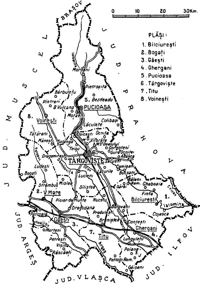
Dâmbovița County (; also spelt Dîmbovița) is a county () of Romania, in Muntenia, with the capital city at Târgoviște, the most important economic, political, administrative and cultural center of the county. It is a traditional administrative unit, first attested in 1512. Demographics In 2021, it had a population of 479,404 and the population density was 120/km2. It is one of the most densely populated counties in Romania. * Romanians – 87.09% * Roma - 3.96% * Bulgarians - 0.31% * Serbians 0.1% * Others - 0.13% * Unknown - 8.41% Name The county is named after the Dâmbovița River, which is a name of Slavic origin, derived from ''Дъб, dâmb'', meaning "oak", as it once flowed through the oak forests of the Wallachian Plain. Geography Dâmbovița county has a total area of 4,054 km2 (1.7% of the country's surface). It is situated in the south-central part of the country, on the Ialomița and Dâmbovița river basins. The highest altitude is Omu Pe ... [...More Info...] [...Related Items...] OR: [Wikipedia] [Google] [Baidu] |
Suceava County
Suceava County () is a county (') of Romania. Most of its territory lies in the southern part of the Historical regions of Romania, historical region of Bukovina, while the remainder forms part of Western Moldavia proper. The county seat and the most populous urban settlement of the county is Suceava. Demographics In 2011, as per the 2011 Romanian census, official census conducted that year, Suceava County had a population of 634,810, with a population density of 74/km2. The proportion of each constituent ethnic group is displayed below as follows, according to how they were officially recorded: * Romanians – 96.14% * Romani people in Romania, Romani – 1.92% * Ukrainians of Romania, Ukrainians (including Hutsuls and Rusyns) – 0.92% * Lipovans – 0.27% * Germans of Romania, Germans (namely Bukovina Germans, Zipser Germans/Saxons, and Regat Germans) – 0.11% * West Slavs (i.e. Poles in Romania, Poles, Slovaks of Romania, Slovaks, and Czechs of Romania, Czechs) as well ... [...More Info...] [...Related Items...] OR: [Wikipedia] [Google] [Baidu] |


