|
List Of National Geoparks
This list includes areas designated as "geopark" on the national level. This should not be confused with members of either the European Geoparks Network or the UNESCO Global Geoparks Network. Australia * Kanawinka Geopark Austria * Kamptal Geopark Brazil * Geopark Paleorrota Bulgaria * Iskar–Panega Geopark China * Protected areas of the People's Republic of China Czech Republic * Bohemian-Moravian Highlands Geopark * Blaník Knights County Geopark * Egeria Geopark * GeoLoci Geopark * Iron Mountains Geopark * Moravian-Silesian Foothills Geopark * Ralsko Geopark Germany * Bergstraße-Odenwald * Bayern–Böhmen * GrenzWelten * Harz - Braunschweiger Land - Ostfalen * Inselsberg – Drei Gleichen * Kyffhäuser * Laacher See * Muskau Arch * Porphyrland * Ries * Ruhrgebiet * Sachsens Mitte * Schieferland * Schwäbische Alb * TERRA.vita * Vulkaneifel * Vulkanregion Vogelsberg * Westerwald–Lahn–Taunus Indonesia * Batur * Belitung * Ciletuh-Palabuha ... [...More Info...] [...Related Items...] OR: [Wikipedia] [Google] [Baidu] |
Geopark
A geopark is a protected area with internationally significant geology within which Sustainability, sustainable development is sought and which includes tourism, conservation, education and research concerning not just geology but other relevant sciences. In 2005, a European Geopark was defined as being: "a territory with a particular geological heritage and with a sustainable territorial development....the ultimate aim of a European Geopark is to bring enhanced employment opportunities for the people who live there." Today the geopark is virtually synonymous with the UNESCO geopark, which is defined and managed under the voluntary authority of UNESCO's International Geoscience Programme, International Geoscience and Geoparks Programme (IGGP). UNESCO provides a standard for geoparks and a certification service to territories that apply for it. The service is available to member states of UNESCO. The list of members is not the same as the member states of the United Nations. Memb ... [...More Info...] [...Related Items...] OR: [Wikipedia] [Google] [Baidu] |
Vulkan Eifel Nature And Geo-Park
The Vulkanland Eifel Geopark () is a German national geopark in the Volcanic Eifel region that was established on 19 April 2005. Covering an area of 2,200 km2, the geopark extends from the Belgian border in the west over the Eifel mountains to the River Rhine in the east. The countryside here which has been shaped by the volcanism of the past contains numerous maars, cinder cones, lava flows lava domes calderas and bubbling springs. The largest caldera was formed by the Laacher See volcano that last erupted about 13,000 years ago. A sign of continuing volcanic activity in this region are the volcanic gases that are still visibly being discharged into the atmosphere. Literature * Karl-Heinz Schumacher und Wilhelm Meyer: ''Geopark Vulkanland Eifel. Lava-Dome und Lavakeller in Mendig.'' Redaktion: Karl Peter Wiemer. Rheinischer Verein für Denkmalpflege und Landschaftsschutz, Cologne, 2006 (=Rheinische Landschaften, Heft 57). *Werner d´Hein: ''Nationaler Geopark Vulkanland Eif ... [...More Info...] [...Related Items...] OR: [Wikipedia] [Google] [Baidu] |
TERRA
Terra may often refer to: * Terra (mythology), primeval Roman goddess * An alternate name for planet Earth, as well as the Latin name for the planet Terra may also refer to: Geography Astronomy * Terra (satellite), a multi-national NASA scientific research satellite * Terrae, extensive land masses found on various solar system bodies ** List of terrae on Mars ** List of terrae on Venus ** Terra, a highland on the Moon (Luna) * Terrestrial (other), things related to land or the planet Earth Latin and other * '' Terra Australis'' (southern land), hypothetical continent appearing on maps from the 15th to the 18th century * '' Terra incognita'', unknown land, for regions that have not been mapped or documented * '' Terra nullius'', land belonging to no one, nobody's land, empty or desolate land * Terra preta ("black earth"), a type of dark, fertile anthropogenic soil found in the Amazon Basin Places * Terra, Cyprus, a village in the Paphos District of Cyprus * ... [...More Info...] [...Related Items...] OR: [Wikipedia] [Google] [Baidu] |
Swabian Jura
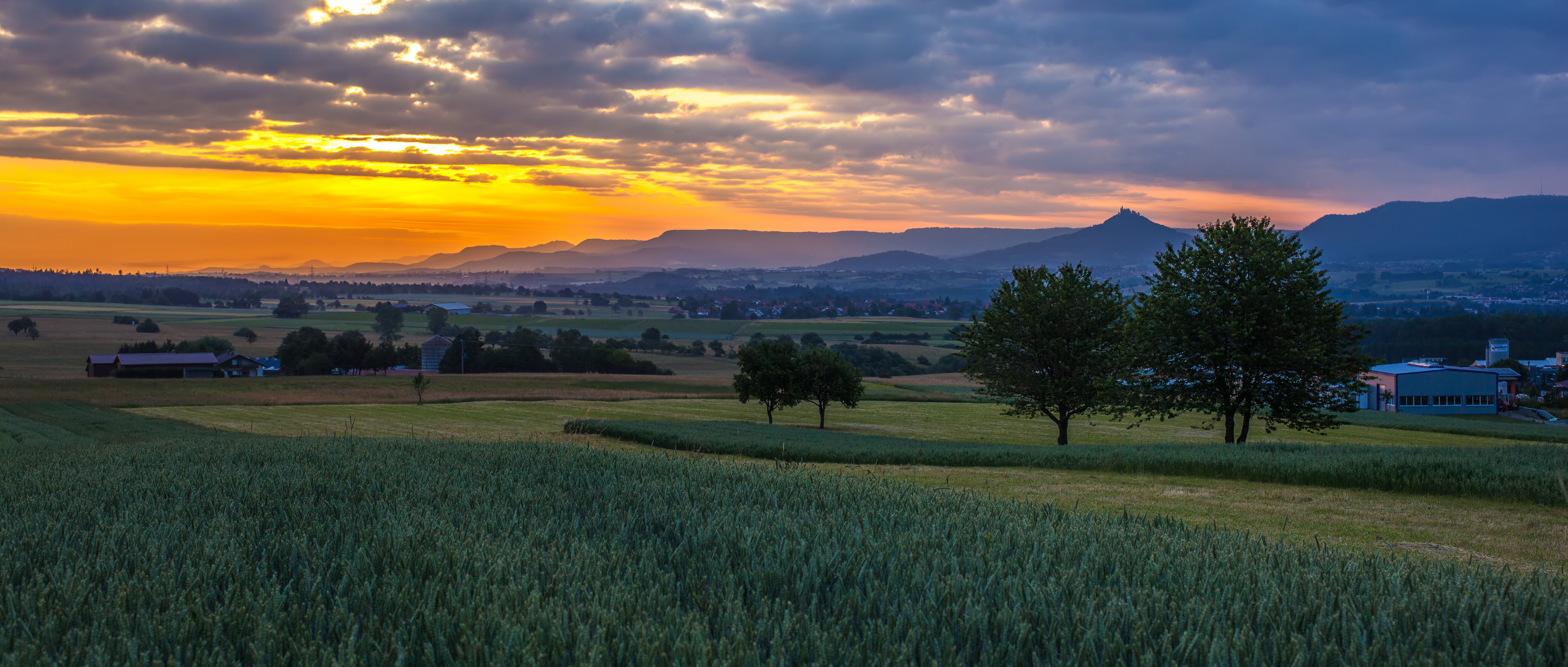
The Swabian Jura ( , more rarely ), sometimes also named Swabian Alps in English, is a mountain range in Baden-Württemberg, Germany, extending from southwest to northeast and in width. It is named after the region of Swabia. It is part of the Table Jura (). The Swabian Jura occupies the region bounded by the Danube in the southeast and the upper Neckar in the northwest. In the southwest it rises to the higher mountains of the Black Forest. The highest mountain in the region is the Lemberg (Swabian Alb), Lemberg (). The area's profile resembles a high plateau, which slowly falls away to the southeast. The northwestern edge is a steep escarpment (called the Albtrauf or Albanstieg, rising up , covered with forests), while the top is flat or gently rolling. In economic and cultural terms, the Swabian Jura includes regions just around the mountain range. It is a popular recreation area. The whole ''Schwäbische Alb'' area is a UNESCO Global Geoparks, UNESCO global geopark coveri ... [...More Info...] [...Related Items...] OR: [Wikipedia] [Google] [Baidu] |
Ruhrgebiet
The Ruhr ( ; , also ''Ruhrpott'' ), also referred to as the Ruhr Area, sometimes Ruhr District, Ruhr Region, or Ruhr Valley, is a wikt:polycentric, polycentric urban area in North Rhine-Westphalia, Germany. With a population density of 1,160/km2 and a population of over 5 million (2017), it is the largest urban area in Germany and the List of urban areas in the European Union, third of the European Union. It consists of several large cities bordered by the rivers Ruhr (river), Ruhr to the south, Rhine to the west, and Lippe (river), Lippe to the north. In the southwest it borders the Bergisches Land. It is considered part of the larger Rhine-Ruhr metropolitan regions in Germany, metropolitan region of more than 10 million people, which is the third largest in Western Europe, behind only London and Paris. The Ruhr cities are, from west to east: Duisburg, Oberhausen, Bottrop, Mülheim, Mülheim an der Ruhr, Essen, Gelsenkirchen, Bochum, Herne, Germany, Herne, Hagen, Dortmund, Ham ... [...More Info...] [...Related Items...] OR: [Wikipedia] [Google] [Baidu] |
Nördlinger Ries
The Nördlinger Ries is an impact crater and large circular depression in western Bavaria and eastern Baden-Württemberg. It is located north of the Danube in the district of Donau-Ries. The city of Nördlingen is located within the depression, about south-west of its centre. Etymology "Ries" is derived from Raetia, since the tribe of Raetians lived in the area in pre- Roman times. Description The depression is a meteorite impact crater formed 14.808 ± 0.038 million years ago in the Miocene. The crater is most commonly referred to simply as the ''Ries crater'' or ''the Ries''. The original crater rim had an estimated diameter of . The present floor of the depression is about below the eroded remains of the rim. It was originally assumed that the Ries was of volcanic, glacial or tectonic origin. Oliver Sachs introduced, in this context, the term "pioneer era" (up to 1870) and marked the beginning of early modern research on the Ries (from 1870), meaning the perio ... [...More Info...] [...Related Items...] OR: [Wikipedia] [Google] [Baidu] |
Muskau Arch
Bad Muskau (; formerly ''Muskau'', , , ) is a spa town in the historic Upper Lusatia region in eastern Germany, at the border with Poland. It is part of the Görlitz district in the State of Saxony. It is located on the banks of the Lusatian Neisse river, directly opposite the town of Łęknica. It is part of the recognized Sorbian settlement area in Saxony. Upper Sorbian has an official status next to German, with all villages bearing names in both languages. Bad Muskau gained worldwide fame through prince and landscape artist Hermann von Pückler-Muskau, who created a unique cultural asset with his landscape park. The Muskau Park, a UNESCO World Heritage Site, is split between Bad Muskau and Łęknica. History Muskau (Sorbian, "men's town") was founded in the 13th century as a trading center and defensive location on the Neisse, being first mentioned in a document in 1249. The state country (''Standesherrschaft'') of Muskau was the largest of the Holy Roman Empire. From ... [...More Info...] [...Related Items...] OR: [Wikipedia] [Google] [Baidu] |
Laacher See
Laacher See (), also known as Lake Laach or Laach Lake, is a volcanic Volcanic crater lake, caldera lake with a diameter of in Rhineland-Palatinate, Germany, about northwest of Koblenz, south of Bonn, and west of Andernach. It is in the Eifel mountain range, and is part of the East Eifel volcanic field within the larger Volcanic Eifel. The lake was formed by a Plinian eruption approximately 13,000 years Before Present, BP with a Volcanic Explosivity Index (VEI) of 6, on the same scale as the Mount Pinatubo#1991 eruption, Pinatubo eruption of 1991. The Volcanic gas, volcanic discharge observable as mofettas on the southeastern shore of the lake is a sign of Dormant volcano, dormant volcanism. Description The lake is oval in shape and surrounded by high banks. The lava was quarried for millstones from the Roman period until the introduction of iron rollers for grinding grain. The water level has considerable rises and falls as the lake has no natural outlet. On the western side ... [...More Info...] [...Related Items...] OR: [Wikipedia] [Google] [Baidu] |


