|
List Of Indian Tornadoes
Tornadoes in India are rare, with only ~12 tornadoes being recorded between 1976 and 2010. Most tornadoes in India are deadly, with an average of 80 people killed per tornado. The deadliest Indian tornado on record hit areas near Belda on March 24, 1998, killing 250 people. Events Pre-1950s * April 8, 1838 - A long-tracked and destructive FU tornado tore through downtown Kolkata, damaging numerous structures and killing 215. * May 1, 1865 - A strong FU tornado tracks through rural areas west of Pandua, Hooghly, Pandua, taking an extremely unusual sharp-turned path and killing 20 people. * April 27, 1888 - A relatively brief FU tornado moves through Serampore, killing 7 people. * March 13, 1921 - A violent tornado struck Barisal., Barisal, West Bengal and caused significant damage to property and infrastructure. Homes were razed, trees were uprooted and many person were killed or injured. * June 30, 1936 - A "terrific cyclone" in North Malabar affected a large swath of area ... [...More Info...] [...Related Items...] OR: [Wikipedia] [Google] [Baidu] |
Tornado In The Indian Ocean
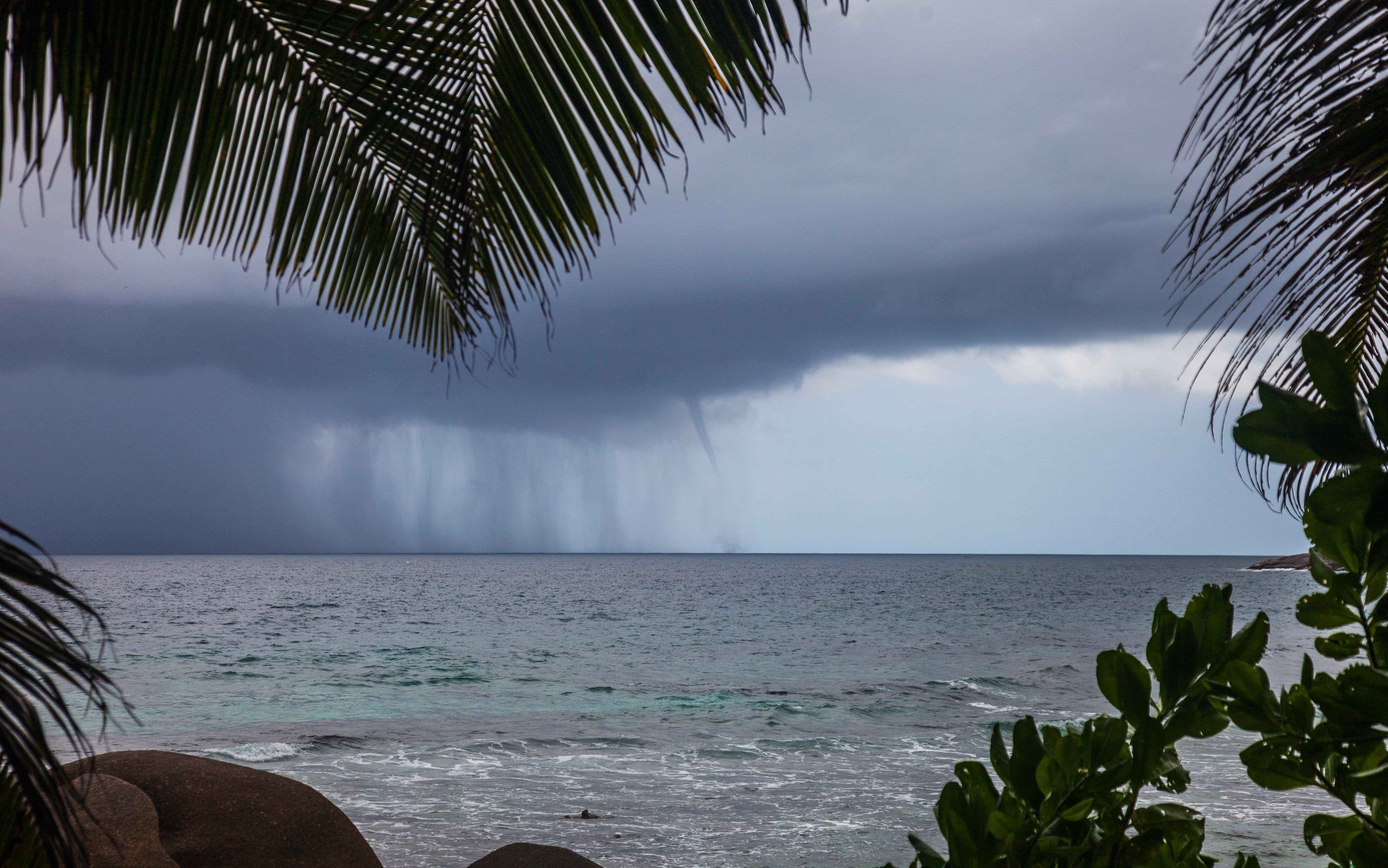
A tornado is a violently rotating column of air that is in contact with the surface of Earth and a cumulonimbus cloud or, in rare cases, the base of a cumulus cloud. It is often referred to as a twister, whirlwind or cyclone, although the word cyclone is used in meteorology to name a weather system with a low-pressure area in the center around which, from an observer looking down toward the surface of the Earth, winds blow counterclockwise in the Northern Hemisphere and clockwise in the Southern Hemisphere. Tornadoes come in many shapes and sizes, and they are often (but not always) visible in the form of a funnel cloud, condensation funnel originating from the base of a cumulonimbus cloud, with a cloud of rotating debris and dust beneath it. Most tornadoes have wind speeds less than , are about across, and travel several kilometers (a few miles) before dissipating. The Tornado records#Highest winds observed in a tornado, most extreme tornadoes can attain wind speeds of mo ... [...More Info...] [...Related Items...] OR: [Wikipedia] [Google] [Baidu] |
Orissa
Odisha (), formerly Orissa ( the official name until 2011), is a state located in Eastern India. It is the eighth-largest state by area, and the eleventh-largest by population, with over 41 million inhabitants. The state also has the third-largest population of Scheduled Tribes in India India, officially the Republic of India, is a country in South Asia. It is the List of countries and dependencies by area, seventh-largest country by area; the List of countries by population (United Nations), most populous country since .... It neighbours the states of Jharkhand and West Bengal to the north, Chhattisgarh to the west, and Andhra Pradesh to the south. Odisha has a coastline of along the Bay of Bengal in the ''Indian Ocean''. The region is also known as Utkaḷa and is mentioned by this name in India's national anthem, Jana Gana Mana. The language of Odisha is Odia language, Odia, which is one of the Classical languages of India. The ancient kingdom of Kalinga ( ... [...More Info...] [...Related Items...] OR: [Wikipedia] [Google] [Baidu] |
Kalbaisakhi
A ''kalbaisakhi'' (, ; , ), also known as ''bordoisila'' () and in some English publications as a nor'wester, is a localised rainfall and thunderstorm event which occurs in Bangladesh as well as the Indian states of Bihar, Jharkhand, Odisha, Tripura, Assam, and West Bengal during summer. These storms generally occur in the afternoon or just before sunset, when thick dark black clouds start appearing over the sky and then bring gale-speed wind with torrential rain, often with hail, but spanning only a short period of time. Etymology In Bengali, the term ''kālbôiśākhī'' refers to a "fateful thing" which occurs in the Bengali month of Bôiśākh. The term ''nor'wester'' is more commonly used in English newspapers since these storms travel from northwest to southeast. In Assamese, the event is known as a ''bôrdôisilā'', which is derived from the Bodo word ''bôrdôisikhlā'', in which ''bôr'' means wind, ''dôi'' means water and ''sikhlā'' means girl, represents the god ... [...More Info...] [...Related Items...] OR: [Wikipedia] [Google] [Baidu] |
Rajkanika
Rajkanika is a town and block of Kendrapara district in the Indian state of Odisha. Geography Rajkanika is surrounded by rivers on three sides, the rivers are Brahmani, Baitarani, and Kharashrota. It is the north end block of Kendrapara district and nearer to Bhadrak and Jajpur District. Its northern end starts from village Gualigan and ends at Bharigada village in the south and starts from Jayanagar in the east to Gopalpur in the west. Demographics Odia is the official and spoken language at Rajkanika. The total population of Rajkanika is 1,38,979 consisting of 66,579 males and 72,400 females (all rural). There are 29 Gram Panchayats and 6 R.I. Circles and 168 (156 inhabited and 12 uninhabited) villages in Kanika Tehsil. Total Number of Households is 24523. Total literacy in Kanika Tehsil is 1,05,731 (77.12%) including 53,565 (86.83%) males and 52,166 (68.55%) females. Scheduled Castes in Kanika 31,859 with 15,629 males and 16,230 females. Population in the age group of 0-6 ... [...More Info...] [...Related Items...] OR: [Wikipedia] [Google] [Baidu] |
Sahnewal Airport
Ludhiana Airport is a domestic airport serving the city of Ludhiana in Punjab, India. It is located near the town of Sahnewal, south-east of Ludhiana on the Grand Trunk Road. There is a flight training club based in the airport. Development The airport was mainly used for government flights, air force exercises and training flights. The only commercial airline the airport had was Alliance Air, which connected it to Delhi with regular flights until April 2021, due to the COVID-19 pandemic. Since then, the airport remained closed, until when in September 2023, the low-cost regional carrier, FlyBig, restarted flight operations to Dehradun with a stopover at Ghaziabad on 6 September 2023, as part of the government's UDAN Scheme. As the airport is too small to accommodate future traffic and demands, and due to zero scopes available to expand the airport because of urban growth around it, in 2019, the Ministry of Civil Aviation decided to build a passenger terminal at the exi ... [...More Info...] [...Related Items...] OR: [Wikipedia] [Google] [Baidu] |
Manigram
Manigram (also spelled Monigram) is a village and a gram panchayat in the Sagardighi CD block in the Jangipur subdivision of Murshidabad district in the state of West Bengal, India. Geography Location Manigram is located at . Villages in Monigram gram panchayat are: Arazi Balarambati, Balarambati, Bhumihar, Chandpara, Dogachhi, Harirampur, Hatpara, Kantanagar, Karala, Kherur, Kismatgadi and Manigram. Area overview Jangipur subdivision is crowded with 52 census towns and as such it had to be presented in two location maps. One of the maps can be seen alongside. The subdivision is located in the Rarh region that is spread over from adjoining Santhal Pargana division of Jharkhand. The land is slightly higher in altitude than the surrounding plains and is gently undulating. The river Ganges, along with its distributaries, is prominent in both the maps. At the head of the subdivision is the 2,245 m long Farakka Barrage, one of the largest projects of its kind in the country. Mur ... [...More Info...] [...Related Items...] OR: [Wikipedia] [Google] [Baidu] |
Berhampore
Berhampore (), also known as Baharampur (), is a city and a municipality in the state of West Bengal, India. Berhampore is the administrative headquarters of the Murshidabad district. As of 2011 census, Berhampore is the seventh largest city in West Bengal. It is located about from Kolkata, the state capital. Berhampore is one of the most important business, administrative, educational and political hub of Bengal as well as of India. It is one of the most popular urban agglomerations of West Bengal state. Berhampore was the first centre of East India Company in India. Not only the British but also the Dutch and the French established their companies in this city and, as a result, it grew as a production hub of India. It is famous for its famous sweets such as Chanabora, Manohara, Rasgulla and many more. The city is divided into five administrative regions: Gora Bazar, Khagra, Indraprastha, Cossimbazar, Haridasmati. Berhampore was a part of Sepoy Mutiny of 1857 which too ... [...More Info...] [...Related Items...] OR: [Wikipedia] [Google] [Baidu] |
Kanchrapara
Kanchrapara is a city and a municipality of North 24 Parganas district in the Indian States and territories of India, state of West Bengal. It is a part of the area covered by Kolkata Metropolitan Development Authority (KMDA). History From early historical period, geographically, this area had been full of swamps, natural riverine lake, low land, water bodies sparse village-settlements surrounded by deep jungle infested with wild animals of all kinds. However, around this area, there were several dozen villages more or less prosperous. This area underwent development from 1862– the Sealdaha Kusthia Broad Gauge Railway Line, through 1863– construction of a locomotive workshop and railway station on the northernmost tip of Bizpur Mouza, undertaken by Eastern Bengal State Railway. In 1914 a carriage and wagon shop were added. Subsequently, a planned Railway Township was laid and built to the East & South West of the Workshops with a wide range of infrastructure. The resulting p ... [...More Info...] [...Related Items...] OR: [Wikipedia] [Google] [Baidu] |
Kendujhar District
Kendujhar district, also known as Keonjhar district, is an administrative district of Odisha. The district is one of the fifth Scheduled Areas of Odisha. The town of Kendujhar (or Kendujhargarh) is the district headquarters. The district has three sub-divisions, Anandapur, Champua, and Kendujhar. Etymology Origin of the name Keonjhar/Kendujhar is not certain. Locals pronounce the name as ''Kenjhar''. In medieval Sanskrit inscriptions the name "Kenjhar" is found. The name has been Sanskritised to Kendujhar by the ex-Durbar government. The name ''Kendujhar'' is derived from ''"Kendu"'', meaning East Indian Ebony (tree which is abundant in the district) and ''"Jhar"'' meaning water spring. History Early history of Kendujhar is not certain. Nagas of Vindhyatabi ruled Keonjhar during the second century CE to fourth century CE and Satrubhanja was famous king of the dynasty. In Sitabhinji, fresco paintings were found in the cave shelter of Ravana Chhaya, which date to the ... [...More Info...] [...Related Items...] OR: [Wikipedia] [Google] [Baidu] |


