|
List Of Andean Peaks With Known Pre-columbian Ascents
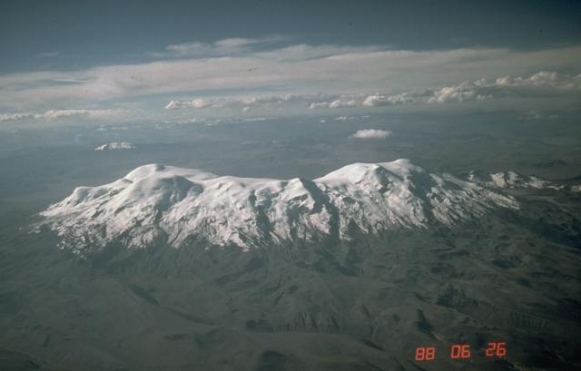
This is an incomplete list of mountains in the Andes that are known to have had pre-Columbian ascents. It is divided into those peaks for which there is direct evidence of an ascent to the summit, and those peaks where evidence has been found only at a lower altitude on the mountain. Ascents were made for religious purposes by groups affiliated with the Inca Empire. These ascents sometimes involved the ritual child sacrifice known as ''qhapaq hucha''. Mountains with known ascents to the summit Image:Coropuna.jpg, Coropuna, main summit on the left, Kasulla on the right. Image:Alto Toroni from the west.jpg, There is a large platform on the summit of Alto Toroni. Image:Licancabur volcano summit chile ii region.jpg, View of Licancabur from near San Pedro de Atacama. Image:Antofalla-sunset.jpg, Antofalla seen from the north. Image:Chozas dobles.jpg, Two small ruined dwellings at about 6700m on Llullaillaco seen from the summit. Mountains with evidence found at high altitude Ref ... [...More Info...] [...Related Items...] OR: [Wikipedia] [Google] [Baidu] |
Inca Empire
The Inca Empire, officially known as the Realm of the Four Parts (, ), was the largest empire in pre-Columbian America. The administrative, political, and military center of the empire was in the city of Cusco. The History of the Incas, Inca civilisation rose from the Peruvian highlands sometime in the early 13th century. The Portuguese explorer Aleixo Garcia was the first European to reach the Inca Empire in 1524. Later, in 1532, the Spanish Empire, Spanish began the conquest of the Inca Empire, and by 1572 Neo-Inca State, the last Inca state was fully conquered. From 1438 to 1533, the Incas incorporated a large portion of western South America, centered on the Andes, Andean Mountains, using conquest and peaceful assimilation, among other methods. At its largest, the empire joined modern-day Peru with what are now western Ecuador, western and south-central Bolivia, northwest Argentina, the southwesternmost tip of Colombia and Incas in Central Chile, a large portion of modern- ... [...More Info...] [...Related Items...] OR: [Wikipedia] [Google] [Baidu] |
Copiapó (volcano)
Copiapó, also known as Azufre, is a stratovolcano located in the Atacama Region of Chile. The volcano separates the two portions in which Nevado Tres Cruces National Park is divided. In its vicinity lies Ojos del Salado. At its summit an Inca platform can be found. Dacitic volcanism occurred at this centre 11-7 million years ago and covered a surface of . The Valle Ancho fault can be traced beneath this volcano. The main cone is formed by dacites and block and ash flows that were later intruded by dacitic porphyries, associated with hydrothermal alteration. A smaller centre formed on the northern side of the main cone, as well as thick () ignimbrites in two units. A complex of lava domes lies at their southern-eastern end with more hydrothermally altered porphyric intrusions named Azufrera de Copiapo. The last activity 6-7 million years ago formed a shield overlying the lava dome complex and the San Roman dome. Obsidian from this volcanic area has been found in archeological ... [...More Info...] [...Related Items...] OR: [Wikipedia] [Google] [Baidu] |
Coropuna
Coropuna is a Volcano#Dormant, dormant Complex volcano, compound volcano located in the Andes mountains of southeast-central Peru. The upper reaches of Coropuna consist of several snow field, perennially snowbound conical summits, lending it the name Nevado Coropuna in Spanish. The complex extends over an area of and its highest summit reaches an altitude of above sea level. This makes the Coropuna complex the List of mountains in Peru, third-highest of Peru. Its thick ice cap is the most extensive in Earth's Tropics, tropical zone, with several Glacier morphology#Outlet glaciers, outlet glaciers stretching out to lower altitudes. Below an elevation of , there are various vegetation belts which include trees, peat bogs, grasses and also Agricultural history of Peru, agricultural areas and pastures. The Coropuna complex consists of several stratovolcanoes. These are composed chiefly of ignimbrites and lava flows on a basement (geology), basement formed by Middle Miocene ignimbr ... [...More Info...] [...Related Items...] OR: [Wikipedia] [Google] [Baidu] |
Socompa
Socompa is a large stratovolcano (composite volcano) on the border of Argentina and Chile. It has an elevation of and is part of the Chilean and Argentine Andean Volcanic Belt (AVB). Socompa is within the Central Volcanic Zone, one of the segments of the AVB, which contains about 44 active volcanoes. It begins in Peru and runs first through Bolivia and Chile, and then Argentina and Chile. Socompa lies close to the pass of the same name where the Salta-Antofagasta railway crosses the Chilian border. Most of the northwestern slope of Socompa collapsed catastrophically 7,200 years ago to form an extensive debris avalanche deposit. The Socompa collapse is among the largest known on land with a volume of and a surface area of ; its features are well-preserved by the arid climate. The deposit was at first considered to be either a moraine or a pyroclastic flow deposit, until the 1980 eruption of Mount St. Helens prompted awareness of the instability of volcanic edifices and the ex ... [...More Info...] [...Related Items...] OR: [Wikipedia] [Google] [Baidu] |
Mercedario
Cerro Mercedario is the highest peak of the Cordillera de la Ramada range and the eighth-highest mountain of the Andes. It is located 100 km to the north of Aconcagua, in the Argentine province of San Juan. Ascent history It was first ascended on January 18, 1934, by and , members of a Polish andinist expedition led by Konstanty Jodko-Narkiewicz.Mercedario on andesargentinos.com.ar (In Spanish) The Polish party erected a on the summit. In 1968, after several attempts by some of the strongest Argentine climbers, a Japanese group led by Saburo Yoshida accomplished the first ascension of the south side. In 1971 an Austrian expedition led by Fritz Morave ... [...More Info...] [...Related Items...] OR: [Wikipedia] [Google] [Baidu] |
Aucanquilcha
Aucanquilcha is a massive stratovolcano located in the Antofagasta Region of northern Chile, just west of the border with Bolivia and within the Alto Loa National Reserve. Part of the Central Volcanic Zone of the Andes, the stratovolcano has the form of a ridge with a maximum height of . The volcano is embedded in a larger cluster of volcanoes known as the Aucanquilcha cluster. This cluster of volcanoes was formed in stages over eleven million years of activity with varying magma output, including lava domes and lava, lava flows. Aucanquilcha volcano proper is formed from four units that erupted between 1.04–0.23 million years ago. During the ice ages, both the principal Aucanquilcha complex and the other volcanoes of the cluster were subject to glaciation, resulting in the formation of moraines and cirques. The cluster has generated lava ranging in composition from andesite to dacite, with the main volcano being exclusively of dacitic composition. Systematic variations in tempe ... [...More Info...] [...Related Items...] OR: [Wikipedia] [Google] [Baidu] |
Aconcagua
Aconcagua () is a mountain in the Principal Cordillera of the Andes mountain range, in Mendoza Province, Argentina. It is the highest mountain in the Americas, the highest outside Asia, and the highest in both the Western Hemisphere and the Southern Hemisphere with a summit elevation of . It lies northwest of the provincial capital, the city of Mendoza, about from San Juan Province, and from Argentina's border with Chile. Aconcagua is one of the Seven Summits, the highest peaks on each of the seven continents. Aconcagua is bounded by the ''Valle de las Vacas'' to the north and east and the ''Valle de los Horcones Inferior'' to the west and south. The mountain and its surroundings are part of Aconcagua Provincial Park. The mountain has a number of glaciers. The largest glacier is the Ventisquero Horcones Inferior at about long, which descends from the south face to about in elevation near the Confluencia camp. Two other large glacier systems are the Ventisquero de l ... [...More Info...] [...Related Items...] OR: [Wikipedia] [Google] [Baidu] |
Cerro El Toro
Cerro El Toro is a mountain in the Andes located on the border between Argentina and Chile. It has an elevation of 6,168 m above sea level. Its territory is within the Argentinean protection areas of Provincial Reserve San Guillermo. The Argentinean side is at San Juan province, commune of Iglesia. Chilean side is at the Huasco province, and commune of Alto del Carmen. First Ascents Toro was first climbed by Incas in unknown dates. A mummy was found on the Argentine slopes in 1964. The first recorded post colonization ascent was by Antonio Beorchia Nigris (Italy), Jorge Enrique Varas and Sergio Fernandez (Argentina) in 02/26/1964. Elevation It has an official height of 6160 meters. Other data from available digital elevation models: SRTM yields 6148 metres, ASTER 6122 metres and TanDEM-X 6184 metres. The height of the nearest key col is 4326 meters, leading to a topographic prominence of 1842 meters. Toro is considered a Mountain Range according to the ''Dominance System'' ... [...More Info...] [...Related Items...] OR: [Wikipedia] [Google] [Baidu] |
Nevado Queva
Nevado Queva or Quewar is a volcano in the Andes mountain range of South America, located in the Salta Province of Argentina. Queva has a summit elevation of above sea level. Its name is alternately spelled Quehuar. There are extensive pre-Columbian ruins on the summit of the mountain, which is a broad crater. It stands as the tallest peak in Nevados de los Pastos Grandes and falls within the Argentinean Provincial Fauna Reserve Los Andes. It is located within the territory of the Argentinean province of Salta Province, Salta. Its slopes are within the administrative boundaries of the Argentinean city of San Antonio de los Cobres. File:Volcan Nevado de Quewar.jpg, Nevado de Quewar File:Queva_summit_ruins.jpg, Pre-Columbian ruins on the summit of Nevado Queva First Ascent Quewar was climbed by the Incas as evidenced by a platform measuring 80 square metres at the summit; this platform was first documented in the modern era in 1974 by Antonio Beorchia Nigris. The first recor ... [...More Info...] [...Related Items...] OR: [Wikipedia] [Google] [Baidu] |
Pular (volcano)
Pular is a volcanic massif in the northern Chilean Andes, in the Antofagasta Region north of Socompa volcano. It consists of the individual mountains Pajonales and Pular, which are among the highest mountains in the region and of great cultural importance to the neighbouring towns of Socaire and Peine. Pular and Pajonales have multiple volcanic craters and have produced lava domes. The mountains were active during the last three million years; whether there was any activity in historical times is unclear. The mountains are largely unglaciated in the present, owing to the dry climate, although groundwater originates on them. During the last glacial maximum, glacial advances left a girdle of moraines around the massif. Name and human importance In the Kunza language Pular means "The Eyebrow", and the name "Cordon Pular" refers to the entire Pular-Pajonales volcanic massif. Another name is "Palar" and the people of Peine call it "Tata Pilancho". An unrelated location named "Pula ... [...More Info...] [...Related Items...] OR: [Wikipedia] [Google] [Baidu] |
Pichu Pichu
Pichu Pichu is an inactive eroded volcano in the Andes of Peru, with seven summits; the highest reaches a height of . It lies east of the city Arequipa and together with its neighbours Misti and Chachani is part of the Central Volcanic Zone of the Andes. Pichu Pichu was active many millions of years ago, producing ignimbrites and lava flows with andesitic composition. During the last two million years, a gigantic landslide descended the western side of the volcano and left a large scar that runs north to south. Pichu Pichu bore glaciers during the last glacial maximum, which left moraines and other glacial landforms after they retreated. Presently, the mountain is covered with snow only during the summer months, when the monsoon brings precipitation from the Amazon; the last permanent ice disappeared during the last decades. Pichu Pichu is an important source of water for its surroundings. Parts of its flanks are forested, and numerous mammal species have been identified on the ... [...More Info...] [...Related Items...] OR: [Wikipedia] [Google] [Baidu] |
Paniri
Paniri (Aymara language, Aymara for "he who comes, visits") is a stratovolcano located in El Loa Province, Antofagasta Region, Chile, and near the border with Bolivia. To its northwest lie the twin volcanoes San Pedro (Chile volcano), San Pedro and San Pablo (volcano), San Pablo, and to its southeast lies Cerro del León, from which it is separated by the huge ''Cerro Chao, Chao'' lava dome. The volcano features lava flows, which are well preserved on the south-southwest flanks, and a scoria cone on its summit. The volcano has three volcanic crater, craters. Paniri also shows evidence of glacier activity on its southeastern slope. The volcano developed in several different stages with substages; the first stage formed a shield like volcano with most of its volume, the later ones formed the cone and "main edifice". One date obtained from the youngest stage is 150,000 years ago, with an uncertainty of 6,000 years. Once considered of Holocene or Pleistocene age, Paniri was later dete ... [...More Info...] [...Related Items...] OR: [Wikipedia] [Google] [Baidu] |


