|
Lampungese People
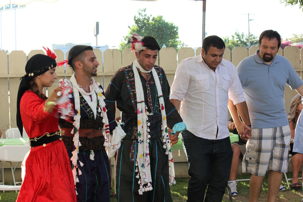
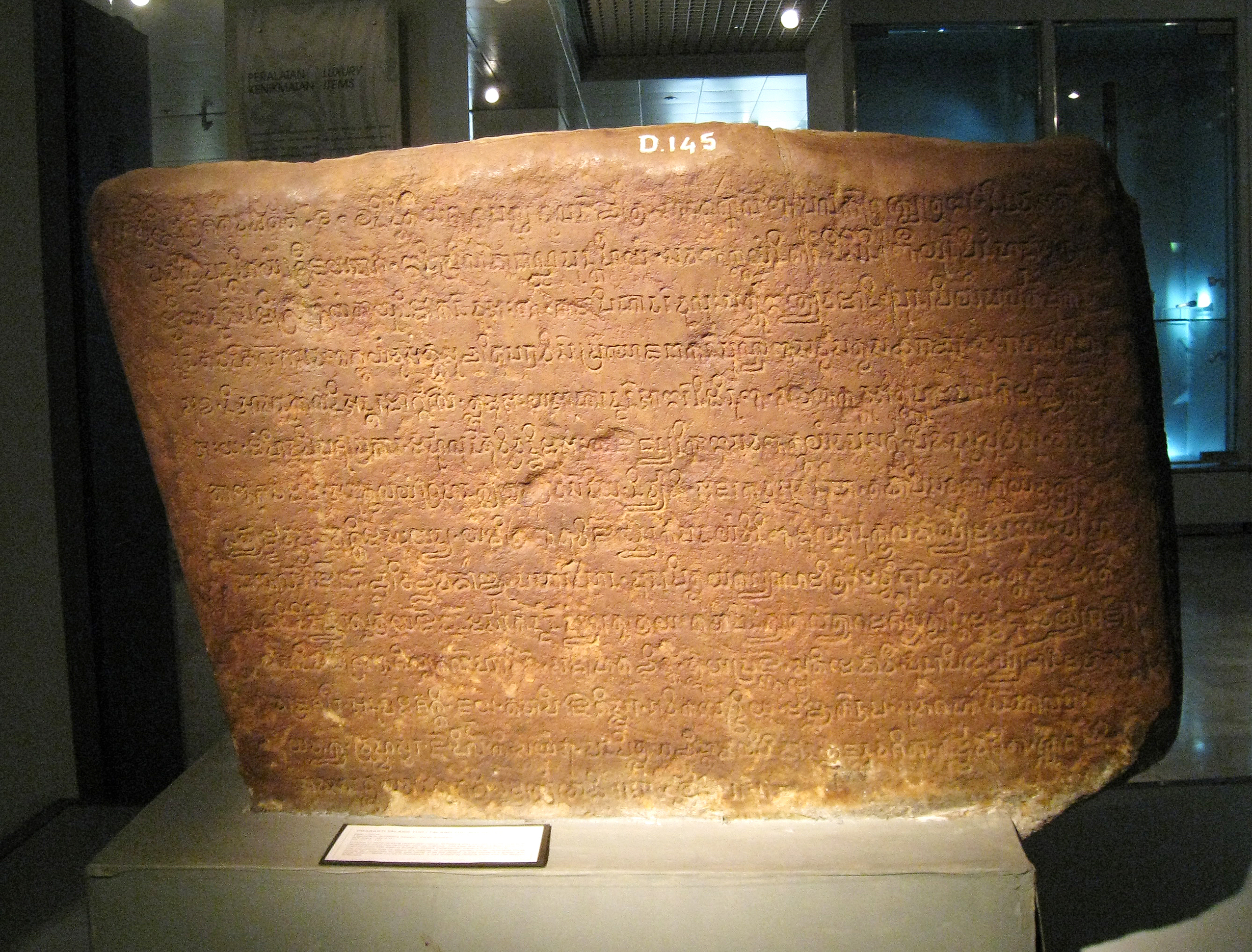
The Lampung or Lampungese (''Jamma Lampung'' ; ''Ulun Lappung'' ) are an indigenous ethnic group native to Lampung and some parts of South Sumatra (especially in Martapura region of East Ogan Komering Ulu Regency, Muaradua district of South Ogan Komering Ulu Regency, Kayu Agung district of Ogan Komering Ilir Regency), Bengkulu (in Merpas district of Kaur Regency), as well as in the southwest coast of Banten (in Cikoneng of Serang Regency). They speak the Lampung language, a Lampungic language estimated to have 1.5 million speakers. Origins The origins of the Lampung people is closely tied to the name of Lampung itself. In the 7th century the Chinese had already mentioned about a place in the south (''Nampang'') where it is said to be the place of the ''Tolang Pohwang'' kingdom, the location of the former kingdom's territory may now refer to the area of Tulang Bawang Regency or regions alongside the Tulang Bawang River, this is supported by Prof. Gabriel Ferrand (1918). There a ... [...More Info...] [...Related Items...] OR: [Wikipedia] [Google] [Baidu] |
Ethnic Group
An ethnicity or ethnic group is a group of people with shared attributes, which they collectively believe to have, and long-term endogamy. Ethnicities share attributes like language, culture, common sets of ancestry, traditions, society, religion, history or social treatment. Ethnicities may also have a narrow or broad spectrum of genetic ancestry, with some groups having mixed genetic ancestry. ''Ethnicity'' is sometimes used interchangeably with ''nation'', particularly in cases of ethnic nationalism. It is also used interchangeably with '' race'' although not all ethnicities identify as racial groups. By way of assimilation, acculturation, amalgamation, language shift, intermarriage, adoption and religious conversion, individuals or groups may over time shift from one ethnic group to another. Ethnic groups may be divided into subgroups or tribes, which over time may become separate ethnic groups themselves due to endogamy or physical isolation from the parent gr ... [...More Info...] [...Related Items...] OR: [Wikipedia] [Google] [Baidu] |
Taiping Huanyu Ji
The ''Taiping Huanyu Ji'' (), or "Universal Geography of the Taiping Era 76–983" is a 10th-century AD geographical treatise by Chinese scholar Yue Shi 樂史 (930–1007), written during the reign of Emperor Taizong of Song in the Northern Song dynasty.Endymion Wilkinson, ''Chinese History: A New Manual'', (Harvard University Asia Center, 2013), pp. 738, 760. Comprising 200 scrolls (or volumes), it has entries for nearly all areas of China at the time of its publication, complete with place-names and their etymologies. The work generally follows Tang dynasty systems of geographical and political designation, dividing China into 13 "Circuits" (), and then subdividing further into the more traditional "prefectures" () and "counties" (). Because it is largely based on Tang works, it constitutes an important source for the study of Tang geography.Endymion Wilkinson, ''Chinese History: A New Manual'' (2013), p. 738. The ''Taiping Huanyu Ji'' generally records places' populations ... [...More Info...] [...Related Items...] OR: [Wikipedia] [Google] [Baidu] |
South East Asia
Southeast Asia is the geographical United Nations geoscheme for Asia#South-eastern Asia, southeastern region of Asia, consisting of the regions that are situated south of China, east of the Indian subcontinent, and northwest of the Mainland Australia, Australian mainland, which is part of Oceania. Southeast Asia is bordered to the north by East Asia, to the west by South Asia and the Bay of Bengal, to the east by Oceania and the Pacific Ocean, and to the south by Australia (continent), Australia and the Indian Ocean. Apart from the British Indian Ocean Territory and two out of Atolls of the Maldives, 26 atolls of the Maldives in South Asia, Maritime Southeast Asia is the only other subregion of Asia that lies partly within the Southern Hemisphere. Mainland Southeast Asia is entirely in the Northern Hemisphere. Timor-Leste and the southern portion of Indonesia are the parts of Southeast Asia that lie south of the equator. The region lies near the intersection of Plate tectonics, ... [...More Info...] [...Related Items...] OR: [Wikipedia] [Google] [Baidu] |
Jambi
Jambi is a province of Indonesia. It is located on the east coast of central Sumatra Sumatra () is one of the Sunda Islands of western Indonesia. It is the largest island that is fully within Indonesian territory, as well as the list of islands by area, sixth-largest island in the world at 482,286.55 km2 (182,812 mi. ... and stretches to the Barisan Mountains in the west. Its capital and largest city is also called Jambi. It is bordered by the provinces of Riau to the north, West Sumatra to the west, Bengkulu to the southwest, South Sumatra to the south, and shares a maritime border with the Riau Islands to the east and the Pacific Ocean to the east. The province has a land area of 49,026.58 km2, and a sea area of 3,274.95 km2. Its area is comparable to the European country of Slovakia. It had a population of 3,092,265 according to the 2010 censusBiro Pusat Statistik, Jakarta, 2011. and 3,548,228 according to the 2020 census;Badan Pusat Statistik, Jaka ... [...More Info...] [...Related Items...] OR: [Wikipedia] [Google] [Baidu] |
Srivijaya
Srivijaya (), also spelled Sri Vijaya, was a Hinduism, Hindu-Buddhism, Buddhist thalassocracy, thalassocratic empire based on the island of Sumatra (in modern-day Indonesia) that influenced much of Southeast Asia. Srivijaya was an important centre for the expansion of Buddhism from the 7th to 11th century AD. Srivijaya was the first polity to dominate much of western Maritime Southeast Asia. Due to its location, Srivijaya developed complex technology utilizing maritime resources. In addition, its economy became progressively reliant on Maritime Silk Road, the booming trade in the region, thus transforming it into a luxury good, prestige goods-based economy. The earliest reference to it dates from the 7th century. A Tang dynasty Chinese people, Chinese Bhikkhu, monk, Yijing (monk), Yijing, wrote that he visited Srivijaya in 671 for six months. The earliest known inscription in which the name Srivijaya appears also dates from the 7th century in the Kedukan Bukit inscription fo ... [...More Info...] [...Related Items...] OR: [Wikipedia] [Google] [Baidu] |
Tulang Bawang River
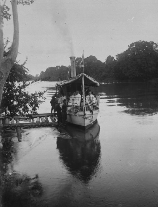
The Tulang Bawang River ( Lampungnese: ''Way Tulang Bawang'') is a river which mostly flows in Lampung, Indonesia. The river lends its name to the Tulang Bawang Regency, where it reaches the Java Sea and the West Tulang Bawang Regency. It also flows across the capital of the regency at Menggala. One of the largest rivers in the province, it is primarily utilized by locals as a source of irrigation with little use as a waterway. History Around the 1750s, the Dutch East India Company (VOC) competed with the British Empire and the more local Palembangese for influence in Lampung, particularly in the pepper trade. Initially they were seen as less desirable to the locals of Tulang Bawang due to their tendency to avoid local conflicts. In 1751 a Dutch post was assaulted and captured by a local prince. It was not until the mid-1800s when the Dutch East Indies managed to subjugate the locals and established formal administration over the banks. At the turn of the twentieth century, th ... [...More Info...] [...Related Items...] OR: [Wikipedia] [Google] [Baidu] |
Tulang Bawang Regency
Tulang Bawang Regency is a Regencies of Indonesia, regency (''kabupaten'') of Lampung Province, Sumatra, Indonesia. The regency was created on 3 January 1997 from the eastern half of North Lampung Regency; when created, it originally covered a much wider area, but on 29 October 2008 the seven northern districts were separated off to form a new Mesuji Regency, and the eight western districts were also separated off to form a new West Tulang Bawang Regency. It now has an area of and had a population of 397,906 at the 2010 CensusBiro Pusat Statistik, Jakarta, 2011. and 430,021 at the 2020 Census;Badan Pusat Statistik, Jakarta, 2021. the official estimate as at mid 2024 was 440,040.Badan Pusat Statistik, Jakarta, 28 February 2025, ''Kabupaten Tulang Bawang Dalam Angka 2025'' (Katalog-BPS 1102001.1808) The regency seat is the town of Menggala, located about from the provincial capital of Bandar Lampung. The regency takes its name from the Tulang Bawang River which flows through the pro ... [...More Info...] [...Related Items...] OR: [Wikipedia] [Google] [Baidu] |
Serang Regency
Serang Regency (Sundanese language, Sundanese: ) is a Regencies of Indonesia, regency of Banten province, Indonesia. It is located in the northwest corner of the island of Java. The administrative center of the regency is at Ciruas, while the capital of the province is the independent municipality of Serang (''Kota Serang'') which was split off the regency on 17 July 2007. Serang municipality is about 10 km from Old Banten, the eponymous former sultanate's capital. Merak, Banten, Merak, a major port and ferry terminal, is located at the northwest tip of Java, within the independent municipality of Cilegon, which was split off from the regency on 20 April 1999. Serang Regency and its semi-enclaved cities have experienced a heavy influx of residents as Jakarta continues its outward growth; some planning agencies consider it to be part of the metropolitan area. It shares its eastern border with Tangerang Regency of Jabodetabek. Serang Regency covers a land area of 1,469.92&nbs ... [...More Info...] [...Related Items...] OR: [Wikipedia] [Google] [Baidu] |
Kaur Regency
Kaur is the most southern regency of Bengkulu Province, Indonesia, on the west coast of the island of Sumatra. It was created on 25 February 2003 from what were formerly the southeastern districts of the South Bengkulu Regency. It has an area of 2,608.85 km2 and had a population of 107,899 at the 2010 CensusBiro Pusat Statistik, Jakarta, 2011. and 126,551 at the 2020 Census;Badan Pusat Statistik, Jakarta, 2021. the official estimate as at mid 2024 was 132,659 - comprising 68,148 males and 64,511 females.Badan Pusat Statistik, Jakarta, 28 February 2025, ''Kabupaten Kaur Dalam Angka 2025'' (Katalog-BPS 1102001.1704) The regency seat is at the town of Bintuhan. Administrative districts The Regency is divided into fifteen districts (), tabulated below with their areas and their populations at the 2010 CensusBiro Pusat Statistik, Jakarta, 2011. and the 2020 Census,Badan Pusat Statistik, Jakarta, 2021. together with the official estimates as at mid 2024.Badan Pusat Statistik, Ja ... [...More Info...] [...Related Items...] OR: [Wikipedia] [Google] [Baidu] |
Bengkulu
Bengkulu (), historically known as Bencoolen, is a province of Indonesia. It is located on the southwest coast of Sumatra. It was formed on 18 November 1968 by separating out the area of the historic Bencoolen Residency from the province of South Sumatra under Law No. 9 of 1967 and was finalized by Government Regulation No. 20 of 1968. Spread over 20,181.53 km2, its land area is comparable to the European country of Slovenia and it is bordered by the provinces of West Sumatra to the north, Jambi to the northeast, Lampung to the southeast, and South Sumatra to the east, and by the Indian Ocean to the northwest, south, southwest, and west. Bengkulu is the 28th largest province by area; it is divided into nine regencies and the city of Bengkulu, the capital and the only independent city. Bengkulu is also the 26th largest province by population in Indonesia, with 1,715,518 inhabitants at the 2010 CensusBiro Pusat Statistik, Jakarta, 2011. and 2,010,670 at the 2020 Census;B ... [...More Info...] [...Related Items...] OR: [Wikipedia] [Google] [Baidu] |


