|
Kuran Wa Munjan District
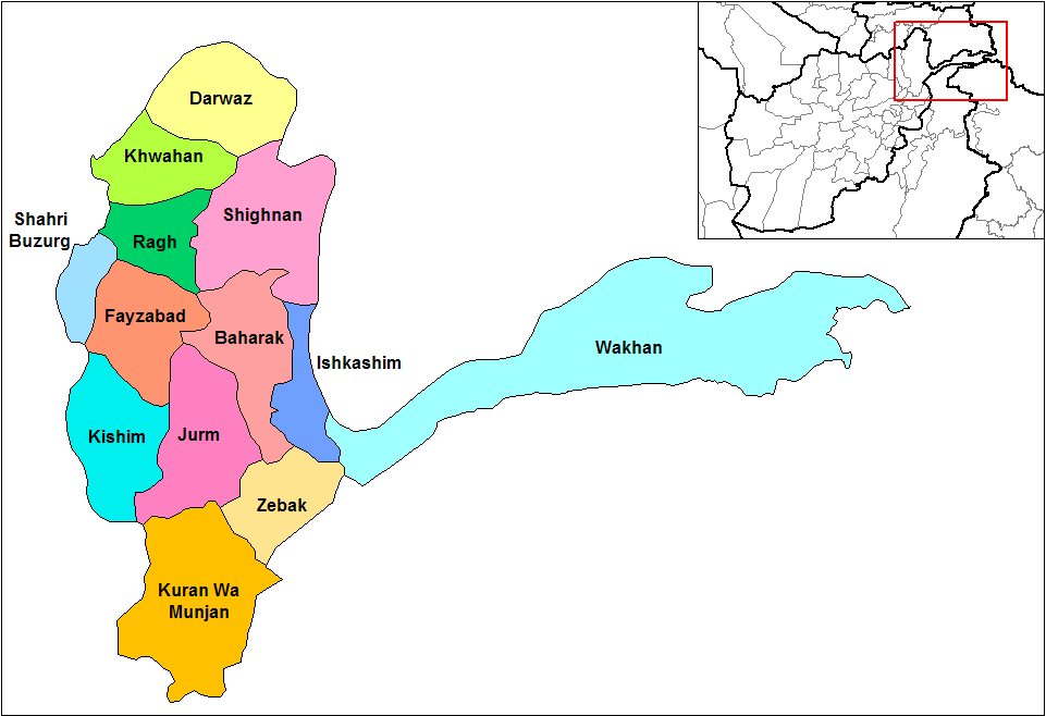
Kuran aw Munjan () is one of the 28 districts of Afghanistan, districts of Badakhshan province in eastern Afghanistan. Located in the Hindu Kush mountains, the district is home to approximately 8,000 residents. The district administrative center is Kuran wa Munjan. The district is in the southwest corner of the province, and is bordered on its northeast side by the Jurm District, Jurm and Zebak District, Zebak Districts. Most of the district borders other provinces of Afghanistan, Afghan provinces, but a very small section on the eastern edge of the district lies on the Durand Line, international border of Afghanistan and Pakistan. The epicenter of the October 26 October 2015 Hindu Kush earthquake, 2015 Hindu Kush earthquake was 45 km north of here. Famous valleys include the Koksha Valley nearby the Kokcha River, Koksha river, which is famous for its mines. References External linksMapat the Afghanistan Information Management Services [...More Info...] [...Related Items...] OR: [Wikipedia] [Google] [Baidu] |
Districts Of Afghanistan
The districts of Afghanistan, known as ''wuleswali'' (, ''wuləswāləi''; , ''wuləswālī''; ''ulasvolik''), are secondary-level administrative units, one level below Provinces of Afghanistan, provinces. The Afghan government issued its first district map in 1973. It recognized 325 districts, counting ''wuleswalis'' (districts), ''alaqadaries'' (sub-districts), and ''markaz-e-wulaiyat'' (provincial center districts). In the ensuing years, additional districts have been added through splits, and some eliminated through merges. In June 2005, the Afghan government issued a map of 398 districts. It was widely adopted by many information management systems, though usually with the addition of ''Sharak-e-Hayratan'' for 399 districts in total. It remains the ''de facto'' standard as of late 2018, despite a string of government announcements of the creation of new districts. The latest announced set includes 421 districts. The country's Central Statistics Office (CSO) and the Indepe ... [...More Info...] [...Related Items...] OR: [Wikipedia] [Google] [Baidu] |
Zebak District
Zebak () is one of the 29 districts of Afghanistan, districts of Badakhshan province in northeastern Afghanistan. It is home to an estimated 8,749 residents, most living in Zebak, Afghanistan, Zebak, the district's Capital (political), capital. Ishkashimi language, Sanglechi-Ishkashmi language, also referred to as ''Zebaki'', is spoken in the district. References External linksMap at the Afghanistan Information Management Services Districts of Badakhshan Province {{Badakhshan-geo-stub ... [...More Info...] [...Related Items...] OR: [Wikipedia] [Google] [Baidu] |
Kokcha River
The Kokcha River () is located in northeastern Afghanistan. A tributary of the Panj river, it flows through Badakhshan Province in the Hindu Kush. It is named after the Koksha Valley. The city of Feyzabad lies along the Kokcha. Near the village of Artin Jelow there is a bridge over the river. Course The Kokcha begins in Kuran wa Munjan District near the district center of Kuran wa Munjan and flows north, passing through Yamgan District and Jurm District. Near the village of Baharak, the Warduj river meets the Kokcha. The river then flows east, going around the northern border of Argo District and passing Feyzabad. Finally, the 320-km long Kokcha enters Takhar Province, flows around the southern border of Rustaq District, and discharges into the Amu Darya near Ai-Khanoum. See also *List of rivers of Afghanistan This is a list of rivers that flow wholly or partly in Afghanistan, arranged geographically by river basin. Flowing into the Arabian Sea *''Indus River ... [...More Info...] [...Related Items...] OR: [Wikipedia] [Google] [Baidu] |
Koksha Valley
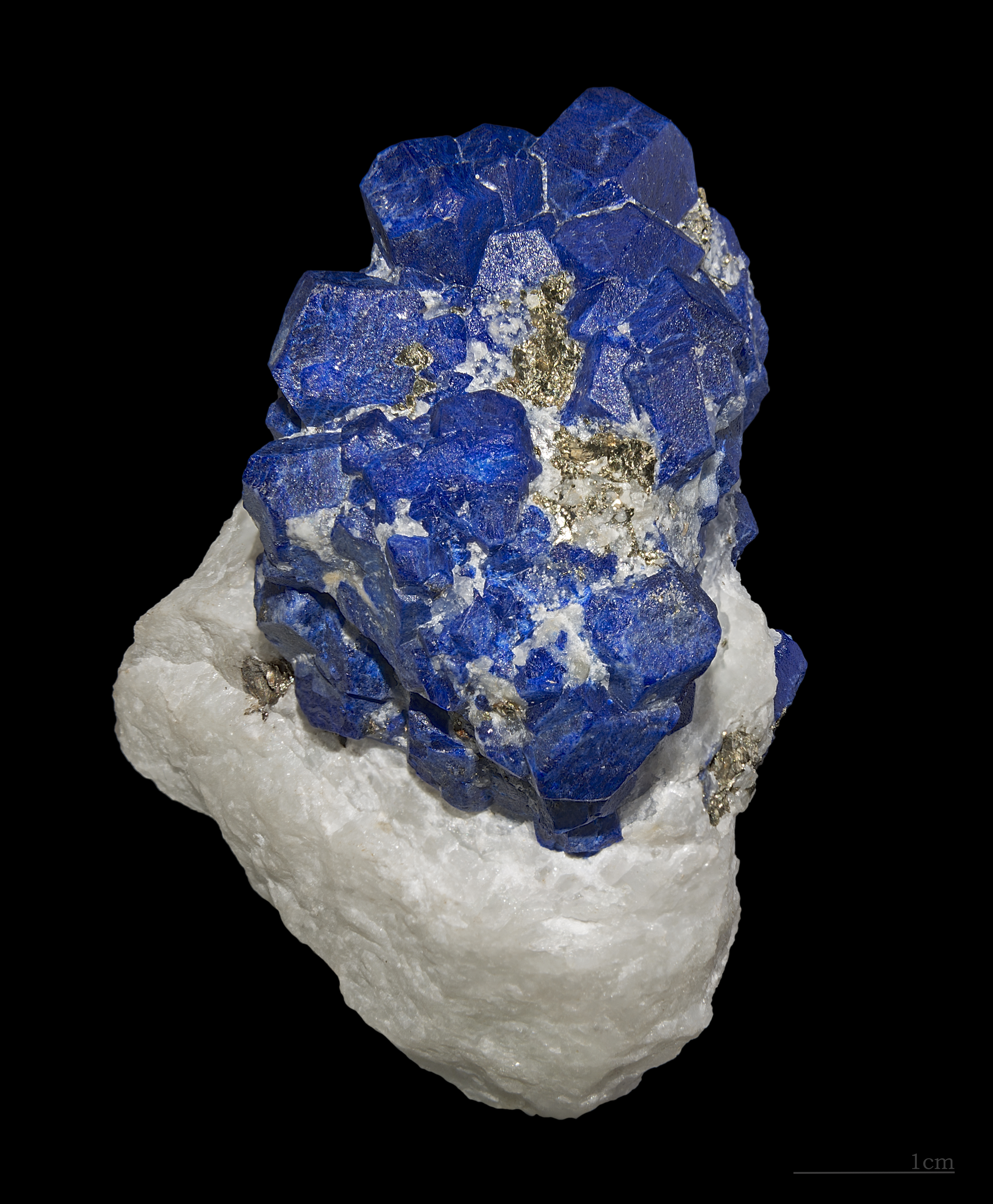
Koksha (, , ) is a valley located in Badakhshan Province's Kuran Wa Munjan District in Afghanistan. Koksha is famous for its lapis lazuli found in the mines of Sar-e-Sang since the 3rd millennium BC. Koksha Valley includes Mount Ladjuar. The main river is the Koksha River, the tributary in the valley. Parts of the valley are also located in Jurm District Jurm District (Dari: جرم) is one of the 28 districts of Badakhshan province in northeastern Afghanistan. The district capital is the town of Jorm. The district is 3 hours from the center of the province in Fayzabad, and is home to approximate .... References {{improve categories, date=September 2022 Badakhshan Province Valleys of Afghanistan Mines in Afghanistan ... [...More Info...] [...Related Items...] OR: [Wikipedia] [Google] [Baidu] |
United States Geological Survey
The United States Geological Survey (USGS), founded as the Geological Survey, is an agency of the U.S. Department of the Interior whose work spans the disciplines of biology, geography, geology, and hydrology. The agency was founded on March 3, 1879, to study the landscape of the United States, its natural resources, and the natural hazards that threaten it. The agency also makes maps of planets and moons, based on data from U.S. space probes. The sole scientific agency of the U.S. Department of the Interior, USGS is a fact-finding research organization with no regulatory responsibility. It is headquartered in Reston, Virginia, with major offices near Lakewood, Colorado; at the Denver Federal Center; and in NASA Research Park in California. In 2009, it employed about 8,670 people. The current motto of the USGS, in use since August 1997, is "science for a changing world". The agency's previous slogan, adopted on its hundredth anniversary, was "Earth Science in the Pub ... [...More Info...] [...Related Items...] OR: [Wikipedia] [Google] [Baidu] |
October 2015 Hindu Kush Earthquake
The October 2015 Hindu Kush earthquake was a magnitude 7.5 earthquake that struck South Asia on 26 October 2015, at 13:39 AFT (14:09 PKT; 14:39 IST; 09:09 UTC) with the epicenter 45 km north of Kuran wa Munjan, Afghanistan, at a depth of 231.0 km. By 5 November, it was estimated that at least 399 people were killed, mostly in Pakistan. Tremors were felt in Pakistan, Uzbekistan, Turkmenistan, Tajikistan and Kyrgyzstan. According to the United States Geological Survey (USGS), Pakistan is located in one of the most earthquake active zones in the world. The earthquake was also felt in New Delhi, in both Pakistan's Azad Kashmir territory, and the Indian state of Jammu and Kashmir and as far as Lucknow and in the prefectures of Kashgar, Aksu, Hotan, and Kizilsu in Xinjiang, China while damage was also reported in Afghan capital Kabul. The earthquake was also felt in the Nepalese capital of Kathmandu. Background The Himalayan mountains, pushed up by the collision of ... [...More Info...] [...Related Items...] OR: [Wikipedia] [Google] [Baidu] |
Pakistan
Pakistan, officially the Islamic Republic of Pakistan, is a country in South Asia. It is the List of countries and dependencies by population, fifth-most populous country, with a population of over 241.5 million, having the Islam by country#Countries, second-largest Muslim population as of 2023. Islamabad is the nation's capital, while Karachi is List of cities in Pakistan by population, its largest city and financial centre. Pakistan is the List of countries and dependencies by area, 33rd-largest country by area. Bounded by the Arabian Sea on the south, the Gulf of Oman on the southwest, and the Sir Creek on the southeast, it shares land borders with India to the east; Afghanistan to the west; Iran to the southwest; and China to the northeast. It shares a maritime border with Oman in the Gulf of Oman, and is separated from Tajikistan in the northwest by Afghanistan's narrow Wakhan Corridor. Pakistan is the site of History of Pakistan, several ancient cultures, including the ... [...More Info...] [...Related Items...] OR: [Wikipedia] [Google] [Baidu] |
Durand Line
The Durand Line (; ; ), also known as the Afghanistan–Pakistan border, is a international border between Afghanistan and Pakistan in South Asia. The western end runs to the border with Iran and the eastern end to the border with China. The Durand Line was established in 1893 as the international border between the Emirate of Afghanistan and the British Indian Empire by Mortimer Durand, a British diplomat of the Indian Civil Service, and Abdur Rahman Khan, the List of monarchs of Afghanistan, Emir of Afghanistan, to fix the limit of their respective Sphere of influence, spheres of influence and improve diplomatic relations and trade. Britain considered Afghanistan to be an independent state at the time, although they controlled its Ministry of Foreign Affairs (Afghanistan), foreign affairs and Foreign relations of Afghanistan, diplomatic relations. The single-page Agreement, dated 12 November 1893, contains seven short articles, including a commitment not to exercise Intervent ... [...More Info...] [...Related Items...] OR: [Wikipedia] [Google] [Baidu] |
Provinces Of Afghanistan
The provinces of Afghanistan ( ''Wilayah, wilāyat'') are the primary administrative divisions. Afghanistan is divided into 34 provinces. Each province encompasses a number of Districts of Afghanistan, districts or usually over 1,000 villages. Provincial governors played a critical role in the reconstruction of the Afghan state following the creation of the new government under Hamid Karzai. According to international security scholar Dipali Mukhopadhyay, many of the provincial governors of the western-backed government were former warlords who were incorporated into the political system. Provinces of Afghanistan Administrative The following table lists the province, capital, number of districts, UN region, region, ISO 3166-2:AF code and license plate code. Demographic The following table lists the province, population in 2024, area in square kilometers and population density. Regions of Afghanistan The following tables summarize data from the demographic ... [...More Info...] [...Related Items...] OR: [Wikipedia] [Google] [Baidu] |
Jurm District
Jurm District (Dari: جرم) is one of the 28 districts of Badakhshan province in northeastern Afghanistan. The district capital is the town of Jorm. The district is 3 hours from the center of the province in Fayzabad, and is home to approximately 41,910 residents. The highest point of the Afghan Hindu Kush The Hindu Kush is an mountain range in Central Asia, Central and South Asia to the west of the Himalayas. It stretches from central and eastern Afghanistan into northwestern Pakistan and far southeastern Tajikistan. The range forms the wester ... is located in Jurm District, at 6,729 meters. The district consists of population clusters and villages. Ferghamenj, Kyb, Kyteb, Ularyb, Ferghameru, Khustak, and Iskan are the clusters. Each cluster contain villages; the district is largely Tajik speaking. References External linksMapat the Afghanistan Information Management Services Districts of Badakhshan Province {{Badakhshan-geo-stub ... [...More Info...] [...Related Items...] OR: [Wikipedia] [Google] [Baidu] |
Countries Of The World
The following is a list providing an overview of sovereign states around the world with information on their status and recognition of their sovereignty. The 205 listed states can be divided into three categories based on membership within the United Nations System: 193 member states of the United Nations, UN member states, two United Nations General Assembly observers#Current non-member observers, UN General Assembly non-member observer states, and ten other states. The ''sovereignty dispute'' column indicates states having undisputed sovereignty (188 states, of which there are 187 UN member states and one UN General Assembly non-member observer state), states having disputed sovereignty (15 states, of which there are six UN member states, one UN General Assembly non-member observer state, and eight de facto states), and states having a political status of the Cook Islands and Niue, special political status (two states, both in associated state, free association with New ... [...More Info...] [...Related Items...] OR: [Wikipedia] [Google] [Baidu] |
Hindu Kush
The Hindu Kush is an mountain range in Central Asia, Central and South Asia to the west of the Himalayas. It stretches from central and eastern Afghanistan into northwestern Pakistan and far southeastern Tajikistan. The range forms the western section of the ''Hindu Kush Himalayan Region'' (''HKH''); to the north, near its northeastern end, the Hindu Kush buttresses the Pamir Mountains near the point where the borders of China, Pakistan and Afghanistan meet, after which it runs southwest through Pakistan and into Afghanistan near their border. The eastern end of the Hindu Kush in the north merges with the Karakoram Range. Towards its southern end, it connects with the White Mountains, Afghanistan, White Mountains near the Kabul River. It divides the valley of the Amu Darya (the ancient ''Oxus'') to the north from the Indus River valley to the south. The range has numerous high snow-capped peaks, with the highest point being Tirich Mir or Terichmir at in the Chitral District ... [...More Info...] [...Related Items...] OR: [Wikipedia] [Google] [Baidu] |


