|
Kinnaur District
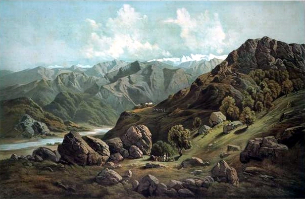
Kinnaur district () is a mountainous district located in the northeast part of the state of Himachal Pradesh, India. Kinnaur district borders Tibet (China) to the east, the state of Uttarakhand to the south, Shimla district to the southwest, Kullu district to the west, and Lahaul and Spiti district to the north. The administrative headquarters of the district is at Reckong Peo. History Over the 10th-11th centuries A.D., Kinnaur was a part of the Guge kingdom. The Guge kingdom broke apart in the 12th century, and the Bushahr state arose in the Western Himalayas, taking over most parts of present-day Kinnaur. The Bushahr state originated in the Kamru village of Sangla valley. However, the uppermost part of Kinnaur remained under Tibetan influence until the late 17th century, when it was handed over to the Bushahr state by the Tibetans as a reward for assistance in the Tibet-Ladakh-Mughal War. The Bushahr state shifted its capital to Sarahan, and later still to Rampur, wh ... [...More Info...] [...Related Items...] OR: [Wikipedia] [Google] [Baidu] |
List Of Districts Of Himachal Pradesh
The northern India, Indian state of Himachal Pradesh is divided into 12 districts, the Revenue department of which is headed by a Deputy Commissioner (India), Deputy Commissioner or District Magistrate, an officer belonging to the Indian Administrative Service. The district magistrate or the deputy commissioner is assisted by a number of officers belonging to Himachal Administrative Service and other Himachal state services. A District Judge serves as the head of the Judiciary of the district. Courts subordinate to him include those of the Civil Judges, Senior Civil Judges, and Judicial Magistrates. A Superintendent of Police (India), Superintendent of Police, an officer belonging to the Indian Police Service is entrusted with the responsibility of maintaining law and order and related issues of the district. He is assisted by the officers of the Himachal Police Service and other Himachal Police officials. A Deputy Conservator of Forests, an officer belonging to the Indian Fo ... [...More Info...] [...Related Items...] OR: [Wikipedia] [Google] [Baidu] |
Guge
Guge () was an ancient dynastic kingdom in Western Tibet. The kingdom was centered in present-day Zanda County, Ngari Prefecture, Tibet Autonomous Region. At various points in history after the 10th century AD, the kingdom held sway over a vast area including south-eastern Zanskar, Kinnaur district, and Spiti Valley, either by conquest or as tributaries. The ruins of the former capital of the Guge kingdom are located at Tsaparang in the Sutlej valley, not far from Mount Kailash and west from Lhasa. History Founding Guge was founded in the 10th century. Its capitals were located at Tholing and Tsaparang. Kyide Nyimagon, a great-grandson of Langdarma, the last monarch of the Tibetan Empire, fled to Ngari Prefecture, Ngari (West Tibet) from the insecure conditions in Ü-Tsang in 910. He established a kingdom around 912, annexing Burang County, Purang and Guge. He established his capital in Guge. Nyimagon later divided his lands into three parts. The king's eldest son Lhachen ... [...More Info...] [...Related Items...] OR: [Wikipedia] [Google] [Baidu] |
Zanskar Range
The Zanskar Range is a mountain range in the union territory of Ladakh that separates the Zanskar valley from Indus valley at Leh. The range lies between and runs parallel to the Great Himalayas to the southwest and the Ladakh Range to the northeast. Geologically, the Zanskar Range is part of the Tethys Himalaya. There are a number of peaks higher than . Its eastern part is known as Rupshu. Geography The Zanskar range spans from the Karcha (Suru) River near Kargil in the northwest to Tso Kar in the southeast. The range separates Indus Valley from the Zanskar Valley. The range is divided from the main Himalaya by the Stod, Tsarap and Zanskar Valleys. The Zanskar River cuts a deep gorge into the range. Passes in the range include Fotu La (on the Leh-Srinagar road), Wakha La, Kanji La, Charchar La, Ruberang La, and Taglang La. Zanskar mountain range.jpg, Zanskar Range, sunrise at Rangdum Padum Road Shingo La Zanskar Oct22 A7C 03574.jpg, Shingo La, view north ... [...More Info...] [...Related Items...] OR: [Wikipedia] [Google] [Baidu] |
Sutlej River
The Sutlej River or the Satluj River is a major river in Asia, flowing through China, India and Pakistan, and is the longest of the five major rivers of the Punjab region. It is also known as ''Satadru''; and is the easternmost tributary of the Indus River. The combination of the Sutlej and Chenab rivers in the plains of Punjab forms the Panjnad, which finally flows into the Indus River at Mithankot. In India, the Bhakra Dam is built around the river Sutlej to provide irrigation and other facilities to the states of Punjab, Rajasthan and Haryana. The waters of the Sutlej are allocated to India under the Indus Waters Treaty between India and Pakistan, and are mostly diverted to irrigation canals in India like the Sirhind Canal, Bhakra Main Line and the Rajasthan canal. The mean annual flow is 14 million acre feet (MAF) (roughly 1.727 × 10¹³ L) upstream of Ropar barrage, downstream of the Bhakra dam. It has several major hydroelectric points, including the ... [...More Info...] [...Related Items...] OR: [Wikipedia] [Google] [Baidu] |
India
India, officially the Republic of India, is a country in South Asia. It is the List of countries and dependencies by area, seventh-largest country by area; the List of countries by population (United Nations), most populous country since 2023; and, since its independence in 1947, the world's most populous democracy. Bounded by the Indian Ocean on the south, the Arabian Sea on the southwest, and the Bay of Bengal on the southeast, it shares land borders with Pakistan to the west; China, Nepal, and Bhutan to the north; and Bangladesh and Myanmar to the east. In the Indian Ocean, India is near Sri Lanka and the Maldives; its Andaman and Nicobar Islands share a maritime border with Thailand, Myanmar, and Indonesia. Modern humans arrived on the Indian subcontinent from Africa no later than 55,000 years ago., "Y-Chromosome and Mt-DNA data support the colonization of South Asia by modern humans originating in Africa. ... Coalescence dates for most non-European populations averag ... [...More Info...] [...Related Items...] OR: [Wikipedia] [Google] [Baidu] |
India's Independence Day
Independence Day is celebrated annually on 15 August as a public holiday in India commemorating the nation's independence from the United Kingdom on 15 August 1947. On this day the Indian Independence Act 1947 came into effect, transferring legislative sovereignty to the Indian Constituent Assembly. India attained independence following the independence movement noted for largely non-violent resistance and civil disobedience led by Indian National Congress under the leadership of Mahatma Gandhi. Independence coincided with the partition of India, in which British India was divided into the Dominions of India and Pakistan; the partition was accompanied by violent riots and mass casualties. On 15 August 1947, the first Prime Minister of India, Jawaharlal Nehru raised the Indian national flag above the Lahori Gate of the Red Fort in Delhi. On each subsequent Independence Day, the incumbent Prime Minister customarily raises the flag and gives an address to the nation.PTI ( ... [...More Info...] [...Related Items...] OR: [Wikipedia] [Google] [Baidu] |
Rampur, Himachal Pradesh
Rampur Bushahr is a town and a municipal council in Shimla district in the Indian state of Himachal Pradesh. It is about 130 km from Shimla and is well connected with NH 5 which passes through Theog, Narkanda and Kumarsain. History The principality of Bushahr (also known as Bashahar, Bushahar, Bashahr) was once among the largest of the twenty-eight Shimla Hill States under the administration of the British Raj keen to invest on regional and transcontinental trade and exploit Himalayan resources. Caught in one of the British imperial enterprise, it was subjected to political-cum-economic vicissitudes, acceding to the Indian Union in 1947. On 8 March 1948, along with twenty other princely hill States of Punjab and Shimla, Bashahr signed an agreement which resulted in its inclusion in the Indian State of Himachal Pradesh. Rampur, a small township situated at 1,005 meters on the left bank of the Sutlej, served as Bushahar's winter capital. Being well connected with major tr ... [...More Info...] [...Related Items...] OR: [Wikipedia] [Google] [Baidu] |
Sarahan
Sarahan is a small town in Himachal Pradesh of India. It is the site of the Bhimakali Temple, originally known as Bhimadevi Temple (Bhīmā Kālī), dedicated to the mother goddess Bhimakali, presiding deity of the rulers of the former Bushahr State. The temple is situated about 170 kilometres from Shimla and is one of 51 Shakti Peethas. The town is known as the "gateway of Kinnaur" it being near the old Indo-Tibetan Road. Seven kilometers below (17 km by road) Sarahan is the river Satluj. Sarahan is identified with the Shonitpur mentioned in Puranas. Sarahan Bushahr has been the summer capital of Bushahr kingdom, with Rampur Bushahr considered the winter capital. The former Chief Minister of Himachal Pradesh Shree Virbhadra Singh is a member of royal family (Son of erstwhile king Padam Singh) and is popularly known as "Raja Sahab" at Sarahann. He has been member of the Assembly/Parliament since 1962 and has held the post of Chief Minister six times. His wife Rani Prat ... [...More Info...] [...Related Items...] OR: [Wikipedia] [Google] [Baidu] |
Sangla Valley
Sangla is a town in the Baspa Valley, in the Kinnaur District of Himachal Pradesh, India, close to the border with Tibet. It is the headquarter of the eponymous Sangla tehsil, and the primary town in the Baspa Valley which is also referred to as the Sangla Valley. Geography Sangla Valley or the Baspa Valley starts at Karcham and ends at Chitkul. Demographics According to the 2011 census, the population of Sangla was 2,224, with 1,125 males and 1,119 females giving it a sex ratio of 995. Around 219 were under the age of 6 years old, corresponding to about 10% of the population. About 62% of the population was scheduled tribes (ST), and around 24% was scheduled caste (SC). About 71% of the population was literate. The local people have a distinct culture and their own dialect, the Kinnauri language Kinnauri is the most widely used language in Kinnaur. The languages have seen different nomenclatures in written literature. Kinnauri was mentioned as Kunawaree (Gerard ... [...More Info...] [...Related Items...] OR: [Wikipedia] [Google] [Baidu] |


