|
Karkinitska And Dzharylgatska Bays
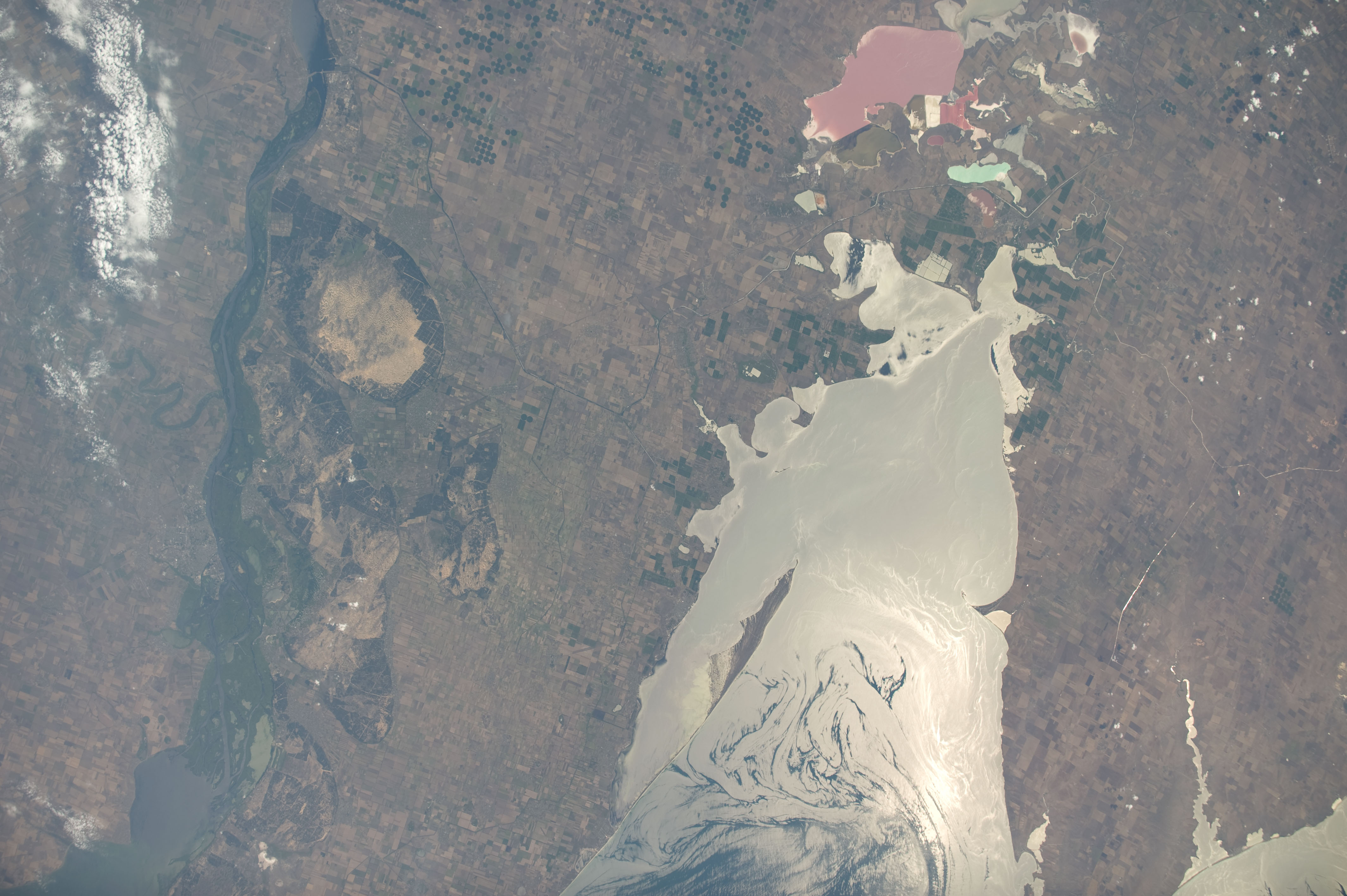
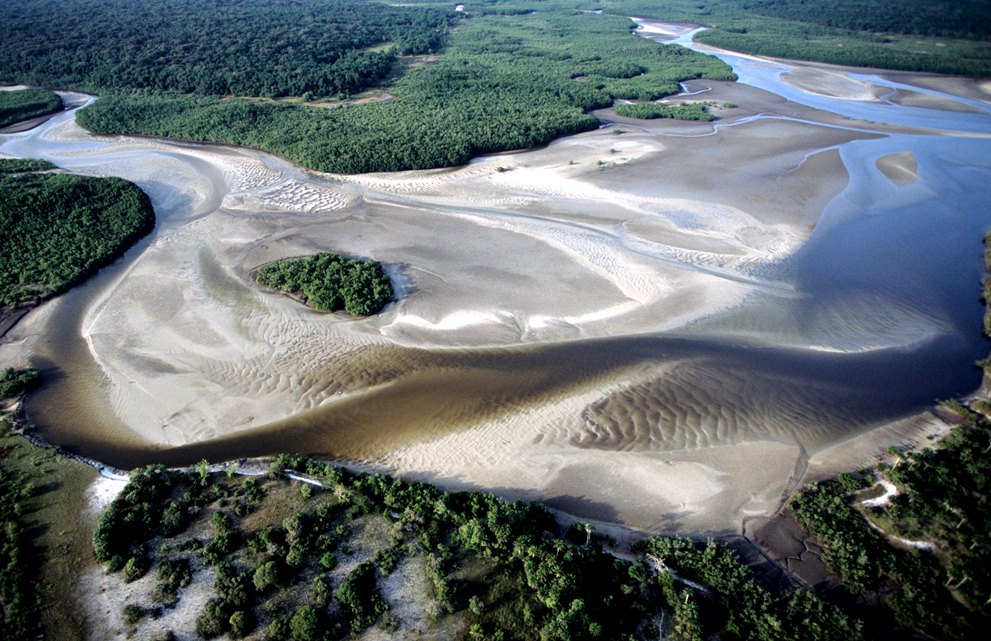
Karkinitska and Dzharylgatska Bays (also Karkinit and Dzharylgach Bays) is a RAMSAR site in Ukraine. The two bays (Karkinit Bay and () in the Northern reaches of the Black Sea between the Ukrainian mainland and Crimea include several island spits and the Dzharylhach island, one of the largest uninhabited islands in Europe. Human activities (fishing, hunting grazing, etc.) are allowed. Administratively, it is shared by the Kherson Region and the Autonomous Republic of Crimea. There are the Dzharylhach National Nature Park based on the Dzharylhach island and the surrounding waters and the ("Swan Islands") ornithological game reserve. See also *Karkinitsky Reserve * * References {{Wetlands of Ukraine Ramsar sites in Ukraine 1976 establishments in Ukraine Protected areas established in 1976 Ramsar sites in Russia ... [...More Info...] [...Related Items...] OR: [Wikipedia] [Google] [Baidu] |
Ukraine
Ukraine is a country in Eastern Europe. It is the List of European countries by area, second-largest country in Europe after Russia, which Russia–Ukraine border, borders it to the east and northeast. Ukraine also borders Belarus to the north; Poland and Slovakia to the west; Hungary, Romania and Moldova to the southwest; and the Black Sea and the Sea of Azov to the south and southeast. Kyiv is the nation's capital and List of cities in Ukraine, largest city, followed by Kharkiv, Odesa, and Dnipro. Ukraine's official language is Ukrainian language, Ukrainian. Humans have inhabited Ukraine since 32,000 BC. During the Middle Ages, it was the site of early Slavs, early Slavic expansion and later became a key centre of East Slavs, East Slavic culture under the state of Kievan Rus', which emerged in the 9th century. Kievan Rus' became the largest and most powerful realm in Europe in the 10th and 11th centuries, but gradually disintegrated into rival regional powers before being d ... [...More Info...] [...Related Items...] OR: [Wikipedia] [Google] [Baidu] |
Russia
Russia, or the Russian Federation, is a country spanning Eastern Europe and North Asia. It is the list of countries and dependencies by area, largest country in the world, and extends across Time in Russia, eleven time zones, sharing Borders of Russia, land borders with fourteen countries. Russia is the List of European countries by population, most populous country in Europe and the List of countries and dependencies by population, ninth-most populous country in the world. It is a Urbanization by sovereign state, highly urbanised country, with sixteen of its urban areas having more than 1 million inhabitants. Moscow, the List of metropolitan areas in Europe, most populous metropolitan area in Europe, is the capital and List of cities and towns in Russia by population, largest city of Russia, while Saint Petersburg is its second-largest city and Society and culture in Saint Petersburg, cultural centre. Human settlement on the territory of modern Russia dates back to the ... [...More Info...] [...Related Items...] OR: [Wikipedia] [Google] [Baidu] |
Ramsar Convention
The Ramsar Convention on Wetlands of International Importance Especially as Waterfowl Habitat is an international treaty for the conservation and sustainable use of Ramsar site, Ramsar sites (wetlands). It is also known as the Convention on Wetlands. It is named after the city of Ramsar, Mazandaran, Ramsar in Iran, where the convention was signed in 1971. Every three years, representatives of the contracting parties meet as the Ramsar Convention#Conference of the Contracting Parties, Conference of the Contracting Parties (COP), the policy-making organ of the wetland conservation, convention which adopts decisions (site designations, resolutions and recommendations) to administer the work of the convention and improve the way in which the parties are able to implement its objectives. In 2022, COP15 was held in Montreal, Canada. List of wetlands of international importance The list of wetlands of international importance included 2,531 Ramsar site, Ramsar sites in Februa ... [...More Info...] [...Related Items...] OR: [Wikipedia] [Google] [Baidu] |
ISS020-E-27184 - View Of Ukraine
The International Space Station (ISS) is a large space station that was Assembly of the International Space Station, assembled and is maintained in low Earth orbit by a collaboration of five space agencies and their contractors: NASA (United States), Roscosmos (Russia), European Space Agency, ESA (Europe), JAXA (Japan), and Canadian Space Agency, CSA (Canada). As the largest space station ever constructed, it primarily serves as a platform for conducting scientific experiments in microgravity and studying the space environment. The station is divided into two main sections: the Russian Orbital Segment (ROS), developed by Roscosmos, and the US Orbital Segment (USOS), built by NASA, ESA, JAXA, and CSA. A striking feature of the ISS is the Integrated Truss Structure, which connect the station’s vast system of solar panels and Spacecraft thermal control, radiators to its pressurized modules. These modules support diverse functions, including scientific research, crew habitation, ... [...More Info...] [...Related Items...] OR: [Wikipedia] [Google] [Baidu] |
RAMSAR Site
A Ramsar site is a wetland site designated to be of international importance under the Ramsar Convention,8 ha (O) *** Permanent 8 ha (P) *** Seasonal Intermittent < 8 ha(Ts) ** es on inorganic soils: *** Permanent (herb dominated) (Tp) *** Permanent / Seasonal / Intermittent (shrub dominated)(W) *** Permanent / Seasonal / Intermittent (tree dominated) (Xf) *** Seasonal/intermittent (herb dominated) (Ts) ** Marshes on soils: *** Permanent (non-forested)(U) *** Permanent (forested)(Xp) ** Marshes on inorganic or peat soils: *** Marshes on inorganic or peat soils / High altitude (alpine) (Va) *** Marshes on inorganic or peat soils / Tundra (Vt) * Saline, [...More Info...] [...Related Items...] OR: [Wikipedia] [Google] [Baidu] |
Karkinit Bay
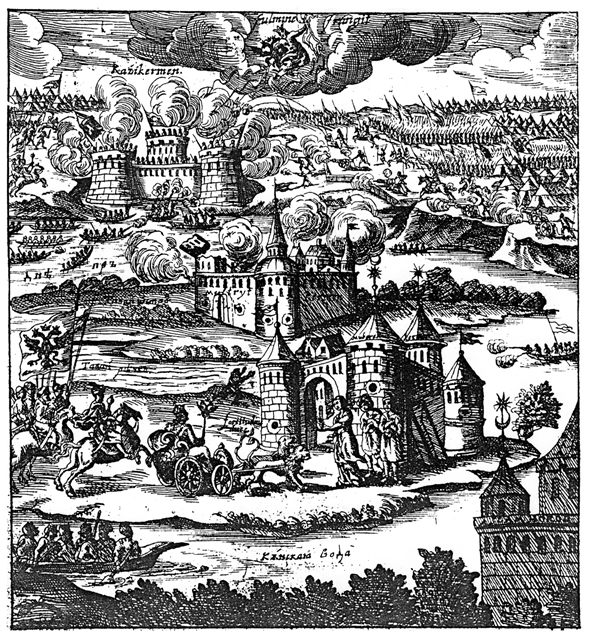
Karkinit, Karkinitski, Carcinites, or Karkinitsky Bay (, ''Karkinits'ka zatoka''; , ''Karkinitskiy zaliv'', ) is a bay of the Black Sea that separates the northwestern Crimean Peninsula from the mainland Ukraine. It was named after the early Greek settlement of Kerkinitis (Κερκινίτης) on the Crimean coast in place of modern Yevpatoria. The northeastern tip of the Karkinitis Bay, by the Isthmus of Perekop, is known as the Perekop Bay or Gulf of Perekop. The bay contains the preserve Karkinits'ka Zatoka State Zakaznik. On the Mercator 1569 world map, the bay is named as Golfo de Nigropoli after the city on north shores of the Pontus Euxeinus. Nigropoli was a city, which, as an 18th century source says "was located on the Silch River that flows into Pontus Euxeinus to the west of the Crimea and forms its own gulf"; the mentioned river most probably being Dnieper. According to Strabo, another name for the Gulf of Carcinites was the Gulf of Tamyraca.Strabo. The Geogr ... [...More Info...] [...Related Items...] OR: [Wikipedia] [Google] [Baidu] |
Black Sea
The Black Sea is a marginal sea, marginal Mediterranean sea (oceanography), mediterranean sea lying between Europe and Asia, east of the Balkans, south of the East European Plain, west of the Caucasus, and north of Anatolia. It is bounded by Bulgaria, Georgia (country), Georgia, Romania, Russia, Turkey, and Ukraine. The Black Sea is Inflow (hydrology), supplied by major rivers, principally the Danube, Dnieper and Dniester. Consequently, while six countries have a coastline on the sea, its drainage basin includes parts of 24 countries in Europe. The Black Sea, not including the Sea of Azov, covers , has a maximum depth of , and a volume of . Most of its coasts ascend rapidly. These rises are the Pontic Mountains to the south, bar the southwest-facing peninsulas, the Caucasus Mountains to the east, and the Crimean Mountains to the mid-north. In the west, the coast is generally small floodplains below foothills such as the Strandzha; Cape Emine, a dwindling of the east end ... [...More Info...] [...Related Items...] OR: [Wikipedia] [Google] [Baidu] |
Crimea
Crimea ( ) is a peninsula in Eastern Europe, on the northern coast of the Black Sea, almost entirely surrounded by the Black Sea and the smaller Sea of Azov. The Isthmus of Perekop connects the peninsula to Kherson Oblast in mainland Ukraine. To the east, the Crimean Bridge, constructed in 2018, spans the Strait of Kerch, linking the peninsula with Krasnodar Krai in Russia. The Arabat Spit, located to the northeast, is a narrow strip of land that separates the Syvash lagoons from the Sea of Azov. Across the Black Sea to the west lies Romania and to the south is Turkey. The population is 2.4 million, and the largest city is Sevastopol. The region, internationally recognized as part of Ukraine, has been under Russian occupation of Crimea, Russian occupation since 2014. Called the Tauric Peninsula until the early modern period, Crimea has historically been at the boundary between the Classical antiquity, classical world and the Pontic–Caspian steppe, steppe. Greeks in pre-Rom ... [...More Info...] [...Related Items...] OR: [Wikipedia] [Google] [Baidu] |
Dzharylhach
Dzharylhach (Cyrillic: Джарилгач, also spelled as Dzharylgach; Crimean Tatar: ) is a sand bank in Skadovsk Raion, Kherson Oblast near Crimea in Ukraine. Along with the Tendra island that lies to the west, in the past it was a spit that Greeks called "Course of Achilles". To the west it stretches as a spit and as a shoal, which sometimes dries up, and connects to the continental portion of Kherson Oblast near the town of Lazurne. The wider portion used to be called Tamyraca. It was named after an ancient town of Tamyraca located on the continent across the bay. Across from the island over the Dzharylhach Bay is the city of Skadovsk. Dzharylhach and its bay is part of the Dzharylhach National Nature Park. Its area of 56 km2 and length of 42 km make it the Black Sea's biggest sand bank, located at the Karkinit Bay. The island has clean sandy beaches and mineral springs. In the middle of the island there is a fresh water spring, and more than four hundred sm ... [...More Info...] [...Related Items...] OR: [Wikipedia] [Google] [Baidu] |
Kherson Region
Kherson Oblast (, ; ), also known as Khersonshchyna (, ), is an oblast (province) in southern Ukraine. It is located just north of Crimea. Its administrative center is Kherson, on the northern or right bank of the Dnieper river, which bisects the oblast. The oblast has an area of 28,461 km2 and a population of It is considered the 'fruit basket' of the country, as much of its agricultural production is dispersed throughout the country, with production peaking during the summer months. Most of the area of the oblast has been under Russian military occupation since early in the 2022 Russian invasion of Ukraine. In September 2022, Russia claimed to have annexed Kherson Oblast after arranging a disputed referendum. The referendum and the subsequent claimed annexation are internationally unrecognized. As the result of a counteroffensive operation, Ukrainian forces retook the whole area on the right bank of the Dnieper, including Kherson city, by mid-November 2022. History ... [...More Info...] [...Related Items...] OR: [Wikipedia] [Google] [Baidu] |
Autonomous Republic Of Crimea
The Autonomous Republic of Crimea is a ''de jure'' administrative division of Ukraine encompassing most of Crimea that was unilaterally annexed by Russia in 2014. The Autonomous Republic of Crimea occupies most of the peninsula,Regions and territories: The Republic of Crimea while the City of Sevastopol (a within Ukraine) occupies the rest. The |
Dzharylhach National Nature Park
The Dzharylhach National Nature Park () is a national park of Ukraine that covers Dzharylhach Island and the adjacent Karkinit Bay in the northern reaches of the Black Sea. Famous for clean sandy beaches and mineral springs in its many small lakes, Dzharylhach is the largest island in the Black Sea. During the Russian invasion of Ukraine, the region was occupied by Russians, who connected the island to the mainland, and then destroyed the national park. History Portions of the park have been protected nature reserves for almost 100 years, as the area is an environmentally sensitive representative of north Black Sea Coast nature habitat. Administratively, the park is in the Skadovsk District of Kherson Oblast. During the Russian invasion of Ukraine, the region has been occupied by Russia in March 2022. In the spring 2023 Russians have created a land bridge to the island and designed the region a military training area, while also opening it for commercial hunting. On 4-5 Augu ... [...More Info...] [...Related Items...] OR: [Wikipedia] [Google] [Baidu] |


