|
K-7 (Kansas Highway)
K-7 is a state highway in the U.S. state of Kansas. It is mostly a small country highway winding its way through the Osage Questas and Glaciated Regions of eastern Kansas, although a portion of the highway passes through the Kansas City metropolitan area. Significant portions of the highway overlap with U.S. Route 169 (US-169) and US-73. It also has junctions with two Interstate highways, Interstate 35 (I-35) in Olathe and I-70 in Bonner Springs. The portion of K-7 between Leavenworth and the Nebraska state line has been designated the "Glacial Hills Scenic Byway." Route description The Kansas Department of Transportation (KDOT) tracks the traffic levels on its highways, and in 2018, they determined that on average the traffic varied from 100 vehicles per day slightly south of the overlap with K-31 to 32200 vehicles per day slightly north of K-10 interchange. The AADT was 195 vehicles per day near the northern terminus and 2040 vehicles per day near the southern terminus. ... [...More Info...] [...Related Items...] OR: [Wikipedia] [Google] [Baidu] |
Kansas Department Of Transportation
The Kansas Department of Transportation (KSDOT) is a state government organization in charge of maintaining public roadways of the U.S. state of Kansas. Funding issues Since 2012, over $2 billion has been diverted from its coffers to the Kansas general fund and state agencies, earning it the nickname "the bank of KDOT", and jeopardizing the agency's ability to maintain roads in the state. Organization * Secretary of Transportation ** Deputy Secretary of Transportation **State Transportation Engineer *** Planning and Development Division *** Aviation Division *** Engineering and Design Division *** Operations Division **** District 1 – Topeka, Kansas, Topeka **** District 2 – Salina, Kansas, Salina **** District 3 – Norton, Kansas, Norton **** District 4 – Chanute, Kansas, Chanute **** District 5 – Hutchinson, Kansas, Hutchinson **** District 6 – Garden City, Kansas, Garden City ** Deputy Secretary of Transportation for Finance and Administration *** Finance Divisi ... [...More Info...] [...Related Items...] OR: [Wikipedia] [Google] [Baidu] |
Interstate 35 In Kansas
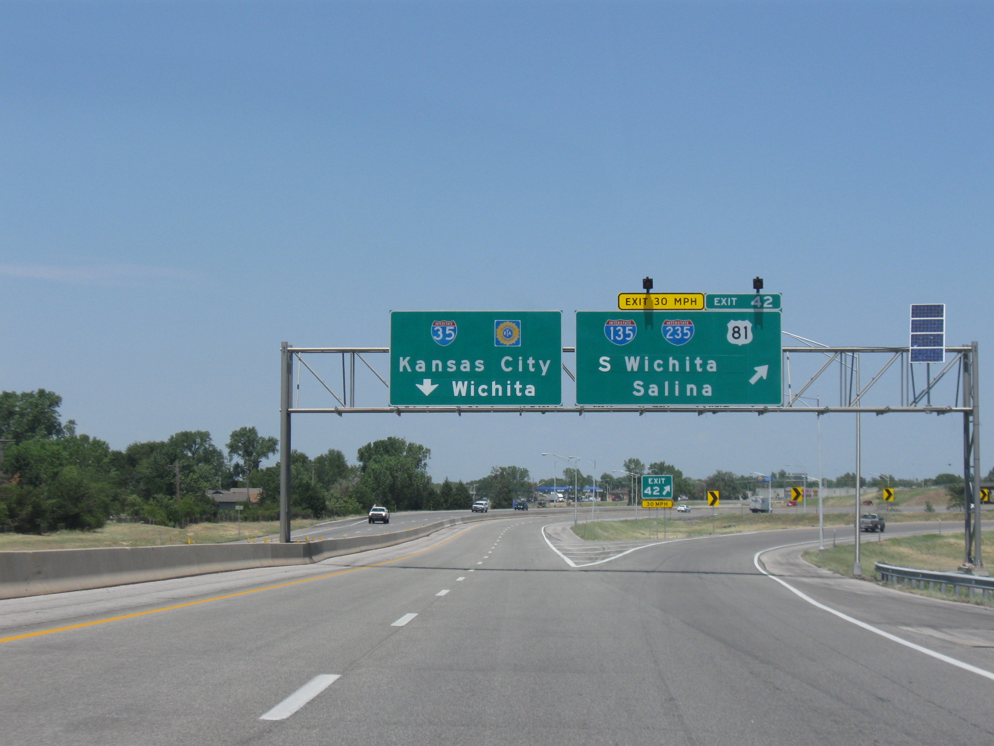
Interstate 35 (I-35) is an Interstate Highway in the US that runs from the Mexican border near Laredo, Texas, to Duluth, Minnesota. In Kansas, the highway goes from the Oklahoma border to Kansas City at the Missouri border, with a length of . Along the way, I-35 passes through Wichita, the state's largest city, linking it to Emporia, Ottawa, and Kansas City and its Johnson County suburbs. The section of the route from the Oklahoma border to I-335 is part of the Kansas Turnpike. Route description Oklahoma border to Emporia I-35 enters Kansas from Oklahoma where the southern terminus of the Kansas Turnpike is located. After passing U.S. Highway 166 (US-166, East 160th Street South, exit 4) to the east of South Haven, the Interstate passes through a toll plaza, making I-35 into a toll road. The highway then passes US-160 (East 10th Avenue, exit 19) east of Wellington, then the Belle Plaine Service Area, the first of three on I-35, and ... [...More Info...] [...Related Items...] OR: [Wikipedia] [Google] [Baidu] |
Concurrency (road)
In a road network, a concurrency is an instance of one physical roadway bearing two or more different route numbers. The practice is often economically and practically advantageous when multiple routes must pass between a single mountain crossing or over a bridge, or through a major city, and can be accommodated by a single right-of-way. Each route number is typically posted on highways signs where concurrencies are allowed, while some jurisdictions simplify signage by posting one priority route number on highway signs. In the latter circumstance, other route numbers disappear when the concurrency begins and reappear when it ends. In most cases, each route in a concurrency is recognized by maps and atlases. Terminology When two roadways share the same right-of-way, it is sometimes called a common section or commons. Other terminology for a concurrency includes overlap, coincidence, duplex (two concurrent routes), triplex (three concurrent routes), multiplex (any number of con ... [...More Info...] [...Related Items...] OR: [Wikipedia] [Google] [Baidu] |
Kansas City Metropolitan Area
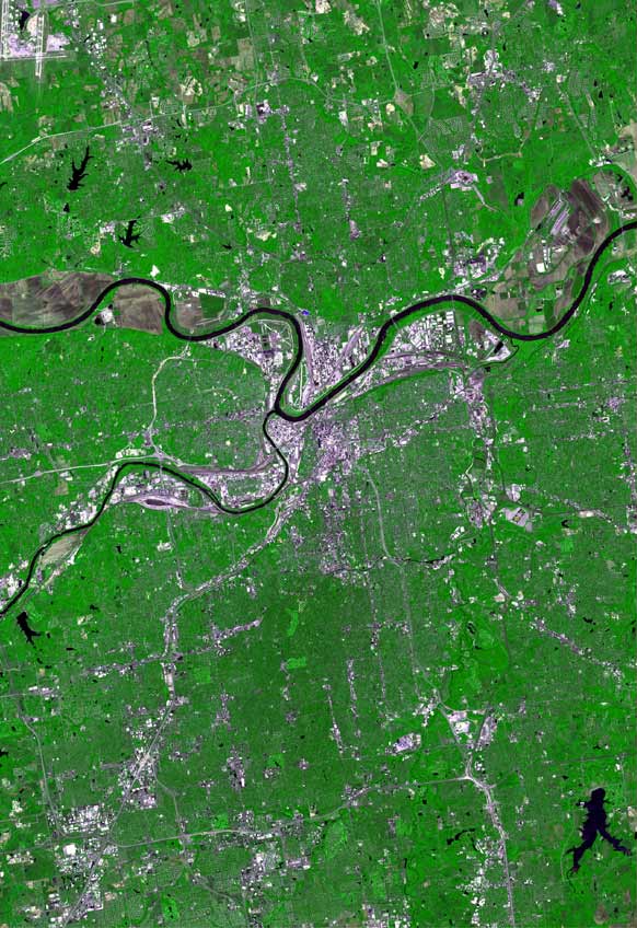
The Kansas City metropolitan area is a bi-state metropolitan area anchored by Kansas City, Missouri. Its 14 counties straddle the border between the U.S. states of Missouri (9 counties) and Kansas (5 counties). With and a population of more than 2.2 million people, it is the second-largest metropolitan area centered in Missouri (after Greater St. Louis) and is the largest metropolitan area in Kansas, though Wichita is the largest metropolitan area centered in Kansas. Alongside Kansas City, Missouri, these are the suburbs with populations above 100,000: Overland Park, Kansas; Kansas City, Kansas; Olathe, Kansas; Independence, Missouri; and Lee's Summit, Missouri. Business enterprises and employers include Oracle (formerly Cerner Corp), AT&T Inc., AT&T, BNSF Railway, GEICO, Asurion, T-Mobile US, T-Mobile (formerly Sprint Corporation, Sprint), Black & Veatch, AMC Theatres, Citigroup, Garmin, Hallmark Cards, Macquarie Group, Waddell & Reed, H&R Block, General Motors Corporation, G ... [...More Info...] [...Related Items...] OR: [Wikipedia] [Google] [Baidu] |
Kansas
Kansas ( ) is a landlocked U.S. state, state in the Midwestern United States, Midwestern region of the United States. It borders Nebraska to the north; Missouri to the east; Oklahoma to the south; and Colorado to the west. Kansas is named after the Kansas River, in turn named after the Kaw people, Kansa people. Its List of capitals in the United States, capital is Topeka, Kansas, Topeka, and its List of cities in Kansas, most populous city is Wichita, Kansas, Wichita; however, the largest urban area is the bi-state Kansas City metropolitan area split between Kansas and Missouri. For thousands of years, what is now Kansas was home to numerous and diverse Plains Indians, Indigenous tribes. The first settlement of non-indigenous people in Kansas occurred in 1827 at Fort Leavenworth. The pace of settlement accelerated in the 1850s, in the midst of political wars over the Slavery in the United States, slavery debate. When it was officially opened to settlement by the U.S. governm ... [...More Info...] [...Related Items...] OR: [Wikipedia] [Google] [Baidu] |
United States
The United States of America (USA), also known as the United States (U.S.) or America, is a country primarily located in North America. It is a federal republic of 50 U.S. state, states and a federal capital district, Washington, D.C. The 48 contiguous states border Canada to the north and Mexico to the south, with the semi-exclave of Alaska in the northwest and the archipelago of Hawaii in the Pacific Ocean. The United States asserts sovereignty over five Territories of the United States, major island territories and United States Minor Outlying Islands, various uninhabited islands in Oceania and the Caribbean. It is a megadiverse country, with the world's List of countries and dependencies by area, third-largest land area and List of countries and dependencies by population, third-largest population, exceeding 340 million. Its three Metropolitan statistical areas by population, largest metropolitan areas are New York metropolitan area, New York, Greater Los Angeles, Los Angel ... [...More Info...] [...Related Items...] OR: [Wikipedia] [Google] [Baidu] |
State Highway
A state highway, state road, or state route (and the equivalent provincial highway, provincial road, or provincial route) is usually a road that is either Route number, numbered or maintained by a sub-national state or province. A road numbered by a state or province falls below numbered national highways (Canada being Trans-Canada Highway#Jurisdiction and designation, a notable exception to this rule) in the hierarchy (route numbers are used to aid navigation, and may or may not indicate ownership or maintenance). Roads maintained by a state or province include both nationally numbered highways and un-numbered state highways. Depending on the state, "state highway" may be used for one meaning and "state road" or "state route" for the other. In some countries such as New Zealand, the word "state" is used in its sense of a sovereign state or country. By this meaning a state highway is a road maintained and numbered by the national government rather than local authorities. By co ... [...More Info...] [...Related Items...] OR: [Wikipedia] [Google] [Baidu] |
White Cloud, Kansas
White Cloud ( Ioway: ''Chína Maxúthga'' pronounced or ''Chína Maxúhga'' pronounced , meaning "Village Cloud-White") is a city in Doniphan County, Kansas, United States. As of the 2020 census, the population of the city was 115. It was named for Francis White Cloud, a son of Chief White Cloud of the Iowa people. White Cloud is the seat of government for the Iowa Tribe of Kansas and Nebraska. White Cloud is also the westernmost city in Kansas that is located on the Missouri River. History The first post office at White Cloud was established in July, 1855. In 1857, the town site was purchased by John Utt and Enoch Spaulding, two land promoters from Oregon, Missouri, who then sold lots in the town. White Cloud prospered by taking advantage of steamboat traffic on the nearby Missouri River. In 1913, ten-year-old Wilbur Chapman of White Cloud gained widespread publicity after raising and selling a pig for $25, which he donated to the American Mission to Lepers. An obel ... [...More Info...] [...Related Items...] OR: [Wikipedia] [Google] [Baidu] |
Nebraska
Nebraska ( ) is a landlocked U.S. state, state in the Midwestern United States, Midwestern region of the United States. It borders South Dakota to the north; Iowa to the east and Missouri to the southeast, both across the Missouri River; Kansas to the south; Colorado to the southwest; and Wyoming to the west. Nebraska is the List of U.S. states and territories by area, 16th-largest state by land area, with just over . With a population of over 2 million as of 2024, it is the List of U.S. states and territories by population, 38th-most populous state and the List of states and territories of the United States by population density, eighth-least densely populated. Its List of capitals in the United States, capital is Lincoln, Nebraska, Lincoln, and its List of municipalities in Nebraska, most populous city is Omaha, Nebraska, Omaha, which is on the Missouri River. Nebraska was admitted into the United States in 1867, two years after the end of the American Civil War. The Nebras ... [...More Info...] [...Related Items...] OR: [Wikipedia] [Google] [Baidu] |
Troy, Kansas
Troy is a city in and the county seat of Doniphan County, Kansas, United States. As of the 2020 census, the population of the city was 964. History Troy is part of the St. Joseph, MO–KS Metropolitan Statistical Area. Troy was platted in 1855. It was named after the ancient city of Troy. The first house in Troy was built in 1856, and the first store opened in 1857. Troy was incorporated as a city in 1860. The first post office in Troy was established in March, 1857. Troy grew up from humble beginnings along the wagon route from St. Joseph, Missouri to Oregon and California. British explorer Richard Francis Burton en route to California in 1860 noted: "Passing through a few wretched shanties called Troy ..." Geography According to the United States Census Bureau, the city has a total area of , of which is land and is water. Climate Demographics 2020 census As of the census of 2020, there were 964 people and 375 households in the city. The racial makeup of ... [...More Info...] [...Related Items...] OR: [Wikipedia] [Google] [Baidu] |
Bonner Springs, Kansas
Bonner Springs is a city in Wyandotte, Leavenworth, and Johnson counties, Kansas, United States. It is part of the Kansas City, Missouri Metro Area. As of the 2020 census, the population of the city was 7,837. Bonner Springs was incorporated as a city on November 10, 1898. Bonner Springs is home to the Azura Amphitheater (previously named the Sandstone Amphitheater), the National Agricultural Center and Hall of Fame, Wyandotte County Historical Museum, and the annual Kansas City Renaissance Festival. History Coronado Spanish explorer Francisco Vázquez de Coronado spent the winter of 1541-1542 at what is now the area of Bonner Springs. The diary of Father Juan Padilla records that the expedition reached the 40th degree (Kansas northern border) and came to a great river (the Missouri). An inscription found on a stone near Atchison has been translated as, "Thus far came Francisco de Coronado, General of an Expedition." The explorers traveled downstream to the mouth of ... [...More Info...] [...Related Items...] OR: [Wikipedia] [Google] [Baidu] |


