|
Islamic Rebellion In Xinjiang (1937)
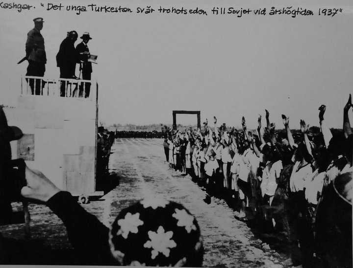
In 1937, 1,500 Uyghur Muslim rebels under the command of Kichik Akhund rebelled in southern Xinjiang against the pro-Soviet forces of Sheng Shicai. The rebels were tacitly aided by the New 36th Division of the Chinese National Revolutionary Army. Start Sheng Shicai had moved against Divisional General Mahmut Muhiti, the commander-in-chief of the 6th Uyghur Division and the deputy chief of the Kashgar Military Region. Muhiti resented the increased Soviet influence and formed a secret group around himself. Sheng feared that Muhiti had allied with Chinese General Ma Hu-shan, a Muslim. However, the Uyghurs of Kashgar heard hostile reports on Ma from Uyghur refugees from Khotan who suffered under him. Muhiti fled Kashgar on April 2, 1937, with a small number of his subordinates and some amount of gold to British India via Yengi Hissar and Yarkand. Soon before his departure, he had sent a message to Ma Hu-Shan about his proposed arrival at Khotan. In response, Ma ordered ... [...More Info...] [...Related Items...] OR: [Wikipedia] [Google] [Baidu] |
Xinjiang Wars
The Xinjiang Wars () were a series of armed conflicts which took place within Xinjiang Province, Republic of China, Xinjiang in the Republic of China (1912–1949), Republic of China during the Warlord Era, Chinese Civil War, and modern era. The wars also played an important role in the East Turkestan independence movement. * Kumul Rebellion, Kumul Rebellion (1931–1934) ** Kirghiz rebellion, Kirghiz rebellion (1932) ** Battle of Aksu (1933) ** Kizil massacre, Kizil massacre (1933) ** Battle of Sekes Tash, Battle of Sekes Tash (1933) ** Battle of Kashgar (1933) ** Battle of Ürümqi (1933) ** Battle of Toksun, Battle of Toksun (1933) ** Battle of Ürümqi (1933), First Battle of Ürümqi (1933) ** Battle of Ürümqi (1933–1934), Second Battle of Ürümqi (1933–1934) ** Battle of Kitai, Battle of Kitai (1934) ** Battle of Kashgar (1934) ** Battle of Yangi Hissar, Battle of Yangi Hissar (1934) ** Battle of Yarkand, Battle of Yarkand (1934) ** Battle of Khotan ** Battle of Tutun ... [...More Info...] [...Related Items...] OR: [Wikipedia] [Google] [Baidu] |
Uighurs
The Uyghurs,. alternatively spelled Uighurs, Uygurs or Uigurs, are a Turkic ethnic group originating from and culturally affiliated with the general region of Central Asia and East Asia. The Uyghurs are recognized as the titular nationality of the Xinjiang Uyghur Autonomous Region in Northwest China. They are one of China's 55 officially recognized ethnic minorities. The Uyghurs have traditionally inhabited a series of oases scattered across the Taklamakan Desert within the Tarim Basin. These oases have historically existed as independent states or were controlled by many civilizations including China, the Mongols, the Tibetans, and various Turkic polities. The Uyghurs gradually started to become Islamized in the 10th century, and most Uyghurs identified as Muslims by the 16th century. Islam has since played an important role in Uyghur culture and identity. An estimated 80% of Xinjiang's Uyghurs still live in the Tarim Basin. The rest of Xinjiang's Uyghurs mostly live ... [...More Info...] [...Related Items...] OR: [Wikipedia] [Google] [Baidu] |
Srinagar
Srinagar (; ) is a city in Indian-administered Jammu and Kashmir in the disputed Kashmir region.The application of the term "administered" to the various regions of Kashmir and a mention of the Kashmir dispute is supported by the tertiary sources (a) through (d), reflecting due weight in the coverage. Although "controlled" and "held" are also applied neutrally to the names of the disputants or to the regions administered by them, as evidenced in sources (f) through (h) below, "held" is also considered politicised usage, as is the term "occupied," (see (i) below). (a) (subscription required) Quote: "Kashmir, region of the northwestern Indian subcontinent ... has been the subject of dispute between India and Pakistan since the partition of the Indian subcontinent in 1947. The northern and western portions are administered by Pakistan and comprise three areas: Azad Kashmir, Gilgit, and Baltistan, the last two being part of a territory called the Northern Areas. Administered ... [...More Info...] [...Related Items...] OR: [Wikipedia] [Google] [Baidu] |
Liu Pin
Liu (; or ) is an East Asian surname. pinyin: in Mandarin Chinese, in Cantonese. It is the family name of the Han dynasty emperors. The character originally meant 'battle axe', but is now used only as a surname. It is listed 252nd in the classic text Hundred Family Surnames. Today, it is the 4th most common surname in mainland China as well as one of the most common surnames in the world. Distribution In 2019 劉 was the fourth most common surname in mainland China. Additionally, it was the most common surname in Jiangxi province. In 2013 it was found to be the 5th most common surname, shared by 67,700,000 people or 5.1% of the population, with the province with the most people being Shandong.中国四百大姓, 袁义达, 邱家儒, Beijing Book Co. Inc., 1 January 2013 Origin One source is that they descend from the Qí (祁) clan of Emperor Yao. For example, the founding emperor of the Han dynasty (one of China's golden ages), Liu Bang (Emperor Gaozu of Han) was a descend ... [...More Info...] [...Related Items...] OR: [Wikipedia] [Google] [Baidu] |
Artux
Artush ( ; also transliterated as Artux or Atush) is a county-level city and the capital of Kizilsu Kyrgyz Autonomous Prefecture in Xinjiang, China. The government seat is in Guangming Road Subdistrict. As of 2018, it has a population of 285,507 people, 81.4 per cent of whom are Uyghurs. Artush is the political, economic and cultural center of Kizilsu Kyrgyz Autonomous Prefecture. History In the Han Dynasty, it was a component of Shule, a significant town on the historic Silk Road, and continues to thrive in trade and business. In 60 BC, the Han Dynasty established the Protectorate of the Western Regions. Subsequently, in the Wei and Jin Dynasties, Artush fell under the authority of the Chief Official of the Western Regions, which later became part of Western Turkic Khaganate. In 649, it was incorporated into the Shule Governor's Office of the Protectorate General to Pacify the West. In 840, the Uyghur Khaganate and other tribes established the Kara-Khanid Khanate, of w ... [...More Info...] [...Related Items...] OR: [Wikipedia] [Google] [Baidu] |
Kashmir
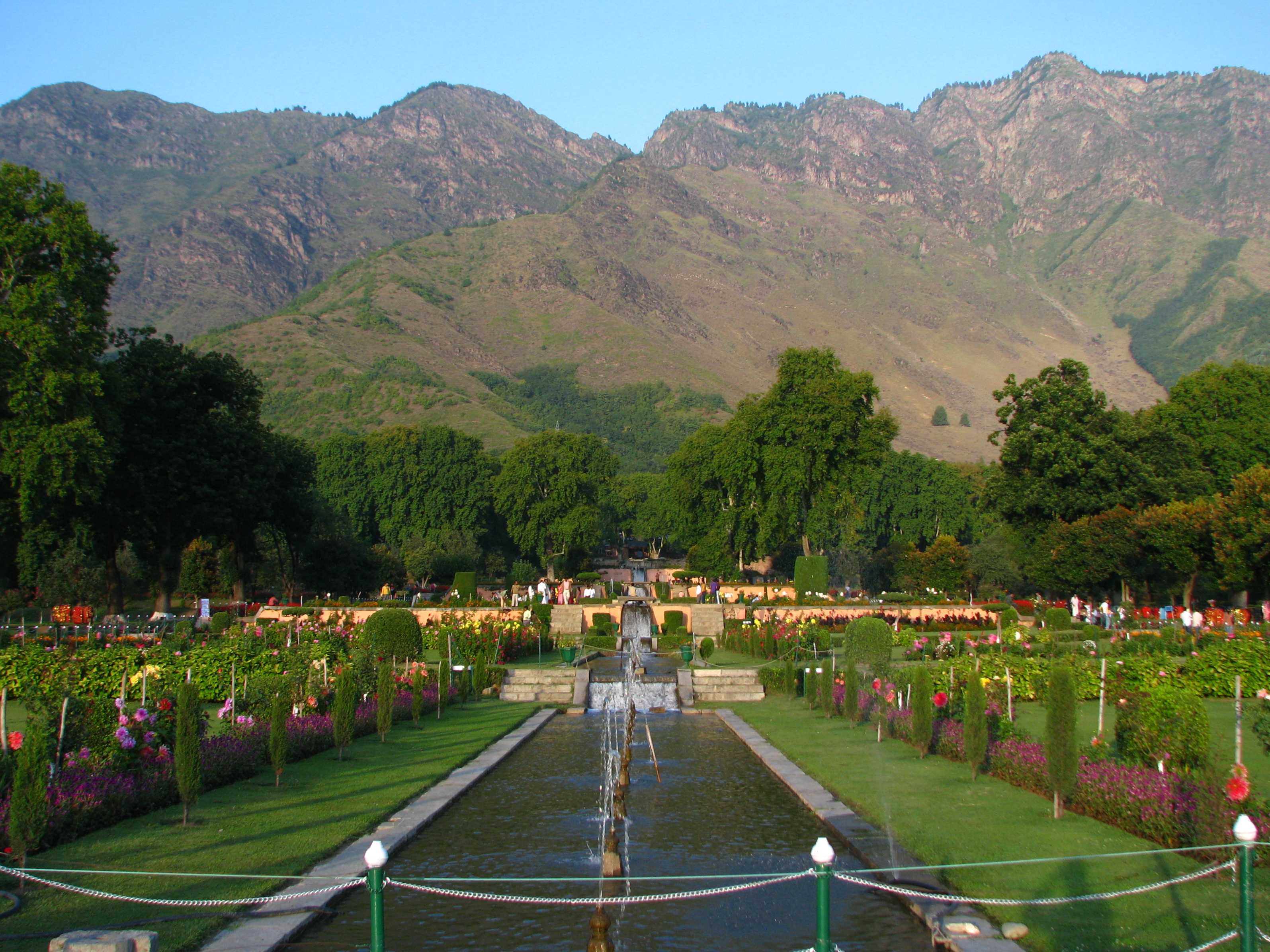
Kashmir ( or ) is the Northwestern Indian subcontinent, northernmost geographical region of the Indian subcontinent. Until the mid-19th century, the term ''Kashmir'' denoted only the Kashmir Valley between the Great Himalayas and the Pir Panjal Range. The term has since also come to encompass a larger area that includes the Indian-administered territories of Jammu and Kashmir (union territory), Jammu and Kashmir and Ladakh, the Pakistani-administered territories of Azad Kashmir and Gilgit-Baltistan, and the Chinese-administered territories of Aksai Chin and the Trans-Karakoram Tract. Quote: "Kashmir, region of the northwestern Indian subcontinent. It is bounded by the Uygur Autonomous Region of Xinjiang to the northeast and the Tibet Autonomous Region to the east (both parts of China), by the Indian states of Himachal Pradesh and Punjab to the south, by Pakistan to the west, and by Afghanistan to the northwest. The northern and western portions are administered by Pakistan a ... [...More Info...] [...Related Items...] OR: [Wikipedia] [Google] [Baidu] |
Yarkant County
Yarkant County,, United States National Geospatial-Intelligence Agency also Shache County,, United States National Geospatial-Intelligence Agency also transliterated from Uyghur as Yakan County, is a county in the Xinjiang Uyghur Autonomous Region, China, located on the southern rim of the Taklamakan Desert in the Tarim Basin. It is one of 11 counties administered under Kashgar Prefecture. The county, usually referred to as Yarkand in English, was the seat of an ancient Buddhist kingdom on the southern branch of the Silk Road and the Yarkand Khanate. The county sits at an altitude of and had a population of . The fertile oasis is fed by the Yarkand River, which flows north down from the Karakorum mountains and passes through the Kunlun Mountains, known historically as the Congling mountains (lit. 'Onion Mountains' - from the abundance of wild onions found there). The oasis now covers , but was likely far more extensive before a period of desiccation affected the region ... [...More Info...] [...Related Items...] OR: [Wikipedia] [Google] [Baidu] |
Yengisar County
Yengisar County, United States National Geospatial-Intelligence Agency (formerly transliterated as Yangi Hissar, from , United States National Geospatial-Intelligence Agency), also known as Yingjisha County, United States National Geospatial-Intelligence Agency ( zh, s=英吉沙县), is a county of Kashgar Prefecture in southwest Xinjiang, China. It covers an area of . As of the 2002 census, it had a population of 230,000. The county seat is the city of Yengisar, a town well known among the local Uyghurs for its handmade knives. The finely-tuned skill of knife-making used to be passed down among generations in Yengisar, but it is slowly dying due to China's strict response to deadly clashes in Xinjiang. History In 1499, Ahmad Alaq seized Kashgar and Yengisar from Mirza Abu Bakr Dughlat. In 1847 and again in 1857, Kashgar and Yengisar were captured. In 1882, Yengisar Independent Subprefecture () was created. In 1913, Yengisar Independent Subprefecture became Yengisar Count ... [...More Info...] [...Related Items...] OR: [Wikipedia] [Google] [Baidu] |
British India
The provinces of India, earlier presidencies of British India and still earlier, presidency towns, were the administrative divisions of British governance in South Asia. Collectively, they have been called British India. In one form or another, they existed between 1612 and 1947, conventionally divided into three historical periods: *Between 1612 and 1757, the East India Company set up "factories" (trading posts) in several locations, mostly in coastal India, with the consent of the Mughal emperors, Maratha Empire or local rulers. Its rivals were the merchant trading companies of Portugal, Denmark, the Netherlands, and France. By the mid-18th century three ''Presidency towns'': Madras, Bombay and Calcutta, had grown in size. *During the period of Company rule in India, 1757–1858, the Company gradually acquired sovereignty over large parts of India, now called "Presidencies". However, it also increasingly came under British government oversight, in effect sharing sovereig ... [...More Info...] [...Related Items...] OR: [Wikipedia] [Google] [Baidu] |
Khotan
Hotan (also known by #Etymology, other names) is a major oasis town in southwestern Xinjiang, an Autonomous regions of China, autonomous region in Northwestern China. The city proper of Hotan broke off from the larger Hotan County to become an administrative area in its own right in August 1984. It is the seat of Hotan Prefecture. With a population of 408,900 (2018 census), Hotan is situated in the Tarim Basin some southwest of the regional capital, Ürümqi. It lies just north of the Kunlun Mountains, which are crossed by the Sanju Pass, Sanju, Hindutash and Ilchi passes. The town, located southeast of Yarkant County and populated almost exclusively by Uyghurs, is a minor agricultural center. An important station on the southern branch of the historic Silk Road, Hotan has always depended on two strong rivers, the Karakash River and the White Jade River, to provide the water needed to survive on the southwestern edge of the vast Taklamakan Desert. The White Jade River still pr ... [...More Info...] [...Related Items...] OR: [Wikipedia] [Google] [Baidu] |
Ma Hu-shan
Ma Hushan (Xiao'erjing: , zh, t=馬虎山, s=马虎山, first=t, p=Mǎ Hǔshān; 1910 – 1954) was a Chinese Muslim warlord and the brother-in-law and follower of Ma Zhongying, a Dungan/Hui Ma Clique warlord. He ruled over an area of Southern Xinjiang, called Tunganistan by Westerners (as the Hui were then known as 'Tunganis'), from 1934 to 1937. Locals sometimes referred to him as ''padishah'' (). Tunganistan Ma Hushan fought against the Russian Red Army and White Russian forces during the Soviet Invasion of Xinjiang and defeated them in battle. “''The Russ brought the fiji'' (airplane) ''and bombed and gassed us''“ he said about the war. He also took part in the war to destroy the First East Turkestan Republic, commanding the new 36th division at the Battle of Kashgar and Battle of Khotan. Ma's 36th Division crushed the Charkhlik Revolt by the Uighurs in the Charkhlik oasis. It controlled southern Xinjiang's oasis and the area was nicknamed "Tunganistan" by Pete ... [...More Info...] [...Related Items...] OR: [Wikipedia] [Google] [Baidu] |
Kashgar
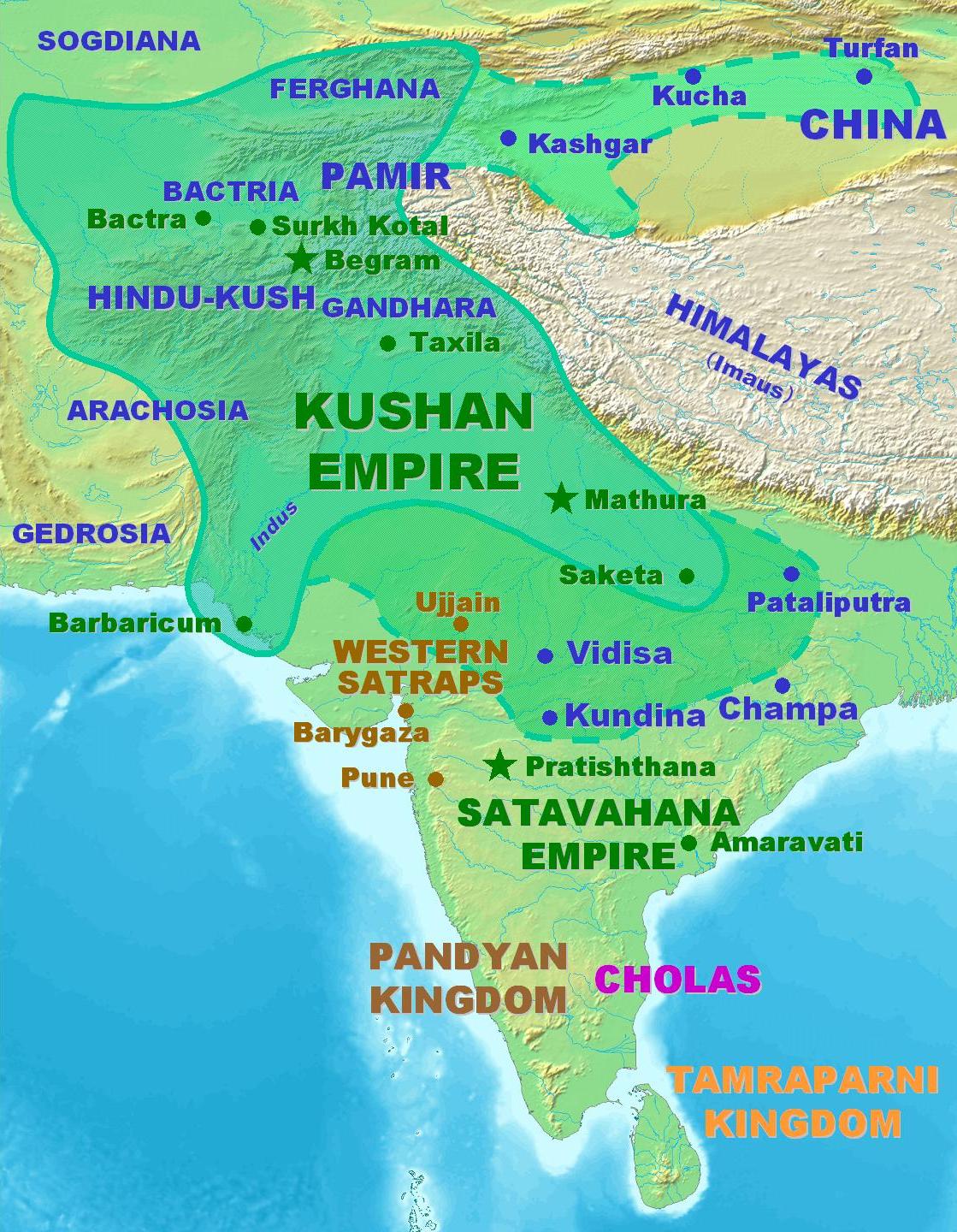
Kashgar () or Kashi ( zh, c=喀什) is a city in the Tarim Basin region of southern Xinjiang, China. It is one of the westernmost cities of China, located near the country's border with Kyrgyzstan and Tajikistan. For over 2,000 years, Kashgar was a strategically important oasis on the Silk Road between China, the Middle East, and Europe. It is one of the oldest continuously inhabited cities in the world and has a population of 711,300 people (). Kashgar's urban area covers , although its administrative area extends over . At the convergence point of widely varying cultures and empires, Kashgar has been under the rule of the Chinese, Turkic, Mongol and Tibetan empires. The city has also been the site of a number of battles between various groups of people on the steppes. Now administered as a county-level city, Kashgar is the administrative centre of Kashgar Prefecture, which has an area of and a population of approximately 4 million . Kashgar was declared a Special Economic ... [...More Info...] [...Related Items...] OR: [Wikipedia] [Google] [Baidu] |


