|
Iceberg That Struck The Titanic
The passenger steamer ''Titanic'' collided with an iceberg and Sinking of the Titanic, sank on the night of 14–15 April 1912 in the Atlantic Ocean, North Atlantic. Of the approximate 2,200 people on board, over 1,500 did not survive. After the disaster, there was interest in the iceberg itself to explain the circumstances of the collision and the resulting damage to the supposedly unsinkable ship. As a result of the ''Titanic'' disaster, an International Ice Patrol was founded whose mission was to reduce the dangers of ice to shipping. The most important sources for the iceberg are reports from surviving crew of the Titanic, crew of the ''Titanic'' and passengers of the Titanic, passengers of the ''Titanic''. There is also historical data on the weather and currents in the North Atlantic that may help to shed light on the disaster. Ships took photographs of icebergs near the spot where Lifeboats of the Titanic, ''Titanics lifeboats were found. The iceberg is purportedly visible ... [...More Info...] [...Related Items...] OR: [Wikipedia] [Google] [Baidu] |
Baffin Bay
Baffin Bay (Inuktitut: ''Saknirutiak Imanga''; kl, Avannaata Imaa; french: Baie de Baffin), located between Baffin Island and the west coast of Greenland, is defined by the International Hydrographic Organization as a marginal sea of the Arctic Ocean. It is sometimes considered a sea of the North Atlantic Ocean. It is connected to the Atlantic via Davis Strait and the Labrador Sea. The narrower Nares Strait connects Baffin Bay with the Arctic Ocean. The bay is not navigable most of the year because of the ice cover and high density of floating ice and icebergs in the open areas. However, a polynya of about , known as the North Water, opens in summer on the north near Smith Sound. Most of the aquatic life of the bay is concentrated near that region. Extent The International Hydrographic Organization defines the limits of Baffin Bay as follows: History The area of the bay has been inhabited since BC. Around AD 1200, the initial Dorset settlers were rep ... [...More Info...] [...Related Items...] OR: [Wikipedia] [Google] [Baidu] |
Sea Ice
Sea ice arises as seawater freezes. Because ice is less dense than water, it floats on the ocean's surface (as does fresh water ice, which has an even lower density). Sea ice covers about 7% of the Earth's surface and about 12% of the world's oceans. Much of the world's sea ice is enclosed within the polar ice packs in the Earth's polar regions: the Arctic ice pack of the Arctic Ocean and the Antarctic ice pack of the Southern Ocean. Polar packs undergo a significant yearly cycling in surface extent, a natural process upon which depends the Arctic ecology, including the ocean's ecosystems. Due to the action of winds, currents and temperature fluctuations, sea ice is very dynamic, leading to a wide variety of ice types and features. Sea ice may be contrasted with icebergs, which are chunks of ice shelves or glaciers that calve into the ocean. Depending on location, sea ice expanses may also incorporate icebergs. General features and dynamics Sea ice does not simply grow ... [...More Info...] [...Related Items...] OR: [Wikipedia] [Google] [Baidu] |
Southampton
Southampton () is a port City status in the United Kingdom, city in the ceremonial county of Hampshire in southern England. It is located approximately south-west of London and west of Portsmouth. The city forms part of the South Hampshire, South Hampshire built-up area, which also covers Portsmouth and the towns of Havant, Waterlooville, Eastleigh, Fareham and Gosport. A major port, and close to the New Forest, it lies at the northernmost point of Southampton Water, at the confluence of the River Test and River Itchen, Hampshire, Itchen, with the River Hamble joining to the south. Southampton is classified as a Medium-Port City . Southampton was the departure point for the and home to 500 of the people who perished on board. The Supermarine Spitfire, Spitfire was built in the city and Southampton has a strong association with the ''Mayflower'', being the departure point before the vessel was forced to return to Plymouth. In the past century, the city was one of Europe's mai ... [...More Info...] [...Related Items...] OR: [Wikipedia] [Google] [Baidu] |
Edward Smith (sea Captain)
Edward John Smith (27 January 1850 – 15 April 1912) was a British naval officer. He served as master of numerous White Star Line vessels. He was the captain of the , and perished when the ship sank on her maiden voyage. Raised in a working class environment, he left school early to join the merchant navy and the Royal Naval Reserve. After earning his master's ticket, he entered the service of the White Star Line, a prestigious British company. He quickly rose through the ranks and graduated in 1887. His first command was . He served as commanding officer of numerous White Star Line vessels,birth/death dates and parents at the |
Gulf Stream
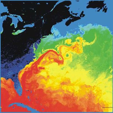
The Gulf Stream, together with its northern extension the North Atlantic Drift, is a warm and swift Atlantic ocean current that originates in the Gulf of Mexico and flows through the Straits of Florida and up the eastern coastline of the United States then veers east near 36 latitude (North Carolina) and moves toward Northwest Europe as the North Atlantic Current. The process of western intensification causes the Gulf Stream to be a northwards accelerating current off the east coast of North America. At about , it splits in two, with the northern stream, the North Atlantic Drift, crossing to Northern Europe and the southern stream, the Canary Current, recirculating off West Africa. The Gulf Stream influences the climate of the coastal areas of the east coast of the United States from Florida to southeast Virginia (near 36 north latitude), and to a greater degree the climate of Northwest Europe. There is consensus that the climate of northwest Europe is warmer than other ar ... [...More Info...] [...Related Items...] OR: [Wikipedia] [Google] [Baidu] |
High-pressure Area
A high-pressure area, high, or anticyclone, is an area near the surface of a planet where the atmospheric pressure is greater than the pressure in the surrounding regions. Highs are middle-scale meteorological features that result from interplays between the relatively larger-scale dynamics of an entire planet's atmospheric circulation. The strongest high-pressure areas result from masses of cold air which spread out from polar regions into cool neighboring regions. These highs weaken once they extend out over warmer bodies of water. Weaker—but more frequently occurring—are high-pressure areas caused by atmospheric subsidence: Air becomes cool enough to precipitate out its water vapor, and large masses of cooler, drier air descend from above. Within high-pressure areas, winds flow from where the pressure is highest, at the center of the area, toward the periphery where the pressure is lower. However, if the planet is rotating, the straight direction of the air flow f ... [...More Info...] [...Related Items...] OR: [Wikipedia] [Google] [Baidu] |
Canada
Canada is a country in North America. Its ten provinces and three territories extend from the Atlantic Ocean to the Pacific Ocean and northward into the Arctic Ocean, covering over , making it the world's second-largest country by total area. Its southern and western border with the United States, stretching , is the world's longest binational land border. Canada's capital is Ottawa, and its three largest metropolitan areas are Toronto, Montreal, and Vancouver. Indigenous peoples have continuously inhabited what is now Canada for thousands of years. Beginning in the 16th century, British and French expeditions explored and later settled along the Atlantic coast. As a consequence of various armed conflicts, France ceded nearly all of its colonies in North America in 1763. In 1867, with the union of three British North American colonies through Confederation, Canada was formed as a federal dominion of four provinces. This began an accretion of provinces and ... [...More Info...] [...Related Items...] OR: [Wikipedia] [Google] [Baidu] |
Computer Simulation
Computer simulation is the process of mathematical modelling, performed on a computer, which is designed to predict the behaviour of, or the outcome of, a real-world or physical system. The reliability of some mathematical models can be determined by comparing their results to the real-world outcomes they aim to predict. Computer simulations have become a useful tool for the mathematical modeling of many natural systems in physics ( computational physics), astrophysics, climatology, chemistry, biology and manufacturing, as well as human systems in economics, psychology, social science, health care and engineering. Simulation of a system is represented as the running of the system's model. It can be used to explore and gain new insights into new technology and to estimate the performance of systems too complex for analytical solutions. Computer simulations are realized by running computer programs that can be either small, running almost instantly on small devices, o ... [...More Info...] [...Related Items...] OR: [Wikipedia] [Google] [Baidu] |
1912 Titanic Itinerary Atlantic EN
Year 191 ( CXCI) was a common year starting on Friday (link will display the full calendar) of the Julian calendar. At the time, it was known as the Year of the Consulship of Apronianus and Bradua (or, less frequently, year 944 ''Ab urbe condita''). The denomination 191 for this year has been used since the early medieval period, when the Anno Domini calendar era became the prevalent method in Europe for naming years. Events By place Parthia * King Vologases IV of Parthia dies after a 44-year reign, and is succeeded by his son Vologases V. China * A coalition of Chinese warlords from the east of Hangu Pass launches a punitive campaign against the warlord Dong Zhuo, who seized control of the central government in 189, and held the figurehead Emperor Xian hostage. After suffering some defeats against the coalition forces, Dong Zhuo forcefully relocates the imperial capital from Luoyang to Chang'an. Before leaving, Dong Zhuo orders his troops to loot the tombs of the Ha ... [...More Info...] [...Related Items...] OR: [Wikipedia] [Google] [Baidu] |
Labrador Sea
The Labrador Sea (French: ''mer du Labrador'', Danish: ''Labradorhavet'') is an arm of the North Atlantic Ocean between the Labrador Peninsula and Greenland. The sea is flanked by continental shelves to the southwest, northwest, and northeast. It connects to the north with Baffin Bay through the Davis Strait. It is a marginal sea of the Atlantic. The sea formed upon separation of the North American Plate and Greenland Plate that started about 60 million years ago and stopped about 40 million years ago. It contains one of the world's largest turbidity current channel systems, the Northwest Atlantic Mid-Ocean Channel (NAMOC), that runs for thousands of kilometers along the sea bottom toward the Atlantic Ocean. The Labrador Sea is a major source of the North Atlantic Deep Water, a cold water mass that flows at great depth along the western edge of the North Atlantic, spreading out to form the largest identifiable water mass in the World Ocean. History The Labrador Sea forme ... [...More Info...] [...Related Items...] OR: [Wikipedia] [Google] [Baidu] |


