|
Helmand Culture
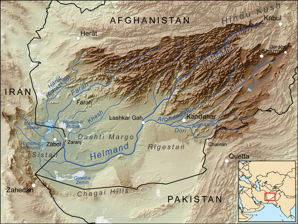
Pottery vessel from Shahr-e Sukhteh The Helmand culture (also Helmand civilization), c. 3300-2350 BCE,Vidale, Massimo, (15 March, 2021)"A Warehouse in 3rd Millennium B.C. Sistan and Its Accounting Technology" in Seminar "Early Urbanization in Iran". is a Bronze Age culture that flourished mainly in the middle and lower valley of the Helmand River, in southern Afghanistan (Kandahar, Helmand and Nimruz provinces) and eastern Iran ( Sistan and Baluchestan Province), predominantly in the third millennium BCE. The people of the Helmand culture lived partly in cities with temples and palaces, providing evidence for a complex and advanced social structure. The main cities so far known are Shahr-i Sokhta (in modern Iran) and Mundigak (Afghanistan). Research on the finds from both places showed that these cities shared the same culture. These are the earliest discovered cities in this part of the world, although the village Mehrgarh further to the south east is considerably older. It is ... [...More Info...] [...Related Items...] OR: [Wikipedia] [Google] [Baidu] |
Indus Valley Civilisation
The Indus Valley Civilisation (IVC), also known as the Indus Civilisation was a Bronze Age civilisation in the northwestern regions of South Asia, lasting from 3300 BCE to 1300 BCE, and in its mature form 2600 BCE to 1900 BCE. Together with ancient Egypt and Mesopotamia, it was one of three early civilisations of the Near East and South Asia, and of the three, the most widespread. Its sites spanned an area from much of Pakistan, to northeast Afghanistan, and northwestern India. The civilisation flourished both in the alluvial plain of the Indus River, which flows through the length of Pakistan, and along a system of perennial monsoon-fed rivers that once coursed in the vicinity of the Ghaggar-Hakra, a seasonal river in northwest India and eastern Pakistan. The term ''Harappan'' is sometimes applied to the Indus civilisation after its type site Harappa, the first to be excavated early in the 20th century in what was then the Punjab province ... [...More Info...] [...Related Items...] OR: [Wikipedia] [Google] [Baidu] |
Kacchi Plain
The Kacchi Plain or Kachhi Plain is located in central Pakistan, in Balochistan Province. History Until the end of the 15th century Kacchi had been a dependency of Sindh. Around 1500, it was taken by Shah Beg of the Arghun Dynasty from the Samma Dynasty of the Sultans of Sindh. The territory was conquered by the Kalhoras Amirs of Sindh; they were displaced by the Nadir Shah of Persia and he made it the part of Kalat Khanate in 1740. Kachhi was notified as a district in February 1965. At that time Naseerabad, Jhal Magsi and Jafarabad districts were included; these were separated in 1987. Geography Plain The Kacchi Plain is an arid plain with mountain ranges on three sides except to the east, located in: *the Kachhi District and Lasbela District *the southern part of Sibi District, extending into the Nasirabad Division (except Sohbatpur District) Districts or areas occasionally included within the plain: *Dera Bugti District (except the northern part) *Sohbatpur District ... [...More Info...] [...Related Items...] OR: [Wikipedia] [Google] [Baidu] |
Quetta
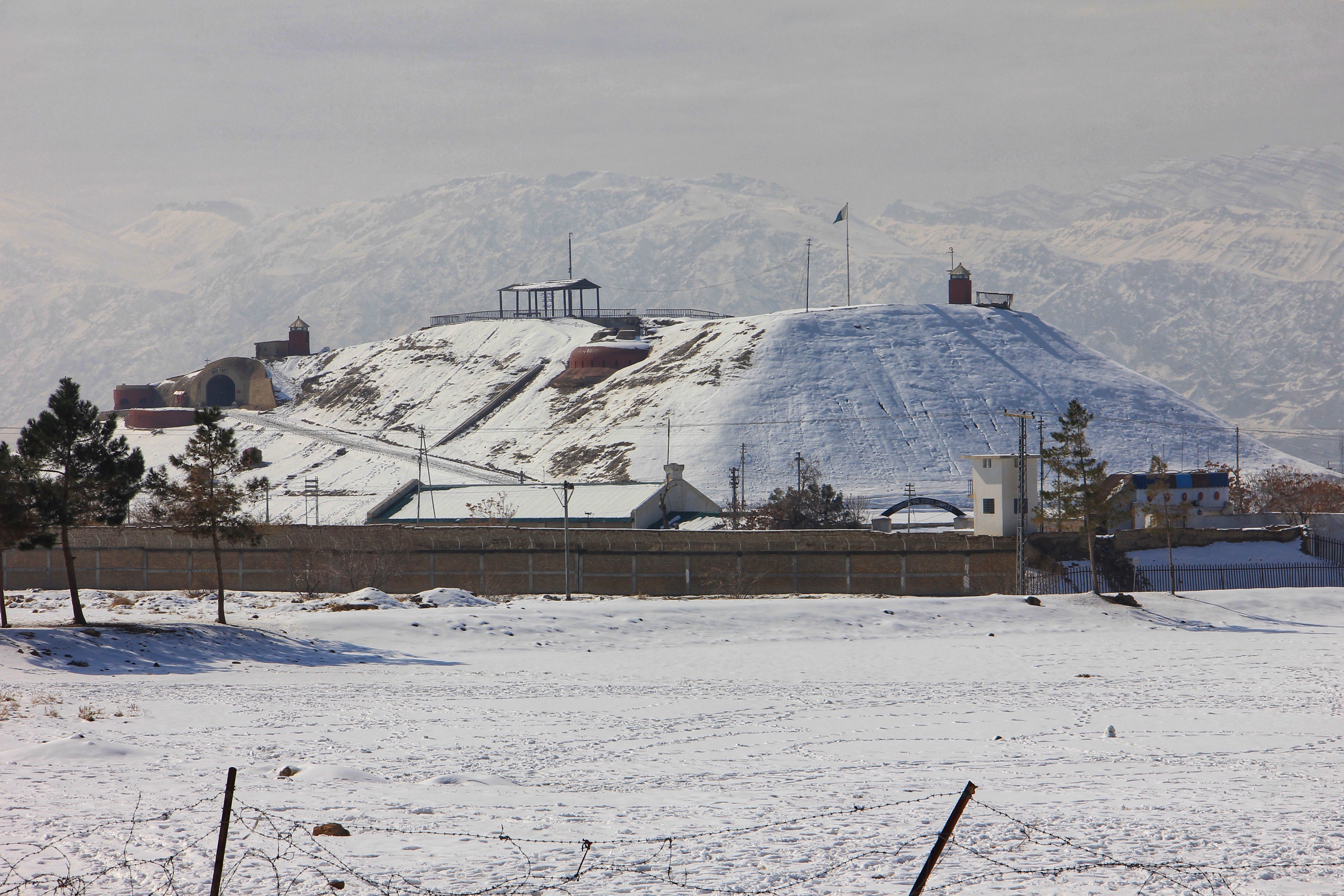
Quetta (; ur, ; ; ps, کوټه) is the tenth most populous city in Pakistan with a population of over 1.1 million. It is situated in south-west of the country close to the International border with Afghanistan. It is the capital of the province of Balochistan where it is the largest city. Quetta is at an average elevation of above sea level, making it Pakistan's only high-altitude major city. The city is known as the ''"Fruit Garden of Pakistan"'' due to the numerous fruit orchards in and around it, and the large variety of fruits and dried fruit products produced there. Located in northern Balochistan near the Pakistan-Afghanistan border and the road across to Kandahar, Quetta is a trade and communication centre between the two countries. The city is near the Bolan Pass route which was once one of the major gateways from Central Asia to South Asia. Quetta played an important role militarily for the Pakistani Armed Forces in the intermittent Afghanistan conflict. ... [...More Info...] [...Related Items...] OR: [Wikipedia] [Google] [Baidu] |
Zabol
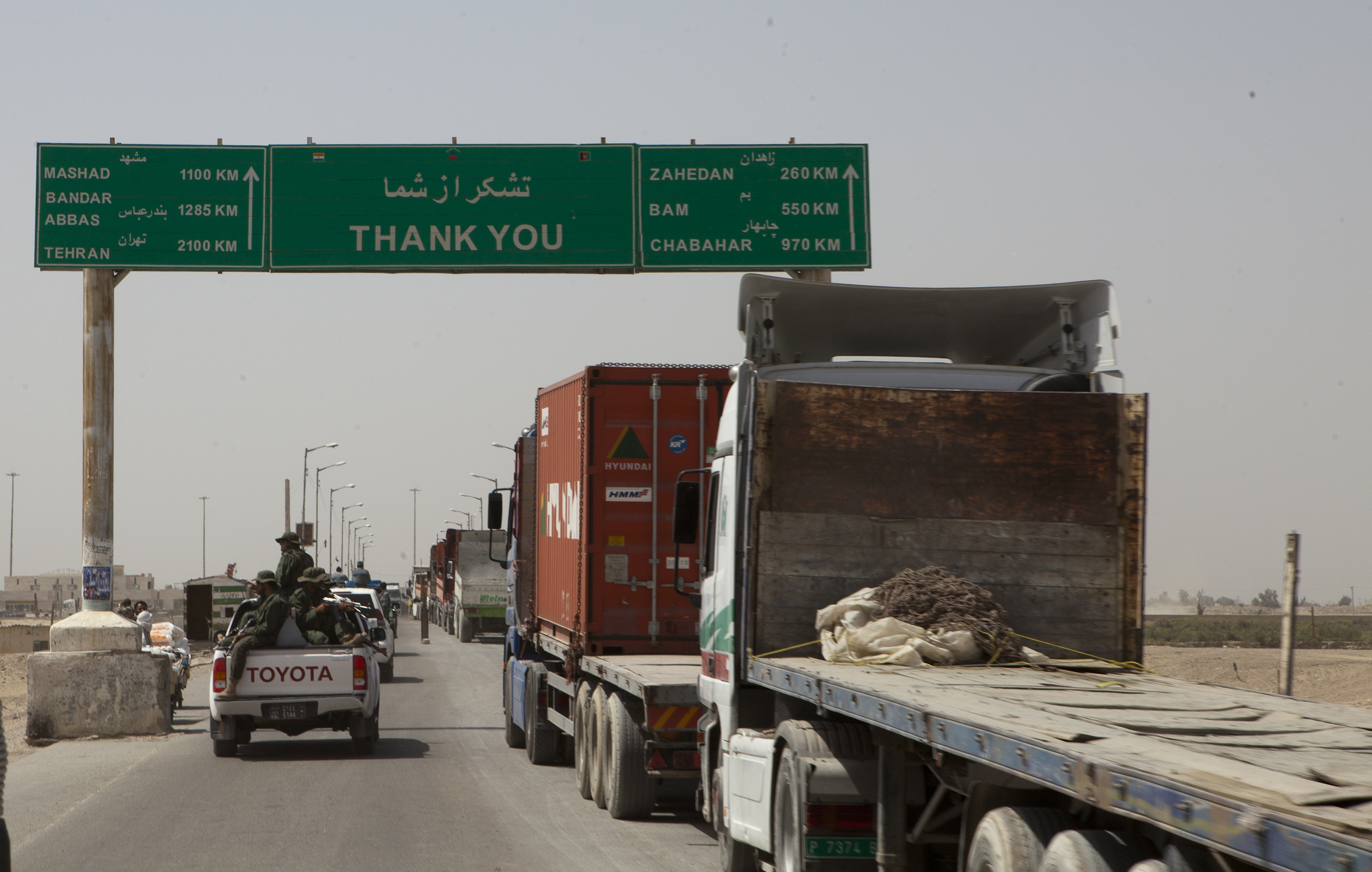
Zabol ( fa, , also transliterated as Zâbol or Zābul) is a city and capital of Zabol County, Sistan and Baluchestan Province, Iran. Zabol is near the border with Afghanistan. Referred to as Sistan until the late 1920s, the city was renamed Zabol by Reza Shah Pahlavi. At the 2006 census, its population was 130,642, in 27,867 families. Zabol is located near Lake Hamun and the region is irrigated by the Helmand River. Lake Hamun is a seasonal lake that is often dry. The people of Zabol are mixed of Persians who speak a variant of the Persian language and known as '' Sistani'' or Seistani which is very similar to Dari, also known as Afghan Persian, and a small minority of Baloch who speak Balochi, a Northwestern Iranian language. The city is home to Zabol University, the largest university in the city, as well as the Zabol Medical Science University and the Sistan Museum of Anthropology. Zabol has a regional airport. Zabol is connected by road to Milak and Zaranj (across ... [...More Info...] [...Related Items...] OR: [Wikipedia] [Google] [Baidu] |
Kandahar
Kandahar (; Kandahār, , Qandahār) is a city in Afghanistan, located in the south of the country on the Arghandab River, at an elevation of . It is Afghanistan's second largest city after Kabul, with a population of about 614,118. It is the capital of Kandahar Province as well as the de facto capital of the Taliban, formally known as the Islamic Emirate of Afghanistan. It also happens to be the centre of the larger cultural region called Loy Kandahar. In 1709, Mirwais Hotak made the region an independent kingdom and turned Kandahar into the capital of the Hotak dynasty. In 1747, Ahmad Shah Durrani, founder of the Durrani dynasty, made Kandahar the capital of the Afghan Empire. Historically this province is considered as important political area for Afghanistan revelations. Kandahar is one of the most culturally significant cities of the Pashtuns and has been their traditional seat of power for more than 300 years. It is a major trading center for sheep, wool, cotton, s ... [...More Info...] [...Related Items...] OR: [Wikipedia] [Google] [Baidu] |
Sistan
Sistān ( fa, سیستان), known in ancient times as Sakastān ( fa, سَكاستان, "the land of the Saka"), is a historical and geographical region in present-day Eastern Iran ( Sistan and Baluchestan Province) and Southern Afghanistan ( Nimruz, Helmand, Kandahar). Largely desert, the region is bisected by the Helmand River, the largest river in Afghanistan, which empties into the Hamun Lake that forms part of the border between the two countries. Etymology Sistan derives its name from ''Sakastan'' ("the land of the Saka"). The Sakas were a Scythian tribe which from the 2nd century BC to the 1st century migrated to the Iranian Plateau and Indus valley, where they carved a kingdom known as the Indo-Scythian Kingdom. In the Bundahishn, a Zoroastrian scripture written in Pahlavi, the province is called "Seyansih". After the Arab conquest of Iran, the province became known as Sijistan/Sistan. The more ancient Old Persian name of the region - prior to Saka dominanc ... [...More Info...] [...Related Items...] OR: [Wikipedia] [Google] [Baidu] |
Dasht-e Margo
Dasht-e Margo (Persian: دشت مارگو), also Dasht-e Mārgow or Dasht-e Margoh, is a desert region in the southern provinces of Nimruz and Helmand in Afghanistan. The desert is adjacent to the Dasht-e Khash and Registan Desert. It is the world's 20th largest desert at about 150,000 km2 in area with an elevation of 500–700 m. The desert consists mainly of sand masses and rocky-clayish plains with solonchaks, takirs, and rarely oases. The desert's name means "Desert of Death" in Dari, with ''dasht'' meaning "plain In geography, a plain is a flat expanse of land that generally does not change much in elevation, and is primarily treeless. Plains occur as lowlands along valleys or at the base of mountains, as coastal plains, and as plateaus or uplands. I ..." and ''margo'' meaning "death". References External links * Deserts of Afghanistan Geography of Helmand Province Geography of Nimruz Province {{Nimruz-geo-stub ... [...More Info...] [...Related Items...] OR: [Wikipedia] [Google] [Baidu] |
Registan Desert
The Registan Desert ( fa, ), also known as Sistan Desert, is an extremely arid plateau region located between Helmand and Kandahar provinces in southeastern Afghanistan. It is a sandy desert consisting of small, red sand hills about high, sand-covered plains, and open rocky and clay-covered areas. The underlying base of the hills consists of partly stabilized ancient transverse dunes, reflecting a west-to-east wind and nearly unlimited sand supply. The desert is very sparsely populated by Baluchi and Pashtun nomads. The desert is gradually encroaching on surrounding agricultural areas. A severe drought in 1998 caused the displacement of approximately 100,000 nomadic people from the Registan desert region. Most of them are now living in temporary settlements between the Arghandab and Helmand Rivers and Registan. A large number are also being supported by the UN in camps for internally displaced persons (IDPs) in Kandahar Province. The UN is currently seeking strategies to ... [...More Info...] [...Related Items...] OR: [Wikipedia] [Google] [Baidu] |
Elamite Language
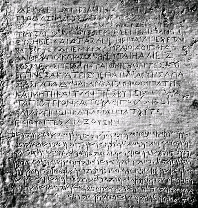
Elamite, also known as Hatamtite and formerly as Susian, is an extinct language that was spoken by the ancient Elamites. It was used in what is now southwestern Iran from 2600 BC to 330 BC. Elamite works disappear from the archeological record after Alexander the Great entered Iran. Elamite is generally thought to have no demonstrable relatives and is usually considered a language isolate. The lack of established relatives makes its interpretation difficult. A sizeable number of Elamite lexemes are known from the trilingual Behistun inscription and numerous other bilingual or trilingual inscriptions of the Achaemenid Empire, in which Elamite was written using Elamite cuneiform (circa 400 BC), which is fully deciphered. An important dictionary of the Elamite language, the ''Elamisches Wörterbuch'' was published in 1987 by W. Hinz and H. Koch. The Linear Elamite script however, one of the scripts used to write the Elamite language circa 2000 BC, has remained elusive until rec ... [...More Info...] [...Related Items...] OR: [Wikipedia] [Google] [Baidu] |
Helmand River
The Helmand River (also spelled Helmend, or Helmund, Hirmand; Pashto/ Persian: ; Greek: ' (''Etýmandros''); Latin: ') is the longest river in Afghanistan and the primary watershed for the endorheic Sistan Basin. It emerges in the Sanglakh Range of the Hindu Kush mountains in the northeastern part of Maidan Wardak Province, where it is separated from the watershed of the Kabul River by the Unai Pass. The Helmand feeds into the Hamun Lake on the border between Afghanistan and Iran. Etymology The name comes from the Avestan ''Haētumant'', literally "dammed, having a dam", which referred to the Helmand River and the irrigated areas around it. Geography The Helmand River stretches for . It rises in the northeastern part of Maidan Wardak Province in the Hindu Kush mountains, about 40 km west of Kabul (), flowing southwestward through Daykundi Province and Uruzgan Province. After passing through the city of Lashkargah in Helmand Province, it enters the desert o ... [...More Info...] [...Related Items...] OR: [Wikipedia] [Google] [Baidu] |


_en_1969.jpg)
.jpg)
