|
HMS Lady Nelson (1798)
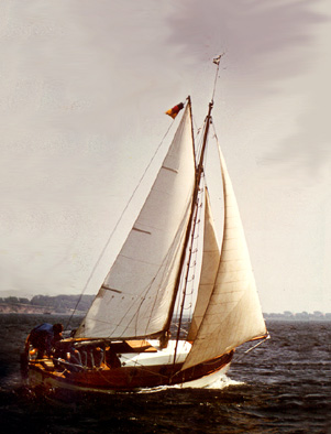
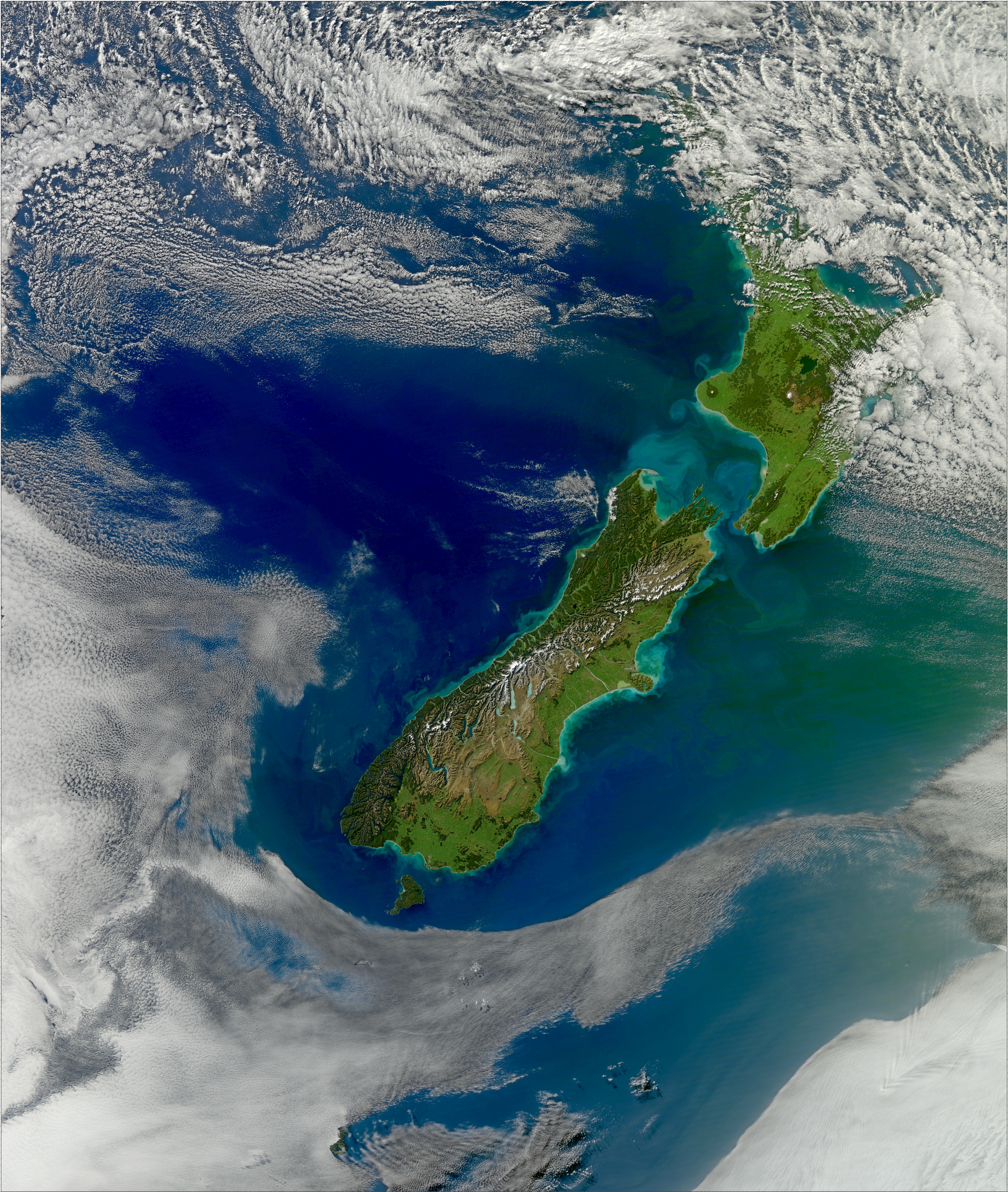
His Majestys Armed Survey Vessel ''Lady Nelson'' was commissioned in 1799 to survey the coast of Australia. At the time large parts of the Australian coast were unmapped and Britain had claimed only part of the continent. The British Government were concerned that, in the event of settlers of another European power becoming established in Australia, any future conflict in Europe would lead to a widening of the conflict into the southern hemisphere to the detriment of the trade that Britain sought to develop. It was against this background that ''Lady Nelson'' was chosen to survey and establish sovereignty over strategic parts of the continent. ''Lady Nelson'' left Portsmouth on 18 March 1800 and arrived at Sydney on 16 December 1800 after having been the first vessel to reach the east coast of Australia via Bass Strait. Prior to that date all vessels had sailed around the southern tip of Tasmania to reach their destination. ''Lady Nelson''s survey work commenced shortly after he ... [...More Info...] [...Related Items...] OR: [Wikipedia] [Google] [Baidu] |
Builder's Old Measurement
Builder's Old Measurement (BOM, bm, OM, and o.m.) is the method used in England from approximately 1650 to 1849 for calculating the cargo capacity of a ship. It is a volumetric measurement of cubic capacity. It estimated the tonnage of a ship based on length and maximum beam. It is expressed in "tons burden" (, ), and abbreviated "tons bm". The formula is: : \text = \frac where: * ''Length'' is the length, in feet, from the stem to the sternpost; * '' Beam'' is the maximum beam, in feet. The Builder's Old Measurement formula remained in effect until the advent of steam propulsion. Steamships required a different method of estimating tonnage, because the ratio of length to beam was larger and a significant volume of internal space was used for boilers and machinery. In 1849, the Moorsom System was created in the United Kingdom. The Moorsom system calculates the cargo-carrying capacity in cubic feet, another method of volumetric measurement. The capacity in cubic feet i ... [...More Info...] [...Related Items...] OR: [Wikipedia] [Google] [Baidu] |
Cutter (boat)
A cutter is any of various types of watercraft. The term can refer to the sail plan, rig (sail plan) of a sailing vessel (but with regional differences in definition), to a governmental enforcement agency vessel (such as a coast guard or border force cutter), to a type of ship's boat which can be used under sail or oars, or, historically, to a type of fast-sailing vessel introduced in the 18th century, some of which were used as small warships. As a sailing rig, a cutter is a single-masted boat, with two or more headsails. On the eastern side of the Atlantic Ocean, Atlantic, the two headsails on a single mast is the fullest extent of the modern definition. In U.S. waters, a greater level of complexity applies, with the placement of the mast and the rigging details of the bowsprit taken into account so a boat with two headsails may be classed as a sloop. Government agencies use the term "cutter" for vessels employed in patrolling their territorial waters and other enforcement a ... [...More Info...] [...Related Items...] OR: [Wikipedia] [Google] [Baidu] |
Roaring Forties
The Roaring Forties are strong westerlies, westerly winds that occur in the Southern Hemisphere, generally between the latitudes of 40th parallel south, 40° and 50th parallel south, 50° south. The strong eastward air currents are caused by the combination of warm air being displaced upward from the Equator towards the South Pole, Earth's rotation, and the scarcity of landmasses to serve as windbreaks at those latitudes. The Roaring Forties were a major aid to ships sailing the Brouwer Route from Europe to the East Indies or Australasia during the Age of Sail, and in modern times are favoured by Yachting, yachtsmen on round-the-world voyages and competitions. The boundaries of the Roaring Forties are not consistent: the wind-stream shifts north or south depending on the season. The strong and continuous winds in the Roaring Forties make this zone advantageous for wind power in places such as New Zealand and Tasmania. Similar but even stronger conditions that occur at more so ... [...More Info...] [...Related Items...] OR: [Wikipedia] [Google] [Baidu] |
Simon's Bay
Simon's Town (), sometimes spelled Simonstown, is a town in the Western Cape, South Africa and is home to Naval Base Simon's Town, the South African Navy's largest base. It is located on the shores of Simon's Bay in False Bay, on the eastern side of the Cape Peninsula. For more than two centuries, it has been a naval base and harbour (first for the British Royal Navy and now the South African Navy). The town is named after Simon van der Stel, an early governor of the Cape Colony. Topography The land rises steeply from near the water's edge and the town is boxed in along the shoreline by the heights above. The small harbour itself is protected from swells by a breakwater that was built with thousands of huge blocks of sandstone quarried out of the face of the mountain above. Simon's Town is now in effect a suburb of the City of Cape Town Metropolitan Municipality. The Simon's Town railway station is the terminus of the Southern Line, a railway line that runs south of the centr ... [...More Info...] [...Related Items...] OR: [Wikipedia] [Google] [Baidu] |
Table Bay
Table Bay (Afrikaans: ''Tafelbaai'') is a natural bay on the Atlantic Ocean overlooked by Cape Town and is at the northern end of the Cape Peninsula, which stretches south to the Cape of Good Hope. It was named because it is dominated by the flat-topped Table Mountain. History Bartolomeu Dias was the first European to explore this region in 1486. The bay, although famous for centuries as a haven for ships, is actually a rather poor natural harbour and is exposed to storm waves from the northwest. Many sailing ships seeking refuge in the bay during the 17th and 18th centuries were driven ashore by winter storms. The Dutch colonists nevertheless persisted with their efforts on the shores of Table Bay, because good natural harbours along this coastline are almost non-existent. The best of them, Saldanha Bay, lacked fresh water. Simon's Bay was well protected from westerly winter storms and swells, but more exposed to summer southeasterly storms and difficult to access overland f ... [...More Info...] [...Related Items...] OR: [Wikipedia] [Google] [Baidu] |
Cape Verde
Cape Verde or Cabo Verde, officially the Republic of Cabo Verde, is an island country and archipelagic state of West Africa in the central Atlantic Ocean, consisting of ten volcanic islands with a combined land area of about . These islands lie between west of Cap-Vert, the westernmost point of continental Africa. The List of islands of Cape Verde, Cape Verde islands form part of the Macaronesia ecoregion, along with the Azores, the Canary Islands, Madeira and the Savage Isles. The Cape Verde archipelago was uninhabited until the 15th century, when Portuguese Empire, Portuguese explorers colonized the islands, establishing one of the first Age of Discovery, European settlements in the tropics. Due to its strategic position, Cape Verde became a significant location in the Atlantic slave trade, transatlantic slave trade during the 16th and 17th centuries. The islands experienced economic growth during this period, driven by their role by the rapid emergence of merchants, priva ... [...More Info...] [...Related Items...] OR: [Wikipedia] [Google] [Baidu] |
Santiago, Cape Verde
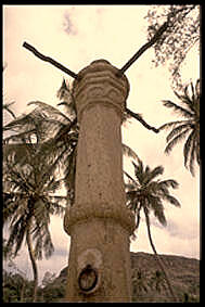
Santiago (Portuguese language, Portuguese for “James, son of Zebedee, Saint James”) is the largest island of Cape Verde, its most important agricultural centre and home to half the nation's population. Part of the Sotavento Islands, it lies between the islands of Maio, Cape Verde, Maio ( to the east) and Fogo, Cape Verde, Fogo ( to the west). It was the first of the islands to be settled: the town of Ribeira Grande (now Cidade Velha and a UNESCO World Heritage Site) was founded in 1462. Santiago is home to the nation's capital city of Praia. History The eastern side of the nearby island of Fogo, Cape Verde, Fogo collapsed into the ocean 73,000 years ago, creating a tsunami high which struck Santiago. In 1460, António de Noli became the first to visit the island. Da Noli settled at ''Ribeira Grande'' (now Cidade Velha) with his family members and Portuguese from Algarve and Alentejo in 1462. [...More Info...] [...Related Items...] OR: [Wikipedia] [Google] [Baidu] |
Praia
Praia (, Portuguese for "beach") is the capital and largest city of Cape Verde.Cape Verde, Statistical Yearbook 2015 Instituto Nacional de Estatística Located on the southern coast of Santiago island within the group, the city is the seat of the ... [...More Info...] [...Related Items...] OR: [Wikipedia] [Google] [Baidu] |
New Holland (Australia)
''New Holland'' () is a historical European name for mainland Australia, Janszoon voyage of 1605–1606, first encountered by Europeans in 1606, by Dutch navigator Willem Janszoon aboard . The name was first applied to Australia in 1644 by the Dutch people, Dutch seafarer Abel Tasman, and for a time came to be applied in most European maps to the vaunted "Southern land" or ''Terra Australis'' even after its coastline was finally explored. The continent of Antarctica, later named in the 1890s, was still in largely speculative form; it resumed the name (sometimes suffixed , ). Its existence had been speculated on in some maps since the 5th century, under the theory of "balancing hemispheres". Lieutenant James Cook, during his First voyage of James Cook, first voyage of discovery, claimed the eastern portion of the Australian continent for the British Crown in 1770, naming it New South Wales. The British settlement of Sydney as a colony in 1788 prompted Britain to formally cl ... [...More Info...] [...Related Items...] OR: [Wikipedia] [Google] [Baidu] |
Matthew Flinders
Captain (Royal Navy), Captain Matthew Flinders (16 March 1774 – 19 July 1814) was a British Royal Navy officer, navigator and cartographer who led the first littoral zone, inshore circumnavigate, circumnavigation of mainland Australia, then called New Holland (Australia), New Holland. He is also credited as being the first person to utilise the name ''Australia'' to describe the entirety of that continent including Van Diemen's Land (now Tasmania), a title he regarded as being "more agreeable to the ear" than previous names such as ''Terra Australis''. Flinders was involved in several voyages of discovery between 1791 and 1803, the most famous of which are the circumnavigation of Australia and an earlier expedition when he and George Bass confirmed that Van Diemen's Land was an island. While returning to Britain in 1803, Flinders was arrested by the French at the colony of Isle de France (Mauritius), Isle de France. Although Britain and France were at war, Flinders thought t ... [...More Info...] [...Related Items...] OR: [Wikipedia] [Google] [Baidu] |
James Grant (navigator)
James Grant (1772 – 11 November 1833) was a Scottish born British Royal Navy officer and navigator in the early nineteenth century. He served in Australia in 1800–1801 and was the first to map the Bass Strait between mainland Australia and Tasmania. Early life Grant was baptized on 6 September 1772 at Forres, Morayshire, Scotland. He was educated at King's College, Aberdeen, under Dr. William Chalmers. He entered the Royal Navy as a captain's servant in August 1793 and was appointed a midshipman in May 1794. He passed his board for promotion to lieutenant and was promoted in 1800. Voyages of exploration Thanks to his friendship with Captain John Schank, as a lieutenant he took command of , a new vessel of 60 tons fitted with a centre-board (or "Schank") keel, towards the end of 1799 he sailed from the River Thames for Port Jackson on 18 March 1800. A brig of 60 tons, she carried a crew comprising the commanding officer, two mates and twelve seamen. His instructions were to ... [...More Info...] [...Related Items...] OR: [Wikipedia] [Google] [Baidu] |
Deptford
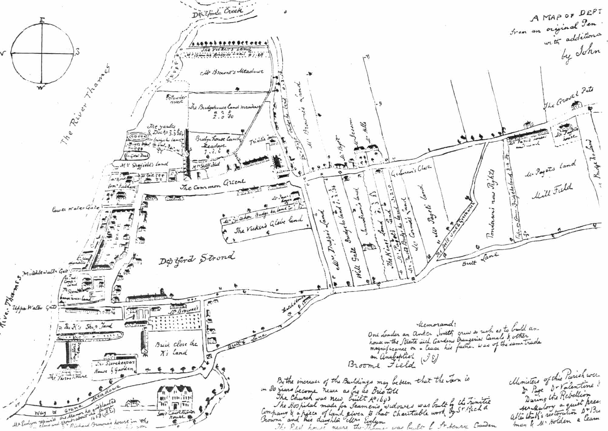
Deptford is an area on the south bank of the River Thames in southeast London, in the Royal Borough of Greenwich and London Borough of Lewisham. It is named after a Ford (crossing), ford of the River Ravensbourne. From the mid 16th century to the late 19th it was home to Deptford Dockyard, the first of the Royal Navy Dockyard, Royal Dockyards. This was a major shipbuilding dock and attracted Peter the Great to come and study shipbuilding. Deptford and the docks are associated with the knighting of Francis Drake, Sir Francis Drake by Elizabeth I, Queen Elizabeth I aboard the ''Golden Hind'', the legend of Walter Raleigh, Sir Walter Raleigh laying down his cape for Elizabeth, James Cook, Captain James Cook's third voyage aboard HMS Resolution (1771), HMS ''Resolution'', and the mysterious apparent murder of Christopher Marlowe in a house along Deptford Strand. Though Deptford began as two small communities, one at the ford, and the other a fishing village on the Thames, Deptfo ... [...More Info...] [...Related Items...] OR: [Wikipedia] [Google] [Baidu] |


