|
Guge
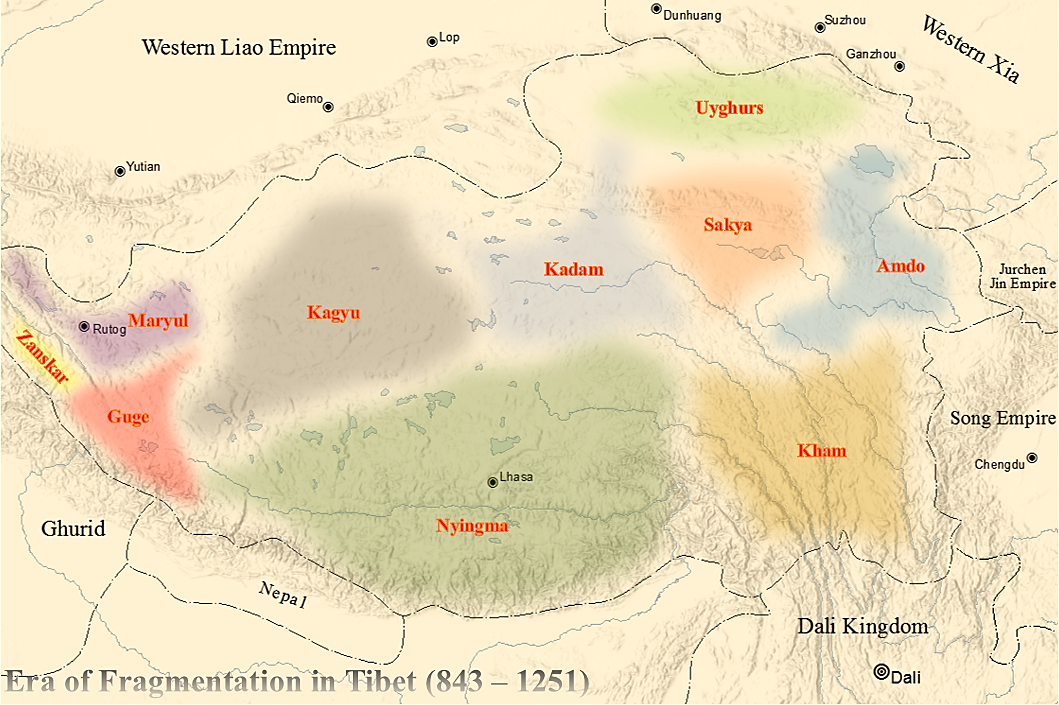
Guge () was an ancient dynastic kingdom in Western Tibet. The kingdom was centered in present-day Zanda County, Ngari Prefecture, Tibet Autonomous Region. At various points in history after the 10th century AD, the kingdom held sway over a vast area including south-eastern Zanskar, Kinnaur district, and Spiti Valley, either by conquest or as tributaries. The ruins of the former capital of the Guge kingdom are located at Tsaparang in the Sutlej valley, not far from Mount Kailash and west from Lhasa. History Founding Guge was founded in the 10th century. Its capitals were located at Tholing and Tsaparang. Kyide Nyimagon, a great-grandson of Langdarma, the last monarch of the Tibetan Empire, fled to Ngari Prefecture, Ngari (West Tibet) from the insecure conditions in Ü-Tsang in 910. He established a kingdom around 912, annexing Burang County, Purang and Guge. He established his capital in Guge. Nyimagon later divided his lands into three parts. The king's eldest son Lhachen ... [...More Info...] [...Related Items...] OR: [Wikipedia] [Google] [Baidu] |
Ngari Prefecture
Ngari Prefecture () or Ali Prefecture ( zh, s=阿里地区 , t=阿里地區 , p=Ālǐ Dìqū) is a prefecture of China's Tibet Autonomous Region covering Western Tibet, whose traditional name is Ngari Khorsum. Its administrative centre and largest settlement is the town of Shiquanhe. It is one of the least densely populated areas in the world, with 0.4 people per square kilometer (1.0 per square mile). History In ancient times, Ngari was known as Zhangzhung. The Zhangzhung kingdom extended over much of western Tibet, until its conquest by the Tibetan Empire under Songtsen Gampo. Zhangzhung sites, such as its capital Khyung-lung dngul-mkhar, are traditionally believed to be closely associated with the development of Bon, the indigenous Tibetan religion. According to Bon tradition, the religion first spread to Zhangzhung from the semi-mythical lands of Olmo Lungring and Tagzig. Thereafter, Bon doctrines were transmitted to central Tibet. Archaeological evidence demonstrated a ... [...More Info...] [...Related Items...] OR: [Wikipedia] [Google] [Baidu] |
Tsaparang
Tsaparang () was the capital of the ancient kingdom of Guge in the Garuda Valley, through which the upper Sutlej River flows, in Ngari Prefecture (Western Tibet) near the border of Ladakh. It is 278 km south-southwest of Shiquanhe, Senggezangbo Town and 26 km west of the 11th-century monastery at Tholing, and not far west of Mount Kailash and Lake Manasarovar. The Tsaparang Dzong architecture, Dzong was located here. Nearby is the Bon monastery of Gurugem monastery, Gurugem. Tsaparang is a huge fortress perched on a pyramid-shaped rock rising about 500 to 600 feet (152 to 183 m) at the end of a long narrow spur. It contains numerous tunnels and caves that have been carved out of the rock. At its base was a village where the common people lived. Above them were two public temples - the Lhakhang Marpo (Red Chapel) and the Lhakhang Karpo (White Chapel), and quarters for the monks. Up, a twisting stone staircase in a tunnel were the royal quarters, and at the very top, the s ... [...More Info...] [...Related Items...] OR: [Wikipedia] [Google] [Baidu] |
Maryul
Maryul (), also called ''mar-yul'' of ''mnga'-ris'', was the western-most Tibetan kingdom based in modern-day Ladakh and some parts of Tibet. The kingdom had its capital at Shey. The kingdom was founded by Lhachen Palgyigon, during the rule of his father Kyide Nyimagon, in .: "it seems that his father bequeathed him a theoretical right of sovereignty, but the actual conquest was effected by dPal-gyi-mgon himself." It stretched from the Zoji La at the border of Kashmir to Demchok in the southeast, and included Rudok and other areas presently in Tibet. The kingdom came under the control of the Namgyal dynasty in 1460, eventually acquiring the name "Ladakh", and lasted until 1842. In that year, the Dogra general Zorawar Singh, having conquered it, made it part of the would-be princely state of Jammu and Kashmir. Etymology ''Mar-yul'' has been interpreted in Tibetan sources as lowland (of Ngari),. Scholars suspect that it was a proper name that was in use earlier, even ... [...More Info...] [...Related Items...] OR: [Wikipedia] [Google] [Baidu] |
Kyide Nyimagon
Kyide Nyimagon (), whose original name was Khri-skyid-lding, was a member of the Yarlung dynasty of Tibet and a descendant of emperor Langdarma. He migrated to Western Tibet and founded the kingdom of Ngari Khorsum ("the three divisions of Ngari") around 912 CE. After his death in 930 CE, his large kingdom was divided among his three sons, giving rise to the three kingdoms of Maryul (Ladakh), Guge-Purang and Zanskar- Spiti. Family After the assassination of the emperor Langdarma, the Tibetan empire entered a period of civil war over succession by Langdarma's two sons (Yum-brtan) and ('Odsrung), which divided the empire into two parts. Ösung's son Depal Khortsen (–) is believed to have controlled most or part of Central Tibet. Nyimagon was one of the sons of Depal Khortsen, the other being Trashi Tsentsän (''bKraśis-brtsegs-brtsan''). Both the sons fled Ü-Tsang (Central Tibet) in 910 when their father was murdered, at the end of the 3rd , which is taken to mark ... [...More Info...] [...Related Items...] OR: [Wikipedia] [Google] [Baidu] |
Yeshe-Ö
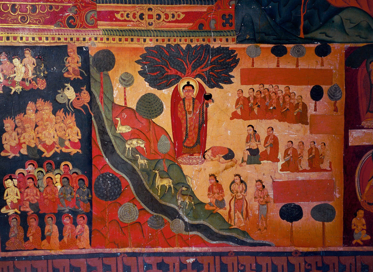
Yeshe-Ö ( 959–1040; Tibetan script, Tibetan: ཡེ་ཤེས་འོད་, Wylie transliteration, Wylie: ye shes 'od; spiritual names Lha bLama Yeshes 'Od, Byang Chub Ye Shes 'Od, Lha Bla Ma, Lalama Yixiwo, also Dharmaraja – 'Noble King') was the first notable lama-king in Tibet. Born as Khor-re, he is better known as Lhachen Yeshe-Ö, his spiritual name. Yeshe-Ö was the second king in the succession of the kingdom of Guge in the southwestern Tibetan Plateau. Yeshe-Ö abdicated the throne in 975 to become a lama. In classical Tibetan historiography, the restoration of an organized and monastic tradition of Tibetan Buddhism is attributed to him. He built Tholing Monastery in 997 when Tholing was the capital of Guge. Yeshe-Ö' sponsored novitiates, including the great translator Rinchen Zangpo. Early life and rule From a young age, Yeshe-Ö was interested in religious matters. He was the son of king Tashi-gon (bKra-shis-mgon), and ruled the merged kingdoms of Tashig ... [...More Info...] [...Related Items...] OR: [Wikipedia] [Google] [Baidu] |
Tholing
Tholing (, literally "high place";), also called Zanda (), is a town and the seat of Zanda County, Ngari Prefecture, in the west of Tibet Autonomous Region, People's Republic of China. The town was the former capital of Guge Kingdom in western Tibet. Now it is an isolated military town. It has a well laid out new street, a post office, and telecommunication facilities. The Tholing Monastery, established in 997 AD, is in the suburbs of the town, in the Grand canyon of the Langchen Tsangpo. Historically, it was an important monastery; the second dissemination of Buddhism in Tibet emanated from it. History Zanda is a Chinese name given to the ancient town known as Tholing, which was once the capital of the Ngari district in western Tibet. The town, the monastery, and Tsaparang, a rocky range with forts, played an important role the history of Tibetan Buddhism in west Tibet. Tholing and Tsaparang were the capital cities of the Parang-Guge Kingdom during the 10-11th centuries when T ... [...More Info...] [...Related Items...] OR: [Wikipedia] [Google] [Baidu] |
Ladakh
Ladakh () is a region administered by India as a union territory and constitutes an eastern portion of the larger Kashmir region that has been the subject of a Kashmir#Kashmir dispute, dispute between India and Pakistan since 1947 and India and China since 1959.The application of the term "administered" to the various regions of Kashmir and a mention of the Kashmir dispute is supported by the WP:TERTIARY, tertiary sources (a) through (e), reflecting WP:DUE, due weight in the coverage. Although "controlled" and "held" are also applied neutrally to the names of the disputants or to the regions administered by them, as evidenced in sources (h) through (i) below, "held" is also considered politicised usage, as is the term "occupied", (see (j) below). (a) (subscription required) Quote: "Kashmir, region of the northwestern Indian subcontinent ... has been the subject of dispute between India and Pakistan since the partition of the Indian subcontinent in 1947. The northern and wester ... [...More Info...] [...Related Items...] OR: [Wikipedia] [Google] [Baidu] |
Kinnaur District
Kinnaur district () is a mountainous district located in the northeast part of the state of Himachal Pradesh, India. Kinnaur district borders Tibet (China) to the east, the state of Uttarakhand to the south, Shimla district to the southwest, Kullu district to the west, and Lahaul and Spiti district to the north. The administrative headquarters of the district is at Reckong Peo. History Over the 10th-11th centuries A.D., Kinnaur was a part of the Guge kingdom. The Guge kingdom broke apart in the 12th century, and the Bushahr state arose in the Western Himalayas, taking over most parts of present-day Kinnaur. The Bushahr state originated in the Kamru village of Sangla valley. However, the uppermost part of Kinnaur remained under Tibetan influence until the late 17th century, when it was handed over to the Bushahr state by the Tibetans as a reward for assistance in the Tibet-Ladakh-Mughal War. The Bushahr state shifted its capital to Sarahan, and later still to Rampur, wh ... [...More Info...] [...Related Items...] OR: [Wikipedia] [Google] [Baidu] |
Burang County
Purang County or Burang County (; zh, s=普兰县) is an administrative division of Ngari Prefecture in the Tibet Autonomous Region (''TAR'') of China. The county seat is Purang Town, known as ''Taklakot'' in Nepali. The county covers an area of , and has a population of 9,657 as of 2010. Geography Political geography Purang County has TAR's south-western border with Nepal's Sudurpashchim and Karnali province, Darchula, Bajhang and Humla District. Further west, India's Uttarakhand State, Pithoragarh district and Chamoli district borders. Buddhist, Hindu and Jain pilgrims going to Lake Manasarovar and Mount Kailash enter from Nepal via Simikot, and from India via Dharchula. The county is bounded by other counties in the Ngari Prefecture, including Zanda to the west, Gar to the northwest and Gê'gyai to the north. To the east is Zhongba County of Shigatse Prefecture. Physical geography The county covers an area of , and has a population of some 9,058 people a ... [...More Info...] [...Related Items...] OR: [Wikipedia] [Google] [Baidu] |
Tibet
Tibet (; ''Böd''; ), or Greater Tibet, is a region in the western part of East Asia, covering much of the Tibetan Plateau and spanning about . It is the homeland of the Tibetan people. Also resident on the plateau are other ethnic groups such as Mongols, Monpa people, Monpa, Tamang people, Tamang, Qiang people, Qiang, Sherpa people, Sherpa, Lhoba people, Lhoba, and since the 20th century Han Chinese and Hui people, Hui. Tibet is the highest region on Earth, with an average elevation of . Located in the Himalayas, the highest elevation in Tibet is Mount Everest, Earth's highest mountain, rising above sea level. The Tibetan Empire emerged in the 7th century. At its height in the 9th century, the Tibetan Empire extended far beyond the Tibetan Plateau, from the Tarim Basin and Pamirs in the west, to Yunnan and Bengal in the southeast. It then divided into a variety of territories. The bulk of western and central Tibet (Ü-Tsang) was often at least nominally unified under a ser ... [...More Info...] [...Related Items...] OR: [Wikipedia] [Google] [Baidu] |
Tibetan Empire
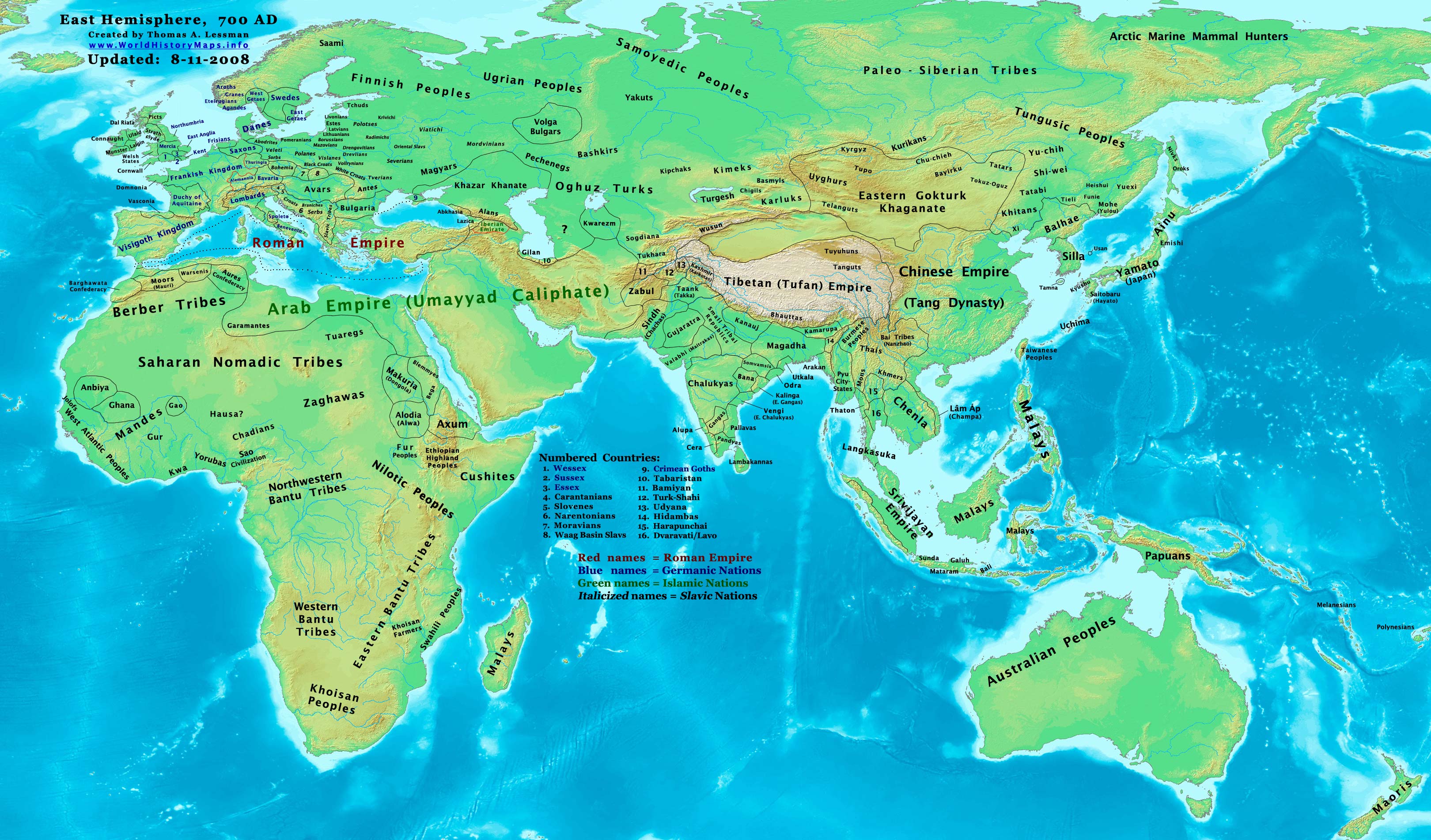
The Tibetan Empire (,) was an empire centered on the Tibetan Plateau, formed as a result of expansion under the Yarlung dynasty heralded by its 33rd king, Songtsen Gampo, in the 7th century. It expanded further under the 38th king, Trisong Detsen, and reached its greatest extent under the 40th king, Ralpacan, Ralpachen, stretching east to Chang'an, west beyond modern Afghanistan, south into modern India and the Bay of Bengal. The Yarlung dynasty was founded in 127 BC in the Yarlung Valley along the Yarlung River, south of Lhasa. The Yarlung capital was moved in the 7th century from the palace Yumbulingka to Lhasa by the 33rd king Songtsen Gampo, and into the Red Fort during the imperial period which continued to the 9th century. The beginning of the imperial period is marked in the reign of the 33rd king of the Yarlung dynasty, Songtsen Gampo. The power of Tibet's military empire gradually increased over a diverse terrain. During the reign of Trisong Detsen, the empire became ... [...More Info...] [...Related Items...] OR: [Wikipedia] [Google] [Baidu] |
Langdarma
Darma U Dum Tsen (), better known as Langdarma (, "Mature Bull" or "Darma the Bull"), was the 41st and last king of the Tibetan Empire who in 838 killed his brother, King Ralpachen, then reigned from 841 to 842 CE before he himself was assassinated.Arthur Mandelbaum, "Lhalung Pelgyi Dorje", Treasury of Lives, 2007. His reign led to the dissolution of the Tibetan Empire, which had extended beyond the Tibetan Plateau to include the Silk Roads with the Tibetan imperial manuscript center at Sachu (Dunhuang), and neighbouring regions in China, East Turkestan, Afghanistan, and India.Samten Karmay ''in'' , pg. 57 History Earlier in his life as a Tibetan prince, Langdarma was Buddhist, but under the influence of Wégyel Toré (), he became a follower of Bon, after which he assassinated his brother King Ralpachen, in 838. Following this, he widely persecuted Tibetan monks, nuns, and destroyed their monasteries"History of Meru Nyingpa Monastery", ''Places'', ''Monasteries'', The H ... [...More Info...] [...Related Items...] OR: [Wikipedia] [Google] [Baidu] |


