|
Great Stone Of Fourstones
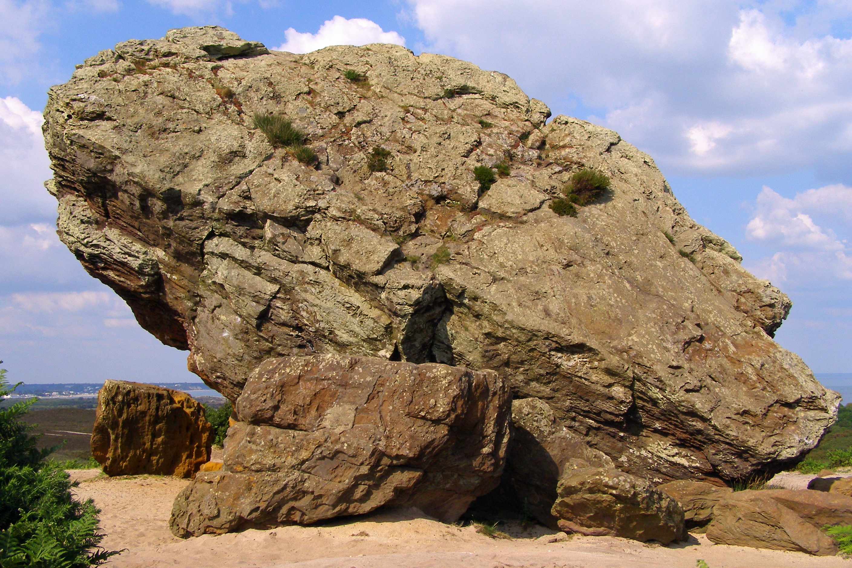
The Great Stone of Fourstones, or the Big Stone as it is known locally, is a glacial deposit on the moorlands of Tatham Fells, England, straddling the county border between North Yorkshire and Lancashire, near Bentham in the District of Craven. The name suggests that there were once four stones, but now there is only one. The other three were possibly broken up for scythe sharpening stones, or building stone, centuries ago. Large stones such as this were useful as boundary markers in the open countryside, and this one was used as a boundary marker for the Lancashire–Yorkshire boundary between Tatham and Bentham parishes. A local myth tells of how the stone was dropped by the devil, on his way to build Devil's Bridge at nearby Kirkby Lonsdale. The stone has 14 steps carved into the side of it to allow access to the top. It is not known when they were carved, but they are well worn from years of use. In John Cary's New and Correct English Atlas published in 1793 The Grea ... [...More Info...] [...Related Items...] OR: [Wikipedia] [Google] [Baidu] |
Glacial Erratic
A glacial erratic is a glacially deposited rock (geology), rock differing from the type of country rock (geology), rock native to the area in which it rests. Erratics, which take their name from the Latin word ' ("to wander"), are carried by glacial ice, often over distances of hundreds of kilometres. Erratics can range in size from pebbles to large boulders such as Okotoks Erratic, Big Rock (16,500 metric tons) in Alberta. Geologists identify erratics by studying the rocks surrounding the position of the erratic and the composition of the erratic itself. Erratics are significant because: *They can be transported by glaciers, and are thereby one of a series of indicators which mark the path of prehistoric Glacial motion, glacier movement. Their lithographic origin can be traced to the parent bedrock, allowing for confirmation of the ice flow route. *They can be transported by ice rafting, which allows quantification of the extent of glacial flooding resulting from ice dam failure ... [...More Info...] [...Related Items...] OR: [Wikipedia] [Google] [Baidu] |
Lonsdale Hundred
The Lonsdale Hundred is a historic hundred of Lancashire, England. Although named after the dale or valley of the River Lune, which runs through the city of Lancaster, for centuries it covered most of the north-western part of Lancashire around Morecambe Bay, including the detached parts of Furness and the Cartmel Peninsula. Ironically, only some of the detached part of North Lonsdale still remains partly within a British parliamentary constituency under the name of Lonsdale, being part of the Westmorland and Lonsdale constituency. Lonsdale was not recorded as a hundred in the Domesday Book of 1086, but the name does appear, in the returns for Yorkshire, apparently as a manor attached to Cockerham. A number of places within the Lune's watershed are traditionally named with specification of 'in Lonsdale': Kirkby Lonsdale, Burton-in-Lonsdale, and Thornton-in-Lonsdale retain the name, while Middleton, Sedbergh, Ingleton and Newby, near Clapham have previously been recorde ... [...More Info...] [...Related Items...] OR: [Wikipedia] [Google] [Baidu] |
Geography Of The City Of Lancaster
Geography (from Ancient Greek ; combining 'Earth' and 'write', literally 'Earth writing') is the study of the lands, features, inhabitants, and phenomena of Earth. Geography is an all-encompassing discipline that seeks an understanding of Earth and its human and natural complexities—not merely where objects are, but also how they have changed and come to be. While geography is specific to Earth, many concepts can be applied more broadly to other celestial bodies in the field of planetary science. Geography has been called "a bridge between natural science and social science disciplines." Origins of many of the concepts in geography can be traced to Greek Eratosthenes of Cyrene, who may have coined the term "geographia" (). The first recorded use of the word γεωγραφία was as the title of a book by Greek scholar Claudius Ptolemy (100 – 170 AD). This work created the so-called "Ptolemaic tradition" of geography, which included "Ptolemaic cartographic theory." ... [...More Info...] [...Related Items...] OR: [Wikipedia] [Google] [Baidu] |
Landforms Of Lancashire
A landform is a land feature on the solid surface of the Earth or other planetary body. They may be natural or may be anthropogenic (caused or influenced by human activity). Landforms together make up a given terrain, and their arrangement in the landscape is known as topography. Landforms include hills, mountains, canyons, and valleys, as well as shoreline features such as bays, peninsulas, and seas, including submerged features such as mid-ocean ridges, volcanoes, and the great oceanic basins. Physical characteristics Landforms are categorized by characteristic physical attributes such as elevation, slope, orientation, structure stratification, rock exposure, and soil type. Gross physical features or landforms include intuitive elements such as berms, cliffs, hills, mounds, peninsulas, ridges, rivers, valleys, volcanoes, and numerous other structural and size-scaled (e.g. ponds vs. lakes, hills vs. mountains) elements including various kinds of inland and oceanic waterbodi ... [...More Info...] [...Related Items...] OR: [Wikipedia] [Google] [Baidu] |
Tourist Attractions In Lancashire
Tourism is travel for pleasure, and the commercial activity of providing and supporting such travel. UN Tourism defines tourism more generally, in terms which go "beyond the common perception of tourism as being limited to holiday activity only", as people "travelling to and staying in places outside their usual environment for not more than one consecutive year for leisure and not less than 24 hours, business and other purposes". Tourism can be domestic (within the traveller's own country) or international. International tourism has both incoming and outgoing implications on a country's balance of payments. Between the second half of 2008 and the end of 2009, tourism numbers declined due to a severe economic slowdown (see Great Recession) and the outbreak of the 2009 H1N1 influenza virus. These numbers, however, recovered until the COVID-19 pandemic put an abrupt end to the growth. The United Nations World Tourism Organization has estimated that global international tourist a ... [...More Info...] [...Related Items...] OR: [Wikipedia] [Google] [Baidu] |
Rock Formations Of England
Rock most often refers to: * Rock (geology), a naturally occurring solid aggregate of minerals or mineraloids * Rock music, a genre of popular music Rock or Rocks may also refer to: Places United Kingdom * Rock, Caerphilly, a location in Wales * Rock, Cornwall, a village in England * Rock, County Tyrone, a village in Northern Ireland * Rock, Devon, a location in England * Rock, Neath Port Talbot, a location in Wales * Rock, Northumberland, a village in England * Rock, Somerset, a location in England * Rock, West Sussex, a hamlet in Washington, England * Rock, Worcestershire, a village and civil parish in England United States * Rock, Kansas, an unincorporated community * Rock, Michigan, an unincorporated community * Rock, West Virginia, an unincorporated community * Rock, Rock County, Wisconsin, a town in southern Wisconsin * Rock, Wood County, Wisconsin, a town in central Wisconsin Elsewhere * Corregidor, an island in the Philippines also known as "The Rock" * Jamaica, an ... [...More Info...] [...Related Items...] OR: [Wikipedia] [Google] [Baidu] |
Tourist Attractions In North Yorkshire
Tourism is travel for pleasure, and the commercial activity of providing and supporting such travel. UN Tourism defines tourism more generally, in terms which go "beyond the common perception of tourism as being limited to holiday activity only", as people "travelling to and staying in places outside their usual environment for not more than one consecutive year for leisure and not less than 24 hours, business and other purposes". Tourism can be domestic (within the traveller's own country) or international. International tourism has both incoming and outgoing implications on a country's balance of payments. Between the second half of 2008 and the end of 2009, tourism numbers declined due to a severe economic slowdown (see Great Recession) and the outbreak of the 2009 H1N1 influenza virus. These numbers, however, recovered until the COVID-19 pandemic put an abrupt end to the growth. The United Nations World Tourism Organization has estimated that global international tourist ... [...More Info...] [...Related Items...] OR: [Wikipedia] [Google] [Baidu] |
Glacial Erratics Of Great Britain
A glacier (; or ) is a persistent body of dense ice, a form of rock, that is constantly moving downhill under its own weight. A glacier forms where the accumulation of snow exceeds its ablation over many years, often centuries. It acquires distinguishing features, such as crevasses and seracs, as it slowly flows and deforms under stresses induced by its weight. As it moves, it abrades rock and debris from its substrate to create landforms such as cirques, moraines, or fjords. Although a glacier may flow into a body of water, it forms only on land“Glacier, N., Pronunciation.” Oxford English Dictionary, Oxford UP, June 2024, https://doi.org/10.1093/OED/7553486115. Accessed 25 Jan. 2025. and is distinct from the much thinner sea ice and lake ice that form on the surface of bodies of water. On Earth, 99% of glacial ice is contained within vast ice sheets (also known as "continental glaciers") in the polar regions, but glaciers may be found in mountain ranges on every continen ... [...More Info...] [...Related Items...] OR: [Wikipedia] [Google] [Baidu] |
Forest Of Bowland
The Forest of Bowland, also known as the Bowland Fells and formerly the Chase of Bowland, is an area of gritstone fells, deep valleys and peat moorland, mostly in north-east Lancashire, England, with a small part in North Yorkshire (however roughly half of the area falls into the area of the historic West Riding of Yorkshire). It is a western outlier of the Pennines. The Forest of Bowland was designated an Area of Outstanding Natural Beauty (AONB) in 1964. The AONB also includes a detached part known as the Forest of Pendle separated from the main part by the River Ribble, Ribble Valley, and anciently a royal forest with its own separate history. One of the best-known features of the area is Pendle Hill, which lies in Pendle Forest. There are more than 500 listed buildings and 18 scheduled monuments within the AONB. The Trough of Bowland is a pass connecting the valley of the River Wyre, Marshaw Wyre with that of Langden Brook, and dividing the upland core of Bowland into two ... [...More Info...] [...Related Items...] OR: [Wikipedia] [Google] [Baidu] |
Landforms Of North Yorkshire
A landform is a land feature on the solid surface of the Earth or other planetary body. They may be natural or may be anthropogenic (caused or influenced by human activity). Landforms together make up a given terrain, and their arrangement in the landscape is known as topography. Landforms include hills, mountains, canyons, and valleys, as well as shoreline features such as bays, peninsulas, and seas, including submerged features such as mid-ocean ridges, volcanoes, and the great oceanic basins. Physical characteristics Landforms are categorized by characteristic physical attributes such as elevation, slope, orientation, structure stratification, rock exposure, and soil type. Gross physical features or landforms include intuitive elements such as berms, cliffs, hills, mounds, peninsulas, ridges, rivers, valleys, volcanoes, and numerous other structural and size-scaled (e.g. ponds vs. lakes, hills vs. mountains) elements including various kinds of inland and oceanic waterbod ... [...More Info...] [...Related Items...] OR: [Wikipedia] [Google] [Baidu] |
Geology Of North Yorkshire
Geology (). is a branch of natural science concerned with the Earth and other astronomical objects, the rocks of which they are composed, and the processes by which they change over time. Modern geology significantly overlaps all other Earth sciences, including hydrology. It is integrated with Earth system science and planetary science. Geology describes the structure of the Earth on and beneath its surface and the processes that have shaped that structure. Geologists study the mineralogical composition of rocks in order to get insight into their history of formation. Geology determines the relative ages of rocks found at a given location; geochemistry (a branch of geology) determines their absolute ages. By combining various petrological, crystallographic, and paleontological tools, geologists are able to chronicle the geological history of the Earth as a whole. One aspect is to demonstrate the age of the Earth. Geology provides evidence for plate tectonics, the evolutionary ... [...More Info...] [...Related Items...] OR: [Wikipedia] [Google] [Baidu] |
List Of Individual Rocks
The following is a list of notable rocks and stones. See also * List of largest meteorites on Earth * List of longest natural arches * List of rock formations * List of rock formations that resemble human beings * List of rocks on Mars * Lists of rocks in Western Australia * List of menhirs, List of standing stones * Monoliths * Moon rocks * Stolen and missing Moon rocks * Stones of Scotland * Glacial erratic **Glacial erratic boulders of Estonia, of Estonia **Glacial erratics on and around Rügen, of Rügen **of Washington (state), Washington State, United States ***Glacial erratic boulders of Island County, Washington, of Island County, Washington ***Glacial erratic boulders of King County, Washington, of King County, Washington ***Glacial erratic boulders of Kitsap County, Washington, of Kitsap County, Washington ***Glacial erratic boulders of Snohomish County, Washington, of Snohomish County, Washington ***Glacial erratic boulders of the Puget Sound region, of the Puget Sound ... [...More Info...] [...Related Items...] OR: [Wikipedia] [Google] [Baidu] |


