|
Gori River
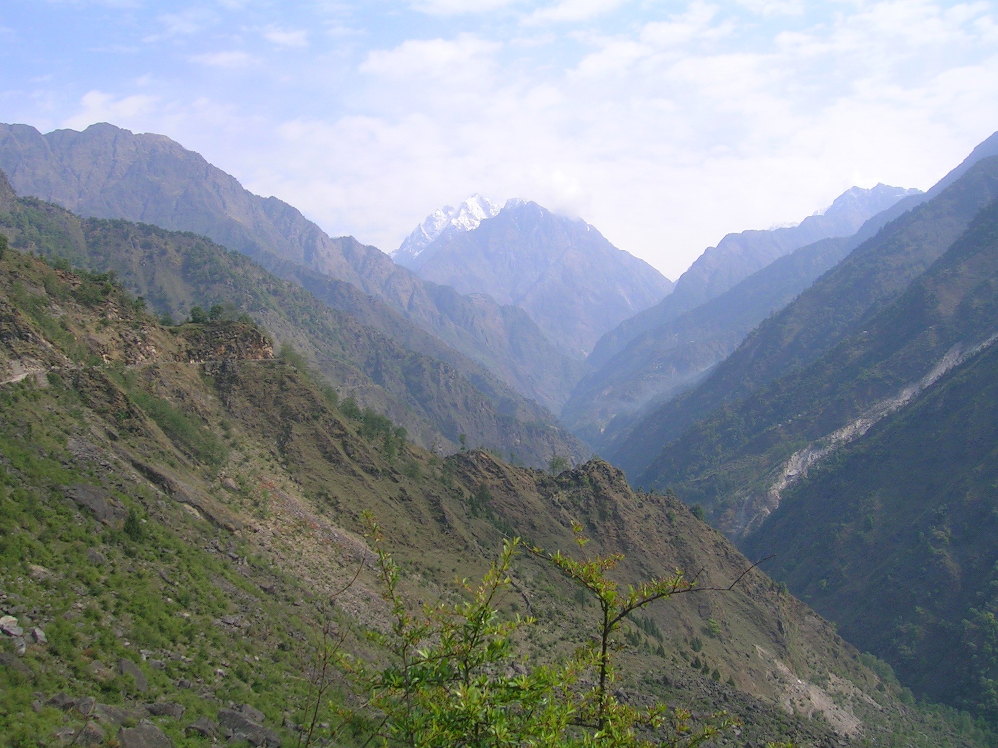
Gori Ganga ( Kumaoni: ''Gori Gād'') is a river in the Munsiari tehsil of the Pithoragarh District, part of the state of Uttarakhand in northern India. Its principal source is the Milam Glacier, just northeast of Nanda Devi along with the Glaciers of the Ralam River, and the Pyunshani and Uttari & Dakshini Balati Glaciers that lie on the western face of the Panchachuli Peaks. Etymology In the local language "gori" means white or fair. "Gad" and "ganga" both mean river. The water of this river froths and contains white clay/sand, so it looks white most of the time. Course The alpine trans-humant village of Milam is located one kilometer below the snout of the glacier. Here a left-bank stream called ''Gonka'' joins the Gori. The valley provides the approach route for access to peaks such as Nanda Devi East, Hardeol, Trishuli, Panchchuli and Nanda Kot. The Gori is also fed by glaciers and streams flowing from the eastern slopes of the east wall of the Nanda Devi Sanctua ... [...More Info...] [...Related Items...] OR: [Wikipedia] [Google] [Baidu] |
Bhotiyas Of Uttarakhand
Bhotiyas are people of presumed Tibetan heritage that live along the Indo-Tibetan border in the upper reaches of the Great Himalayas, at elevations ranging from to . In Uttarakhand, they inhabit seven river valleys, three in the Garhwal division (Jadh, Mana and Niti) and four in the Kumaon division (Johar, Darma, Byans and Chaudans). They follow Hinduism with Buddhism and traditionally speak West Himalayish languages related to the old Zhang-Zhung language, Zhangzhung language. Their main traditional occupation used to be India–Tibet relations, Indo-Tibetan trade, with limited amounts of agriculture and pastoralism. The Indo-Tibetan trade came to a halt following the 1962 Sino-Indian War, Sino-Indian war, and was resumed only in the early 1990s under state-regulated mechanisms. Their major livelihood at present is the collection of medicinal and aromatic plants in the Himalayas. Many have also migrated out of their traditional habitats to towns at lower elevations. The tradit ... [...More Info...] [...Related Items...] OR: [Wikipedia] [Google] [Baidu] |
Uttarakhand
Uttarakhand (, ), also known as Uttaranchal ( ; List of renamed places in India, the official name until 2007), is a States and union territories of India, state in North India, northern India. The state is bordered by Himachal Pradesh to the northwest, Tibet to the north, Nepal to the east, Uttar Pradesh to the south and southeast, with a small part touching Haryana in the west. Uttarakhand has a total area of , equal to 1.6% of the total area of India. Dehradun serves as the state capital, with Nainital being the judicial capital. The state is divided into two divisions, Garhwal division, Garhwal and Kumaon division, Kumaon, with a total of List of districts of Uttarakhand, 13 districts. The forest cover in the state is 45.4% of the state's geographical area. The cultivable area is 16% of the total geographical area. The two major rivers of the state, the Ganges and its tributary Yamuna, originate from the Gangotri and Yamunotri glaciers respectively. Ranked 6th among the Top 1 ... [...More Info...] [...Related Items...] OR: [Wikipedia] [Google] [Baidu] |
Panchchuli Glacier
Panchchuli Glacier is a Himalayan glacier, situated in the Pithoragarh district of Uttarakhand, India. Geography It is located in the easternmost part of Kumaun. It is in the west and east of five peaks of Panchchuli on the Johar Valley and Darma valley. Uttari Balati glacier is situated north to it. Panchachuli group of glaciers includes: * Meola * Sona * Uttari Balati * Dakshini Balati The popular trek is through the Darma Valley to East Facing glacier. Pithoragarh-Dharchula-Tawaghat-Sobla-Dar-Sela-Bailing-Son-Duktu. The glacier is the source of the Yuli River. See also * List of glaciers A glacier ( ) or () is a persistent body of dense ice that is constantly moving under its own weight; it forms where the accumulation of snow exceeds its ablation (melting and sublimation) over many years, often centuries. Glaciers slowly defor ... References Glaciers of Uttarakhand Geography of Pithoragarh district {{Uttarakhand-geo-stub ... [...More Info...] [...Related Items...] OR: [Wikipedia] [Google] [Baidu] |
Nanda Devi
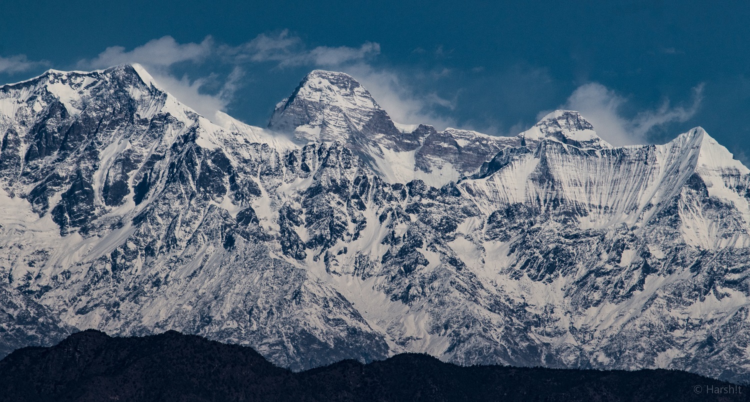
Nanda Devi is the second-highest mountain in India, after Kangchenjunga, and the highest located entirely within the country. (Kangchenjunga is on the border of India and Nepal.) Nanda Devi is the 23rd-highest peak in the world and ranked 74th by prominence . Nanda Devi was considered the highest mountain in the world before computations in 1808 proved Dhaulagiri to be higher. It was also the highest mountain in India until 1975, when Sikkim, an independent kingdom until 1948 and a protectorate of India thereafter, became a state of India. It is located in the Chamoli district of Uttarakhand, between the Rishiganga valley on the west and the Goriganga valley on the east. The peak, whose name means "Bliss-Giving Goddess", is regarded as the patron goddess of the Garhwal and Kumaon Himalayas. In acknowledgment of its religious significance and for the protection of its fragile ecosystem, the Government of India declared the peak as well as the circle of high mountains ... [...More Info...] [...Related Items...] OR: [Wikipedia] [Google] [Baidu] |
Milam Glacier
Milam Glacier is a major glacier of Himalaya in the Munsiyari tehsil of Pithoragarh district of Kumaon region in the Uttrakhand state of India. The Milam village, near the snout of Milam Glacier, is the source of the Goriganga River which flows to Munsiyari through the Johar Valley inhabited by Shauka Tibeto-Burman ethnic people. Munsiari-Bugdiar-Milam Road (MBMR), the paved motorable road being constructed by the BRO as part of the India–China Border Roads (ICBRs) with expected completion date of March 2026, provides access to Milam village and glacier from the district sub-division headquarter Munsiyari. [...More Info...] [...Related Items...] OR: [Wikipedia] [Google] [Baidu] |
India
India, officially the Republic of India, is a country in South Asia. It is the List of countries and dependencies by area, seventh-largest country by area; the List of countries by population (United Nations), most populous country since 2023; and, since its independence in 1947, the world's most populous democracy. Bounded by the Indian Ocean on the south, the Arabian Sea on the southwest, and the Bay of Bengal on the southeast, it shares land borders with Pakistan to the west; China, Nepal, and Bhutan to the north; and Bangladesh and Myanmar to the east. In the Indian Ocean, India is near Sri Lanka and the Maldives; its Andaman and Nicobar Islands share a maritime border with Thailand, Myanmar, and Indonesia. Modern humans arrived on the Indian subcontinent from Africa no later than 55,000 years ago., "Y-Chromosome and Mt-DNA data support the colonization of South Asia by modern humans originating in Africa. ... Coalescence dates for most non-European populations averag ... [...More Info...] [...Related Items...] OR: [Wikipedia] [Google] [Baidu] |
Pithoragarh District
Pithoragarh district is the easternmost district in the state of Uttarakhand. It is located in the Himalayas and has an area of and a population of 483,439 (as of 2011). The city of Pithoragarh, located in Saur Valley, is its headquarters. The district is within the Kumaon division of Uttarakhand state. The Tibet plateau is situated to the north and Nepal is to the east. The Kali River (Uttarakhand), Kali River which originates from the Kalagiri Mountain flows south, forming the eastern border with Nepal. The Hindu pilgrimage route for Mount Kailash-Lake Manasarovar passes through this district via Lipulekh Pass in the greater Himalayas. The district is administratively divided into six Tehsils: Munsyari; Dharchula; Didihat; Berinag; Gangolihat; and Pithoragarh. Naini Saini Airport is the nearest civil airport, but it does not have a regular scheduled commercial passenger service. The mineral deposits present in the district are magnesium ore, copper ore, limestone, and slate. ... [...More Info...] [...Related Items...] OR: [Wikipedia] [Google] [Baidu] |
Tehsil
A tehsil (, also known as tahsil, taluk, or taluka () is a local unit of administrative division in India and Pakistan. It is a subdistrict of the area within a Zila (country subdivision), district including the designated populated place that serves as its administrative centre, with possible additional towns, and usually a number of village#South Asia, villages. The terms in India have replaced earlier terms, such as ''pargana'' (''pergunnah'') and ''thana''. In List of mandals in Andhra Pradesh, Andhra Pradesh and List of mandals in Telangana, Telangana, a newer unit called mandal (circle) has come to replace the tehsil system. A mandal is generally smaller than a tehsil, and is meant for facilitating local self-government in the panchayati raj in India, panchayat system. In West Bengal, Bihar, Jharkhand, community development blocks (CDBs) are the empowered grassroots administrative unit, replacing tehsils. Tehsil office is primarily tasked with land revenue administration, be ... [...More Info...] [...Related Items...] OR: [Wikipedia] [Google] [Baidu] |
Munsiari
Munsyari ( Kumaoni: ''Munsyār'') is the name of the sub-division headquarters, a municipal board, a conglomeration of revenue villages and it also refers to the entire region as Munsiyari Tehsil and Sub Division in the Pithoragarh District in the hill-state of Uttarakhand, India. It is a hill station and lies at the base of the great Himalayan mountain range, at an elevation of about ''Garhwal-Himalaya-Ost'', 1:150,000 scale topographic map, prepared in 1992 by Ernst Huber for the Swiss Foundation for Alpine Research, based on maps of the Survey of India, and is a starting point of various treks into the interior of the range. Economy Principally subsistence based agriculture and animal husbandry and allied activities. Many families are dependent on forests and natural resources for their livelihoods. Establishment During a summer festival organized in Munsiyari market in 2013, a proposal for granting Munsiyari the status of ''Nagar Panchayat'' (lower level Municipali ... [...More Info...] [...Related Items...] OR: [Wikipedia] [Google] [Baidu] |
River
A river is a natural stream of fresh water that flows on land or inside Subterranean river, caves towards another body of water at a lower elevation, such as an ocean, lake, or another river. A river may run dry before reaching the end of its course if it runs out of water, or only flow during certain seasons. Rivers are regulated by the water cycle, the processes by which water moves around the Earth. Water first enters rivers through precipitation, whether from rainfall, the Runoff (hydrology), runoff of water down a slope, the melting of glaciers or snow, or seepage from aquifers beneath the surface of the Earth. Rivers flow in channeled watercourses and merge in confluences to form drainage basins, or catchments, areas where surface water eventually flows to a common outlet. Rivers have a great effect on the landscape around them. They may regularly overflow their Bank (geography), banks and flood the surrounding area, spreading nutrients to the surrounding area. Sedime ... [...More Info...] [...Related Items...] OR: [Wikipedia] [Google] [Baidu] |
Kumaoni Language
Kumaoni ( Kumaoni-Devanagari: , ) is an Indo-Aryan language spoken by over two million people of the Kumaon region of the state of Uttarakhand in northern India and parts of Doti region in Western Nepal. As per 1961 survey there were 1,030,254 Kumaoni speakers in India. The number of speakers increased to 2.2 million in 2011. Kumaoni is not endangered but UNESCO's ''Atlas of the World's Languages in Danger'' designates it as a language in the ''unsafe'' category, meaning it requires consistent conservation efforts. Script Kumaoni is written using the Devanagari script. Geographic distribution and dialects There are several dialects spoken in the Kumaon region. There is not single accepted method of dividing up the dialects of Kumaoni. Broadly speaking, Kali (or Central) Kumaoni is spoken in Almora and northern Nainital. North-eastern Kumaoni is spoken in Pithoragarh. South-eastern Kumaoni is spoken in South-eastern Nainital. Western Kumaoni is spoken west of Almora and Na ... [...More Info...] [...Related Items...] OR: [Wikipedia] [Google] [Baidu] |


