|
Geography Of Benin
Benin, a narrow, key-shaped, north–south strip of land in West Africa, lies between the Equator and the Tropic of Cancer. Its latitude ranges from 6°30 N to 12°30 N and its longitude from 1° E to 3°40 E. It is bounded by Togo to the west, Burkina Faso and Niger to the north, Nigeria to the east, and the Bight of Benin to the south. With an area of , it is slightly bigger than the nation of Bulgaria. It extends from the Niger River in the north to the Atlantic Ocean in the south, a distance of . Although the coastline measures , the country measures about at its widest point. It is one of the smaller countries in West Africa, about one eighth the size of Nigeria, its neighbor to the east. It is, however, twice as large as Togo, its neighbor to the west. A relief map of Benin shows that it has little variation in elevation, averaging in elevation. Biogeography The country can be divided into four main areas from the south to the north. The low-lying, sandy, coastal plain ... [...More Info...] [...Related Items...] OR: [Wikipedia] [Google] [Baidu] |
Equator
The equator is the circle of latitude that divides Earth into the Northern Hemisphere, Northern and Southern Hemisphere, Southern Hemispheres of Earth, hemispheres. It is an imaginary line located at 0 degrees latitude, about in circumference, halfway between the North Pole, North and South Pole, South poles. The term can also be used for any other celestial body that is roughly spherical. In three-dimensional space, spatial (3D) geometry, as applied in astronomy, the equator of a rotating spheroid (such as a planet) is the parallel (circle of latitude) at which latitude is defined to be 0°. It is an imaginary line on the spheroid, equidistant from its geographical pole, poles, dividing it into northern and southern hemispheres. In other words, it is the intersection of the spheroid with the plane (geometry), plane perpendicular to its axis of rotation and midway between its geographical poles. On and near the equator (on Earth), noontime sunlight appears almost directly o ... [...More Info...] [...Related Items...] OR: [Wikipedia] [Google] [Baidu] |
Ecoregion
An ecoregion (ecological region) is an ecological and geographic area that exists on multiple different levels, defined by type, quality, and quantity of environmental resources. Ecoregions cover relatively large areas of land or water, and contain characteristic, geographically distinct assemblages of natural communities and species. The biodiversity of flora, fauna and ecosystems that characterise an ecoregion tends to be distinct from that of other ecoregions. In theory, biodiversity or conservation ecoregions are relatively large areas of land or water where the probability of encountering different species and communities at any given point remains relatively constant, within an acceptable range of variation (largely undefined at this point). Ecoregions are also known as "ecozones" ("ecological zones"), although that term may also refer to biogeographic realms. Three caveats are appropriate for all bio-geographic mapping approaches. Firstly, no single bio-geographic fram ... [...More Info...] [...Related Items...] OR: [Wikipedia] [Google] [Baidu] |
Guinean Forest-savanna Mosaic
Demographics of Guinea describes the condition and overview of Guinea's peoples. Demographic topics include basic education, health, and population statistics as well as identified racial and religious affiliations. Population According to the total population was in , compared to only 3 094 000 in 1950. The proportion of children below the age of 15 in 2010 was 42.9%, 53.8% was between 15 and 65 years of age, while 3.3% was 65 years or older . Population Estimates by Sex and Age Group (01.VII.2020) (Population in households only. Post-censal estimates.): Vital statistics Registration of vital events is in Guinea not complete. The website Our World in Data prepared the following estimates based on statistics from the Population Department of the United Nations. Demographic and Health Surveys Total Fertility Rate (TFR) (Wanted Fertility Rate) and Crude Birth Rate (CBR): Fertility data as of 2012 and 2018 (DHS Program): Life expectancy Ethnic groups * Fulɓe ... [...More Info...] [...Related Items...] OR: [Wikipedia] [Google] [Baidu] |
World Wildlife Fund
The World Wide Fund for Nature (WWF) is a Swiss-based international non-governmental organization founded in 1961 that works in the field of wilderness preservation and the reduction of human impact on the environment. It was formerly named the World Wildlife Fund, which remains its official name in Canada and the United States. WWF is the world's largest conservation organization, with over 5 million supporters worldwide, working in more than 100 countries and supporting around 3,000 conservation and environmental projects. It has invested over $1 billion in more than 12,000 conservation initiatives since 1995. WWF is a foundation with 65% of funding from individuals and bequests, 17% from government sources (such as the World Bank, FCDO, and USAID) and 8% from corporations in 2020. WWF aims to "stop the degradation of the planet's natural environment and to build a future in which humans live in harmony with nature." '' Living Planet Report'' has been published every two year ... [...More Info...] [...Related Items...] OR: [Wikipedia] [Google] [Baidu] |
Zou River
The Zou is a river of south-western Benin. It drains into the Ouémé River. The river banks are inhabited in parts by the Mahi people near the Togo Togo, officially the Togolese Republic, is a country in West Africa. It is bordered by Ghana to Ghana–Togo border, the west, Benin to Benin–Togo border, the east and Burkina Faso to Burkina Faso–Togo border, the north. It is one of the le ... border. See also * List of rivers of Benin References Rivers of Benin {{Benin-river-stub ... [...More Info...] [...Related Items...] OR: [Wikipedia] [Google] [Baidu] |
Couffo River
The Couffo or Kouffo is a river in West Africa. It rises in Togo but runs for much of its course through Benin Benin, officially the Republic of Benin, is a country in West Africa. It was formerly known as Dahomey. It is bordered by Togo to the west, Nigeria to the east, Burkina Faso to the north-west, and Niger to the north-east. The majority of its po ..., draining into Lake Ahémé. It forms part of the Togo–Benin border and also serves as the border between Benin's Kouffo and Zou departments. See also * List of rivers of Africa References Rivers of Benin Rivers of Togo {{Benin-river-stub ... [...More Info...] [...Related Items...] OR: [Wikipedia] [Google] [Baidu] |
Lagoon
A lagoon is a shallow body of water separated from a larger body of water by a narrow landform, such as reefs, barrier islands, barrier peninsulas, or isthmuses. Lagoons are commonly divided into ''coastal lagoons'' (or ''barrier lagoons'') and ''atoll lagoons''. They have also been identified as occurring on mixed-sand and gravel coastlines. There is an overlap between bodies of water classified as coastal lagoons and bodies of water classified as Estuary, estuaries. Lagoons are common coastal features around many parts of the world. Definition and terminology Lagoons are shallow, often elongated bodies of water separated from a larger body of water by a shallow or exposed shoal, reef, coral reef, or similar feature. Some authorities include fresh water bodies in the definition of "lagoon", while others explicitly restrict "lagoon" to bodies of water with some degree of salinity. The distinction between "lagoon" and "estuary" also varies between authorities. Richard A. Davis J ... [...More Info...] [...Related Items...] OR: [Wikipedia] [Google] [Baidu] |
Marsh
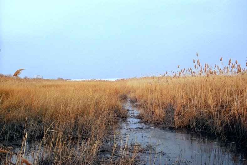
In ecology, a marsh is a wetland that is dominated by herbaceous plants rather than by woody plants.Keddy, P.A. 2010. Wetland Ecology: Principles and Conservation (2nd edition). Cambridge University Press, Cambridge, UK. 497 p More in general, the word can be used for any low-lying and seasonally waterlogged terrain. In Europe and in agricultural literature low-lying meadows that require draining and embanked polderlands are also referred to as marshes or marshland. Marshes can often be found at the edges of lakes and streams, where they form a transition between the aquatic and terrestrial ecosystems. They are often dominated by grasses, rushes or reeds. If woody plants are present they tend to be low-growing shrubs, and the marsh is sometimes called a carr. This form of vegetation is what differentiates marshes from other types of wetland such as swamps, which are dominated by trees, and mires, which are wetlands that have accumulated deposits of acidic peat. Marshes ... [...More Info...] [...Related Items...] OR: [Wikipedia] [Google] [Baidu] |
Benin Topography
Benin, officially the Republic of Benin, is a country in West Africa. It was formerly known as Dahomey. It is bordered by Togo to the west, Nigeria to the east, Burkina Faso to the north-west, and Niger to the north-east. The majority of its population lives on the southern coastline of the Bight of Benin, part of the Gulf of Guinea in the northernmost tropical portion of the Atlantic Ocean. The capital is Porto-Novo, and the seat of government is in Cotonou, the most populous city and economic capital. Benin covers an area of , and its population in was estimated to be approximately million. It is a tropical country with an economy heavily dependent on agriculture and is an exporter of palm oil and cotton. From the 17th to the 19th century, political entities in the area included the Kingdom of Dahomey, the city-state of Porto Novo, and other states to the north. This region was referred to as the Slave Coast of West Africa from the early 17th century due to the high number o ... [...More Info...] [...Related Items...] OR: [Wikipedia] [Google] [Baidu] |
Niger River
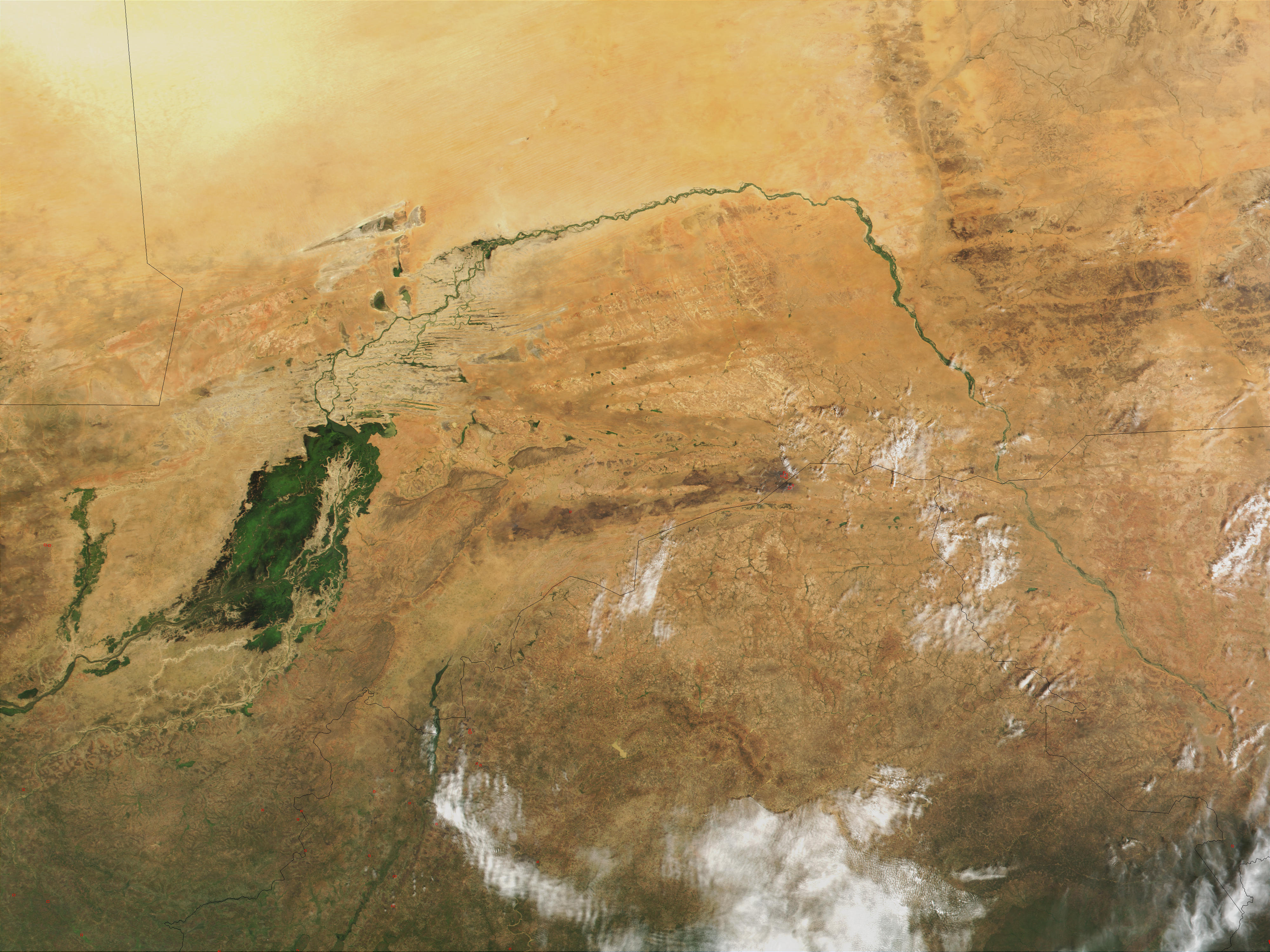
The Niger River ( ; ) is the main river of West Africa, extending about . Its drainage basin is in area. Its source is in the Guinea Highlands in south-eastern Guinea near the Sierra Leone border. It runs in a crescent shape through Mali, Niger, on the border with Benin and then through Nigeria, discharging through a massive River delta, delta, known as the Niger Delta, into the Gulf of Guinea in the Atlantic Ocean. The Niger is the third-longest river in Africa, exceeded by the Nile and the Congo River. Its main tributary is the Benue River. Etymology The Niger has different names in the different languages of the region: * Fula language, Fula: ''Maayo Jaaliba'' * Manding languages, Manding: ''Jeliba'' or ''Joliba'' "great river" * Tuareg languages, Tuareg: ''Eġərəw n-Igərǝwăn'' "river of rivers" * Songhay languages, Songhay: ''Isa'' "the river" * Zarma language, Zarma: ''Isa Beeri'' "great river" * Hausa language, Hausa: ''Kwara'' *Nupe language, Nupe: ''Èdù'' ... [...More Info...] [...Related Items...] OR: [Wikipedia] [Google] [Baidu] |


