|
Extreme Points Of The African Union
The African Union covers almost the entirety of continental Africa and several off-shore islands. Consequently, it is wildly diverse, including the world's largest hot desert (the Sahara), huge jungles and savannas, and the world's longest river (the Nile). Overview The AU presently has an area of 29,922,059 km² (18,592,705 mi²), with 24,165 km² (15,015 mi²) of coastline. The vast majority of this area is on continental Africa, while the only significant territory off the mainland is the island of Madagascar ( the world's fourth largest), accounting for slightly less than 2% of the total. Extreme points Countries bordering the African Union The AU has two land borders: Morocco borders the Spanish semi-enclaves of Ceuta, Melilla, and Peñón de Vélez de la Gomera and Egypt's Sinai Peninsula borders the Gaza Strip for 11 km (6.8 mi) and Israel for 400 km (248 mi) on its western frontier. Since it is Asian, the Sinai is the only terr ... [...More Info...] [...Related Items...] OR: [Wikipedia] [Google] [Baidu] |
Location Of The African Union
In geography, location or place are used to denote a region (point, line, or area) on Earth's surface or elsewhere. The term ''location'' generally implies a higher degree of certainty than ''place'', the latter often indicating an entity with an ambiguous boundary, relying more on human or social attributes of place identity and sense of place than on geometry. Types Locality A locality, settlement, or populated place is likely to have a well-defined name but a boundary that is not well defined varies by context. London, for instance, has a legal boundary, but this is unlikely to completely match with general usage. An area within a town, such as Covent Garden in London, also almost always has some ambiguity as to its extent. In geography, location is considered to be more precise than "place". Relative location A relative location, or situation, is described as a displacement from another site. An example is "3 miles northwest of Seattle". Absolute location An absolute locati ... [...More Info...] [...Related Items...] OR: [Wikipedia] [Google] [Baidu] |
Pole Of Inaccessibility
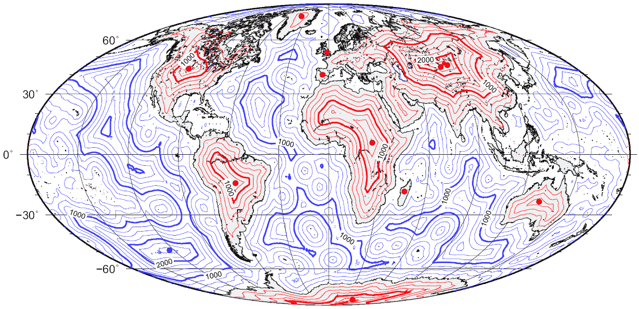
A pole of inaccessibility with respect to a geographical criterion of inaccessibility marks a location that is the most challenging to reach according to that criterion. Often it refers to the most distant point from the coastline, implying a maximum degree of continentality or oceanity. In these cases, a pole of inaccessibility can be defined as the center of the largest circle that can be drawn within an area of interest without encountering a coast. Where a coast is imprecisely defined, the pole will be similarly imprecise. Northern pole of inaccessibility The Northern pole of inaccessibility, sometimes known as the Arctic pole, is located on the Arctic Ocean pack ice at a distance farthest from any land mass. The original position was wrongly believed to lie at 84°03′N 174°51′W. It is not clear who first defined this point but it may have been Sir Hubert Wilkins, who wished to traverse the Arctic Ocean by aircraft, in 1927. He was finally successful in 1928. I ... [...More Info...] [...Related Items...] OR: [Wikipedia] [Google] [Baidu] |
Peñón De Vélez De La Gomera
(; ) is a Spanish exclave and rocky tied island, in the western Mediterranean Sea, connected to the Moroccan shore by a sandy isthmus. It is also connected to a smaller islet to the east, La Isleta, by a rocky isthmus. The tied island was named ' (Rock of Badis) and was connected to the town of Badis. , along with La Isleta, is a premodern overseas possession known as a . It is administered by the Spanish central government and has a population consisting only of a small number of Spanish military personnel. Its border with Morocco is long, making it one of the shortest international borders in the world. Geography is located southeast of Ceuta. It was a natural island in the Alboran Sea until 1934, when a huge thunderstorm washed large quantities of sand into the short channel between the island and the African continent. The channel was turned into a tombolo and the island became a peninsula, connected to the Moroccan coast by an long sandy isthmus, which is th ... [...More Info...] [...Related Items...] OR: [Wikipedia] [Google] [Baidu] |
Melilla
Melilla ( , ; ; rif, Mřič ; ar, مليلية ) is an autonomous city of Spain located in north Africa. It lies on the eastern side of the Cape Three Forks, bordering Morocco and facing the Mediterranean Sea. It has an area of . It was part of the Province of Málaga until 14 March 1995, when the Statute of Autonomy of Melilla was passed. Melilla is one of the special member state territories of the European Union. Movements to and from the rest of the EU and Melilla are subject to specific rules, provided for ''inter alia'' in the Accession Agreement of Spain to the Schengen Convention. As of 2019, Melilla had a population of 86,487. The population is chiefly divided between people of Iberian and Riffian extraction. There is also a small number of Sephardic Jews and Sindhi Hindus. Regarding sociolinguistics, Melilla features a diglossia between the official Spanish (strong language) and Tarifit (weak language). Melilla, like the autonomous city of Ceuta and Sp ... [...More Info...] [...Related Items...] OR: [Wikipedia] [Google] [Baidu] |
Ceuta
Ceuta (, , ; ar, سَبْتَة, Sabtah) is a Spanish autonomous city on the north coast of Africa. Bordered by Morocco, it lies along the boundary between the Mediterranean Sea and the Atlantic Ocean. It is one of several Spanish territories in Africa and, along with Melilla and the Canary Islands, one of only a few that are permanently inhabited by a civilian population. It was a regular municipality belonging to the province of Cádiz prior to the passing of its Statute of Autonomy in March 1995, henceforth becoming an autonomous city. Ceuta, like Melilla and the Canary Islands, was classified as a free port before Spain joined the European Union. Its population consists mainly of Christians and Muslims. There is also a small minority of Sephardic Jews and Sindhi Hindus, the latter of whom originate from current-day Pakistan. Spanish is the only official language, but Darija Arabic is quite prominent as well. Names The name Abyla has been said to have been a ... [...More Info...] [...Related Items...] OR: [Wikipedia] [Google] [Baidu] |
Morocco
Morocco (),, ) officially the Kingdom of Morocco, is the westernmost country in the Maghreb region of North Africa. It overlooks the Mediterranean Sea to the north and the Atlantic Ocean to the west, and has land borders with Algeria to the east, and the disputed territory of Western Sahara to the south. Mauritania lies to the south of Western Sahara. Morocco also claims the Spanish exclaves of Ceuta, Melilla and Peñón de Vélez de la Gomera, and several small Spanish-controlled islands off its coast. It spans an area of or , with a population of roughly 37 million. Its official and predominant religion is Islam, and the official languages are Arabic and Berber; the Moroccan dialect of Arabic and French are also widely spoken. Moroccan identity and culture is a mix of Arab, Berber, and European cultures. Its capital is Rabat, while its largest city is Casablanca. In a region inhabited since the Paleolithic Era over 300,000 years ago, the first Moroccan st ... [...More Info...] [...Related Items...] OR: [Wikipedia] [Google] [Baidu] |
Madagascar (island)
Madagascar (; mg, Madagasikara, ), officially the Republic of Madagascar ( mg, Repoblikan'i Madagasikara, links=no, ; french: République de Madagascar), is an island country in the Indian Ocean, approximately off the coast of East Africa across the Mozambique Channel. At Madagascar is the world's second-largest island country, after Indonesia. The nation is home to around 30 million inhabitants and consists of the island of Madagascar (the fourth-largest island in the world), along with numerous smaller peripheral islands. Following the prehistoric breakup of the supercontinent Gondwana, Madagascar split from the Indian subcontinent around 90 million years ago, allowing native plants and animals to evolve in relative isolation. Consequently, Madagascar is a biodiversity hotspot; over 90% of its wildlife is endemic. Human settlement of Madagascar occurred during or before the mid first millennium AD by Austronesian peoples, presumably arriving on outrigger canoes f ... [...More Info...] [...Related Items...] OR: [Wikipedia] [Google] [Baidu] |
Tugela Falls
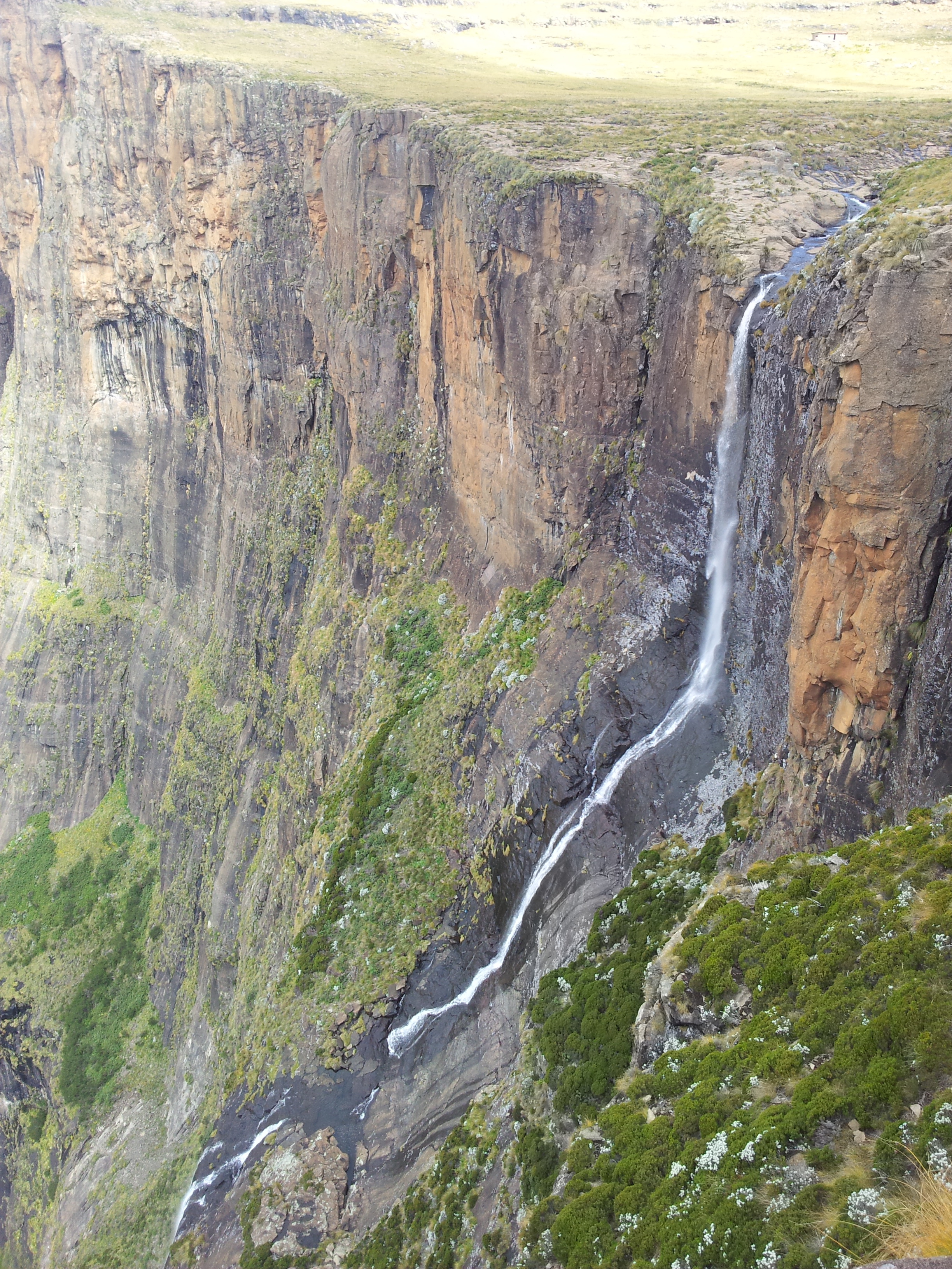
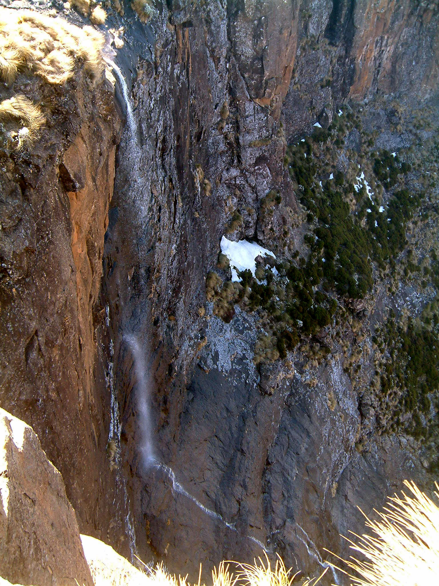
Tugela Falls is a complex of seasonal waterfalls located in the Drakensberg (''Dragon's Mountains'') of Royal Natal National Park in KwaZulu-Natal Province, Republic of South Africa. According to some measurements, it is the world's tallest waterfall. A revisited validation of waterfall measurements is not available, and there's still uncertainty whether Tugela or Venezuela's Angel Falls is the tallest (both measurements were taken at considerable distance from the two waterfalls). The combined total drop of its five distinct free-leaping falls is officially . In 2016, however, a Czech scientific expedition took new measurements, making the falls tall. The data were sent to the World Waterfall Database for confirmation. The source of the Tugela River ( Zulu for 'sudden') is the Mont-Aux-Sources plateau which extends several kilometers beyond The Amphitheatre escarpment from which the falls drop. Height controversy There is an argument that Tugela Falls is the tallest water ... [...More Info...] [...Related Items...] OR: [Wikipedia] [Google] [Baidu] |
List Of Waterfalls By Height
The following are lists of waterfalls in the world by height, classified into two categories — natural and artificial waterfall, artificial. Natural waterfalls are further subdivided between overall height and tallest single drop. Each column (Waterfall, Height, Locality, Country) is sortable by using the up/down link in the column headings at the top of each column. World's tallest natural waterfalls By overall height This list consists of waterfalls which are known to have an overall height of at least . Underwater falls, such as the Denmark Strait cataract, are not included. By tallest single drop This list consists of the waterfalls which are known to have a singular individual step with a vertical drop of at least . World's tallest artificial waterfalls See also *List of waterfalls *List of waterfalls by flow rate *List of waterfalls by type References {{Reflist External linksWorld Waterfall Database: Worlds Tallest Waterfalls Lists of waterfalls, Heightne ... [...More Info...] [...Related Items...] OR: [Wikipedia] [Google] [Baidu] |
Lake Victoria
Lake Victoria is one of the African Great Lakes. With a surface area of approximately , Lake Victoria is Africa's largest lake by area, the world's largest tropical lake, and the world's second-largest fresh water lake by surface area after Lake Superior in North America. In terms of volume, Lake Victoria is the world's ninth-largest continental lake, containing about of water. Lake Victoria occupies a shallow depression in Africa. The lake has an average depth of and a maximum depth of .United Nations, ''Development and Harmonisation of Environmental Laws Volume 1: Report on the Legal and Institutional Issues in the Lake Victoria Basin'', United Nations, 1999, page 17 Its catchment area covers . The lake has a shoreline of when digitized at the 1:25,000 level, with islands constituting 3.7% of this length. The lake's area is divided among three countries: Kenya occupies 6% (), Uganda 45% (), and Tanzania 49% (). Though having multiple local language names ( luo, Na ... [...More Info...] [...Related Items...] OR: [Wikipedia] [Google] [Baidu] |
Lake Tanganyika
Lake Tanganyika () is an African Great Lake. It is the second-oldest freshwater lake in the world, the second-largest by volume, and the second-deepest, in all cases after Lake Baikal in Siberia. It is the world's longest freshwater lake. The lake is shared among four countries— Tanzania, the Democratic Republic of the Congo (DRC), Burundi, and Zambia, with Tanzania (46%) and DRC (40%) possessing the majority of the lake. It drains into the Congo River system and ultimately into the Atlantic Ocean. Etymology "Tanganika" was the name of the lake that Henry Morton Stanley encountered when he was at Ujiji in 1876. The name first originated from the Bembe language when they arrived in South Kivu around the 7th century, they discovered the lake and started calling it “êtanga ‘ya’ni’â” which means “a big river” in their Bantu language. Stanley found also other names for the lake among different ethnic groups, like the Kimana, the Yemba and the Msaga. An al ... [...More Info...] [...Related Items...] OR: [Wikipedia] [Google] [Baidu] |
List Of Lakes By Depth
These articles lists the world's deepest lakes. Lakes ranked by maximum depth This list contains all lakes whose maximum depth is reliably known to exceed '' Geologically, the Caspian Sea, like the Black and Mediterranean seas, is a remnant of the ancient Tethys Ocean. The deepest area is oceanic rather than continental crust. However, it is generally regarded by geographers as a large endorheic salt lake. Lakes ranked by mean depth Mean depth can be a more useful indicator than maximum depth for many ecological purposes. Unfortunately, accurate mean depth figures are only available for well-studied lakes, as they must be calculated by dividing the lake's volume by its surface area. A reliable volume figure requires a bathymetric survey. Therefore, mean depth figures are not available for many deep lakes in remote locations. The average lake on Earth has the mean depth 41.8 meters (137.14 feet) The Caspian Sea ranks much further down the list on mean depth, as it has a l ... [...More Info...] [...Related Items...] OR: [Wikipedia] [Google] [Baidu] |


