|
Extreme Points Of Africa
The extreme points of Africa are the points that are further north, south, east or west than any other location on Africa, the continent. Latitude and longitude Geographic coordinates expressed in WGS 84. Africa :Africa * Northernmost point — Galite Islands, Iles des Chiens, Tunisia (37°32'N) * Great capes#Five southernmost capes, Southernmost point — Cape Agulhas, South Africa (34°51'15"S). If the Prince Edward Islands are included in Africa, then Marion Island is the southernmost point at 46°54'S. * Westernmost point — Santo Antão, Cape Verde, Santo Antão, Cape Verde Islands (25°25'W) * Easternmost point — Rodrigues (island), Rodrigues, Mauritius (63°30'E) :Africa (mainland) *Northernmost point — Ras ben Sakka, Tunisia *Great capes#Five southernmost capes, Southernmost point — Cape Agulhas, South Africa *Westernmost point — Pointe des Almadies, Cap Vert Peninsula, Ngor, Dakar, Senegal (17°33'22"W) *Easternmost point — Ras Hafun (Raas Xaafuun), Somalia ... [...More Info...] [...Related Items...] OR: [Wikipedia] [Google] [Baidu] |
Africa
Africa is the world's second-largest and second-most populous continent after Asia. At about 30.3 million km2 (11.7 million square miles) including adjacent islands, it covers 20% of Earth's land area and 6% of its total surface area.Sayre, April Pulley (1999), ''Africa'', Twenty-First Century Books. . With nearly billion people as of , it accounts for about of the world's human population. Demographics of Africa, Africa's population is the youngest among all the continents; the median age in 2012 was 19.7, when the worldwide median age was 30.4. Based on 2024 projections, Africa's population will exceed 3.8 billion people by 2100. Africa is the least wealthy inhabited continent per capita and second-least wealthy by total wealth, ahead of Oceania. Scholars have attributed this to different factors including Geography of Africa, geography, Climate of Africa, climate, corruption, Scramble for Africa, colonialism, the Cold War, and neocolonialism. Despite this lo ... [...More Info...] [...Related Items...] OR: [Wikipedia] [Google] [Baidu] |
Ngor, Dakar
Ngor ( in Wolof) is a commune d'arrondissement of the city of Dakar, Senegal. As of 2013 it had a population of 17,383. The westernmost point of the country and the mainland African continent is located in Ngor. Ngor is one of the four original Lebou villages of the Cap-Vert Peninsula, along with Yoff, Hann, and Ouakam. It includes the small . Ngor's recorded history dates back to 1550, when migrants from the interior of Senegal including the Walo, Cayor, Jolof (also as Djolof or Wolof) and Baol Baol or Bawol was a kingdom in what is now central Senegal. Founded in the 11th century, it was a vassal of the Jolof Empire before becoming independent in the mid-16th century. The ruler bore the title of Teigne (title), Teigne (or Teeň) and re ... came into the Cap-Vert peninsula. Sports club The most notable football club is Olympique de Ngor. The club once played at the First Division of Senegal and later Ligue 1 (Premier League) and was relegated in 2016 to Ligue 2 where t ... [...More Info...] [...Related Items...] OR: [Wikipedia] [Google] [Baidu] |
Djibouti
Djibouti, officially the Republic of Djibouti, is a country in the Horn of Africa, bordered by Somalia to the south, Ethiopia to the southwest, Eritrea in the north, and the Red Sea and the Gulf of Aden to the east. The country has an area of . In antiquity, the territory, together with Ethiopia, Eritrea and Somaliland, was part of the Land of Punt. Nearby Zeila, now in Somaliland, was the seat of the medieval Adal Sultanate, Adal and Ifat Sultanate, Ifat Sultanates. In the late 19th century, the colony of French Somaliland was established after the ruling Dir (clan), Dir, Somali people, Somali, and Afar people, Afar sultans signed treaties with the French, and its Imperial Ethiopian Railway, railroad to Dire Dawa (and later Addis Ababa) allowed it to quickly supersede Zeila as the port for southern Ethiopia and the Ogaden. It was renamed the French Territory of the Afars and the Issas in 1967. A decade later, the Djiboutian people 1977 Afars and Issas independence referendu ... [...More Info...] [...Related Items...] OR: [Wikipedia] [Google] [Baidu] |
Lake Assal (Djibouti)
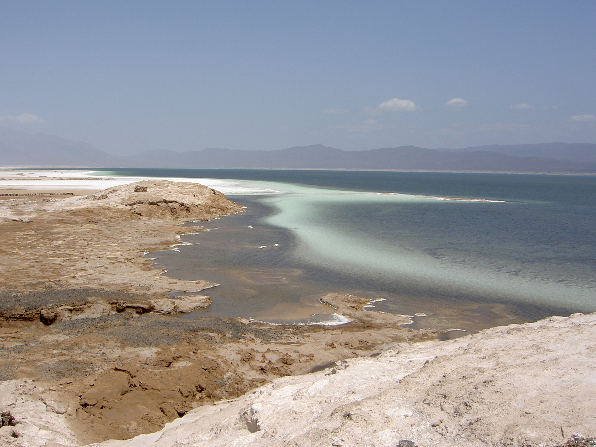
Lake Assal ( , Literal translation, lit. “Honey Lake”) is a Volcanic crater lake, crater lake in central-western Djibouti. It is located at the western end of Gulf of Tadjoura between Arta Region, and Tadjoura Region, touching Dikhil Region, at the top of the Great Rift Valley, some west of Djibouti (city), Djibouti city. Lake Assal is a saline lake that lies below sea level in the Afar Triangle, making it the lowest point on land in Africa and the third-lowest point on Earth after the Sea of Galilee and the Dead Sea. No outflow occurs from the lake, and due to high evaporation, the salinity level of its waters is 10 times that of the sea, making it the List of bodies of water by salinity, fifth most saline body of water in the world, behind Garabogazköl, Lake Retba, Gaet'ale Pond and Lake Elton. The salt in the lake is exploited under four concessions awarded in 2002 at the southeast end of the lake; the major share of production (nearly 80%) is held by Société d’Explo ... [...More Info...] [...Related Items...] OR: [Wikipedia] [Google] [Baidu] |
Tanzania
Tanzania, officially the United Republic of Tanzania, is a country in East Africa within the African Great Lakes region. It is bordered by Uganda to the northwest; Kenya to the northeast; the Indian Ocean to the east; Mozambique and Malawi to the south; Zambia to the southwest; and Rwanda, Burundi, and the Democratic Republic of the Congo to the west. According to a 2024 estimate, Tanzania has a population of around 67.5 million, making it the most populous country located entirely south of the equator. Many important hominid fossils have been found in Tanzania. In the Stone and Bronze Age, prehistoric migrations into Tanzania included South Cushitic languages, Southern Cushitic speakers similar to modern day Iraqw people who moved south from present-day Ethiopia; Eastern Cushitic people who moved into Tanzania from north of Lake Turkana about 2,000 and 4,000 years ago; and the Southern Nilotic languages, Southern Nilotes, including the Datooga people, Datoog, who originated fro ... [...More Info...] [...Related Items...] OR: [Wikipedia] [Google] [Baidu] |
Mount Kilimanjaro
Mount Kilimanjaro () is a dormant volcano in Tanzania. It is the highest mountain in Africa and the highest free-standing mountain above sea level in the world, at above sea level and above its plateau base. It is also the highest volcano in the Eastern Hemisphere and the fourth most topographically prominent peak on Earth. Kilimanjaro's southern and eastern slopes served as the home of the Chagga Kingdoms until their abolition in 1963 by Julius Nyerere. The origin and meaning of the name Kilimanjaro is unknown, but may mean "mountain of greatness" or "unclimbable". Although described in classical sources, German missionary Johannes Rebmann is credited as the first European to report the mountain's existence, in 1848. After several European attempts, Hans Meyer reached Kilimanjaro's highest summit in 1889. The mountain was incorporated into Kilimanjaro National Park in 1973. As one of the Seven Summits, Kilimanjaro is a major hiking and climbing destination. There a ... [...More Info...] [...Related Items...] OR: [Wikipedia] [Google] [Baidu] |
Democratic Republic Of The Congo
The Democratic Republic of the Congo (DRC), also known as the DR Congo, Congo-Kinshasa, or simply the Congo (the last ambiguously also referring to the neighbouring Republic of the Congo), is a country in Central Africa. By land area, it is the List of African countries by area, second-largest country in Africa and the List of countries and dependencies by area, 11th-largest in the world. With a population of around 112 million, the DR Congo is the most populous nominally List of countries and territories where French is an official language, Francophone country in the world. Belgian French, French is the official and most widely spoken language, though there are Languages of the Democratic Republic of the Congo, over 200 indigenous languages. The national capital and largest city is Kinshasa, which is also the economic center. The country is bordered by the Republic of the Congo, the Cabinda Province, Cabinda exclave of Angola, and the South Atlantic Ocean to the west; the Cen ... [...More Info...] [...Related Items...] OR: [Wikipedia] [Google] [Baidu] |
South Sudan
South Sudan (), officially the Republic of South Sudan, is a landlocked country in East Africa. It is bordered on the north by Sudan; on the east by Ethiopia; on the south by the Democratic Republic of the Congo, Uganda and Kenya; and on the west by the Central African Republic. South Sudan's diverse landscape includes vast plains and plateaus, dry and tropical savannahs, inland floodplains, and forested mountains. The Nile, Nile River system is the defining physical feature of the country, running south to north across its center, which is dominated by a large swamp known as the Sudd. South Sudan has a population of just over 12.7 million in 2024. Juba is the Capital city, capital and largest city. Sudan was occupied by History of Egypt under the Muhammad Ali dynasty, Egypt under the Muhammad Ali dynasty and governed as an Anglo-Egyptian Sudan, Anglo-Egyptian condominium until Sudanese independence in 1956. Following the First Sudanese Civil War, the Southern Sudan Autonomous ... [...More Info...] [...Related Items...] OR: [Wikipedia] [Google] [Baidu] |
Central African Republic
The Central African Republic (CAR) is a landlocked country in Central Africa. It is bordered by Chad to Central African Republic–Chad border, the north, Sudan to Central African Republic–Sudan border, the northeast, South Sudan to Central African Republic–South Sudan border, the east, the Democratic Republic of the Congo to Central African Republic–Democratic Republic of the Congo border, the south, the Republic of the Congo to Central African Republic–Republic of the Congo border, the southwest, and Cameroon to Cameroon–Central African Republic border, the west. Bangui is the country's capital and largest city, bordering the Democratic Republic of the Congo. The Central African Republic covers a land area of about . As of 2024, it has a population of 5,357,744, consisting of about 80 ethnic groups, and is in the scene of a Central African Republic Civil War, civil war, which has been ongoing since 2012. Having been a Ubangi-Shari, French colony under the name Ubangi ... [...More Info...] [...Related Items...] OR: [Wikipedia] [Google] [Baidu] |
Pole Of Inaccessibility
In geography, a pole of inaccessibility is the farthest (or most difficult to reach) location in a given landmass, sea, or other topographical feature, starting from a given boundary, relative to a given criterion. A geographical criterion of inaccessibility marks a location that is the most challenging to reach according to that criterion. Often it refers to the most distant point from the coastline, implying the farthest point into a landmass from the shore, or the farthest point into a body of water from the shore. In these cases, a pole of inaccessibility is the center of a maximally large circle that can be drawn within an area of interest only touching but not crossing a coastline. Where a coast is imprecisely defined, the pole will be similarly imprecise. Northern pole of inaccessibility The northern pole of inaccessibility, sometimes known as the Arctic pole, is located on the Arctic Ocean pack ice at a distance farthest from any landmass. The original position was wro ... [...More Info...] [...Related Items...] OR: [Wikipedia] [Google] [Baidu] |
Republic Of The Congo
The Republic of the Congo, also known as Congo-Brazzaville, the Congo Republic or simply the Congo (the last ambiguously also referring to the neighbouring Democratic Republic of the Congo), is a country located on the western coast of Central Africa to the west of the Congo River. It is bordered to the west by Gabon, to the northwest by Cameroon, to the northeast by the Central African Republic, to the southeast by the Democratic Republic of the Congo, to the south by the Angolan exclave of Cabinda Province, Cabinda, and to the southwest by the Atlantic Ocean. The region was dominated by Bantu peoples, Bantu-speaking tribes at least 3,000 years ago, who built trade links leading into the Congo River basin. From the 13th century, the present-day territory was dominated by a confederation led by Vungu which included Kakongo and Ngoyo. Kingdom of Loango, Loango emerged in the 16th century. In the late 19th century France colonised the region and incorporated it into French Equato ... [...More Info...] [...Related Items...] OR: [Wikipedia] [Google] [Baidu] |
Epena
Epena is a village of 5,190 people, the administrative seat of Epena District in the Likouala Department of northeastern Republic of the Congo. It is on the Likouala-aux-Herbes river, just east of the Lake Télé Community Reserve. A paved road, opened in 1989, links Epena to the departmental capital Impfondo Impfondo is a town and a commune in the northeastern Republic of the Congo lying on the Oubangui River. It is home to an airport and is linked by river barge to Brazzaville and to Bangui. It is the administrative centre of the Likouala Departm .... The population of Epena is primarily Bomitaba and speaks the Bomitaba language. The village marks a rough divide between the Bomitaba linguistic area and that of the Dibole language to the south.Leitch, 787. Notable residents * Aminata Aboubakar Yacoub - Congolese Olympic swimmer References Likouala Department Populated places in the Republic of the Congo {{RCongo-geo-stub ... [...More Info...] [...Related Items...] OR: [Wikipedia] [Google] [Baidu] |


