|
Ethnic Groups Of Vojvodina
Vojvodina is a province in Republic of Serbia and one of the most ethnically diverse regions in Europe, home to 25 different ethnicities. Serbs *Serbs – There were 1,289,635 Serbs in Vojvodina or 66.76% of the population in the province. Serbs make up an absolute majority in most of the municipalities and large cities of Vojvodina, except in Subotica (second largest city), which has a mixed population with no absolute majority of any nation (but the Serbian language is spoken by plurality in Subotica). Large cities with a Serb ethnic majority are: Sremska Mitrovica (87.37%), Ruma (86.58%), Inđija (84.87%), Pančevo (79%), Novi Sad (78.79%), Bačka Palanka (78.59%), Kikinda (75.43%), Zrenjanin (74.24%), Vršac (72.26%), Sombor (63.29%), and Apatin (62.79%). Other municipalities with a Serb ethnic majority are: Pećinci (91.1%), Opovo (86.14%), Titel (86.51%), Žabalj (84.69%), Odžaci (83.16%), Stara Pazova (82.86%), Irig (78.53%), Sremski Karlovci (77.94%), Šid (77.93%) ... [...More Info...] [...Related Items...] OR: [Wikipedia] [Google] [Baidu] |
Vojvodina
Vojvodina ( ; sr-Cyrl, Војводина, ), officially the Autonomous Province of Vojvodina, is an Autonomous administrative division, autonomous province that occupies the northernmost part of Serbia, located in Central Europe. It lies within the Pannonian Basin, bordered to the south by the national capital Belgrade and the Sava and Danube Rivers. The administrative centre, Novi Sad, is the second-largest city in Serbia. The historic regions of Banat, Bačka, Syrmia and northernmost part of Mačva overlap the province. Modern Vojvodina is multi-ethnic and multi-cultural, with some 26 ethnic groups and six official languages. Fewer than two million people, nearly 27% of Serbia's population, live in the province. Name ''Vojvodina'' is also the Serbian word for voivodeship, a type of duchy overseen by a voivode. The Voivodeship of Serbia and Banat of Temeschwar, Serbian Voivodeship, a precursor to modern Vojvodina, was an Austrian province from 1849 to 1860. Its official name ... [...More Info...] [...Related Items...] OR: [Wikipedia] [Google] [Baidu] |
Opovo
Opovo (; ) is a town and municipality located in the South Banat District of the autonomous province of Vojvodina, Serbia. The town has a population of 4,147, while Opovo municipality has 9,462 inhabitants (2022 census). Name In Serbian, the town is known as ''Opovo'' (Опово), in German as ''Opowa'', in Hungarian as ''Ópáva'', in Croatian as ''Opovo'', in Romanian as ''Opovo'', in Slovak as ''Opovo'', and in Rusyn as Опово. History There are traces from Neolithic and Roman periods in this area. An older settlement named Želj existed at this locality during medieval Hungarian and later Ottoman administration. During Hungarian administration it was part of the Kovin county and during Ottoman administration part of the Temeşvar Eyalet. Southern part of modern Opovo is still called Želj by local inhabitants. According to historical sources, modern Opovo was mentioned first in 1672-1690 and it was populated by Serbs. They lived in the houses made from mud. Durin ... [...More Info...] [...Related Items...] OR: [Wikipedia] [Google] [Baidu] |
Temerin
Temerin ( sr-Cyrl, Темерин; , ) is a town and municipality located in the South Bačka District of the autonomous province of Vojvodina in Serbia. The town has a population of 17,998, while the municipality has a population of 25,780 (2022 census). Name In Serbian language, Serbian, the town is known as ''Temerin'' (Темерин), in Hungarian language, Hungarian as ''Temerin'', in German language, German as ''Temeri'', and in Croatian language, Croatian as ''Temerin''. Location The territory of the municipality of Temerin lies in the southeast part of Bačka plain. It borders the municipalities of Žabalj to the east, Srbobran to the north, Vrbas (city), Vrbas to the west, and Novi Sad to the south. The most influential factor in the development of Temerin is its proximity to Novi Sad, the economic center of Vojvodina. The territory of the Municipality of Temerin covers the area of around , and has a shape of an irregular trapezoid, spreading in the northwest to south ... [...More Info...] [...Related Items...] OR: [Wikipedia] [Google] [Baidu] |
Beočin
Beočin ( sr-Cyrl, Беочин, ; ) is a town and municipality located in the South Bačka District of the autonomous province of Vojvodina, Serbia. The population of the town is 7,274, whilst Beočin's municipality population is 13,875 (2022 census). There is also a Beočin Monastery from the 16th century in the municipality. Name In Serbian, the town is known as ''Beočin'' (Беочин), in Croatian as ''Beočin'', in Hungarian as ''Belcsény'', in German (dated) as ''Beotschin'', in Slovak as ''Beočín'', and in Rusyn as Беочин. The name of the town derives from the word that came from local Serbian dialect, which in modern standard Serbian would be written as "beli otac" or in English as "white father" (the full meaning of the name is "the place that belong to white father"). The name referred to the prior of the nearby Beočin monastery. Geography Although it is geographically located in Syrmia, Beočin administratively belong to South Bačka District ... [...More Info...] [...Related Items...] OR: [Wikipedia] [Google] [Baidu] |
Novi Bečej
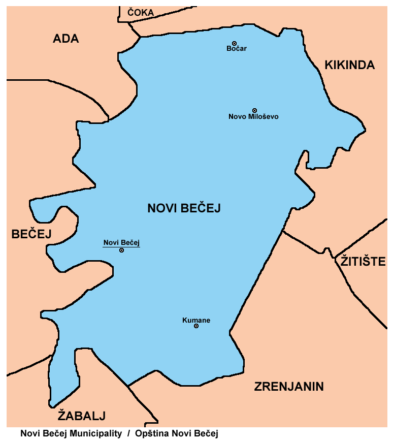
Novi Bečej (, ) is a town and municipality located in the Central Banat District of the autonomous province of Vojvodina, Serbia. The town has a population of 10,967, while Novi Bečej municipality has 19,886 inhabitants (2022 census). Name Novi Bečej means "New Bečej". In the past it was known as ''Turski Bečej'' ( sr-cyrl, Турски Бечеј, "Turkish Bečej"), while the current town of Bečej, across the river Tisa (in the Bačka region) was in the past known as ''Stari Bečej'' (Serbian Cyrillic: , "Old Bečej"). There are several theories about town's name origin. The first one is that it derives from ''Castellum de Beche'', which was the name of the fort located near today's town center. The other theory is that the name was given after the family Wechey, which used to rule the settlement and the land around modern-day Novi Bečej. The town was also known as ''Turski Bečej'' (Турски Бечеј). In 1919 it was renamed ''Novi Bečej'' (Нови Беч ... [...More Info...] [...Related Items...] OR: [Wikipedia] [Google] [Baidu] |
Sečanj
Sečanj (, ) is a town located in the Central Banat District of the autonomous province of Vojvodina, Serbia. As of 2022 census, the town itself had a population of 1,889, while the Sečanj municipality has 10,544 inhabitants. Name "Sečanj" is a Slavic calendar, Slavic name for the first month in the calendar year. The Serbian Ekavian variant of this name was eventually replaced with the Latin-derived "Januar", while the Croatian Ijekavian variant "Siječanj" remains in use in Croatia. In Serbian language, Serbian and Croatian language, Croatian, the town is known as ''Sečanj'' (Сечањ), in Hungarian language, Hungarian as ''Szécsány'' or ''Torontálszécsány'', in German language, German as ''Setschan'' or ''Petersheim'', and in Romanian language, Romanian as ''Seceani''. Serbian, Hungarian, and Romanian language are officially used by municipal authorities. Demographics According to the 2011 census, the population of the municipality of Sečanj was 13,267 inhabitan ... [...More Info...] [...Related Items...] OR: [Wikipedia] [Google] [Baidu] |
Bela Crkva (Vojvodina)
Bela Crkva ( sr-cyrl, Бела Црква, ; ; ; ) is a town and municipality located in the South Banat District of the autonomous province of Vojvodina, Serbia. The town has a population of 7,456, while the Bela Crkva municipality has 14,451 inhabitants (2022 census). Bela Crkva lakes at the outskirts of the town are a popular summer tourist destination. Name The name of the town ''Bela Crkva'' means "white church" in English. In Romanian, the town is known as ''Biserica Albă'' (formerly Albești), in German as ''Weißkirchen'', in Hungarian as ''Fehértemplom'' (formerly Fejéregyház), and in Turkish as ''Aktabya''. History Neolithic findings of ceramics and burial with Greek-style pots dating to late fifth century BCE have been found in the area. The town was founded in 1717 when this region was included into the Habsburg monarchy. It was part of the Banatian Military Frontier of the Monarchy and, since 1774, was a seat of the Illyrian (Serbian) section of the ... [...More Info...] [...Related Items...] OR: [Wikipedia] [Google] [Baidu] |
Kovin
Kovin (, ) is a town and municipality located in the South Banat District of the autonomous province of Vojvodina, Serbia. The town has a population of 11,623, while the municipality has 28,141 inhabitants (2022 census). Other names In Romanian language, Romanian, the town is known as ''Cuvin'', in Hungarian language, Hungarian as ''Kevevára'' or (until 1899) ''Temeskubin'', and in German language, German as ''Kubin'' or Temeschkubin. In the past, the town was also known as ''Donji Kovin'' ("Lower Kovin") in contrast to the town with same name in Hungary that was known in Serbian language, Serbian as ''Ráckeve, Gornji Kovin'' ("Upper Kovin") and in Hungarian as ''Ráckeve'' ("the Serb Kovin"). History The Dacians, Dacian tribe of Albocenses dwelled in this area in the second century AD. There are remains of the ancient Ancient Rome, Roman fortress called ''Contra Margum'', opposite to the Margum Dubravica, Margum, a fortress on the other side of the Danube. In the nint ... [...More Info...] [...Related Items...] OR: [Wikipedia] [Google] [Baidu] |
Šid
Šid ( sr-cyr, Шид, ; ) is a town and municipality located in the Srem District of the autonomous province of Vojvodina, Serbia. It has a population of 12,628, while the municipality has 27,894 inhabitants (2022 census). A border crossing between Serbia and Croatia is located in the town. Name In Serbian language, Serbian, the town is known as ''Šid'' (Шид), in Hungarian language, Hungarian as ''Sid'', in German language, German as ''Schid'', in Slovak language, Slovak as ''Šíd'', and in Pannonian Rusyn language, Rusyn as Шид. History Šid was firstly mentioned in 1702. At first, settlement was part of Podunavlje, Danubian Military Frontier, but since the middle of the 18th century, it was part of the Syrmia County of the Habsburg monarchy, Habsburg Kingdom of Slavonia. In 1848–1849, Šid was part of Serbian Vojvodina, and in 1849–1860 part of Voivodeship of Serbia and Banat of Temeschwar. After the abolishment of the voivodeship in 1860, Šid was again incorporat ... [...More Info...] [...Related Items...] OR: [Wikipedia] [Google] [Baidu] |
Sremski Karlovci
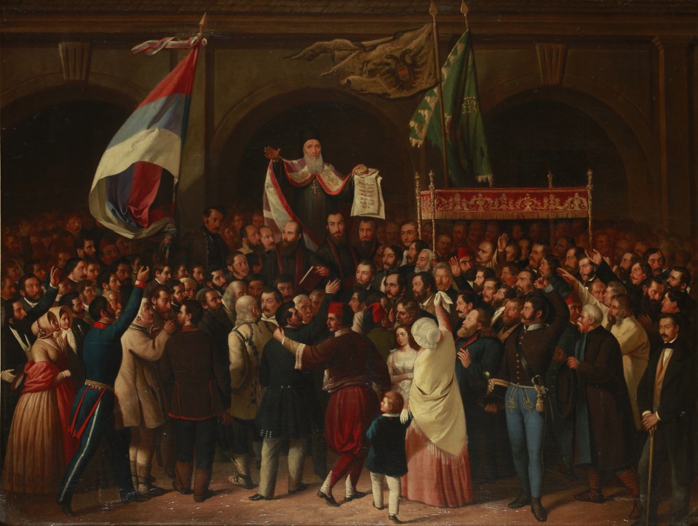
Sremski Karlovci ( sr-Cyrl, Сремски Карловци, ) is a town and municipality located in the South Bačka Districtautonomous province of Vojvodina, Serbia. It is situated on the banks of the Danube, from Novi Sad. According to the 2022 census results, it has a population of 7,872 inhabitants. The town has traditionally been known as the seat of the Patriarchate of Karlovci, Serbian Orthodox Church in the Habsburg Monarchy. It was the political and cultural capital of Serbian Vojvodina after the May Assembly and during the Revolution in 1848. Name In Serbian language, Serbian, the town is known as ''Sremski Karlovci'' (Сремски Карловци), in Croatian language, Croatian as ''Srijemski Karlovci'', in German language, German as ''Karlowitz'' or ''Carlowitz'', in Hungarian language, Hungarian as ''Karlóca'', in Polish language, Polish as ''Karłowice'', in Romanian language, Romanian as ''Carloviț'' and in Turkish language, Turkish as ''Karlofça''. The form ... [...More Info...] [...Related Items...] OR: [Wikipedia] [Google] [Baidu] |
Irig, Serbia
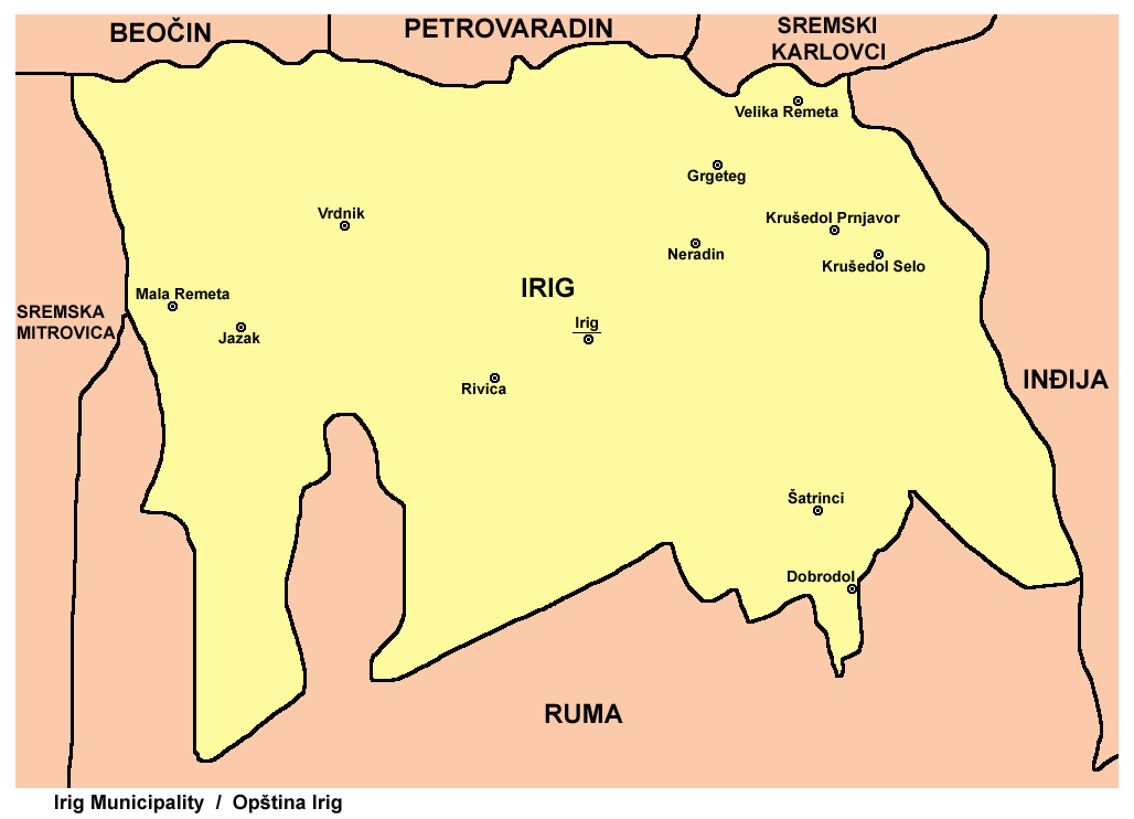
Irig (, ; ) is a town and municipality located in the Srem District of the autonomous province of Vojvodina, Serbia. The town has a population of 4,415, while Irig municipality has 10,866 inhabitants. Name In Serbian, the town is known as ''Irig'' (Ириг), in Croatian as ''Irig'', in Hungarian as ''Ireg'' or ''Ürög'', in German as ''Irick'', in Slovak as ''Irig'', and in Rusyn as Ириґ. History Irig was first mentioned in the historical documents in 1225. In the 15th century, the masters of the town were Serbian despots Vuk Grgurević, Đorđe Branković, and Jovan Branković. During the 15th and 16th century, ten Orthodox monasteries were built in the surrounding of Irig (Two of those were located just near the town). Between 1526 and 1699, the town was under Ottoman administration. During this time, it belonged to the Sanjak of Syrmia, and was the administrative seat of one of the seven nahijas in that sanjak. In 1665, the town had 2,000 houses, one mosque an ... [...More Info...] [...Related Items...] OR: [Wikipedia] [Google] [Baidu] |
Stara Pazova
Stara Pazova (, ; ; ) is a small town located in the Srem District of the autonomous province of Vojvodina, Serbia. The town has a population of 18,522, while Stara Pazova municipality has 62,318 inhabitants (2022 census). The entrance into town from Inđija lies on 45th parallel north, it is half-way between the North Pole and the equator. Name In Serbian, the town is known as ''Stara Pazova'' (Стара Пазова), formerly also ''Pazova'' (Пазова); in Slovak as ''Stará Pazova''; in German as ''Alt-Pasua'', ''Alt-Pazua'' or ''Pazua''; and in Hungarian as ''Ópazova''. History During the Ottoman administration (16th-18th century), Pazova was populated by ethnic Serbs and was part of the Ottoman Sanjak of Syrmia. In 1718, the town became part of the Habsburg monarchy. In the 18th century (after 1760) Lutheran Slovaks settled in Pazova, and in 1791 Germans arrived here as well. The Germans lived in a separate settlement known as Nova Pazova ("New Pazova"), thus th ... [...More Info...] [...Related Items...] OR: [Wikipedia] [Google] [Baidu] |


