|
Département Of Mont Tonnerre
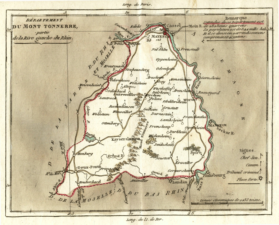
Mont-Tonnerre () was a department of the First French Republic and later the First French Empire in present-day Germany. It was named after the highest point in the Palatinate, the ''Donnersberg'' ("Thunder Mountain", possibly referring to Donar, god of thunder). It was the southernmost of four departments formed in 1797 when the west bank of the Rhine was annexed by France. Prior to the French occupation, its territory was divided between the Archbishopric of Mainz, the Bishopric of Speyer, the Bishopric of Worms, Nassau-Weilburg, Hesse-Darmstadt, the Electorate of the Palatinate and the imperial cities of Worms and Speyer. Its territory is now part of the German states of Rhineland-Palatinate and Saarland. Its capital was Mainz (). The department was subdivided into the following arrondissements and cantons (situation in 1812): [...More Info...] [...Related Items...] OR: [Wikipedia] [Google] [Baidu] |
Mainz
Mainz (; #Names and etymology, see below) is the capital and largest city of the German state of Rhineland-Palatinate, and with around 223,000 inhabitants, it is List of cities in Germany by population, Germany's 35th-largest city. It lies in the Frankfurt Rhine-Main, Rhine-Main Metropolitan Region—Germany's second-largest metropolitan region after Rhine-Ruhr—which also encompasses the cities of Frankfurt am Main, Wiesbaden, Darmstadt, Offenbach am Main, and Hanau. Mainz is located at the northern end of the Upper Rhine Plain, on the left bank of the Rhine. It is the largest city of Rhenish Hesse, a region of Rhineland-Palatinate that was historically part of Grand Duchy of Hesse, Hesse, and is Rheinhessen (wine region), one of Germany's most important wine regions because of its mild climate. Mainz is connected to Frankfurt am Main by the Rhine-Main S-Bahn rapid transit system. Before 1945, Mainz had six boroughs on the other side of the Rhine (see: :de:Rechtsrheinische St ... [...More Info...] [...Related Items...] OR: [Wikipedia] [Google] [Baidu] |
Speyer
Speyer (, older spelling ; ; ), historically known in English as Spires, is a city in Rhineland-Palatinate in the western part of the Germany, Federal Republic of Germany with approximately 50,000 inhabitants. Located on the left bank of the river Rhine, Speyer lies south of Ludwigshafen and Mannheim, and south-west of Heidelberg. Founded by the Ancient Rome, ancient Romans as a fortified town on the northeast frontiers of their Roman Empire, it is one of Germany's oldest cities. Speyer Cathedral, a number of other churches, and the ("old gate") dominate the Speyer landscape. In the cathedral, beneath the high altar, are the tombs of eight Holy Roman Emperors and List of German monarchs, German kings. The city is famous for the 1529 Protestation at Speyer. One of the ShUM-cities which formed the cultural center of Jewish life in Europe during the Middle Ages, Medieval / Middle Ages, Speyer and its Jewish courtyard, Speyer, Jewish courtyard was inscribed on the UNESCO (United ... [...More Info...] [...Related Items...] OR: [Wikipedia] [Google] [Baidu] |
Ingelheim
Ingelheim (), officially Ingelheim am Rhein (), is a town in the Mainz-Bingen Districts of Germany, district in the Rhineland-Palatinate state of Germany. The town sprawls along the Rhine's left bank. It has been Mainz-Bingen's district seat since 1996. From the later half of the 8th century, the Imperial Palace, Ingelheim, Ingelheim Imperial Palace, which served emperors and kings as a lodging and a ruling seat until the 11th century, was to be found here. Etymology The typically Rhenish Hesse, Rhenish-Hessian placename ending ''—heim'' might well go back to Franks, Frankish times, that is to say, likely as far back as the 5th or 6th century. Settlements or estates then took their lords’ names and were given this suffix, which means "home" in German language, German. The name is recorded in later documents as ''Ingilinhaim'', ''Ingilinheim'' (782), ''Ingilenhaim'', ''Engelheim'', ''Hengilonheim'', ''Engilonheim'' (822), ''Engilinheim'' (826), ''Hingilinheim'' (855), ''Ing ... [...More Info...] [...Related Items...] OR: [Wikipedia] [Google] [Baidu] |
Nieder-Olm
Nieder-Olm is a town in the Mainz-Bingen district in Rhineland-Palatinate, Germany. Until 5 November 2006 it was an ''Ortsgemeinde'' – a municipality belonging to a ''Verbandsgemeinde'', a kind of collective municipality – but it was raised to town the next day. It is still the seat of the ''Verbandsgemeinde'' of Nieder-Olm, and functions as a middle centre in the region. Geography Location Nieder-Olm lies some 10 km south of Mainz in the heart of Rhenish Hesse, on the east bank of the Selz in the northern part of the Rhenish-Hessian Hills (''Rheinhessisches Hügelland''), known as the Mainz Basin. The town's average elevation lies at some 150 m above sea level. The highest elevation within municipal limits is the Mühlberg at 243 m in the northeast between Nieder-Olm and Mainz-Ebersheim. The landscape is strongly characterized by winegrowing and fruit growing. A wood named ''Im Loh'' can be found in the northeast of the municipal area. It is only som ... [...More Info...] [...Related Items...] OR: [Wikipedia] [Google] [Baidu] |
Kirchheimbolanden
Kirchheimbolanden is the capital and the second largest city of the Donnersbergkreis, in Rhineland-Palatinate. Situated in south-western Germany, it is approximately 25 km west of Worms, Germany, Worms, and 30 km north-east of Kaiserslautern. The first part of the name, ''Kirchheim'', dates back to 774. It became a town in 1368, and the Sponheim family improved its security with many towers and walls. William, Duke of Nassau, ancestor of the royal families of Belgium, Sweden, Denmark and Norway, and of the grand-ducal family of Luxembourg, was born in Kirchheimbolanden. It was also ruled by the First French Empire between 1792 and 1814, before passing to the Kingdom of Bavaria in 1815. It was a rural district centre in the ''Rheinkreis'', which was renamed ''Pfalz'' (Palatinate (region), Palatinate) in 1835. Etymology The name ''Kirchheim'' was first mentioned in the Lorsch codex on 28 December 774, which can be traced back to the 7th century, where a parish church s ... [...More Info...] [...Related Items...] OR: [Wikipedia] [Google] [Baidu] |
Bechtheim
Bechtheim is an ''Ortsgemeinde'' – a municipality belonging to a ''Verbandsgemeinde'', a kind of collective municipality – in the Alzey-Worms district in Rhineland-Palatinate, Germany. It belongs to the ''Verbandsgemeinde'' of Wonnegau, whose seat is in Osthofen. History The Frankish nobleman Bero supposedly took his lordly seat here in the 6th century and founded “Beroheim” (''–heim'' means “home”), out of which developed Bechtheim. Saint Lambert's Basilica was founded in the 8th century by the Cathedral Foundation of Liège, in whose ownership the municipality found itself then. In 793, Bechtheim had its first documentary mention in a document from Fulda Abbey. In the Lorsch codex the place was named in 1070. First the Lords of Bolanden and thereafter, as of 1267, the Counts of Leiningen held ownership rights to Bechtheim. The latter nobles pledged their holding several times. In 1700, the so-called Simultaneum was also introduced into Bechtheim, whereby Prot ... [...More Info...] [...Related Items...] OR: [Wikipedia] [Google] [Baidu] |
Bingen Am Rhein
Bingen am Rhein () is a town in the Mainz-Bingen district in Rhineland-Palatinate, Germany. The settlement's original name was Bingium, a Celtic languages, Celtic word that may have meant "hole in the rock", a description of the shoal behind the Mouse Tower (German: ''Mäuseturm''), known as the ''Binger Loch''. Bingen was the starting point for the ''Via Ausonia'', a Ancient Rome, Roman military road that linked the town with Trier. Bingen is well known for, among other things, the legend about the Mouse Tower, in which Hatto II, the Archbishop of Mainz, was allegedly eaten by mice. Since the 19th century, the legend has increasingly been attributed to Hatto I, a predecessor of Hatto II. Saint Hildegard von Bingen, an important polymath, abbess, mysticism, mystic and musician, one of the most influential medieval composers and one of the earliest Western composers whose music is widely preserved and performed, was born 40 km away from Bingen, in Bermersheim vor der Höhe. Bi ... [...More Info...] [...Related Items...] OR: [Wikipedia] [Google] [Baidu] |
Alzey
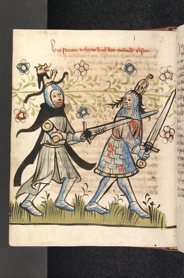
Alzey () is a ''Verband''-free town – one belonging to no ''Verbandsgemeinde'' – in the Alzey-Worms district in Rhineland-Palatinate, Germany. It is the fifth-largest town in Rhenish Hesse, after Mainz, Worms, Germany, Worms, Ingelheim am Rhein and Bingen am Rhein, Bingen. Alzey is one of the ''Nibelungenstädte'' – towns associated with the – because it is represented in this work by the character Volker von Alzey. Hence, Alzey is also known as ''Volkerstadt''. Geography Location Alzey lies in Rhenish Hesse on the western edge of the northern part of the Upper Rhine Plain. It is surrounded by the northern part of the Alzey Hills, which meets the Rhenish Hesse Hills towards the south and the North Palatine Uplands towards the east. The town is found some 30 km southwest of Mainz and some 22 km (as the crow flies, in each case) northwest of Worms, Germany, Worms. Through Alzey, in places underground, flows the river Selz, a left-bank tributary to the Rhine. ... [...More Info...] [...Related Items...] OR: [Wikipedia] [Google] [Baidu] |
Canton (administrative Division)
A canton is a type of administrative division of a country. In general, cantons are relatively small in terms of area and population when compared with other administrative divisions such as county, counties, Department (administrative division), departments, or provinces. Internationally, the most politically important cantons are the Cantons of Switzerland, Swiss cantons. As the constituents of the Swiss Confederation, theoretically and historically, they are semi-sovereign states. The term is derived from the French language, French word ''wikt:canton#French, canton'', meaning "corner" or "district" (from which "cantonment" is also derived). In specific countries Cantons exist or previously existed in the following countries: *Cantons of Belgium *Bohol#U.S. intervention and occupation, Cantonal Government of Bohol *Cantons of Bolivia *Cantons of the Federation of Bosnia and Herzegovina, Cantons of Bosnia and Herzegovina: federal units of the Federation of Bosnia and Herzegovi ... [...More Info...] [...Related Items...] OR: [Wikipedia] [Google] [Baidu] |
Arrondissement
An arrondissement (, , ) is any of various administrative divisions of France, Belgium, Haiti, and certain other Francophone countries, as well as the Netherlands. Europe France The 101 French departments are divided into 342 ''arrondissements'', which may be roughly translated into English as districts. The capital of an arrondissement is called a subprefecture. When an arrondissement contains the prefecture (capital) of the department, that prefecture is the capital of the arrondissement, acting both as a prefecture and as a subprefecture. Arrondissements are further divided into cantons and communes. Municipal arrondissement A municipal arrondissement (, pronounced ), is a subdivision of the commune, used in the three largest cities: Paris, Lyon, and Marseille. It functions as an even lower administrative division, with its own mayor. Although usually referred to simply as an "arrondissement", they should not be confused with departmental arrondissements, whic ... [...More Info...] [...Related Items...] OR: [Wikipedia] [Google] [Baidu] |


