|
Duffy's Hill
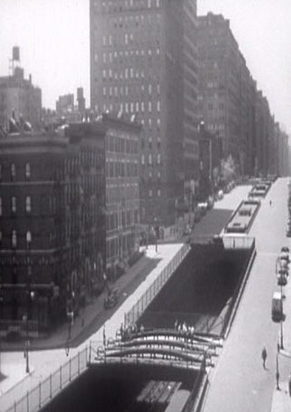
Duffy's Hill is a hill located on Lexington Avenue between 102nd and 103rd Streets in the East Harlem neighborhood of Manhattan, New York City. It was named for Michael James Duffy, a Tammany Hall Alderman who spent $250,000 to build 26 rowhouses on the south side of 101st Street between Lexington and Park Avenues in 1894. He continued building between Third Avenue and Lexington Avenue up to 104th Street, a section of the city sometimes known at the time as "Duffyville". The hill marked the site of cable car accidents by 1897, as the cars had to quickly accelerate and decelerate at this point. The New York Railways Corporation had a 24-hour guard stationed at the base of the hill at 103rd Street by 1937 to watch over streetcar incidents related to the hill. At one time, Lexington Avenue buses would detour onto Park Avenue to avoid the hill. The National Board of Fire Underwriters noted that Lexington Avenue's grade of 12.6% was the steepest of any "important localit in Ma ... [...More Info...] [...Related Items...] OR: [Wikipedia] [Google] [Baidu] |
Hellenic Orthodox Church Of Sts
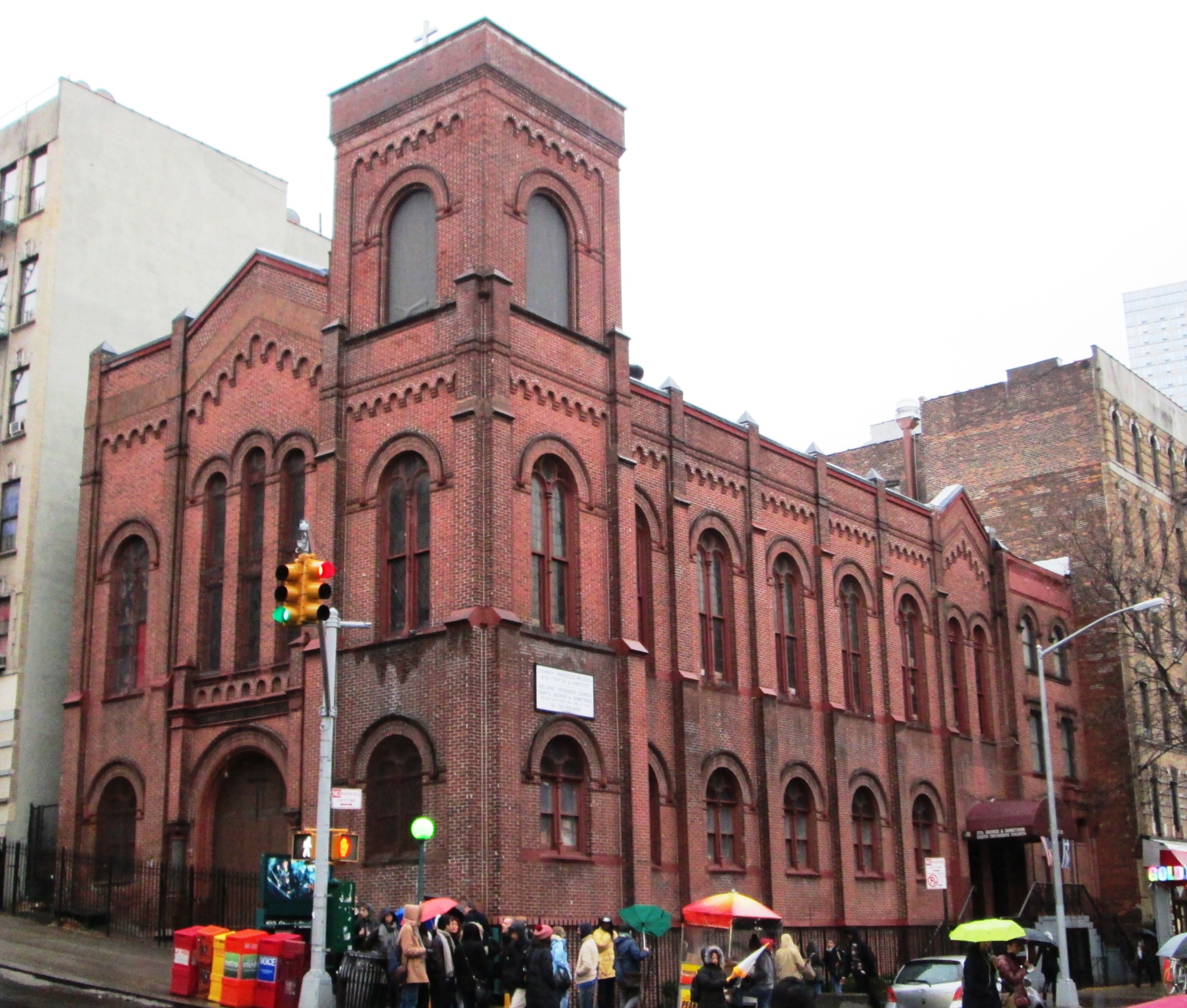
Hellenic is a synonym for Greek. It means either: *of or pertaining to the Hellenic Republic (modern Greece) or Greek people (Hellenes, ) and culture *of or pertaining to ancient Greece, ancient Greek people, culture and civilization. It may also refer to: * Hellenic Academy, an independent high school in Harare, Zimbabwe * Hellenic Airlines * Hellenic College, a liberal arts college in Brookline, Massachusetts * Hellenic College of London * Hellenic Conservatory * Hellenic FC, a football club in South Africa * Hellenic Football League, an association football league in England * Hellenic languages, a branch of the Indo-European languages * Hellenic Parliament * Hellenic Petroleum (company) * Hellenic Post * Hellenic Republic Asset Development Fund * Hellenic studies * Tampa Bay Hellenic, a women's soccer team in the United States * Hellenic (horse) (1987–2011), a thoroughbred racehorse * ' See also * Greek (other) * Helladic period, the Bronze Age in mainland Greece * ... [...More Info...] [...Related Items...] OR: [Wikipedia] [Google] [Baidu] |
Park Avenue, Manhattan
Park Avenue is a boulevard in New York City that carries north and southbound traffic in the boroughs of Manhattan and the Bronx. For most of the road's length in Manhattan, it runs parallel to Madison Avenue to the west and Lexington Avenue to the east. Park Avenue's entire length was formerly called Fourth Avenue; the title still applies to the section between Cooper Square and 14th Street. The avenue is called Union Square East between 14th and 17th streets, and Park Avenue South between 17th and 32nd streets. History Early years and railroad construction Because of its designation as the widest avenue on Manhattan's East Side, Park Avenue originally carried the tracks of the New York and Harlem Railroad built in the 1830s, just a few years after the adoption of the Manhattan street grid. The railroad's right-of-way at ground level forced foot and carriage traffic onto either side of the tracks. Later on, the railroad was run through an open cut tunnel under Murray ... [...More Info...] [...Related Items...] OR: [Wikipedia] [Google] [Baidu] |
Hills Of New York (state)
A hill is a landform that extends above the surrounding terrain. It often has a distinct summit, and is usually applied to peaks which are above elevation compared to the relative landmass, though not as prominent as mountains. Hills fall under the category of slope landforms. Terminology The distinction between a hill and a mountain is unclear and largely subjective, but a hill is universally considered to be not as tall, or as steep as a mountain. Geographers historically regarded mountains as hills greater than above sea level. In contrast, hillwalkers have tended to regard mountains as peaks above sea level. The ''Oxford English Dictionary'' also suggests a limit of and Whittow states "Some authorities regard eminences above as mountains, those below being referred to as hills." Today, a mountain is usually defined in the UK and Ireland as any summit at least high, while the UK government's Countryside and Rights of Way Act 2000 defined mountainous areas (for the ... [...More Info...] [...Related Items...] OR: [Wikipedia] [Google] [Baidu] |
Landforms Of Manhattan
A landform is a land feature on the solid surface of the Earth or other planetary body. They may be natural or may be anthropogenic (caused or influenced by human activity). Landforms together make up a given terrain, and their arrangement in the landscape is known as topography. Landforms include hills, mountains, canyons, and valleys, as well as shoreline features such as bays, peninsulas, and seas, including submerged features such as mid-ocean ridges, volcanoes, and the great oceanic basins. Physical characteristics Landforms are categorized by characteristic physical attributes such as elevation, slope, orientation, structure stratification, rock exposure, and soil type. Gross physical features or landforms include intuitive elements such as berms, cliffs, hills, mounds, peninsulas, ridges, rivers, valleys, volcanoes, and numerous other structural and size-scaled (e.g. ponds vs. lakes, hills vs. mountains) elements including various kinds of inland and oceanic waterbod ... [...More Info...] [...Related Items...] OR: [Wikipedia] [Google] [Baidu] |
Metropolitan Transportation Authority
The Metropolitan Transportation Authority (MTA) is a New York state public benefit corporations, public benefit corporation in New York (state), New York State responsible for public transportation in the New York metropolitan area, New York City metropolitan area. The MTA is the largest public transit authority in North America, serving 12 counties in Downstate New York, along with two counties in southwestern Connecticut under contract to the Connecticut Department of Transportation, carrying over 11 million passengers on an average weekday systemwide, and over 850,000 vehicles on its MTA Bridges and Tunnels, seven toll bridges and two tunnels per weekday. History Founding In February 1965, New York governor Nelson Rockefeller suggested that the New York State Legislature create an authority to purchase, operate, and modernize the Long Island Rail Road (LIRR). The LIRR, then a subsidiary of the Pennsylvania Railroad (PRR), had been operating under bankruptcy protection since 1 ... [...More Info...] [...Related Items...] OR: [Wikipedia] [Google] [Baidu] |
New York City Subway
The New York City Subway is a rapid transit system in New York City serving the New York City boroughs, boroughs of Manhattan, Brooklyn, Queens, and the Bronx. It is owned by the government of New York City and leased to the New York City Transit Authority, an affiliate agency of the Government of New York (state), state-run Metropolitan Transportation Authority (MTA). Opened on October 27, 1904, the New York City Subway is one of the world's oldest public transit systems, one of the most-used, and the one with the second-most stations after the Beijing Subway, with New York City Subway stations, 472 stations in operation (423, if stations connected by transfers are counted as single stations). The system has operated 24/7 service every day of the year throughout most of its history, barring emergencies and disasters. By annual ridership, the New York City Subway is the busiest rapid transit system in both the Western Hemisphere and the Western world, as well as the List of m ... [...More Info...] [...Related Items...] OR: [Wikipedia] [Google] [Baidu] |
103rd Street Station (IRT Lexington Avenue Line)
The 103rd Street station is a local metro station, station on the IRT Lexington Avenue Line of the New York City Subway. Located at the intersection of Lexington Avenue (Manhattan), Lexington Avenue and 103rd Street in East Harlem, it is served by the train at all times, the 6d (New York City Subway service), <6> train during weekdays in the peak direction, and the train during late nights. This station was constructed as part of the Dual Contracts by the Interborough Rapid Transit Company and opened in 1918. It was renovated in 1990 and in 2015–2016. History Construction and opening Following the completion of the Early history of the IRT subway, original subway, there were plans to construct a line along Manhattan's east side north of 42nd Street. The original plan for what became the extension north of 42nd Street was to continue it south through Irving Place and into what is now the BMT Broadway Line at Ninth Street (Manhattan), Ninth Street and Broadway (Man ... [...More Info...] [...Related Items...] OR: [Wikipedia] [Google] [Baidu] |
National Board Of Fire Underwriters
The American Insurance Association (AIA) is an insurance industry trade association representing about 300 insurance companies that provide property insurance and/or casualty insurance in the United States. Founded in 1866 as the National Board of Fire Underwriters (NBFU), it consolidated with two other associations, the AIA and the Association of Casualty and Surety Companies, to form the current organization. The AIA is legally incorporated as a tax-exempt organization under Section 501(c)(6) of the US Internal Revenue Code (Title 26 of the United States Code) and has IRS Employer Identification Number 133173374. It is based in Washington, D.C. The organization’s activities include lobbying local, state, and federal policymakers on behalf of its members; republishing and analyzing recent legislation and regulatory agency rulemaking to determine and communicate to members potential impacts on their business operations; engaging in public relations on behalf of the property-c ... [...More Info...] [...Related Items...] OR: [Wikipedia] [Google] [Baidu] |
Park Avenue
Park Avenue is a boulevard in New York City that carries north and southbound traffic in the borough (New York City), boroughs of Manhattan and the Bronx. For most of the road's length in Manhattan, it runs parallel to Madison Avenue to the west and Lexington Avenue (Manhattan), Lexington Avenue to the east. Park Avenue's entire length was formerly called Fourth Avenue; the title still applies to the section between Cooper Square and 14th Street (Manhattan), 14th Street. The avenue is called Union Square East between 14th and 17th Street (Manhattan), 17th streets, and Park Avenue South between 17th and 32nd Street (Manhattan), 32nd streets. History Early years and railroad construction Because of its designation as the widest avenue on Manhattan's East Side, Park Avenue originally carried the tracks of the New York and Harlem Railroad built in the 1830s, just a few years after the adoption of the Commissioners' Plan of 1811, Manhattan street grid. The railroad's Right-of-wa ... [...More Info...] [...Related Items...] OR: [Wikipedia] [Google] [Baidu] |
Third And Lexington Avenues Line
The Third and Lexington Avenues Line, also known as the Third Avenue Line, is a public transit line in Manhattan, New York City, running from Lower Manhattan to Fort George in Washington Heights. Originally a streetcar line, it now consists of the M98, M101, M102, and M103 bus routes, operated by the Manhattan and Bronx Surface Transit Operating Authority under the New York City Transit brand. The M98 bus route operates on Third Avenue between East 65th Street and East 127th Street, although it previously continued to 32nd Street. The M101, M102 and M103 bus routes run southbound on Lexington Avenue north of East 24th Street. Current bus service M98 The M98 operates between Hunter College at East 68th Street on the Upper East Side and Fort Tryon Park in Inwood near West 192nd Street. The M98 operates northbound via Third Avenue, and southbound via Lexington Avenue. At East 120th Street, southbound service shifts from Park to Lexington Avenues, while at East 127th Street, the ... [...More Info...] [...Related Items...] OR: [Wikipedia] [Google] [Baidu] |
104th Street (Manhattan)
The borough of Manhattan in New York City contains 214 numbered east–west streets ranging from 1st to 228th, the majority of them designated in the Commissioners' Plan of 1811. These streets do not run exactly east–west, because the grid plan is aligned with the Hudson River, rather than with the cardinal directions. Thus, the majority of the Manhattan grid's "west" is approximately 29 degrees north of true west; the angle differs above 155th Street, where the grid initially ended. The grid now covers the length of the island from 14th Street north. All numbered streets carry an East or West prefix – for example, East 10th Street or West 10th Street – which is demarcated at Broadway below 8th Street, and at Fifth Avenue at 8th Street and above. The numbered streets carry crosstown traffic. In general, but with numerous exceptions, even-numbered streets are one-way eastbound and odd-numbered streets are one-way westbound. Most wider streets, and a few of the narr ... [...More Info...] [...Related Items...] OR: [Wikipedia] [Google] [Baidu] |
Third Avenue, Manhattan
Third Avenue is a north-south thoroughfare on the East Side of the New York City borough of Manhattan, as well as in the center portion of the Bronx. Its southern end is at Astor Place and St. Mark's Place. It transitions into Cooper Square, and further south, the Bowery, Chatham Square, and Park Row. The Manhattan side ends at East 128th Street. Third Avenue is two-way from Cooper Square to 24th Street, but carries only northbound (uptown) traffic while in Manhattan above 24th Street; in the Bronx, it is again two-way. However, the Third Avenue Bridge carries vehicular traffic in the opposite direction, allowing only southbound vehicular traffic, rendering the avenue essentially non-continuous to motor vehicles between the boroughs. The street leaves Manhattan and continues into the Bronx across the Harlem River over the Third Avenue Bridge north of East 129th Street to East Fordham Road at Fordham Center, where it intersects with U.S. 1. It is one of the four stre ... [...More Info...] [...Related Items...] OR: [Wikipedia] [Google] [Baidu] |


