|
Districts Of Mauritius
The Districts of the Republic of Mauritius are the second-level administrative divisions after the Outer Islands of Mauritius. Mauritius Island Mauritius Island is divided into nine districts which consist of one city, four towns, and 130 villages. Its capital is Port Louis. The Plaines Wilhems District consists mainly of four towns: Beau Bassin-Rose Hill, Curepipe, Quatre Bornes, and Vacoas-Phoenix. The other districts consist of different villages, some of which are further divided into suburbs. As of 31 December 2012, the urban population stood at 536,086 and the rural population was 718,925. Autonomous region and Villages Rodrigues used to be the tenth district of Mauritius, until the island gained autonomy in 2002. Its capital is Port Mathurin. Dependencies of Mauritius # Agaléga. # Saint Brandon # Chagos Archipelago The capital of Agaléga is Vingt-Cinq. Saint Brandon is sparsely populated, its main settlement is Île Raphael (pop. 40). Chagos Arc ... [...More Info...] [...Related Items...] OR: [Wikipedia] [Google] [Baidu] |
Mauritius
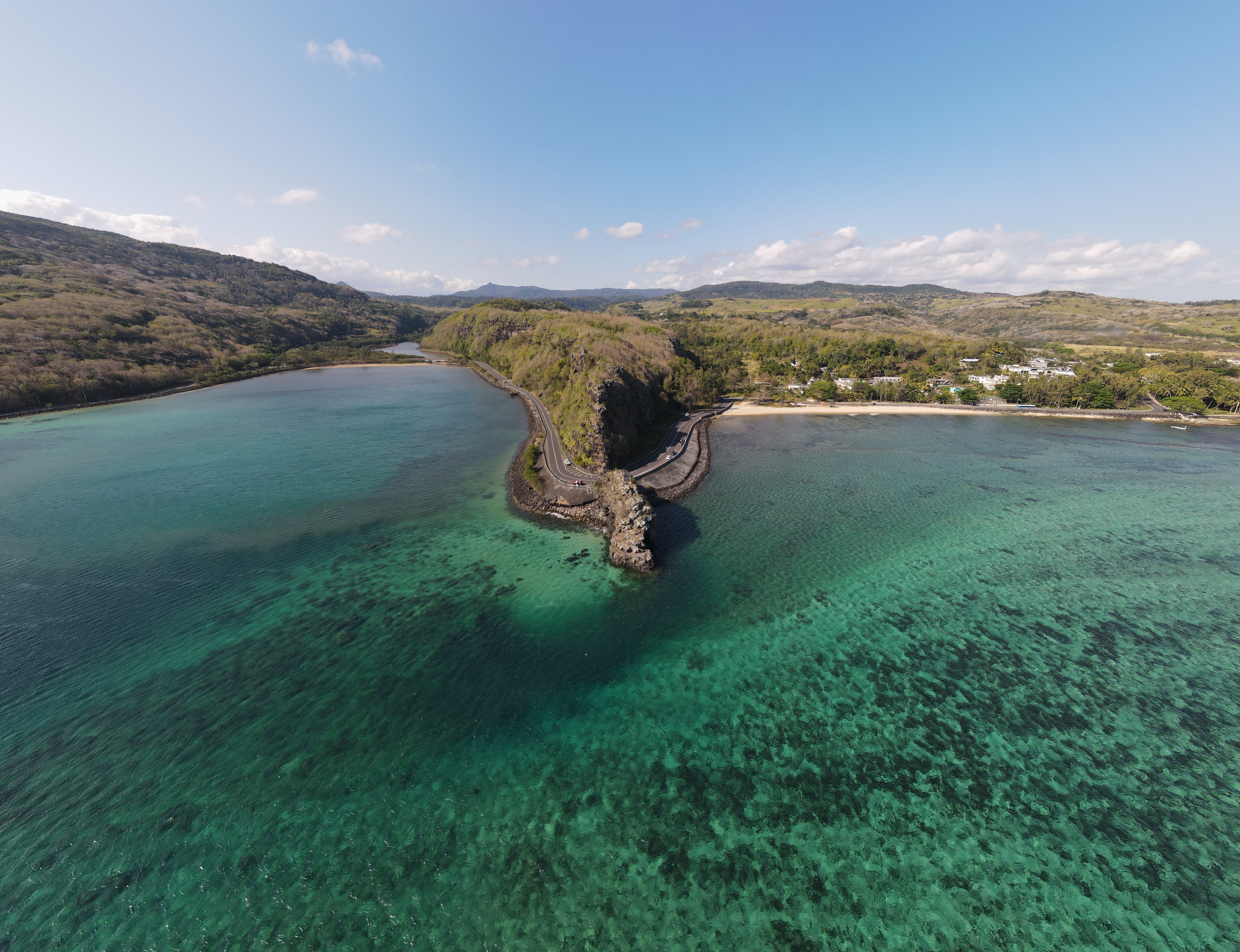
Mauritius, officially the Republic of Mauritius, is an island country in the Indian Ocean, about off the southeastern coast of East Africa, east of Madagascar. It includes the main island (also called Mauritius), as well as Rodrigues, Agaléga, and St. Brandon (Cargados Carajos shoals). The islands of Mauritius and Rodrigues, along with nearby Réunion (a French overseas department), are part of the Mascarene Islands. The main island of Mauritius, where the population is concentrated, hosts the capital and largest city, Port Louis. The country spans and has an exclusive economic zone covering approximately . The 1502 Portuguese Cantino planisphere has led some historians to speculate that Arab sailors were the first to discover the uninhabited island around 975, naming it ''Dina Arobi''. Called ''Ilha do Cirne'' or ''Ilha do Cerne'' on early Portuguese maps, the island was visited by Portuguese sailors in 1507. A Dutch fleet, under the command of Admiral Van War ... [...More Info...] [...Related Items...] OR: [Wikipedia] [Google] [Baidu] |
Savanne District
Savanne () or Savannah is a Districts of Mauritius, district of Mauritius, situated in the south of the island. The district has an area of . , the estimated population was 68,585. Places The Savanne District include different regions. Some regions are further divided into suburbs. * Baie-du-Cap * Bel-Ombre, Mauritius, Bel-Ombre * Bénarès, Mauritius, Bénarès * Batimarais, Mauritius, Batimarias * Bois-Chéri * Britannia, Mauritius, Britannia * Camp Diable * Chamouny * Chemin-Grenier * Grand Bois, Mauritius, Grand Bois * La Flora, Mauritius, La Flora * Rivière-des-Anguilles * Rivière Du Poste * Saint-Aubin, Mauritius, Saint-Aubin * Souillac, Mauritius, Souillac * Surinam, Mauritius, Surinam Places of interest * Ganga Talao * Trou aux Cerfs#Bassin Blanc, Bassin Blanc * The World of Seashells * Bel Ombre, Mauritius#Bel Ombre Nature Reserve, Bel Ombre Nature Reserve * Chazal Ecotourism * Domaine du Cerf d’Or * Macondé View Point * Valle Advenature Park Savanne Mountai ... [...More Info...] [...Related Items...] OR: [Wikipedia] [Google] [Baidu] |
Administrative Divisions In Africa
Administration may refer to: Management of organizations * Management, the act of directing people towards accomplishing a goal: the process of dealing with or controlling things or people. ** Administrative assistant, traditionally known as a secretary, or also known as an administrative officer, administrative support specialist, or management assistant: a person whose work consists of supporting management ** Administration (government), management in or of government, the management of public affairs; government. *** Administrative division, a term for an administrative region within a country that is created for the purpose of managing of land and the affairs of people. ** Academic administration, a branch of an academic institution responsible for the maintenance and supervision of the institution ** Arts administration, a field that concerns business operations around an art organization ** Business administration, the performance or management of business operations *** ... [...More Info...] [...Related Items...] OR: [Wikipedia] [Google] [Baidu] |
Lists Of Administrative Divisions
A list is a set of discrete items of information collected and set forth in some format for utility, entertainment, or other purposes. A list may be memorialized in any number of ways, including existing only in the mind of the list-maker, but lists are frequently written down on paper, or maintained electronically. Lists are "most frequently a tool", and "one does not ''read'' but only ''uses'' a list: one looks up the relevant information in it, but usually does not need to deal with it as a whole".Lucie Doležalová,The Potential and Limitations of Studying Lists, in Lucie Doležalová, ed., ''The Charm of a List: From the Sumerians to Computerised Data Processing'' (2009). Purpose It has been observed that, with a few exceptions, "the scholarship on lists remains fragmented". David Wallechinsky, a co-author of '' The Book of Lists'', described the attraction of lists as being "because we live in an era of overstimulation, especially in terms of information, and lists help us ... [...More Info...] [...Related Items...] OR: [Wikipedia] [Google] [Baidu] |
Subdivisions Of Mauritius
Mauritius, officially the Republic of Mauritius, is an island country in the Indian Ocean, about off the southeastern coast of East Africa, east of Madagascar. It includes the main island (also called Mauritius), as well as Rodrigues, Agaléga, and St. Brandon (Cargados Carajos shoals). The islands of Mauritius and Rodrigues, along with nearby Réunion (a French overseas department), are part of the Mascarene Islands. The main island of Mauritius, where the population is concentrated, hosts the capital and largest city, Port Louis. The country spans and has an exclusive economic zone covering approximately . The 1502 Portuguese Cantino planisphere has led some historians to speculate that Arab sailors were the first to discover the uninhabited island around 975, naming it ''Dina Arobi''. Called ''Ilha do Cirne'' or ''Ilha do Cerne'' on early Portuguese maps, the island was visited by Portuguese sailors in 1507. A Dutch fleet, under the command of Admiral Van Warwyck, land ... [...More Info...] [...Related Items...] OR: [Wikipedia] [Google] [Baidu] |
Districts Of Mauritius
The Districts of the Republic of Mauritius are the second-level administrative divisions after the Outer Islands of Mauritius. Mauritius Island Mauritius Island is divided into nine districts which consist of one city, four towns, and 130 villages. Its capital is Port Louis. The Plaines Wilhems District consists mainly of four towns: Beau Bassin-Rose Hill, Curepipe, Quatre Bornes, and Vacoas-Phoenix. The other districts consist of different villages, some of which are further divided into suburbs. As of 31 December 2012, the urban population stood at 536,086 and the rural population was 718,925. Autonomous region and Villages Rodrigues used to be the tenth district of Mauritius, until the island gained autonomy in 2002. Its capital is Port Mathurin. Dependencies of Mauritius # Agaléga. # Saint Brandon # Chagos Archipelago The capital of Agaléga is Vingt-Cinq. Saint Brandon is sparsely populated, its main settlement is Île Raphael (pop. 40). Chagos Arc ... [...More Info...] [...Related Items...] OR: [Wikipedia] [Google] [Baidu] |
List Of Places In Mauritius ...
This is a list of populated places in Mauritius and Agaléga. Mauritius Cities Towns Villages Agaléga See also * Outer islands of Mauritius * Districts of Mauritius * Geography of Mauritius * ISO 3166-2:MU References {{DEFAULTSORT:Places in Mauritius Mauritius geography-related lists Mauritius Mauritius Mauritius, officially the Republic of Mauritius, is an island country in the Indian Ocean, about off the southeastern coast of East Africa, east of Madagascar. It includes the main island (also called Mauritius), as well as Rodrigues, Ag ... [...More Info...] [...Related Items...] OR: [Wikipedia] [Google] [Baidu] |
Diego Garcia
Diego Garcia is the largest island of the Chagos Archipelago. It has been used as a joint UK–U.S. military base since the 1970s, following the expulsion of the Chagossians by the UK government. The Chagos Islands are set to become a former British Overseas Territories, British overseas territory — a treaty to transfer sovereignty from the UK to Mauritius was signed on 22 May 2025, with a provision that the military base at the island would remain under British control for at least 99 years. Located just south of the equator in the central Indian Ocean, Diego Garcia lies east of Tanzania, east-southeast of Somalia, south of the Maldives, southwest of India, west-southwest of Sumatra, northwest of Australia, and northeast of Mauritius#Mauritius_Island, Mauritius Island. Diego Garcia is part of the Chagos–Laccadive Ridge, Chagos-Laccadive Ridge, an underwater mountain range that includes the Lakshadweep, the Maldives, and the other 60 small islands of the Chagos Archi ... [...More Info...] [...Related Items...] OR: [Wikipedia] [Google] [Baidu] |
Île Raphael
Île Raphael is an island in the Saint Brandon archipelago, a group of 30 outer islands of Mauritius. The island is named after Veuve Raphaël. Veuve Raphaël's husband was a sea captain and had installations on the corner of rue (route) des Pamplemousses and rue Fanfaron in Port Louis. Captain Raphaël travelled regularly to Île Raphael, St Brandon from Port Louis and, on 17 May 1816 and November 1817, is on record as bringing back salted fish (Poisson Salé) on a Lugger called 'Le Cheriby' ('angel' in old French). Île Raphaël is today the headquarters and principal fishing base of the Raphael Fishing Company which is the second oldest commercial company in Mauritius. Population Today, Île Raphael's population amounts to around 40 people and constitutes the majority of Saint Brandon's entire resident population. Some employees of Raphael Fishing Company stay and work on the island for periods of up to seven months, depending on the season. Key Biodiversity Area I ... [...More Info...] [...Related Items...] OR: [Wikipedia] [Google] [Baidu] |
Chagos Archipelago
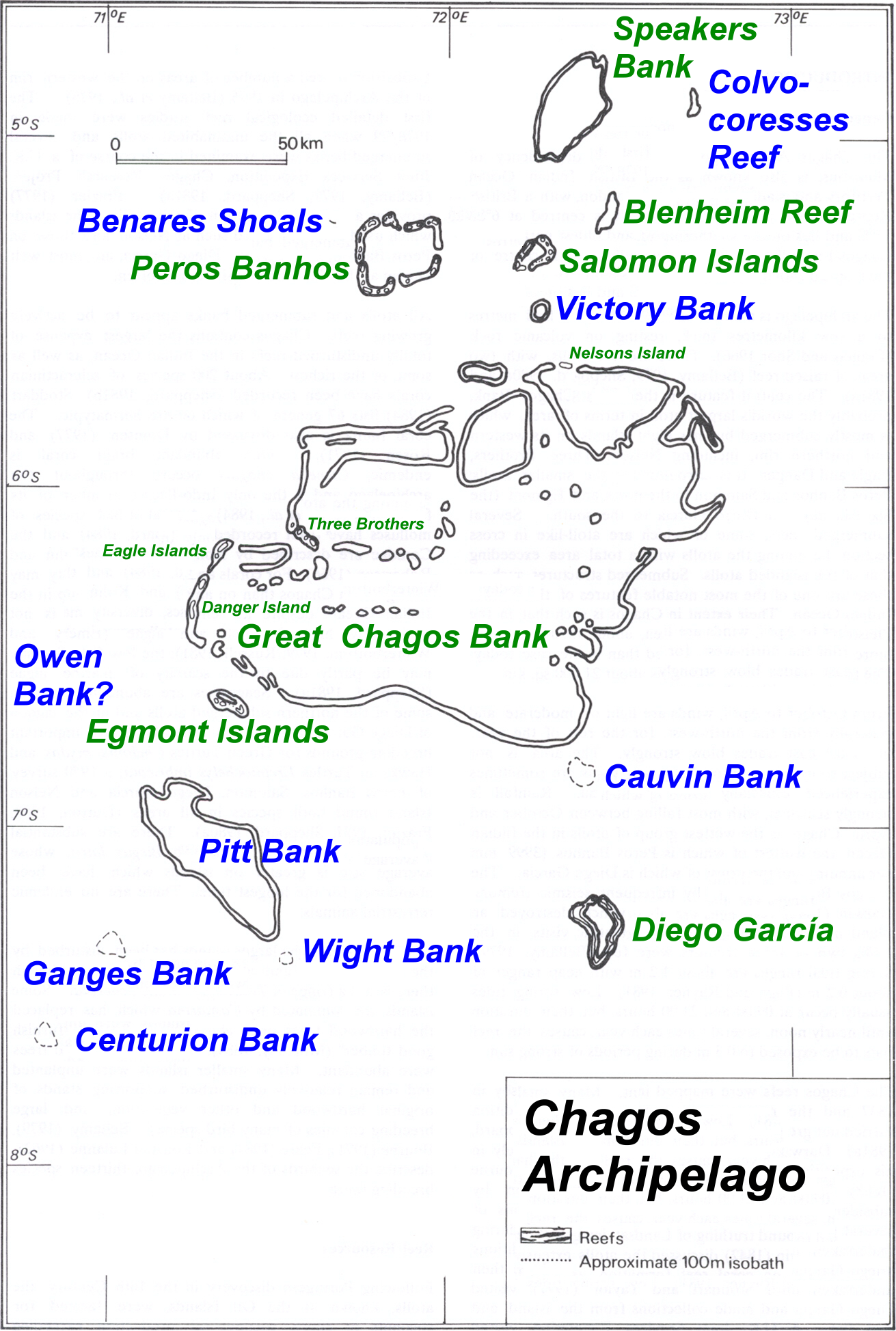
The Chagos Archipelago (, ) or Chagos Islands (formerly , and later the Oil Islands) is a group of seven atolls comprising more than 60 islands in the Indian Ocean about south of the Maldives archipelago. This chain of islands is the southernmost archipelago of the Chagos–Laccadive Ridge, a long submarine mountain range in the Indian Ocean. In its north are the Salomon Islands, Nelsons Island and Peros Banhos; towards its south-west are the Three Brothers, Chagos, Three Brothers, Eagle Islands, Egmont Islands and Danger Island, Great Chagos Bank, Danger Island; southeast of these is Diego Garcia, by far the largest island. All are low-lying atolls, save for a few extremely small instances, set around lagoons. From 1715 to 1810, the Chagos Islands were part of France's List of French possessions and colonies, Indian Ocean possessions, administered through Isle de France (Mauritius), Isle de Francewhich was a French colonial empire, colony of France (later renamed as Mauritius). ... [...More Info...] [...Related Items...] OR: [Wikipedia] [Google] [Baidu] |
Agaléga
Agaléga () is a dependency of Mauritius, as defined by the Constitution of Mauritius, which consists of two outer islands located in the Indian Ocean, about north of Mauritius Island. Similar to other Mauritian islands such as St. Brandon, Agaléga is run directly by the Prime Minister of Mauritius through the Prime Minister's Office to the Outer Island Development Corporation (OIDC). The population of the islands rose from 289 in 2011 to 330 in 2022. The islands have a total area of . The North island is long and wide, while the South island is long and wide. The North Island is home to the islands' airstrip and the capital Vingt-Cinq. The islands are known for their production of coconuts, their main industry and, also, for the Agalega day gecko. Etymology There are three different explanations for the name Agaléga. # One hypothesis is that the Portuguese explorer, Dom Pedro Mascarenhas, named Agaléga and the island of Sainte Marie (off the east coast of Madag ... [...More Info...] [...Related Items...] OR: [Wikipedia] [Google] [Baidu] |


