|
Dere Street
Dere Street or Deere Street is a modern designation of a Roman roads, Roman road which ran north from Eboracum (York), crossing the Stanegate at Corbridge (Hadrian's Wall was crossed at the Portgate, just to the north) and continuing beyond into what is now Scotland, later at least as far as the Antonine Wall. It was the Romans' major route for communications and supplies to the north and to Scotland. Portions of its route are still followed by modern roads, including the A1(M) (south of the River Tees), the B6275 road through Piercebridge, where Dere Street crosses the River Tees, and the A68 road, A68 north of Corbridge in Northumberland. Name The Roman name for the route is lost. Its English name corresponds with the Saxon Britain, post-Roman Anglo-Saxons, Anglo-Saxon Heptarchy, kingdom of Deira, through which the first part of its route lies. That kingdom possibly took its name from the Yorkshire River Derwent, Yorkshire, River Derwent. The term "street" derives from its Old ... [...More Info...] [...Related Items...] OR: [Wikipedia] [Google] [Baidu] |
Eboracum
Eboracum () was a castra, fort and later a coloniae, city in the Roman province of Roman Britain, Britannia. In its prime it was the largest town in northern Britain and a provincial capital. The site remained occupied after the decline of the Western Roman Empire and ultimately developed into the present-day city of York, in North Yorkshire, England. Two Roman emperors died in Eboracum: Septimius Severus in 211 AD, and Constantius Chlorus in 306 AD. The first known recorded mention of Eboracum by name is dated , and is an address containing the settlement's name, ''Eburaci'', on a wooden stylus tablet from the Roman fortress of Vindolanda in what is now Northumberland. During the Roman period, the name was written both ''Eboracum'' and ''Eburacum'' (in nominative form). The name ''Eboracum'' comes from the Common Brittonic ''*Eburākon'', which means "Taxus baccata, yew tree place". The word for "yew" was ''*ebura'' in Proto-Celtic (cf. Old Irish ''ibar'' "yew-tree ... [...More Info...] [...Related Items...] OR: [Wikipedia] [Google] [Baidu] |
Cramond Roman Fort
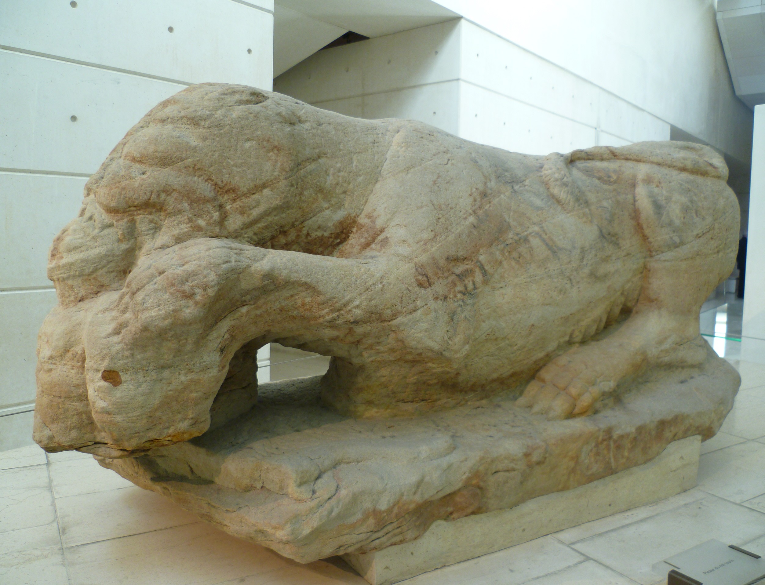
Cramond Roman Fort is a Roman-Era archaeological site at Cramond, Edinburgh, Scotland. The settlement may be the "Rumabo" listed in the 7th-century ''Ravenna Cosmography''. The fort was established around 140 AD and occupied until around 170 AD, with a further period of occupation from around 208 to 214 AD. Among the many archaeological finds, one of the most famous is a sculpture known as the Cramond Lioness. History The fort at Cramond was located on the River Almond at the point where it flows into the Forth. In Roman times, there was probably a natural harbour here. One suggested interpretation is that Cramond formed a chain of Lothian forts along with Carriden and Inveresk. The fort was established around 140 AD during the building of the Antonine Wall, and remained in use until around 170 AD when the Romans retreated south to Hadrian's Wall. [...More Info...] [...Related Items...] OR: [Wikipedia] [Google] [Baidu] |
A68 Road
The A68 is a major road in the United Kingdom, running from Darlington in England to the A720 in Edinburgh, the capital of Scotland. It crosses the Anglo-Scottish border at Carter Bar and is the only road to do so for some distance either way; the next major crossings are the A697 from Coldstream to Cornhill-on-Tweed in the east, and the A7 near Canonbie to the west. Route The southernmost section of the A68, as it leaves Darlington, has been described as a "rustbelt". In January 2022 there was a proposal to widen key roundabouts in Darlington to ease traffic flow. The road crosses the A1(M) at Copshaw Hill Interchange. It bypasses Bishop Auckland and runs through West Auckland, Toft Hill and Tow Law, where Durham County Council has installed a live camera so that drivers can check traffic and weather. It then passes Consett and Corbridge; it used to pass through the centre of the town but since 1979 has run on a bypass to the east, crossing the River Tyne over Styford ... [...More Info...] [...Related Items...] OR: [Wikipedia] [Google] [Baidu] |
Piercebridge
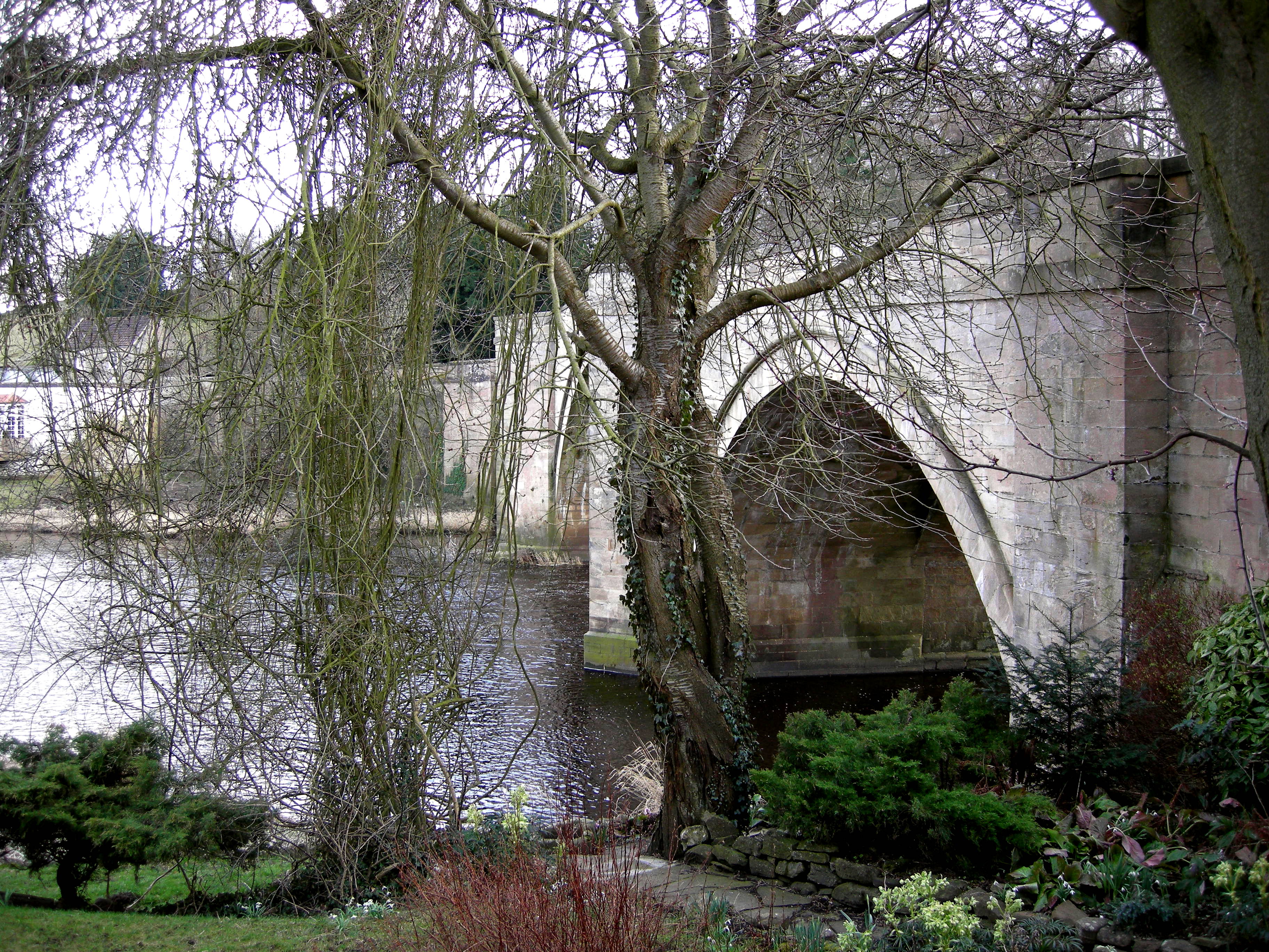
Piercebridge is a village and civil parish in the borough of Darlington and the ceremonial county of Durham, England. It is situated a few miles west of the town of Darlington. It is on the site of a Roman fort of AD 260–270, which was built at the point where Dere Street crossed the River Tees. Part of the fort is under the village green. The village is sited where the York- Newstead Roman road known as Dere Street crosses the River Tees. The excavated Roman fort is open to the public and the remains of Piercebridge Roman Bridge over the Tees now lie around south of the current course of the river, approximately east of Piercebridge, at the east side of Cliffe, Richmondshire. Toponym Piercebridge is named after its Roman bridge or ''brigg'': in 1104 it was ''Persebrig''; in 1577 it was ''Priestbrigg''. It is thought that ''pierce'' comes from ''pershe'', meaning osiers, perhaps because the bridge was at least partly made of osier twigs in 1050 when the name is first re ... [...More Info...] [...Related Items...] OR: [Wikipedia] [Google] [Baidu] |
River Tees
The River Tees (), in England, rises on the eastern slope of Cross Fell in the North Pennines and flows eastwards for to reach the North Sea in the North East of England. The modern-day history of the river has been tied with the industries on Teesside in its lower reaches, where it has provided the means of import and export of goods to and from the North East England. The need for water further downstream also meant that reservoirs were built in the extreme upper reaches, such as Cow Green. Etymology The name ''Tees'' is possibly of Brittonic origin. The element ''*tēs'', meaning "warmth" with connotations of "boiling, excitement" ( Welsh ''tes''), may underlie the name. ''*Teihx-s'', a root possibly derived from Brittonic ''*ti'' (Welsh ''tail'', "dung, manure"), has also been used to explain the name ''Tees'' (compare River Tyne). Geography The river drains and has a number of tributaries including the River Greta, River Lune, River Balder, River Leven and ... [...More Info...] [...Related Items...] OR: [Wikipedia] [Google] [Baidu] |
A1(M)
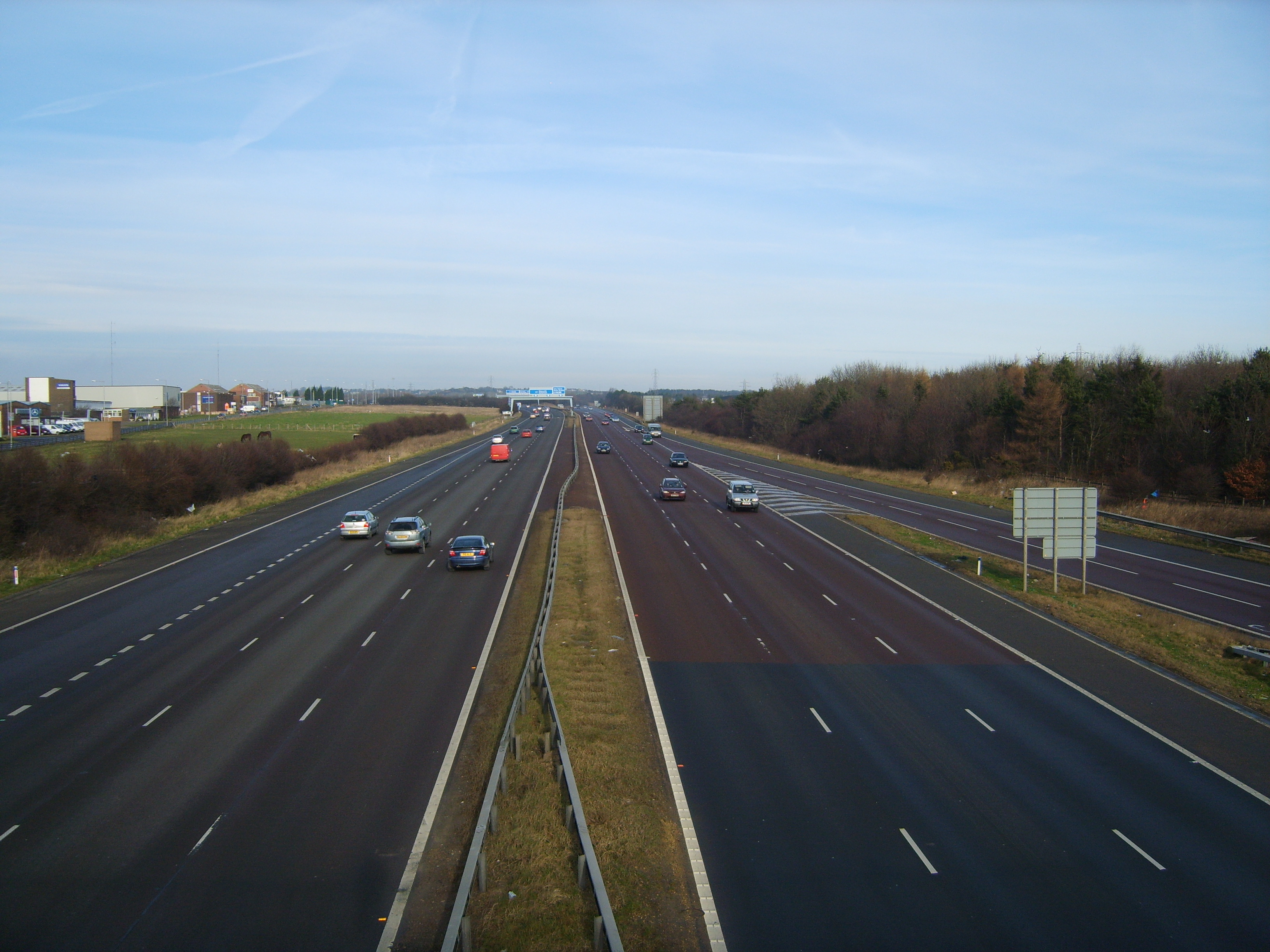
A1(M) is the designation given to a series of four separate motorway sections in the UK. Each section is an upgrade to a section of the A1, a major north–south road which connects London, the capital of England, with Edinburgh, the capital of Scotland. The first section, the Doncaster Bypass, opened in 1961 and is one of the oldest sections of motorway in Britain. Construction of a new section of A1(M) between Leeming and Barton was completed on 29 March 2018, a year later than the anticipated opening in 2017 due to extensive archaeological excavations. Its completion linked the Barton to Washington section with the Darrington to Leeming Bar section, forming the longest A1(M) section overall and reducing the number of sections from five to four. In 2015, a proposal was made by three local government organisations to renumber as M1 the section of A1(M) between Micklefield and Washington, making this section a northern extension of the M1. Overview From London to S ... [...More Info...] [...Related Items...] OR: [Wikipedia] [Google] [Baidu] |
Antonine Wall
The Antonine Wall () was a turf fortification on stone foundations, built by the Romans across what is now the Central Belt of Scotland, between the Firth of Clyde and the Firth of Forth. Built some twenty years after Hadrian's Wall to the south, and intended to supersede it, while it was garrisoned it was the northernmost frontier barrier of the Roman Empire. It spanned approximately and was about high and wide. Lidar scans have been carried out to establish the length of the wall and the Roman distance units used. Security was bolstered by a deep ditch on the northern side. It is thought that there was a wooden palisade on top of the turf. The barrier was the second of two "great walls" created by the Romans in Great Britain in the second century AD. Its ruins are less evident than those of the better-known and longer Hadrian's Wall to the south, primarily because the turf and wood wall has largely weathered away, unlike its stone-built southern predecessor. Construction be ... [...More Info...] [...Related Items...] OR: [Wikipedia] [Google] [Baidu] |
Scotland
Scotland is a Countries of the United Kingdom, country that is part of the United Kingdom. It contains nearly one-third of the United Kingdom's land area, consisting of the northern part of the island of Great Britain and more than 790 adjacent Islands of Scotland, islands, principally in the archipelagos of the Hebrides and the Northern Isles. To the south-east, Scotland has its Anglo-Scottish border, only land border, which is long and shared with England; the country is surrounded by the Atlantic Ocean to the north and west, the North Sea to the north-east and east, and the Irish Sea to the south. The population in 2022 was 5,439,842. Edinburgh is the capital and Glasgow is the most populous of the cities of Scotland. The Kingdom of Scotland emerged as an independent sovereign state in the 9th century. In 1603, James VI succeeded to the thrones of Kingdom of England, England and Kingdom of Ireland, Ireland, forming a personal union of the Union of the Crowns, three kingdo ... [...More Info...] [...Related Items...] OR: [Wikipedia] [Google] [Baidu] |
Portgate
The Portgate was a fortified gateway, constructed as part of Hadrian's Wall where it crossed the Roman road now known as Dere Street, which preceded Hadrian's Wall by around 50 years. It was built to control traffic along Dere Street as it passed north through Hadrian's Wall. The gate's remains exist beneath the old B6318 Military Road to the south-west of the Stagshaw Roundabout (the B6318 was diverted slightly for the construction of the Stagshaw Roundabout, leaving two short sections of the existing road unlinked – the remains of the Portgate are buried beneath the western section). Origins of the name If any name was given to the structure by the Romans, it is no longer known. The name Portgate is thought to be of Anglo-Saxon origin. Construction The Portgate was constructed from very large masonry blocks. It projected between and north of the wall, sitting astride the wall. It was probably a square or rectangular structure. Excavations and investigations *17 ... [...More Info...] [...Related Items...] OR: [Wikipedia] [Google] [Baidu] |
Hadrian's Wall
Hadrian's Wall (, also known as the ''Roman Wall'', Picts' Wall, or ''Vallum Aelium'' in Latin) is a former defensive fortification of the Roman province of Roman Britain, Britannia, begun in AD 122 in the reign of the Emperor Hadrian. Running from Wallsend on the River Tyne in the east to Bowness-on-Solway in the west of what is now northern England, it was a stone wall with large ditches in front and behind, stretching across the whole width of the island. Soldiers were garrisoned along the line of the wall in large Castra, forts, smaller milecastles, and intervening Turret (Hadrian's Wall), turrets. In addition to the wall's defensive military role, its gates may have been customs posts. Hadrian's Wall Path generally runs close along the wall. Almost all the standing masonry of the wall was removed in early modern times and used for local roads and farmhouses. None of it stands to its original height, but modern work has exposed much of the footings, and some segments d ... [...More Info...] [...Related Items...] OR: [Wikipedia] [Google] [Baidu] |
Corbridge
Corbridge is a village in Northumberland, England, west of Newcastle upon Tyne, Newcastle and east of Hexham. Villages nearby include Halton, Northumberland, Halton, Acomb, Northumberland, Acomb, Aydon and Sandhoe. Etymology Corbridge was known to the Roman Britain, Romans as something like ''Corstopitum'' or ''Coriosopitum'', and wooden writing tablets found at the Roman fort of Vindolanda nearby suggest it was probably locally called ''Coria'' (meaning a tribal centre). According to Bethany Fox, the early attestations of the English name ''Corbridge'' "show variation between ''Cor''- and ''Col''-, as in the earliest two forms, ''Corebricg'' and ''Colebruge'', and there has been extensive debate about what its etymology may be. Some relationship with the Roman name ''Corstopitum'' seems clear, however". History Roman fort and town Coria was the most northerly town in the Roman Empire, lying at the junction of the Stanegate and Dere Street, the two most important local Rom ... [...More Info...] [...Related Items...] OR: [Wikipedia] [Google] [Baidu] |
Stanegate
The Stanegate (meaning "stone road" in Northumbrian dialect) was an important Roman road and early frontier built in what is now northern England. It linked many forts including two that guarded important river crossings: Corstopitum (Corbridge) on the River Tyne in the east (situated on Dere Street) and Luguvalium (Carlisle) (on the River Eden) in the west. The Stanegate ran through the natural gap formed by the valleys of the River Tyne in Northumberland and the River Irthing in Cumbria. It predated the Hadrian's Wall frontier by several decades; the Wall would later follow a similar route, albeit slightly to the north. The Stanegate should not be confused with the two Roman roads called Stane Street in the south of England, namely Stane Street (Chichester) and Stane Street (Colchester). In both these cases the meaning is the same as for the northern version, indicating a stone or paved road. The Stanegate differed from most other Roman roads in that it often followed ... [...More Info...] [...Related Items...] OR: [Wikipedia] [Google] [Baidu] |


