|
Zvornik
Zvornik ( sr-cyrl, Зворник, ) is a city in Republika Srpska, Bosnia and Herzegovina. In 2013, it had a population of 58,856 inhabitants. Zvornik is located on the Drina River, on the eastern slopes of Majevica mountain, at the altitude of 146m. The town of Mali Zvornik ("Little Zvornik") lies directly across the river in Serbia. Kula Grad, a village that is part of Zvornik municipality, has a Middle Age fort, Zvornik fortress, built in the 12th century. History Zvornik is first mentioned in 1410, although it was known as ''Zvonik'' ("bell tower") at that time. The town's geographic location has made it an important trade link between Bosnia and the east. For instance, the main road connecting Sarajevo and Belgrade runs through the city. The medieval fort known as Kula grad was built in the early 7th century and still stands on the Mlađevac mountainous range overlooking the Drina Valley. Ottoman rule During the Ottoman period, Zvornik was the capital of the Sanjak ... [...More Info...] [...Related Items...] OR: [Wikipedia] [Google] [Baidu] |
Mali Zvornik
Mali Zvornik ( sr-cyr, Мали Зворник, ) is a town and municipality located in the Mačva District of western Serbia. In 2022, the population of the town is 4,297, while the population of the municipality is 11,219. It lays on the Drina river opposite of the town of Zvornik, in Bosnia and Herzegovina. Also, a border crossing between Serbia and Bosnia and Herzegovina is located in the town. History There are traces of human life from Bronze Age in this area, as well as traces from the time of Roman Empire. Ancient Roman settlement ''Ad Drinum'' existed somewhere at this location. In the Middle Ages, Mali Zvornik was one of the main mining centres of the Serbian state. On Orlovine Hill near Mali Zvornik there are remains of the large Medieval fortress that was probably built in the first half of the 15th century, in the time of the Serbian Despotate. During the Ottoman Empire, Ottoman rule, this area was part of the Pashaluk of Bosnia. Until 1878 it was the only Bosnian m ... [...More Info...] [...Related Items...] OR: [Wikipedia] [Google] [Baidu] |
Drina
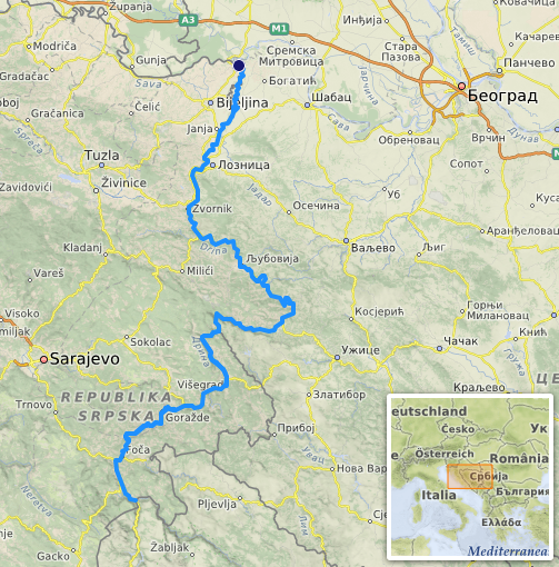
The Drina ( sr-Cyrl, Дрина, ) is a long river in the Balkans, which forms a large portion of the border between Bosnia and Herzegovina and Serbia. It is the longest tributary of the Sava River and the longest karst river in the Dinaric Alps which belongs to the Danube River drainage basin. Its name is derived from the Roman name of the river () which in turn is derived from Greek (Ancient Greek: ) which is derived from the native name of Illyrian origin. But, this etymology is not sure.Illyrian languages are poorly documented (only ~50 glosses, mostly personal/place names). - No surviving texts exist, unlike Thracian (which has ~200 inscriptions and loanwords in Greek). - Scholars often label any pre-Slavic Balkan hydronym as "Illyrian" by default, even without proof.We don’t know if Drinus was Illyrian, Thracian, or another lost Paleo-Balkan language. - The safest claim: Drina derives from a ancient Indo-European root (*dhreu-*), preserved in Latin Drinus, but i ... [...More Info...] [...Related Items...] OR: [Wikipedia] [Google] [Baidu] |
Sanjak Of Zvornik
The Sanjak of Zvornik (, ) was one of the sanjaks in the Ottoman Empire with Zvornik (in modern-day Bosnia and Herzegovina) as its administrative centre. It was divided into 4 different districts: Žepče, Maglaj, Tuzla and Kladanj. The sanjak was created between 1478 and 1483. Following its dissolution in 1878 after the Austro-Hungarian Empire defeated the Ottomans, Zvornik became part of the Zvornik Kotar. During the Ottoman period, Zvornik was the capital of the Sanjak of Zvornik (an administrative region) within the Bosnia Eyalet. This was primarily the case because of the city's crucial role in the economy and the strategic importance of the city's location. The Sanjak of Zvornik was one of six Ottoman sanjaks with most developed shipbuilding (besides sanjaks of Vidin, Nicopolis, Požega, Smederevo and Mohač). In the year 1806 the city of Zvornik was home to the famous Bosniak The Bosniaks (, Cyrillic script, Cyrillic: Бошњаци, ; , ) are a South Slavs, S ... [...More Info...] [...Related Items...] OR: [Wikipedia] [Google] [Baidu] |
List Of Cities In Bosnia And Herzegovina
This is a list of city, cities and towns with over 10,000 inhabitants (or lower if the municipality has over 20,000 inhabitants) in Bosnia and Herzegovina. For the full list of populated places, see List of populated places in Bosnia and Herzegovina. Organization Apart from entities, cantons and municipalities, Bosnia and Herzegovina also has officially designated cities. Official cities have their own mayor and city council, which is a big difference to the municipalities of Bosnia and Herzegovina, which have a municipal council and mayor. Powers of city councils of official cities are between the government of municipalities and government cantons in the Federation of Bosnia and Herzegovina or a government entity in Republika Srpska. There are thirty five official cities in Bosnia and Herzegovina (as of 2024): *Banja Luka *Bijeljina *Bihać *Bosanska Krupa *Brčko *Cazin *Čapljina *Derventa *Doboj *Goražde *Gračanica, Bosnia and Herzegovina, Gračanica *Gradačac *Gradi ... [...More Info...] [...Related Items...] OR: [Wikipedia] [Google] [Baidu] |
Eyalet Of Bosnia
The Eyalet of Bosnia (; By Gábor Ágoston, Bruce Alan Masters ; ), was an eyalet (administrative division, also known as a ''beylerbeylik'') of the Ottoman Empire, mostly based on the territory of the present-day state of Bosnia and Herzegovina. Prior to the Great Turkish War, it had also included most of Slavonia, Lika, and Dalmatia in present-day Croatia. Its reported area in 1853 was . Background After the execution of King Stephen Tomašević in 1463, the central part of the Kingdom of Bosnia was transformed into the sanjak of Bosnia. The Duchy of Herzegovina was added in 1483. History Establishment In 1580, Ferhad Pasha Sokolović became the first governor of the Bosnia Eyalet, as beylerbey (also referred to as "pasha"). The Bosnia Eyalet (or Pashaluk) included the Sanjak of Bosnia (central province), Sanjak of Herzegovina, Sanjak of Viçitrina, Sanjak of Prizren, Sanjak of Klis, Sanjak of Krka, and Sanjak of Pakrac. The Ottoman wars in Europe continued throu ... [...More Info...] [...Related Items...] OR: [Wikipedia] [Google] [Baidu] |
Stojan Čupić
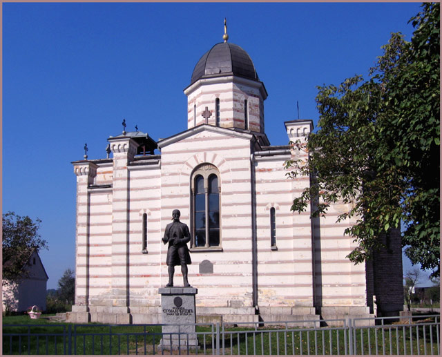
Stojan Čupić (, sr-cyr, Стојан Чупић; ca. 1765 – 1815) was a Serbian revolutionary general (''vojvoda''), one of the most important commanders of the First Serbian Uprising. He was active in the Mačva region. __NOTOC__ Early life Born in Piva, in the Sanjak of Herzegovina (now in Montenegro), his original surname was Dobrilović (Добриловић). He was brought up in Salaš Crnobarski (at that time known as Ali-Agin Salaš) in Mačva in the Sanjak of Smederevo (now in Serbia), where he was schooled. He lived with his grandfather, Todor "Toda", his parents being dead. His grandfather was a chieftain in his home village, but moved for an unknown reason to Serbia, leaving his sons back home. The sons died, so Stojan and his three older sisters went to live with grandfather Toda. Strahinja Čupić, a rich man without children from Salaš Noćajski, adopted Stojan when he was a boy, and brought him up "as though he was of his own blood". His adoptive father f ... [...More Info...] [...Related Items...] OR: [Wikipedia] [Google] [Baidu] |
Sanjak Of Vidin
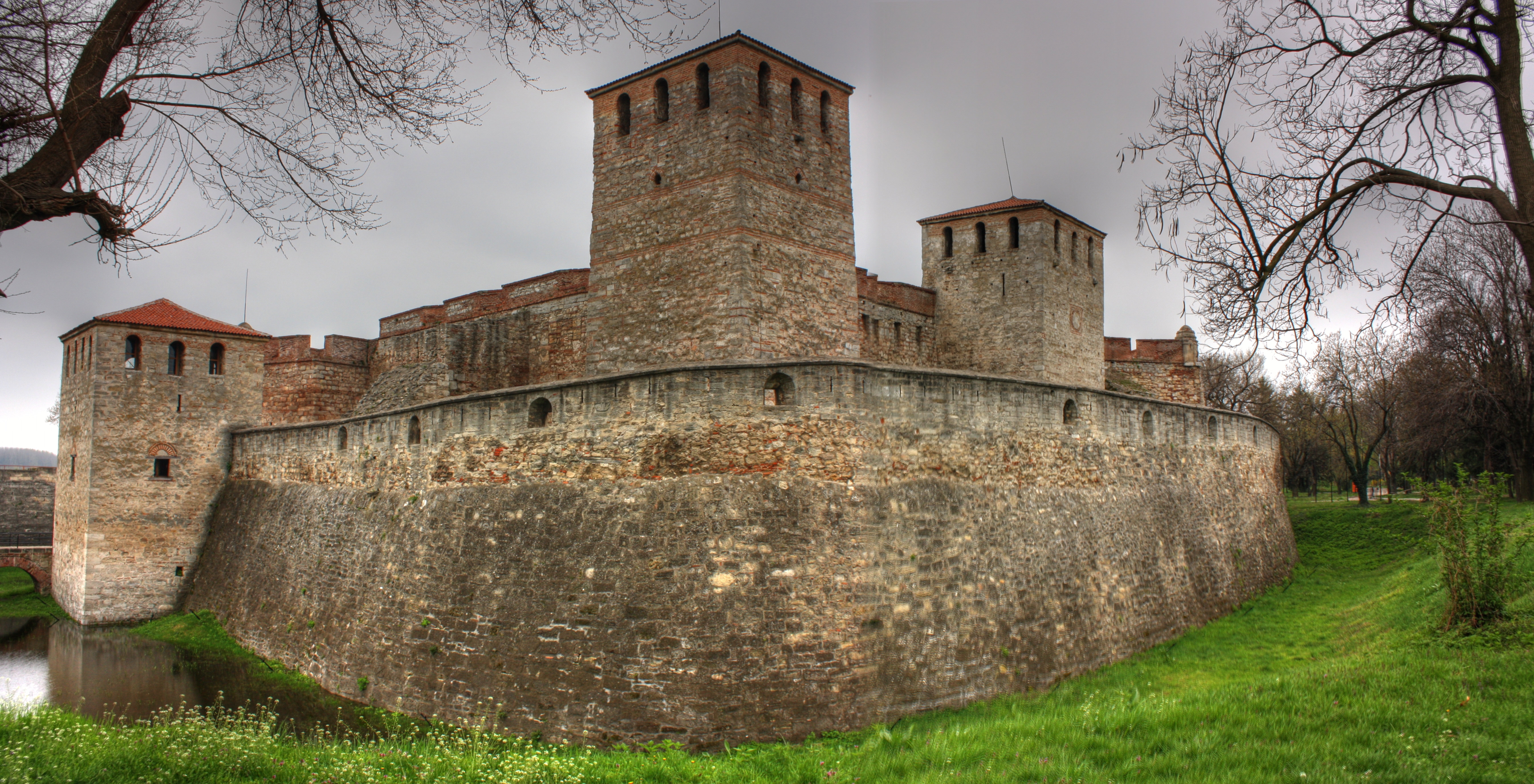
The Sanjak of Vidin or the Vidin Sanjak (, , ) was a sanjak in the Ottoman Empire, with Vidin as its administrative centre. It was established after the Battle of Nicopolis in 1396 out of the territories of the Tsardom of Vidin and in the mid-15th century annexed some territories that belonged to the Serbian Despotate before the Ottomans captured it. Background After the major breakthrough into the Balkans at the end of the 14th century, the Ottomans were well aware of the strategic importance of Danube and decided to capture all important fortresses on its banks. The Tsardom of Vidin, which was under control of Ivan Sratsimir, became an Ottoman vassal state in 1393, and a strong Ottoman garrison was stationed in Vidin. Before the Battle of Nicopolis in 1396, Sratsimir surrendered the Ottoman garrison to the crusaders who were soon defeated, while Sratsimir was captured by the Ottomans and killed in 1397. According to the Ottoman tax registers from 1454-55 the territory o ... [...More Info...] [...Related Items...] OR: [Wikipedia] [Google] [Baidu] |
Sanjak Of Nicopolis
The Sanjak of Nicopolis ( ''Nikopolski sandzhak'', ) was a sanjak in the Ottoman Empire, with Nikopol in modern Bulgaria as its administrative centre. It was established out of the territories of the Tsardom of Vidin, after the Battle of Nicopolis in 1396. Administration The earliest defter of the Sanjak of Nicopolis is composed in the mid-15th century. One group of scholars dated this defter to 1430 while another group of scholars dated it to 1479/1480. This was the first Ottoman defter which mentioned the Romani people, who lived in 431 households, or 3.5 percent of households in this sanjak. Administrative division In the collected notes of Evliya Çelebi (mid-17th century) the Sanjak of Nicopolis with 20 ziamets and 244 timars and income of 40,000 aspres was mentioned as one of 24 Ottoman sanjaks in Rumelia. In the mid-19th century it had 15 kadiluks. Sanjak-beys Bulgarian historian Rusi Stojkov believed that Skanderbeg was mentioned in 1430 Ottoman defter as a sanj ... [...More Info...] [...Related Items...] OR: [Wikipedia] [Google] [Baidu] |
Sanjak Of Pojega
The Sanjak of Pojega (; ) was an administrative territorial entity of the Ottoman Empire formed around 1538. It existed until the Treaty of Karlowitz (1699), when the region was transferred to the Habsburg monarchy. It was located in present-day eastern Croatia, in the Slavonia region. The capital of the sanjak was Pojega (Croatian: Požega). History The city of Požega was taken by Yahyapaşazade Mehmed Bey tr">:tr:Yahyapaşazade_Mehmet_Paşa">tr the Sanjakbey of Semendire (Smederevo), most likely on January 15, 1537, and the citadel was taken ten days later. By early 1538, the Sanjak of Pojega was created and, after the Battle of Gorjani, Mehmed Bey's son Arslan tr">:tr:Yahyapaşazade_Arslan_Paşa">trwas appointed the first sanjakbey. The first defter in the sanjak was held in 1540. The Sanjak of Pojega included territory between Sava and Drava rivers and at first was part of the Rumelia Eyalet. In 1541, it was included into Budin Eyalet, in 1580 into Bosnia Eyalet, ... [...More Info...] [...Related Items...] OR: [Wikipedia] [Google] [Baidu] |
Sanjak Of Smederevo
The Sanjak of Smederevo (, ), also known in historiography as the Pashalik of Belgrade (, ), was an Ottoman Empire, Ottoman administrative unit (sanjak) centered on Smederevo, that existed between the 15th and the outset of the 19th centuries. It was located in the territory of present-day Central Serbia. Administration Eyalet belonging The sanjak belonged to Rumelia Eyalet between 1459 and 1541, and again between 1716 and 1717 and again 1739 and 1817 (nominally to 1830), to Budin Eyalet between 1541 and 1686, and to Temeșvar Eyalet between 1686 and 1688 and again between 1690 and 1716. Borders During the governorship of Hadji Mustafa Pasha (1793–1801), the administration was expanded eastwards to include the Kladovo area, until then part of the Sanjak of Vidin. History 15th century The Sanjak of Smederevo was formed after the fall of the Serbian Despotate in 1459, and its administrative seat was Smederevo, at the time defended by imposing Smederevo Fortress. Ottoman sources n ... [...More Info...] [...Related Items...] OR: [Wikipedia] [Google] [Baidu] |
Podrinje
Podrinje ( sr-Cyrl, Подриње) is the Slavic name of the Drina river basin, known in English as the Drina Valley. The Drina basin is shared between Bosnia and Herzegovina and Serbia, with majority of its territory being located in Eastern Bosnia, entire Upper Drina course and majority of the Middle course, while the Lower Drina course is shared between two countries, with the river representing border. The part of the Drina basin located in Bosnia and Herzegovina is also called Eastern Bosnia. History Between 1918 and 1922, Podrinje District, with its seat in Šabac, was one of the districts of the Kingdom of Serbs, Croats and Slovenes. The district comprised the north-western part of present-day Šumadija and Western Serbia. Between 1922 and 1929, Podrinje Oblast existed in roughly the same area also with its seat in Šabac. In 1929, a large province of the Kingdom of Yugoslavia known as the Drina Banovina was formed with its capital in Sarajevo. Drina Banovina included ... [...More Info...] [...Related Items...] OR: [Wikipedia] [Google] [Baidu] |
Republika Srpska
Republika Srpska ( sr-Cyrl, Република Српска, ; also referred to as the Republic of Srpska or Serb Republic) is one of the two Political divisions of Bosnia and Herzegovina, entities within Bosnia and Herzegovina, the other being the Federation of Bosnia and Herzegovina. Situated in the northern and eastern regions of the country, it recorded a population of 1,228,423 in the 2013 census. Its largest city and administrative hub is Banja Luka, located on the banks of the Vrbas (river), Vrbas River. Republika Srpska was established in 1992 at the onset of the Bosnian War with the stated purpose of safeguarding the interests of the Serbs of Bosnia and Herzegovina. During the conflict, the Ethnic cleansing in the Bosnian War, expulsion of the majority of Croats of Bosnia and Herzegovina, Croats and Bosniaks from territories controlled by Republika Srpska occurred, while the majority of Serbs of Bosnia and Herzegovina, Serbs were displaced or expelled from the Federati ... [...More Info...] [...Related Items...] OR: [Wikipedia] [Google] [Baidu] |


